Category:Haggs
Jump to navigation
Jump to search
English: Haggs is a village in the Falkirk unitary authority area. On the east side of the A80 road which separates it from Banknock, Haggs is the location where the route of the A80 turns into motorway.
village in Falkirk, Scotland, UK  | |||||
| Upload media | |||||
| Instance of | |||||
|---|---|---|---|---|---|
| Location |
| ||||
| Population |
| ||||
| Area |
| ||||
| official website | |||||
 | |||||
Media in category "Haggs"
The following 5 files are in this category, out of 5 total.
-
 Haggs - geograph.org.uk - 1460342.jpg 640 × 359; 76 KB
-
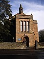
 Haggs Parish Church - geograph.org.uk - 1834420.jpg 1,024 × 677; 143 KB
-
 Parish Church, Haggs - geograph.org.uk - 2645007.jpg 4,000 × 3,000; 2.3 MB
-
 Parish Church, Haggs - geograph.org.uk - 2645017.jpg 3,000 × 4,000; 3.67 MB
-
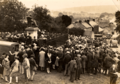 Unveiling of the statue of Thomas Carlyle, Ecclefechan.png 1,000 × 701; 1.57 MB


