Category:Hadrian's Cycleway
Jump to navigation
Jump to search
Hadrian's Cycleway, National Cycle Network route 72

Media in category "Hadrian's Cycleway"
The following 129 files are in this category, out of 129 total.
-
 A tough climb on Hadrian's Cycleway - geograph.org.uk - 207897.jpg 640 × 480; 88 KB
-
 All the Tyne bridges - geograph.org.uk - 1051432.jpg 640 × 480; 103 KB
-
 Angler at St Anthony's Point - geograph.org.uk - 1052192.jpg 640 × 480; 86 KB
-

-
 Banks East Turret - geograph.org.uk - 207950.jpg 640 × 480; 98 KB
-
 Banks East Turret - geograph.org.uk - 987722.jpg 640 × 480; 117 KB
-
 Barriers on Hadrian's Way - geograph.org.uk - 1038637.jpg 640 × 480; 95 KB
-
 Bascule Bridge, St Peter's Basin - geograph.org.uk - 1052185.jpg 640 × 480; 92 KB
-
 Birchfield Gate - geograph.org.uk - 1362236.jpg 640 × 480; 90 KB
-
 Boathouse of Tyne Rowing Club - geograph.org.uk - 1038626.jpg 640 × 480; 75 KB
-
 Boustead Hill - geograph.org.uk - 933243.jpg 640 × 480; 67 KB
-
 Bridge on Hadrian's Way - geograph.org.uk - 1038630.jpg 640 × 480; 106 KB
-
 Bridge over Hadrian's Way - geograph.org.uk - 1038632.jpg 640 × 480; 80 KB
-
 Carlisle to Newcastle railway - geograph.org.uk - 1073175.jpg 640 × 480; 138 KB
-
 Cattle on the Solway marshes - geograph.org.uk - 933248.jpg 640 × 480; 67 KB
-
 Cattle on the Solway Marshes - geograph.org.uk - 933250.jpg 640 × 480; 66 KB
-
 Copthorne Hotel, Newcastle - geograph.org.uk - 1051733.jpg 640 × 480; 103 KB
-
 Creek at Tyne Riverside Country Park - geograph.org.uk - 1038622.jpg 640 × 480; 151 KB
-
 Crossing of Neptune Road - geograph.org.uk - 1038639.jpg 640 × 480; 80 KB
-
 Crossroads at Dykesfield - geograph.org.uk - 933256.jpg 640 × 480; 65 KB
-
 Cycle path - geograph.org.uk - 515097.jpg 640 × 480; 57 KB
-
 Cycle path near Greenhead - geograph.org.uk - 990797.jpg 640 × 480; 112 KB
-
 Cycle path on Greenhead Bank - geograph.org.uk - 207983.jpg 640 × 480; 101 KB
-
 Cycleway bridge over the Tipalt Burn - geograph.org.uk - 990799.jpg 640 × 480; 142 KB
-
 Cycleway bridge over Tipalt Burn - geograph.org.uk - 990798.jpg 480 × 640; 136 KB
-

-

-
 Cycleway sign on Hadrian's Way - geograph.org.uk - 1052475.jpg 640 × 480; 95 KB
-

-

-

-
 Fields and barn near Birchfield Gate - geograph.org.uk - 1362222.jpg 640 × 480; 50 KB
-
 Footbridge over the A1 - geograph.org.uk - 1038640.jpg 640 × 480; 98 KB
-
 Former North Wylam Railway Station - geograph.org.uk - 1517986.jpg 640 × 480; 97 KB
-
 Gateway on Hadrian's Way at Low Walker - geograph.org.uk - 1052469.jpg 640 × 480; 105 KB
-
 Grass Dyke and the Solway Marshes - geograph.org.uk - 933240.jpg 640 × 480; 81 KB
-
 Hadrian's Cycleway and Military Road - geograph.org.uk - 208890.jpg 640 × 480; 94 KB
-
 Hadrian's Cycleway at Vindolanda - geograph.org.uk - 764893.jpg 640 × 480; 126 KB
-
 Hadrian's Cycleway.jpg 640 × 480; 63 KB
-
 Hadrian's Wall at Birdoswald - geograph.org.uk - 552095.jpg 640 × 480; 145 KB
-
 Hadrian's Wall at Wallsend - geograph.org.uk - 1052507.jpg 640 × 480; 84 KB
-

-
 Hadrian's Wall National Trail at Gilsland - geograph.org.uk - 987798.jpg 640 × 480; 149 KB
-

-
 Hadrian's Way - geograph.org.uk - 1342025.jpg 640 × 480; 86 KB
-
 Hadrian's Way - geograph.org.uk - 1362814.jpg 640 × 480; 130 KB
-
 Hadrian's Way above Redheugh Bridge - geograph.org.uk - 1051389.jpg 640 × 480; 101 KB
-
 Hadrian's Way and Lemington Road - geograph.org.uk - 1038629.jpg 640 × 480; 106 KB
-
 Hadrian's Way and Neptune Road - geograph.org.uk - 1038638.jpg 640 × 480; 114 KB
-
 Hadrian's Way at Newcastle Business Park - geograph.org.uk - 1051342.jpg 640 × 480; 112 KB
-

-

-
-

-

-
 Hadrian's Way seat - geograph.org.uk - 1038618.jpg 480 × 640; 93 KB
-
 Hadrian's Way, Lemington - geograph.org.uk - 1038631.jpg 640 × 480; 71 KB
-
 Hadrians Cycleway at Walltown - geograph.org.uk - 445331.jpg 640 × 480; 61 KB
-
 Hagg Bank Bridge - geograph.org.uk - 742122.jpg 640 × 427; 79 KB
-
 Hagg Bank Bridge, Wylam - geograph.org.uk - 445276.jpg 640 × 480; 70 KB
-
 Heddon Haughs - geograph.org.uk - 1038610.jpg 640 × 480; 111 KB
-
 Icon Hadrianswall.jpg 206 × 210; 15 KB
-
 Jewson's, St Lawrence Road - geograph.org.uk - 1052182.jpg 640 × 480; 60 KB
-
 Leahill Turret - geograph.org.uk - 207963.jpg 640 × 480; 94 KB
-
 Leahill Turret - geograph.org.uk - 987732.jpg 640 × 480; 67 KB
-
 Logo Hadrians Cycleway.jpg 655 × 222; 36 KB
-
 Mariner's Wharf - geograph.org.uk - 1052123.jpg 640 × 480; 66 KB
-
 Melkridge Village Green - geograph.org.uk - 764523.jpg 640 × 480; 54 KB
-

-

-

-
-
 National Cycle Network sign - geograph.org.uk - 1745548.jpg 480 × 640; 131 KB
-
 Newburn Bridge - geograph.org.uk - 1038624.jpg 640 × 480; 121 KB
-
-
 Northern approach to Scotswood Bridge - geograph.org.uk - 1038635.jpg 640 × 480; 109 KB
-
 Old Fishmarket, Newcastle - geograph.org.uk - 1051994.jpg 480 × 640; 65 KB
-
 Old railway bridge near Scotswood Bridge - geograph.org.uk - 1038959.jpg 640 × 480; 112 KB
-

-
 Path at Rickerby - geograph.org.uk - 940841.jpg 480 × 640; 116 KB
-

-

-
 Premier Inn, Newcastle - geograph.org.uk - 1051960.jpg 640 × 480; 89 KB
-
-

-

-

-
 Pylons across the Tyne - geograph.org.uk - 1038615.jpg 640 × 480; 63 KB
-
 Railway path along the Tyne - geograph.org.uk - 1038462.jpg 640 × 480; 161 KB
-
 River Caldew - geograph.org.uk - 940519.jpg 640 × 480; 93 KB
-
 River Tyne and C2C Cycle Route - geograph.org.uk - 1573176.jpg 600 × 450; 94 KB
-
 River Tyne and the Dunston Coal Staithes - geograph.org.uk - 1051304.jpg 640 × 480; 116 KB
-
 Road above Haltwhistle - geograph.org.uk - 208894.jpg 640 × 480; 83 KB
-
 Road junction, Kirkandrews-on-Eden - geograph.org.uk - 933396.jpg 640 × 480; 94 KB
-
 Road to Twice Brewed and Vindolanda - geograph.org.uk - 1617887.jpg 600 × 450; 348 KB
-
 Ryton Island - geograph.org.uk - 1038617.jpg 640 × 480; 73 KB
-
 Scotswood Road, Newcastle - geograph.org.uk - 1051267.jpg 640 × 480; 67 KB
-
 Seat on Hadrian's Way at Low Walker - geograph.org.uk - 1052439.jpg 640 × 480; 177 KB
-

-
 Solway Marshes near Dykesfield - geograph.org.uk - 933252.jpg 640 × 480; 67 KB
-

-
 St Anthony's Point - geograph.org.uk - 1052193.jpg 640 × 480; 133 KB
-
 St Peter's Basin - geograph.org.uk - 1052183.jpg 640 × 480; 83 KB
-
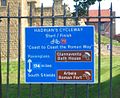 Start Hadrians Cycleway.jpg 597 × 490; 101 KB
-
 The "Keelmans" - geograph.org.uk - 1038613.jpg 640 × 480; 78 KB
-
 The Greyhound Inn, Burgh-by-Sands - geograph.org.uk - 933356.jpg 640 × 480; 62 KB
-
 The Ropery, St Peter's - geograph.org.uk - 1052187.jpg 640 × 480; 80 KB
-
 Tide warning - geograph.org.uk - 933199.jpg 640 × 480; 96 KB
-
 Toll Bar Cottage, Whitchester - geograph.org.uk - 764520.jpg 640 × 480; 67 KB
-

-
 Underpass under the Eden Bridge - geograph.org.uk - 940833.jpg 640 × 480; 105 KB
-
 Vallum House, Burgh-by-Sands - geograph.org.uk - 933352.jpg 640 × 480; 86 KB
-

-

-
 West End Croft, Burgh-by-Sands - geograph.org.uk - 933347.jpg 640 × 480; 68 KB
-
 Westwood Cottages - geograph.org.uk - 1617914.jpg 600 × 450; 213 KB
-
 Whitehouse Enterprise Centre - geograph.org.uk - 1038976.jpg 640 × 480; 82 KB
-
 William Armstrong Drive - geograph.org.uk - 1050947.jpg 640 × 480; 108 KB
-
 Wreck at St Anthony's Point - geograph.org.uk - 1052194.jpg 480 × 640; 102 KB
-
 Bardon Mill Pottery - geograph.org.uk - 371105.jpg 424 × 640; 113 KB
-
 Bridge on the A69 near Hexham - geograph.org.uk - 552108.jpg 640 × 480; 140 KB
-
 Byway open to all traffic - geograph.org.uk - 95675.jpg 640 × 480; 112 KB
-
 From Greenhead Bank to Haltwhistle - geograph.org.uk - 207987.jpg 640 × 480; 74 KB
-
 Lane near Brampton - geograph.org.uk - 207920.jpg 640 × 480; 85 KB
-
 Low Geltbridge - geograph.org.uk - 207904.jpg 640 × 480; 77 KB
-
 Road closure at the Brampton By-pass - geograph.org.uk - 207913.jpg 640 × 480; 76 KB
-
 Road Junction on Hadrian's Wall - geograph.org.uk - 121040.jpg 480 × 640; 93 KB
-
 The Bowes Hotel - geograph.org.uk - 621722.jpg 640 × 480; 76 KB
-
 Tow House Looking Towards Redburn - geograph.org.uk - 219449.jpg 640 × 482; 60 KB


