Category:Haddington, East Lothian (civil parish)
Jump to navigation
Jump to search
Scottish parish in East Lothian, Scotland, UK | |||||
| Upload media | |||||
| Instance of | |||||
|---|---|---|---|---|---|
| Part of |
| ||||
| Named after | |||||
| Location |
| ||||
| Population |
| ||||
| Area |
| ||||
 | |||||
Subcategories
This category has the following 4 subcategories, out of 4 total.
Media in category "Haddington, East Lothian (civil parish)"
The following 200 files are in this category, out of 1,009 total.
(previous page) (next page)-
 "Path" Barney Mains - geograph.org.uk - 5376405.jpg 1,024 × 683; 419 KB
-
 'The Lamp Of Lothian' - geograph.org.uk - 2359337.jpg 640 × 480; 65 KB
-

-

-
 18thC gravestone, St. Mary's Kirkyard - geograph.org.uk - 2364723.jpg 4,000 × 2,248; 2.62 MB
-

-
 18thC tombstone, St. Mary's Kirkyard, Haddington - geograph.org.uk - 2359411.jpg 1,920 × 2,560; 1.61 MB
-

-

-
-
-
 79 High Street - geograph.org.uk - 6304777.jpg 427 × 640; 299 KB
-
 A delivery of poultry manure at Abbey Mains - geograph.org.uk - 4399355.jpg 3,264 × 2,448; 4.39 MB
-
 A farm track at Barney Mains - geograph.org.uk - 2290289.jpg 640 × 427; 140 KB
-
 A farm track at Seaton Law - geograph.org.uk - 2295553.jpg 640 × 427; 175 KB
-
 A footpath sign for the Garleton Hills - geograph.org.uk - 2293835.jpg 427 × 640; 145 KB
-
-
 A Host of Golden Daffodils in Haddington - geograph.org.uk - 6104012.jpg 4,592 × 3,448; 3.47 MB
-
 A loch below Skid Hill - geograph.org.uk - 2696712.jpg 800 × 530; 147 KB
-
 A long narrow field - geograph.org.uk - 2792258.jpg 640 × 360; 232 KB
-
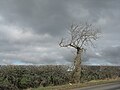
 A magnificent old tree - geograph.org.uk - 2295511.jpg 640 × 427; 164 KB
-
 A ruined building at Byres Farm - geograph.org.uk - 3800854.jpg 640 × 427; 190 KB
-
 A small wood near Merryhatton - geograph.org.uk - 2792288.jpg 640 × 360; 227 KB
-
 A stubble field at Haddington - geograph.org.uk - 5621638.jpg 1,024 × 683; 840 KB
-
 A sunset silhouette - geograph.org.uk - 3765499.jpg 640 × 637; 185 KB
-
 A wet field - geograph.org.uk - 2134650.jpg 640 × 480; 120 KB
-
 A1 - geograph.org.uk - 2792276.jpg 640 × 360; 208 KB
-
 A1 cutting - geograph.org.uk - 5529047.jpg 800 × 450; 217 KB
-
 A1 Dual Carriageway - geograph.org.uk - 2123123.jpg 640 × 480; 179 KB
-
 A1 underpass for Haddington Railway Walk - geograph.org.uk - 4777549.jpg 1,024 × 678; 132 KB
-
 A199 bridge over Haddington Railway Walk - geograph.org.uk - 4777520.jpg 1,024 × 678; 321 KB
-
 A199, Gladsmuir - geograph.org.uk - 5521324.jpg 800 × 535; 156 KB
-
 A6093 heading north east - geograph.org.uk - 4492132.jpg 640 × 480; 57 KB
-
 A6093 towards Haddington - geograph.org.uk - 4492129.jpg 640 × 480; 57 KB
-
 A6093, Barberfield - geograph.org.uk - 4492138.jpg 640 × 480; 54 KB
-
 Abbey Bridge - geograph.org.uk - 3840459.jpg 640 × 360; 237 KB
-
 Abbey Bridge - geograph.org.uk - 4582121.jpg 800 × 533; 225 KB
-
 Abbey Bridge across the River Tyne - geograph.org.uk - 4399144.jpg 3,264 × 2,448; 4.89 MB
-
 Abbey Bridge from the mill - geograph.org.uk - 4399174.jpg 3,264 × 2,448; 5.29 MB
-
 Abbey Bridge near Haddington - geograph.org.uk - 2850638.jpg 800 × 533; 142 KB
-
 Abbey Mains Cottages - geograph.org.uk - 958021.jpg 640 × 480; 84 KB
-
 Abbey Mains farm cottages - geograph.org.uk - 958035.jpg 640 × 480; 78 KB
-
 Abbey Mill - geograph.org.uk - 4582126.jpg 800 × 533; 222 KB
-
 Abbey Mill Farm - geograph.org.uk - 4399116.jpg 3,264 × 2,448; 5.31 MB
-
 Abbey Mill from the west - geograph.org.uk - 4399245.jpg 3,264 × 2,448; 5.9 MB
-
 Abbey Mill, Haddington - geograph.org.uk - 4399196.jpg 3,264 × 2,448; 6.29 MB
-

-

-
 Alba Nursery - geograph.org.uk - 5702901.jpg 1,024 × 683; 349 KB
-
 Alders by the River Tyne - geograph.org.uk - 5362456.jpg 3,264 × 2,448; 6.63 MB
-
 Alderston Hill - geograph.org.uk - 3908609.jpg 640 × 360; 221 KB
-
 Alderston Road - geograph.org.uk - 3688670.jpg 640 × 480; 267 KB
-
 Amisfield Walled Garden - geograph.org.uk - 5358556.jpg 3,264 × 2,448; 3.23 MB
-

-

-
 Approaching Bearford Bridge - geograph.org.uk - 4492801.jpg 640 × 520; 94 KB
-
 Arable fields near the A1 - geograph.org.uk - 1597147.jpg 640 × 427; 94 KB
-
 Arable land, Bearford - geograph.org.uk - 1862730.jpg 640 × 480; 158 KB
-
 Arable land, Camptoun - geograph.org.uk - 3604655.jpg 640 × 360; 185 KB
-
 Arable land, Morham - geograph.org.uk - 3776755.jpg 640 × 480; 260 KB
-
 Arable land, Samuelston - geograph.org.uk - 4107978.jpg 640 × 360; 225 KB
-
 Artillery Park, Haddington - geograph.org.uk - 5321676.jpg 1,024 × 683; 273 KB
-
 Ash tree in a hedgerow - geograph.org.uk - 4399275.jpg 3,264 × 2,448; 3.62 MB
-
 Athelstaneford and North Berwick Law - geograph.org.uk - 2442092.jpg 800 × 534; 163 KB
-
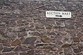 Auction Mart sign, Haddington - geograph.org.uk - 4816051.jpg 800 × 534; 239 KB
-
 B1343 - geograph.org.uk - 4131214.jpg 800 × 600; 485 KB
-
 B1343 under Byers Hill - geograph.org.uk - 2182180.jpg 640 × 359; 55 KB
-
 B6368 - geograph.org.uk - 4815981.jpg 1,024 × 768; 316 KB
-
 B6369 near Colstoun Mains - geograph.org.uk - 4492231.jpg 640 × 480; 66 KB
-
 B6369 towards Gifford - geograph.org.uk - 4492249.jpg 640 × 480; 48 KB
-
 Bales and woodland - geograph.org.uk - 4492236.jpg 640 × 480; 103 KB
-
 Ballroom Window - geograph.org.uk - 6304779.jpg 427 × 640; 283 KB
-
 Bangly Brae - geograph.org.uk - 3769813.jpg 640 × 426; 264 KB
-
 Bangly Brae - geograph.org.uk - 5435824.jpg 1,024 × 683; 239 KB
-
 Bangly Brae, near Haddington - geograph.org.uk - 5516711.jpg 1,024 × 682; 184 KB
-
 Bangly Hill - geograph.org.uk - 3908602.jpg 640 × 360; 182 KB
-
 Bank of Scotland in Haddington - geograph.org.uk - 5659285.jpg 2,048 × 1,536; 756 KB
-
 Barley bales and barn at Garleton - geograph.org.uk - 2596905.jpg 2,592 × 1,944; 2.47 MB
-
 Barley near Beanston Mill - geograph.org.uk - 5375469.jpg 1,024 × 683; 337 KB
-
 Barley near Bolton - geograph.org.uk - 4815445.jpg 1,024 × 768; 454 KB
-
 Barley near Merryhatton - geograph.org.uk - 3102463.jpg 3,264 × 2,448; 4.89 MB
-
 Barley, Barney Mains - geograph.org.uk - 5376411.jpg 1,024 × 683; 356 KB
-
 Barley, hedge and broken gate at Merryhatton - geograph.org.uk - 3102467.jpg 3,264 × 2,448; 4.72 MB
-
 Barley, Letham Mains Smallholdings - geograph.org.uk - 5089349.jpg 800 × 534; 210 KB
-
 Barn at Garleton - geograph.org.uk - 1813438.jpg 640 × 480; 46 KB
-
 Barnes Castle - geograph.org.uk - 3408027.jpg 640 × 480; 264 KB
-
 Barnes Castle corner tower - geograph.org.uk - 2364534.jpg 640 × 487; 79 KB
-
 Barnes Castle east front - geograph.org.uk - 2364571.jpg 640 × 480; 78 KB
-
 Barnes Castle from the north - geograph.org.uk - 2364513.jpg 640 × 485; 64 KB
-

-
 Barnes Castle gun loop - geograph.org.uk - 2364589.jpg 640 × 487; 119 KB
-
 Barnes Castle interior - geograph.org.uk - 2364619.jpg 640 × 480; 95 KB
-
-
 Barnes Castle south front - geograph.org.uk - 2364550.jpg 640 × 480; 88 KB
-
 Barnes Castle tower with gunloop - geograph.org.uk - 2364585.jpg 640 × 480; 129 KB
-
 Barnes Castle window - geograph.org.uk - 2364603.jpg 640 × 480; 126 KB
-
 Barney Hill - geograph.org.uk - 3408004.jpg 640 × 480; 253 KB
-
 Barney Hill - geograph.org.uk - 3793035.jpg 2,560 × 1,920; 2.85 MB
-
 Barney Hill, near Haddington - geograph.org.uk - 5516683.jpg 1,024 × 682; 105 KB
-
 Barney Mains - geograph.org.uk - 3408019.jpg 640 × 480; 275 KB
-
 Barney Mains from the west - geograph.org.uk - 2696706.jpg 800 × 530; 183 KB
-
 Bean straw - geograph.org.uk - 2594687.jpg 640 × 480; 287 KB
-
 Bearford Bridge - geograph.org.uk - 1862716.jpg 640 × 480; 142 KB
-
 Bearford Bridge - geograph.org.uk - 4492802.jpg 640 × 480; 82 KB
-
 Bearford Bridge - geograph.org.uk - 4747852.jpg 3,264 × 2,448; 5.78 MB
-
 Beech trees on Barney Hill - geograph.org.uk - 2290294.jpg 427 × 640; 149 KB
-
 Beeches, Beech Hill - geograph.org.uk - 2697136.jpg 640 × 360; 258 KB
-
 Begbie - geograph.org.uk - 2436583.jpg 640 × 440; 256 KB
-
 Begbie Wood - geograph.org.uk - 3604583.jpg 480 × 640; 367 KB
-
 Begbie Wood - geograph.org.uk - 5552701.jpg 531 × 800; 300 KB
-
 Begbie, from the bridge - geograph.org.uk - 1249650.jpg 640 × 480; 98 KB
-
 Behind Market Street - geograph.org.uk - 3818362.jpg 640 × 480; 279 KB
-
 Behind Market Street - geograph.org.uk - 4816049.jpg 800 × 534; 212 KB
-
 Bermaline malting mill, Haddington - geograph.org.uk - 2850705.jpg 800 × 533; 162 KB
-
 Bermaline Mill - geograph.org.uk - 1862431.jpg 640 × 480; 115 KB
-
 Bermaline Mills - geograph.org.uk - 4514291.jpg 1,280 × 851; 363 KB
-
 Bermaline Mills, Haddington - geograph.org.uk - 4582092.jpg 800 × 533; 239 KB
-

-
 Beside Cockmilane Brae - geograph.org.uk - 5427105.jpg 800 × 450; 215 KB
-
 Beside the Tyne, Abbeymill - geograph.org.uk - 5375451.jpg 1,024 × 683; 378 KB
-
 Between the A1s - geograph.org.uk - 2789422.jpg 640 × 360; 188 KB
-
 Big fence - geograph.org.uk - 2691368.jpg 640 × 360; 246 KB
-
 Birk Hedges - geograph.org.uk - 4486638.jpg 640 × 480; 90 KB
-
 Bolton to Gifford path - geograph.org.uk - 3776781.jpg 640 × 480; 249 KB
-
 Bolton to Gifford path - geograph.org.uk - 4815362.jpg 1,024 × 768; 532 KB
-
 Bolton to Gifford path - geograph.org.uk - 4815447.jpg 1,024 × 768; 378 KB
-
 Bolton to Gifford path - geograph.org.uk - 4815453.jpg 1,024 × 768; 367 KB
-
 Bolton to Gifford path - geograph.org.uk - 5991013.jpg 1,024 × 768; 410 KB
-
 Bolton to Gifford path - geograph.org.uk - 5991024.jpg 1,024 × 768; 514 KB
-
 Bridge by Begbie Wood - geograph.org.uk - 3599610.jpg 640 × 480; 337 KB
-
 Bridge over Mill Lade - geograph.org.uk - 4582569.jpg 800 × 533; 314 KB
-
 Bridge over the A1 - geograph.org.uk - 3438228.jpg 640 × 360; 241 KB
-
 Bridge over the Haddington Railway Walk - geograph.org.uk - 4777613.jpg 1,024 × 678; 258 KB
-
 Bridge over the Haddington Railway Walk - geograph.org.uk - 4777620.jpg 1,024 × 678; 276 KB
-
 Bridge, Haddington - geograph.org.uk - 2435969.jpg 640 × 480; 357 KB
-
 Building site west of Haddington - geograph.org.uk - 4778632.jpg 1,024 × 678; 159 KB
-
 Building site, Haddington - geograph.org.uk - 5005333.jpg 1,024 × 683; 387 KB
-
 Burn, Bearsford - geograph.org.uk - 1862724.jpg 480 × 640; 173 KB
-
 Burn. Playmuir Wood - geograph.org.uk - 1734198.jpg 640 × 480; 174 KB
-
 Burns Monument information - geograph.org.uk - 4409281.jpg 3,140 × 1,844; 2.07 MB
-
 Burns, the East Lothian Connections - geograph.org.uk - 4409287.jpg 3,069 × 1,971; 1.74 MB
-
 Burnt tree - geograph.org.uk - 3785507.jpg 640 × 480; 352 KB
-
 Bus shelter on the B6471 near Haddington - geograph.org.uk - 4212856.jpg 1,600 × 1,064; 1,017 KB
-
 By Hopefield - geograph.org.uk - 5552499.jpg 800 × 531; 216 KB
-
-
 Byres Farm - geograph.org.uk - 3800856.jpg 640 × 426; 184 KB
-
 Byres from Byres Hill - geograph.org.uk - 5516986.jpg 1,024 × 682; 126 KB
-
 Byres Hill - geograph.org.uk - 3793028.jpg 2,560 × 1,920; 2.57 MB
-
 Byres Hill - geograph.org.uk - 5411405.jpg 1,024 × 576; 323 KB
-
 Byres Hill car park - geograph.org.uk - 5410489.jpg 1,024 × 576; 452 KB
-
 Cabbages at East Garleton - geograph.org.uk - 2596933.jpg 2,592 × 1,944; 3 MB
-
 Cadzow White Cattle at Lennoxlove - geograph.org.uk - 2376543.jpg 2,592 × 1,944; 2.74 MB
-
 Car park, Byres Hill - geograph.org.uk - 2076726.jpg 800 × 530; 208 KB
-
 Cemetery, Haddington - geograph.org.uk - 1862442.jpg 640 × 480; 124 KB
-
 Cereal field and shelterbelt at Monkrigg - geograph.org.uk - 2376622.jpg 2,592 × 1,944; 2.92 MB
-
 Cereals, Clerkington - geograph.org.uk - 2436045.jpg 640 × 480; 297 KB
-
 Church Street, Haddington - geograph.org.uk - 5230271.jpg 1,024 × 755; 163 KB
-
 Clacherdean Wood - geograph.org.uk - 2795922.jpg 640 × 480; 364 KB
-
 Clacherdean Wood - geograph.org.uk - 2798620.jpg 640 × 480; 370 KB
-
 Clacherdean Wood - geograph.org.uk - 2798632.jpg 640 × 480; 357 KB
-
 Clacherdean Wood - geograph.org.uk - 2798639.jpg 640 × 480; 314 KB
-
 Clacherdean Wood - geograph.org.uk - 3509958.jpg 640 × 480; 377 KB
-
 Clacherdean Wood - geograph.org.uk - 3776775.jpg 640 × 480; 371 KB
-
 Clacherdean Wood - geograph.org.uk - 3776778.jpg 640 × 480; 322 KB
-
 Cleared woodland - geograph.org.uk - 2436017.jpg 640 × 480; 272 KB
-
 Cockles Brae - geograph.org.uk - 4815854.jpg 1,024 × 768; 354 KB
-
 Cockles Brae - geograph.org.uk - 5427112.jpg 800 × 450; 217 KB
-
 Colstoun Water - geograph.org.uk - 2723890.jpg 640 × 360; 259 KB
-
 Colstoun Water - geograph.org.uk - 2942201.jpg 640 × 480; 377 KB
-
 Colstoun Water - geograph.org.uk - 4815973.jpg 1,024 × 768; 338 KB
-
 Colstoun Wood - geograph.org.uk - 1031420.jpg 640 × 480; 135 KB
-
 Colstoun Wood - geograph.org.uk - 1031427.jpg 640 × 480; 128 KB
-
 Colstoun Wood - geograph.org.uk - 2697122.jpg 640 × 360; 275 KB
-
 Colstoun Wood - geograph.org.uk - 2796170.jpg 640 × 480; 256 KB
-
 Colstoun Wood - geograph.org.uk - 4815845.jpg 1,024 × 768; 488 KB
-
 Colt's-foot - geograph.org.uk - 4399322.jpg 3,264 × 2,448; 5.76 MB
-
 Company of Soldiers, all in a line. - geograph.org.uk - 1009500.jpg 640 × 480; 91 KB
-
 Construction, The Maltings - geograph.org.uk - 5764338.jpg 1,024 × 683; 305 KB
-
 Control, Grants' Braes - geograph.org.uk - 4815983.jpg 1,024 × 768; 333 KB
-
 Control, Grants' Braes - geograph.org.uk - 4815985.jpg 1,024 × 768; 329 KB
-
 Cottages at Barney Mains - geograph.org.uk - 2696283.jpg 800 × 530; 168 KB
-
 Cottages at Barney Mains Farm - geograph.org.uk - 2290286.jpg 640 × 420; 166 KB
-
 Coulston woodlands - geograph.org.uk - 2796173.jpg 640 × 480; 371 KB
-
 Council offices, Haddington - geograph.org.uk - 5764398.jpg 1,024 × 683; 396 KB
-
 Court street, Haddington - geograph.org.uk - 4506152.jpg 1,280 × 851; 351 KB
-
 Court Street, Haddington - geograph.org.uk - 4513133.jpg 1,280 × 851; 411 KB
-
 Court Street, Haddington - geograph.org.uk - 5529076.jpg 1,600 × 1,030; 314 KB
-
 Court Street, Haddington - geograph.org.uk - 5764389.jpg 1,024 × 683; 333 KB
-
 Crop field and hedgerow - geograph.org.uk - 4478779.jpg 640 × 480; 52 KB
-
 Crop field and hedgerow - geograph.org.uk - 4478782.jpg 640 × 480; 76 KB
-
 Crop field beside woodland - geograph.org.uk - 4492243.jpg 640 × 480; 66 KB
-
 Crop field near Barberfield - geograph.org.uk - 4492135.jpg 640 × 480; 80 KB
-
 Crop field near Bearford Bridge - geograph.org.uk - 4478809.jpg 640 × 480; 63 KB
-
 Crop field near Mitchell Hall - geograph.org.uk - 4478795.jpg 640 × 480; 62 KB
-
 Crop field towards Newbold Cottage - geograph.org.uk - 4486639.jpg 640 × 480; 92 KB
-
 Crop field towards Seggarsdean - geograph.org.uk - 4478806.jpg 640 × 480; 39 KB
-
 Crop field towards woodland - geograph.org.uk - 4478805.jpg 640 × 480; 61 KB
-
 Crop field towards woodland - geograph.org.uk - 4478810.jpg 640 × 480; 66 KB
-
 Crop field, Nether Sunnyside - geograph.org.uk - 4492122.jpg 640 × 480; 55 KB
-
 Crop field, Sandersdean - geograph.org.uk - 4492253.jpg 640 × 480; 60 KB


&filefrom=Crop+fields+towards+Black+Wood+-+geograph.org.uk+-+4478783.jpg#mw-category-media)