Category:Höllental (Black Forest)
Jump to navigation
Jump to search
Deutsch: Das Höllental ist ein tief eingeschnittenes, teilweise schluchtartiges Tal im Südschwarzwald in Baden-Württemberg (Deutschland).
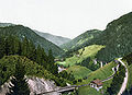
English: The Höllental is one of the valleys in the Black Forest that cuts through the asymmetric ridgeline of mountains from its plateau-like eastern uplands and runs down its steep western escarpment. The valley follows the line of the Bonndorf Rift Valley (Bonndorfer Graben), which runs from Kaiserstuhl via the Wutach gorge and Hegau to Lake Constance and is part of this tectonically-formed fault. Additionally it could have been created as a result of repeated glaciation of the Black Forest's uplands by ice lakes that could have spilled westwards over the eroded ridgeline. As a result the tributaries of the Höllenbach east of the ridgeline flow initially southeast, turning almost 180° towards the northeast into the Höllental itself, a situation similar to that of the Maloja pass in Engadin.
valley in the Black Forest, Germany  | |||||
| Upload media | |||||
| Instance of | |||||
|---|---|---|---|---|---|
| Location |
| ||||
| Located in or next to body of water | |||||
 | |||||
Subcategories
This category has the following 12 subcategories, out of 12 total.
B
F
- Fasnet im Höllental (3 F)
H
- Hirschsprung (Schwarzwald) (55 F)
- Höllentalbahn im Höllental (37 F)
J
K
- Kreuzfelsen (Breitnau) (3 F)
O
P
- Piketfelsen (Breitnau) (10 F)
R
Media in category "Höllental (Black Forest)"
The following 37 files are in this category, out of 37 total.
-
 Aufstieg zur Ruine Falkenstein.jpg 4,000 × 3,000; 4.89 MB
-
 Bemooste Steine im Höllental zwischen Ruine Bubenstein und Ruine Falkenstein.jpg 2,180 × 2,028; 2.21 MB
-
 Black Forest (9812966053).jpg 1,594 × 1,147; 284 KB
-
 Black Forest Autochrome 20 Höllental.jpg 2,269 × 1,762; 1.16 MB
-
 Blick in das Höllental.jpg 1,600 × 1,200; 650 KB
-
 Blick vom Jockelshof in Buchenbach Richtung Höllental.jpg 4,000 × 2,412; 1.83 MB
-
 Blick vom Piketfelsen auf Höllsteig.jpg 4,896 × 3,672; 8.69 MB
-
 Blick über Bisten in das Höllental - panoramio.jpg 3,072 × 2,304; 6.15 MB
-
 Blick über das Höllental.jpg 1,600 × 1,200; 764 KB
-
 Doppelstockzug auf der Fahrt ins Höllental.jpg 2,791 × 1,861; 3.17 MB
-
 Eingang in die Hölle.jpg 1,664 × 2,400; 822 KB
-
 Falkensteig Höllental 1867.jpg 816 × 496; 79 KB
-
 Fr. Zone Baden 1947 12 Höllental, Schwarzwald.jpg 1,070 × 670; 346 KB
-
 Fr. Zone Baden 1948 26 Höllental, Schwarzwald.jpg 1,070 × 670; 516 KB
-
 Fr. Zone Baden 1948 37 Höllental, Schwarzwald.jpg 1,070 × 670; 715 KB
-

-
 Hirschsprung 1900.jpg 2,581 × 3,413; 4.49 MB
-
 Hirschsprung im Höllental.jpg 1,749 × 1,050; 451 KB
-
 Hoellental 1900.jpg 3,526 × 2,512; 3.14 MB
-
 Hoellentalbahn 1900.jpg 3,441 × 2,482; 2.88 MB
-
 Höllental - panoramio (1).jpg 3,734 × 2,265; 3.72 MB
-
 Höllental - panoramio (3).jpg 4,608 × 2,751; 4.08 MB
-
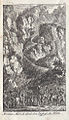
 Höllental Hischsprung Moreau 1796.jpg 1,504 × 2,192; 1,015 KB
-
 Höllental zwischen Ruine Bubenstein und Ruine Falkenstein.jpg 4,000 × 3,000; 5.03 MB
-
 Im Höllental zwischen Ruine Bubenstein und Ruine Falkenstein.jpg 4,000 × 3,000; 5.15 MB
-
 Kleiner Posthaldefelsen (5).jpg 4,000 × 3,000; 4.7 MB
-
 Little Chapel (240000155).jpeg 1,600 × 1,067; 568 KB
-
 Marsch durch die Hölle.jpg 1,273 × 916; 523 KB
-
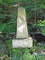 Memorial Robert Thiery.jpg 2,736 × 3,648; 2.74 MB
-
 Moreau in der Hölle.jpg 565 × 982; 267 KB
-
 Pavillion aussichtspunkt ravenna.jpg 4,242 × 3,182; 7.22 MB
-
 Pavillon auf dem Galgenbühl.JPG 4,000 × 3,000; 3.17 MB
-
 Ravenna 02.jpg 3,104 × 4,672; 3.5 MB
-
 Ravenna 05.jpg 4,672 × 3,104; 2.88 MB
-
 Ravennaschlucht im Höllental 1904.jpg 1,392 × 688; 141 KB
-
 Sanatorium St. Blasien 17 Im Höllental.jpg 1,400 × 1,001; 345 KB
-
 St. Oswald Kreisarchiv 2.jpg 3,197 × 2,145; 1.02 MB


.jpg)


,_RP-F-00-9035.jpg)


.jpg)
.jpg)


.jpg)
.jpeg)


