Category:Gwinear–Gwithian
Jump to navigation
Jump to search
coastal civil parish in west Cornwall, England  | |||||
| Upload media | |||||
| Instance of | |||||
|---|---|---|---|---|---|
| Location | Cornwall, South West England, England | ||||
| Area |
| ||||
 | |||||
Subcategories
This category has the following 8 subcategories, out of 8 total.
Media in category "Gwinear–Gwithian"
The following 200 files are in this category, out of 527 total.
(previous page) (next page)-
 "Come and play..." - geograph.org.uk - 3194184.jpg 1,142 × 857; 288 KB
-
 'Peace Camp' on Godrevy Island - geograph.org.uk - 3060218.jpg 640 × 480; 36 KB
-
 A bushy hedge - geograph.org.uk - 5141650.jpg 640 × 426; 66 KB
-
 A field of grass and woodland - geograph.org.uk - 177590.jpg 640 × 427; 113 KB
-
 A good vantage point - geograph.org.uk - 3233904.jpg 640 × 481; 63 KB
-
 A solitary cow - geograph.org.uk - 5141642.jpg 640 × 426; 46 KB
-
 A30 near Connor Downs - geograph.org.uk - 6205632.jpg 1,024 × 768; 251 KB
-
 Above Castle Giver Cove - geograph.org.uk - 5347060.jpg 1,600 × 1,067; 484 KB
-
 Agricultural premises at Fraddam - geograph.org.uk - 5190495.jpg 640 × 480; 49 KB
-
 All quiet on New Years Day - geograph.org.uk - 4312080.jpg 800 × 531; 109 KB
-
 Animal feeder - geograph.org.uk - 6018334.jpg 1,024 × 681; 116 KB
-
 Arable field near Pennance Vean - geograph.org.uk - 4312070.jpg 800 × 531; 138 KB
-
 Arable land near Reawla - geograph.org.uk - 3801832.jpg 1,024 × 680; 282 KB
-
 B3301 Gwithian Towans - geograph.org.uk - 6164896.jpg 640 × 480; 52 KB
-

-
 B3302 Hayle Road has become Calais Road - geograph.org.uk - 3188971.jpg 3,073 × 2,048; 761 KB
-
 Barns at Bosparva - geograph.org.uk - 196765.jpg 640 × 480; 98 KB
-
 Barns, Polmenor - geograph.org.uk - 5117509.jpg 640 × 344; 40 KB
-
 Bay with rocks - geograph.org.uk - 6304441.jpg 800 × 600; 107 KB
-
 Beach at Godrevy Point - geograph.org.uk - 2170935.jpg 640 × 420; 153 KB
-
 Beach at Gwithian Towans (6521).jpg 4,288 × 2,848; 4.94 MB
-
 Beach at Gwithian Towans (6526).jpg 4,288 × 2,848; 3.54 MB
-
 Beach below Upton Towans (6527).jpg 4,288 × 2,848; 5.46 MB
-
 Beach below Upton Towans (6528).jpg 4,288 × 2,848; 3.8 MB
-
 Beach from Peter's Point - geograph.org.uk - 5170968.jpg 1,024 × 770; 195 KB
-
 Beach near Godrevy Point - geograph.org.uk - 1853479.jpg 640 × 480; 50 KB
-
 Beach near Upton Towans - geograph.org.uk - 107863.jpg 640 × 480; 107 KB
-
 Beach on St Ives Bay - geograph.org.uk - 4312105.jpg 1,024 × 680; 143 KB
-
 Beached seals, Mutton Cove - geograph.org.uk - 5743966.jpg 640 × 428; 186 KB
-
 Belted Galloway - geograph.org.uk - 6018313.jpg 1,024 × 615; 141 KB
-
 Bend on St Ives Lane, B3301 - geograph.org.uk - 5741351.jpg 640 × 480; 88 KB
-
 Bezurrel farm - geograph.org.uk - 182893.jpg 640 × 480; 117 KB
-
 Bridge at Calloose - geograph.org.uk - 186505.jpg 640 × 480; 128 KB
-
 Bridleway and track junction - geograph.org.uk - 2259857.jpg 640 × 480; 63 KB
-
 Bridleway from Roseworthy Barton - geograph.org.uk - 2699969.jpg 640 × 427; 280 KB
-
 Bridleway near Relistian - geograph.org.uk - 2988576.jpg 640 × 427; 101 KB
-
 Bridleways everywhere - geograph.org.uk - 2699984.jpg 640 × 427; 230 KB
-
 By the Cornish Main Line - geograph.org.uk - 5117150.jpg 640 × 426; 59 KB
-
 Cabbage field near Gwithian - geograph.org.uk - 4312083.jpg 800 × 531; 140 KB
-
 Camborne , Countryside Scenery - geograph.org.uk - 6338555.jpg 6,000 × 4,000; 6.53 MB
-
 Camborne , Countryside Scenery - geograph.org.uk - 6338561.jpg 6,000 × 4,000; 5.82 MB
-
 Carnhell Green Fellowship - geograph.org.uk - 3734959.jpg 640 × 424; 68 KB
-
 Cattle grazing - geograph.org.uk - 5117134.jpg 640 × 426; 69 KB
-
 Cattle grazing - geograph.org.uk - 6018326.jpg 1,024 × 681; 94 KB
-
 Cattle near Higher Pencobben - geograph.org.uk - 5741895.jpg 640 × 480; 103 KB
-
 Ceres Rock - geograph.org.uk - 5745655.jpg 640 × 480; 58 KB
-
 Chimney on St Gothian Sands (6516).jpg 2,848 × 4,288; 4.87 MB
-
 Churchtown Road (B3301) at Gwithian Parish Church - geograph.org.uk - 5384784.jpg 4,000 × 3,000; 3.26 MB
-
 Churchtown Road, Gwithian. - geograph.org.uk - 1811922.jpg 640 × 480; 77 KB
-

-
 Cliff face detail, Godrevy Point - geograph.org.uk - 5744115.jpg 640 × 480; 199 KB
-
 Cliff face detail, near Peter's Point - geograph.org.uk - 5756861.jpg 640 × 480; 176 KB
-
 Cliff face detail, near Peter's Point - geograph.org.uk - 5756866.jpg 640 × 480; 186 KB
-
 Cliff near Peter's Point - geograph.org.uk - 5756828.jpg 640 × 480; 120 KB
-
 Cliff near Peter's Point - geograph.org.uk - 5756846.jpg 640 × 480; 138 KB
-
 Cliff on south side* of Peter's Point - geograph.org.uk - 5746279.jpg 640 × 480; 146 KB
-
 Cliff top at Gwithian Towans - geograph.org.uk - 3233598.jpg 640 × 480; 72 KB
-
 Cliffs and a stack - geograph.org.uk - 3194198.jpg 1,142 × 857; 230 KB
-
 Cliffs east of the Knavocks (6486).jpg 4,288 × 2,848; 6.28 MB
-
 Coast path at Godrevy Point - geograph.org.uk - 1853388.jpg 640 × 480; 92 KB
-
 Coast path near Navax Point - geograph.org.uk - 1853384.jpg 640 × 480; 121 KB
-
 Coast south of Godrevy Point - geograph.org.uk - 1853478.jpg 640 × 480; 65 KB
-
 Coast towards Navax Point - geograph.org.uk - 1852052.jpg 640 × 480; 78 KB
-
 Coastal rock, Godrevy - geograph.org.uk - 5743977.jpg 640 × 480; 132 KB
-
 Coastal View north at Gwithian Towans - geograph.org.uk - 6205644.jpg 1,024 × 768; 250 KB
-
 Connor Downs - geograph.org.uk - 3425273.jpg 2,592 × 1,944; 1.09 MB
-
 Corner in Gwithian - geograph.org.uk - 5744684.jpg 640 × 480; 131 KB
-
 Cornish Farmland - geograph.org.uk - 5117192.jpg 640 × 426; 43 KB
-
 Cornish farmland - geograph.org.uk - 5141657.jpg 640 × 426; 54 KB
-
 Cornish farmland - geograph.org.uk - 5141661.jpg 640 × 566; 57 KB
-
 Coswinsawsin Lane - geograph.org.uk - 2258187.jpg 480 × 640; 101 KB
-
 Cove east of Kynance Cove - geograph.org.uk - 5742230.jpg 640 × 480; 142 KB
-
 Crossing Gwinear Road - geograph.org.uk - 2505856.jpg 640 × 466; 151 KB
-
 Crossing Gwinear Road - geograph.org.uk - 2515818.jpg 640 × 405; 160 KB
-
 Cut Mark, Gwithian, Corner Cottage - geograph.org.uk - 5159426.jpg 960 × 1,280; 243 KB
-
 Deformed rock outcrop - geograph.org.uk - 6304466.jpg 600 × 800; 164 KB
-
 Deformed slates, Godrevy Point - geograph.org.uk - 6304460.jpg 800 × 600; 137 KB
-
 Deformed turbidites - geograph.org.uk - 6304365.jpg 600 × 800; 153 KB
-
 Dramatic weather over St Ives Bay - geograph.org.uk - 5745406.jpg 640 × 480; 70 KB
-
 Electricity pylons at Trevarnon - geograph.org.uk - 3230604.jpg 480 × 640; 67 KB
-
 Farm building, Trevaskis - geograph.org.uk - 5141645.jpg 640 × 426; 54 KB
-
 Farm tack and field - geograph.org.uk - 5462645.jpg 640 × 480; 69 KB
-
 Farmland - geograph.org.uk - 5141644.jpg 640 × 426; 65 KB
-
 Farmland and footpath - geograph.org.uk - 3803307.jpg 1,024 × 680; 351 KB
-
 Farmland east of Gwinear Road - geograph.org.uk - 2515826.jpg 640 × 479; 152 KB
-
 Farmland east of Gwinear Road - geograph.org.uk - 2515829.jpg 640 × 429; 161 KB
-
 Farmland footpath - geograph.org.uk - 3801837.jpg 1,024 × 680; 336 KB
-
 Farmland, Coldharbour - geograph.org.uk - 5117194.jpg 640 × 426; 41 KB
-
 Farmland, The Hood - geograph.org.uk - 5117128.jpg 640 × 426; 85 KB
-
 Farmland, Trenowin - geograph.org.uk - 5117186.jpg 640 × 426; 50 KB
-
 Farmland, Trevaskis - geograph.org.uk - 5117181.jpg 640 × 426; 47 KB
-
 Farms west of Camborne - geograph.org.uk - 2515842.jpg 640 × 397; 155 KB
-
 Field and hedge - geograph.org.uk - 5141658.jpg 640 × 504; 45 KB
-
 Field at Garrack - geograph.org.uk - 3230557.jpg 640 × 480; 50 KB
-
 Field entrance off St Ives Lane - geograph.org.uk - 3465452.jpg 640 × 480; 105 KB
-
 Field near Roseworthy Barton - geograph.org.uk - 5536414.jpg 640 × 439; 38 KB
-
 Field off Coswinsawsin Lane - geograph.org.uk - 2258178.jpg 640 × 480; 60 KB
-
 Field off Coswinsawsin Lane - geograph.org.uk - 2258193.jpg 640 × 480; 72 KB
-
 Fishing Cove and Navax Point (6482).jpg 4,288 × 2,848; 6.11 MB
-
 Flora covered drystone wall. - geograph.org.uk - 2514525.jpg 3,072 × 2,304; 1.37 MB
-
 Flora topped drystone wall. - geograph.org.uk - 2514544.jpg 2,304 × 3,072; 1.29 MB
-
 Footbridge over Red River - geograph.org.uk - 1853482.jpg 640 × 480; 81 KB
-
 Footpath bridge over A30 north of Connor Downs - geograph.org.uk - 4875063.jpg 1,600 × 1,066; 165 KB
-

-
 Footsteps in the sand of Gwithian Beach - geograph.org.uk - 3197795.jpg 1,306 × 979; 156 KB
-
 Fraddam Garage - geograph.org.uk - 5462620.jpg 640 × 480; 43 KB
-
 Frascati - geograph.org.uk - 5117155.jpg 640 × 426; 61 KB
-
 Frascati - geograph.org.uk - 6018319.jpg 1,024 × 681; 96 KB
-
 Geese in the orchard - geograph.org.uk - 2259897.jpg 640 × 480; 125 KB
-
 Godrevy Beach, Cornwall - geograph.org.uk - 2372532.jpg 1,600 × 1,200; 319 KB
-
 Godrevy café - geograph.org.uk - 3702164.jpg 1,024 × 729; 129 KB
-
 Godrevy Cove (6508).jpg 4,288 × 2,848; 5.06 MB
-
 Godrevy Farm - geograph.org.uk - 3825549.jpg 1,536 × 1,152; 1.06 MB
-
 Godrevy Island (6487).jpg 4,288 × 2,848; 4.87 MB
-
 Godrevy Island (6488).jpg 4,288 × 2,848; 5.48 MB
-
 Godrevy Island (6507).jpg 4,288 × 2,848; 6 MB
-
 Godrevy Island - 1987 - geograph.org.uk - 2412444.jpg 2,272 × 1,514; 728 KB
-
 Godrevy Island - 1987 - geograph.org.uk - 2412453.jpg 2,270 × 1,514; 576 KB
-
 Godrevy Island - geograph.org.uk - 1809548.jpg 640 × 480; 75 KB
-
 Godrevy Island - geograph.org.uk - 1853392.jpg 640 × 480; 58 KB
-
 Godrevy Island - geograph.org.uk - 2602170.jpg 2,816 × 2,112; 1.24 MB
-
 Godrevy Island - geograph.org.uk - 3465305.jpg 640 × 480; 102 KB
-
 Godrevy Island - geograph.org.uk - 5347048.jpg 1,600 × 1,067; 251 KB
-
 Godrevy Island - geograph.org.uk - 5347066.jpg 1,600 × 1,067; 206 KB
-
 Godrevy Island and Gwithian Towans (6520).jpg 4,288 × 2,848; 5.69 MB
-

-
 Godrevy Island and lighthouse - geograph.org.uk - 4792438.jpg 2,000 × 1,359; 1.23 MB
-
 Godrevy Island and St Gothian Sands (6525).jpg 4,288 × 2,848; 4.94 MB
-
 Godrevy Island and the lighthouse - geograph.org.uk - 3825554.jpg 1,024 × 768; 173 KB
-
 Godrevy Island from Godrevy Rocks (6510).jpg 4,288 × 2,848; 5.09 MB
-
 Godrevy Island from the Knavocks (6496).jpg 4,288 × 2,848; 6.06 MB
-
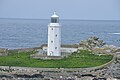
 Godrevy island lighthouse. - geograph.org.uk - 2514508.jpg 3,072 × 2,304; 1.19 MB
-
 Godrevy Lighthouse (6504).jpg 4,288 × 2,848; 5.21 MB
-
 Godrevy Lighthouse - geograph.org.uk - 2602158.jpg 2,112 × 2,816; 1.06 MB
-
 Godrevy lighthouse from Godrevy Point - geograph.org.uk - 3704479.jpg 1,024 × 696; 105 KB
-
 Godrevy Park Caravan Club Site, Upton Towans, Hayle - geograph.org.uk - 3936971.jpg 2,009 × 1,308; 648 KB
-
 Godrevy Point - geograph.org.uk - 6267898.jpg 1,005 × 754; 682 KB
-
 Godrevy point and lighthouse - geograph.org.uk - 1809296.jpg 640 × 480; 103 KB
-
 Godrevy Point north side - geograph.org.uk - 1809190.jpg 640 × 480; 87 KB
-
 Godrevy Point Path - geograph.org.uk - 6031517.jpg 3,264 × 2,448; 2.76 MB
-
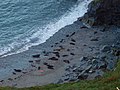 Godrevy Point seals - geograph.org.uk - 3704485.jpg 1,024 × 768; 216 KB
-
 Godrevy Rocks - geograph.org.uk - 3825547.jpg 1,536 × 1,152; 1,018 KB
-
 Godrevy Rocks and St Ives Bay - geograph.org.uk - 3825557.jpg 1,536 × 1,152; 965 KB
-

-
 Grazing land - geograph.org.uk - 5117141.jpg 640 × 426; 56 KB
-
 Grazing land, Trenawin - geograph.org.uk - 5117185.jpg 640 × 426; 51 KB
-
 Grazing, Roseworthy - geograph.org.uk - 5476109.jpg 640 × 408; 60 KB
-
 Grazing, Trevaskis - geograph.org.uk - 5536417.jpg 640 × 430; 69 KB
-
 Green Lane at Garrack - geograph.org.uk - 3230571.jpg 640 × 480; 63 KB
-
 Grey Seals - Godrevy Point - geograph.org.uk - 1809207.jpg 640 × 480; 137 KB
-
 Grey seals at Godrevy Point - geograph.org.uk - 1853389.jpg 640 × 480; 108 KB
-

-
 Gwinear church - geograph.org.uk - 3803726.jpg 1,024 × 680; 241 KB
-
 Gwinear Rd - geograph.org.uk - 5141651.jpg 640 × 426; 55 KB
-
 Gwinear Road Level Crossing - geograph.org.uk - 4167285.jpg 640 × 480; 58 KB
-
 Gwinear Road Station (remains) - geograph.org.uk - 2031864.jpg 640 × 399; 264 KB
-
 Gwinear-Gwithian , A30 - geograph.org.uk - 6305237.jpg 6,000 × 4,000; 5.67 MB
-
 Gwinear-Gwithian , Castle Giver Cove - geograph.org.uk - 6338508.jpg 6,000 × 4,000; 7.6 MB
-
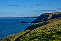
 Gwinear-Gwithian , Coastal Scenery - geograph.org.uk - 6337821.jpg 6,000 × 4,000; 6.33 MB
-
 Gwinear-Gwithian , Coastal Scenery - geograph.org.uk - 6337826.jpg 6,000 × 4,000; 7.41 MB
-
 Gwinear-Gwithian , Coastal Scenery - geograph.org.uk - 6337833.jpg 6,000 × 4,000; 6.94 MB
-
 Gwinear-Gwithian , Coastal Scenery - geograph.org.uk - 6338412.jpg 6,000 × 4,000; 7.18 MB
-
 Gwinear-Gwithian , Coastal Scenery - geograph.org.uk - 6338413.jpg 6,000 × 4,000; 7.78 MB
-
 Gwinear-Gwithian , Coastal Scenery - geograph.org.uk - 6338417.jpg 4,000 × 6,000; 6.68 MB
-
 Gwinear-Gwithian , Coastal Scenery - geograph.org.uk - 6338419.jpg 6,000 × 4,000; 6.15 MB
-
 Gwinear-Gwithian , Coastal Scenery - geograph.org.uk - 6338420.jpg 6,000 × 4,000; 7.51 MB
-
 Gwinear-Gwithian , Coastal Scenery - geograph.org.uk - 6338421.jpg 6,000 × 4,000; 6.72 MB
-
 Gwinear-Gwithian , Coastal Scenery - geograph.org.uk - 6338422.jpg 6,000 × 4,000; 6.46 MB
-
 Gwinear-Gwithian , Coastal Scenery - geograph.org.uk - 6338425.jpg 6,000 × 4,000; 6.84 MB
-
 Gwinear-Gwithian , Coastal Scenery - geograph.org.uk - 6338438.jpg 6,000 × 4,000; 5.74 MB
-
 Gwinear-Gwithian , Coastal Scenery - geograph.org.uk - 6338439.jpg 6,000 × 4,000; 7.49 MB
-
 Gwinear-Gwithian , Coastal Scenery - geograph.org.uk - 6338486.jpg 6,000 × 4,000; 7.32 MB
-
 Gwinear-Gwithian , Coastal Scenery - geograph.org.uk - 6338502.jpg 6,000 × 4,000; 6.68 MB
-
 Gwinear-Gwithian , Crop Field - geograph.org.uk - 6337790.jpg 6,000 × 4,000; 7.53 MB
-
 Gwinear-Gwithian , Crop Field - geograph.org.uk - 6338462.jpg 6,000 × 4,000; 5.82 MB
-
 Gwinear-Gwithian , Field - geograph.org.uk - 6337795.jpg 6,000 × 4,000; 7.43 MB
-
 Gwinear-Gwithian , Footpath - geograph.org.uk - 6338414.jpg 4,000 × 6,000; 7.24 MB
-
 Gwinear-Gwithian , Godrevy Cove - geograph.org.uk - 6338416.jpg 6,000 × 4,000; 6.92 MB
-
 Gwinear-Gwithian , Godrevy Cove - geograph.org.uk - 6338426.jpg 6,000 × 4,000; 6.81 MB
-
 Gwinear-Gwithian , Godrevy Island - geograph.org.uk - 6338427.jpg 6,000 × 4,000; 7.48 MB
-
 Gwinear-Gwithian , Godrevy Island - geograph.org.uk - 6338428.jpg 6,000 × 4,000; 6.66 MB
-
 Gwinear-Gwithian , Godrevy Island - geograph.org.uk - 6338435.jpg 6,000 × 4,000; 6.41 MB
-
 Gwinear-Gwithian , Godrevy Island - geograph.org.uk - 6338483.jpg 6,000 × 4,000; 7.31 MB
-
 Gwinear-Gwithian , Godrevy National Trust Car Park - geograph.org.uk - 6337831.jpg 6,000 × 4,000; 6.39 MB
-
 Gwinear-Gwithian , Grassy Field - geograph.org.uk - 6337796.jpg 6,000 × 4,000; 7.04 MB
-
 Gwinear-Gwithian , Grassy Field - geograph.org.uk - 6338468.jpg 6,000 × 4,000; 7.54 MB
-
 Gwinear-Gwithian , Grassy Field - geograph.org.uk - 6338470.jpg 6,000 × 4,000; 6.38 MB
-
 Gwinear-Gwithian , Grassy Field - geograph.org.uk - 6338546.jpg 6,000 × 4,000; 6.06 MB
-
 Gwinear-Gwithian , Grassy Track - geograph.org.uk - 6337792.jpg 6,000 × 4,000; 6.46 MB
-
 Gwinear-Gwithian , Grassy Track - geograph.org.uk - 6337794.jpg 6,000 × 4,000; 5.99 MB
-
 Gwinear-Gwithian , Grassy Track - geograph.org.uk - 6338548.jpg 6,000 × 4,000; 5.75 MB
-
 Gwinear-Gwithian , Kynance Cove - geograph.org.uk - 6338475.jpg 6,000 × 4,000; 6.65 MB
-
 Gwinear-Gwithian , Loggans Road - geograph.org.uk - 6337774.jpg 6,000 × 4,000; 7.21 MB
-
 Gwinear-Gwithian , Loggans Road B3301 - geograph.org.uk - 6337776.jpg 6,000 × 4,000; 7.4 MB
-
 Gwinear-Gwithian , Loggans Road B3301 - geograph.org.uk - 6337778.jpg 6,000 × 4,000; 6.82 MB
-
 Gwinear-Gwithian , Loggans Road B3301 - geograph.org.uk - 6337779.jpg 6,000 × 4,000; 6.65 MB
-
 Gwinear-Gwithian , Loggans Road B3301 - geograph.org.uk - 6337781.jpg 6,000 × 4,000; 6.71 MB
-
 Gwinear-Gwithian , Mutton Cove - geograph.org.uk - 6338442.jpg 6,000 × 4,000; 6.33 MB
-
 Gwinear-Gwithian , Mutton Cove - geograph.org.uk - 6338445.jpg 6,000 × 4,000; 6.94 MB
-
 Gwinear-Gwithian , Mutton Cove - geograph.org.uk - 6338447.jpg 4,000 × 6,000; 7.53 MB


.jpg)
.jpg)
.jpg)
.jpg)


.jpg)
_at_Gwithian_Parish_Church_-_geograph.org.uk_-_5384784.jpg)


.jpg)


.jpg)


.jpg)

.jpg)
.jpg)
.jpg)


.jpg)
_-_geograph.org.uk_-_1809583.jpg)

.jpg)

.jpg)
.jpg)

.jpg)


_-_geograph.org.uk_-_2031864.jpg)


