Category:GvSIG
Jump to navigation
Jump to search
Desktop application for working with geographic data   | |||||
| Upload media | |||||
| Instance of | |||||
|---|---|---|---|---|---|
| Copyright license | |||||
| Has use | |||||
| Platform | |||||
| Software version identifier |
| ||||
| official website | |||||
| |||||
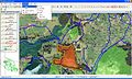
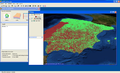
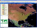
GvSIG is a multilingual, open source geographic information system (GIS) that can handle both vector and raster data.
Media in category "GvSIG"
The following 11 files are in this category, out of 11 total.
-
 GvSIG - Geographic Information System.jpg 1,280 × 770; 558 KB
-
 GvSIG - GIS.jpg 1,280 × 770; 607 KB
-
 GvSIG 3D 01.png 800 × 484; 357 KB
-
 GvSIG China sreenshot.png 1,024 × 735; 817 KB
-
 GvSIG raster 01.png 800 × 555; 212 KB
-
 GvSIG redes 02 mini.png 150 × 88; 24 KB
-
 GvSIG redes 02.png 800 × 468; 580 KB
-
 GvSIG screenshot.JPG 1,024 × 768; 133 KB
-
 GvSIG载图.JPG 1,280 × 772; 154 KB
-
 Logo gvSIG.png 270 × 272; 16 KB
-
 SEXTANTE - gvSIG.png 1,280 × 770; 260 KB


