Category:Guideposts of Via dei Monti Lariani - sezione 3
Jump to navigation
Jump to search
Subcategories
This category has only the following subcategory.
G
Media in category "Guideposts of Via dei Monti Lariani - sezione 3"
The following 92 files are in this category, out of 92 total.
-
 Bridge over Torrente Serio, towards Carcente 2.jpg 7,024 × 4,968; 11.21 MB
-
 Cartello di località Barna 563.jpg 1,767 × 1,164; 907 KB
-
 Cartello per Mulino - Plesio e segnavia VML3 a Barì.jpg 7,296 × 5,472; 8.03 MB
-
 Climbing on VML3 to the houses of Mutadello.jpg 4,608 × 3,456; 5.37 MB
-
 Detail of a route marker VML3 between waterworks building over Garzeno and L'Avolo.jpg 4,608 × 3,456; 4.63 MB
-
 Detail of a VML3 route marker on a building at Monti di Bracco.jpg 7,296 × 5,472; 12.11 MB
-
 Detail of VML3 route marker at Monti di Bracco.jpg 3,648 × 2,176; 1.65 MB
-
 Guidepost and information board for Rifugio La Canua, in Montuglio.jpg 7,296 × 5,472; 9.98 MB
-
 Guidepost and route marker VML3 above Bracco.jpg 7,296 × 5,472; 14.35 MB
-
 Guidepost Barna 563.jpg 2,759 × 4,287; 2.32 MB
-
 Guidepost between Naro and Alpe di Nalcim 01.jpg 7,296 × 5,472; 13.77 MB
-
 Guidepost between Naro and Alpe di Nalcim 02.jpg 7,296 × 5,472; 10.54 MB
-
 Guidepost in Barì (Plesio) 01.jpg 7,296 × 5,472; 7.82 MB
-
 Guidepost in Barì (Plesio) 02.jpg 5,720 × 4,408; 4.37 MB
-
 Guidepost in Barì (Plesio), al bivio tra Breglia e Mulino Spinzi.jpg 7,296 × 5,472; 5.82 MB
-
 Guidepost in Guaggio di Sotto (Garzeno).jpg 1,302 × 2,174; 1.12 MB
-
 Guidepost in Monti di Giugallo.jpg 7,296 × 5,472; 9.59 MB
-
 Guidepost in Piazza del Tavolo (Barna).jpg 4,576 × 1,886; 2.24 MB
-
 Guidepost north of Alpe di Nalcim 01.jpg 7,296 × 5,472; 12.9 MB
-
 Guidepost north of Alpe di Nalcim 02.jpg 7,296 × 5,472; 11.8 MB
-
 Guidepost on VML3 at fork between Alpe di Nalcim and Monti Dacca 01.jpg 7,296 × 5,472; 10.74 MB
-
 Guidepost on VML3 at fork between Alpe di Nalcim and Monti Dacca 02.jpg 7,296 × 5,472; 12.07 MB
-
 Guidepost on VML3 between Val Beller and Monti di Naro (2).jpg 7,296 × 5,472; 9.14 MB
-
 Guidepost on VML3 between Val Beller and Monti di Naro (3).jpg 7,296 × 5,472; 8.52 MB
-
 Guidepost on VML3 between Val Beller and Monti di Naro.jpg 7,296 × 5,472; 11.55 MB
-
 Guidepost to Carcente in Monti di Carcente (cropped).jpg 2,115 × 2,792; 2.23 MB
-
 Guidepost to Rifugio La Canua.jpg 3,332 × 3,600; 6.4 MB
-
 Guidepost to San Bernardo between Labbio and San Bernardo.jpg 4,290 × 2,778; 7.3 MB
-
 Guidepost VML3 at Monti di Narro.jpg 7,296 × 5,472; 8.51 MB
-
 Guidepost VML3 between S. Bernardo and Monte Piazze.jpg 3,930 × 2,916; 3.88 MB
-
 Guideposto VML3 over Bracco.jpg 2,992 × 3,720; 5.15 MB
-
 Guideposts in Monte Piazze 01.jpg 4,608 × 3,456; 7.2 MB
-
 Guideposts in Monte Piazze 02.jpg 4,608 × 3,456; 7.19 MB
-
 Guideposts pointing to Breglia, along VML3.jpg 7,296 × 5,472; 9.43 MB
-
 Mutadello, a painted route marks signal the need to turn left towards Monte Piazze.jpg 4,608 × 3,456; 5.96 MB
-
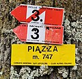 Piazza m. 747.jpg 3,855 × 3,699; 2.49 MB
-
 Place name sign at Monti Luina.jpg 7,296 × 5,472; 7.68 MB
-
 Rifugio La Preda 03.jpg 7,296 × 5,472; 11.02 MB
-
 Route marker and name sign in Monti di Naro.jpg 7,296 × 5,472; 5.69 MB
-
 Route marker of VML3 in Pian del Lac.jpg 7,296 × 5,472; 11.85 MB
-
 Route marker VML3 along road towards Alpe Rescanscia.jpg 7,296 × 5,472; 11.13 MB
-
 Route marker VML3 and Sentiero 4 Valli between Barì and Breglia.jpg 1,273 × 1,318; 472 KB
-
 Route marker VML3 between just south of Monte Piazze.jpg 4,608 × 3,456; 4.72 MB
-
 Route marker VML3 between S. Bernardo and Monte Piazze.jpg 4,608 × 3,456; 5.47 MB
-
 Route marker VML3 between waterworks building over Garzeno and L'Avolo.jpg 4,608 × 3,456; 9.22 MB
-
 Route marker VML3 on a building, exiting Monte Piazze towards San Bernardo.jpg 2,493 × 1,383; 644 KB
-
 Route marker VML3 on a building, on the path to Luina.jpg 7,296 × 5,472; 8.93 MB
-
 Route marker VML3 on Via del Murello.jpg 5,968 × 5,440; 7.89 MB
-
 Route markers VML3 and VML4 along Via Sant'Anna (Garzeno).jpg 4,608 × 3,456; 8.57 MB
-
 Route markers VML4 and VML3 between Garzeno and L'Avolo.jpg 4,608 × 3,456; 10.71 MB
-
 Route markers VML4 and VML3 between Garzeno and waterworks building.jpg 4,608 × 3,456; 9.73 MB
-
 Segnavia a Cardano, via Carlo Galbiati (1-2).jpg 5,096 × 5,180; 3.07 MB
-
 Segnavia a Cardano, via Carlo Galbiati (2-2).jpg 4,016 × 4,472; 2.78 MB
-
 Segnavia a Cardano.jpg 3,916 × 4,660; 2.56 MB
-
 Segnavia a La Piazza.jpg 7,296 × 5,472; 4.78 MB
-
 Segnavia a Montuglio.jpg 5,288 × 5,252; 8.54 MB
-
 Segnavia Barna 563 m.jpg 4,148 × 5,285; 4.41 MB
-
 Segnavia Codogna piazza Camozzi (2-2). 01.jpg 5,004 × 4,760; 5.62 MB
-
 Segnavia Codogna piazza Camozzi (2-2). 02.jpg 4,164 × 5,408; 5.57 MB
-
 Segnavia in legno a Breglia.jpg 4,425 × 3,699; 7.11 MB
-
 Segnavia La Piazza 770 m.jpg 6,261 × 5,238; 3.58 MB
-
 Segnavia Mulino Chioderia (1-2).jpg 5,676 × 5,176; 4.88 MB
-
 Segnavia Mulino Chioderia (2-2).jpg 3,704 × 4,920; 3.29 MB
-
 Segnavia per Barna (1-2).jpg 5,008 × 5,148; 6.58 MB
-
 Segnavia per Barna (2-2).jpg 6,828 × 5,336; 7.12 MB
-
 Segnavia sopra Barna (Plesio) 1-2.jpg 6,840 × 4,832; 7.45 MB
-
 Segnavia sopra Barna (Plesio) 2-2.jpg 6,224 × 5,152; 3.37 MB
-
 Segnavia su VML tra La Piazza e Barna.jpg 4,608 × 3,960; 2.46 MB
-
 Segnavia VML3 tra Barì e Maggino.jpg 5,876 × 4,494; 4.67 MB
-
 Street corner of Via Sopra Pozzi and Via Sant'Anna (Garzeno).jpg 4,608 × 3,456; 5.15 MB
-
 Via alla Mason dei Monti seen from intersection with Via Carcente.jpg 7,296 × 5,472; 7.12 MB
-
 Via dei Monti Lariani in Garzeno, route marker.jpg 4,608 × 3,456; 5.76 MB
-
 Via Sant'Anna, seen from intersection with Via Sopra Pozzi.jpg 4,608 × 3,456; 6.43 MB
-
 VML directional route marker towards Carcente.jpg 7,296 × 5,472; 11.5 MB
-
 VML3 detour between Breglia and Rifugio La Preda 02.jpg 7,296 × 5,472; 10.42 MB
-
 VML3 detour between Breglia and Rifugio La Preda 03.jpg 7,296 × 5,472; 10.57 MB
-
 VML3 detour between Breglia and Rifugio La Preda 04.jpg 7,296 × 5,472; 10.34 MB
-
 VML3 detour between Breglia and Rifugio La Preda 06.jpg 7,296 × 5,472; 8.54 MB
-
 VML3 guidepost at Bocchetta di San Bernardo - 1.jpg 4,608 × 3,456; 6.76 MB
-
 VML3 guidepost at Bocchetta di San Bernardo - 2.jpg 4,608 × 3,456; 7.08 MB
-
 VML3 guidepost between Brecchio e Labbio.jpg 2,211 × 2,811; 5.5 MB
-
 VML3 guidepost between Labbio and San Bernardo.jpg 4,608 × 3,456; 8.46 MB
-
 VML3 route marker at Monti di Bracco.jpg 5,888 × 5,148; 5.5 MB
-
 VML3 route marker between Bracco and San Domenico.jpg 7,296 × 5,472; 12.94 MB
-
 VML3 route marker between Guaggio and Mutadello.jpg 4,608 × 3,456; 2.9 MB
-
 VML3 route marker entering Mutadello from west.jpg 4,608 × 3,456; 5.68 MB
-
 VML3 route marker in Mutadello.jpg 4,608 × 3,456; 6.79 MB
-
 VML3 route marker in Piazze.jpg 4,608 × 3,456; 8.64 MB
-
 VML3 route marker on a building at Monti di Bracco.jpg 7,296 × 5,472; 7.37 MB
-
 VML3 route marker, between Torrente Albano and Catasco.jpg 4,056 × 1,563; 2.75 MB
-
 VML3, directional route marker between Mutadello and Monte Piazze.jpg 4,608 × 3,456; 8.2 MB
-
 VML4 leaves Garzeno towards L'Avolo.jpg 4,608 × 3,456; 10.23 MB


_01.jpg)
_02.jpg)
,_al_bivio_tra_Breglia_e_Mulino_Spinzi.jpg)
.jpg)


.jpg)
.jpg)

.jpg)


.jpg)


.jpg)
.jpg)


._01.jpg)
._02.jpg)


.jpg)
.jpg)
.jpg)
.jpg)
_1-2.jpg)
_2-2.jpg)


.jpg)


.jpg)