Category:Gryphenhübeli (Bern)
Jump to navigation
Jump to search
| Object location | | View all coordinates using: OpenStreetMap |
|---|
Deutsch: Gryphenhübeli ist ein Quartier, respektive "Statistischer Bezirk", im Stadtteil Kirchenfeld-Schosshalde, der auch als Stadtteil IV bekannt ist, in der Stadt Bern in der Schweiz. Siehe auch Grenzen Gryphenhübeliquartier auf OSM
quarter/"statistical district", in the district Kirchenfeld-Schosshalde/quarter IV in the city of Bern, Switzerland  | |||||
| Upload media | |||||
| Instance of |
| ||||
|---|---|---|---|---|---|
| Part of | |||||
| Location | Kirchenfeld-Schosshalde, Bern, Bern-Mittelland administrative district, Bernese Mittelland administrative region, Bern, Switzerland | ||||
| Area |
| ||||
 | |||||
Subcategories
This category has the following 17 subcategories, out of 17 total.
B
- Brunnen Muristrasse (Bern) (4 F)
E
F
- Felsenburg (Bern) (21 F)
M
- Mahogany Hall Bern (1 F)
N
S
T
V
Media in category "Gryphenhübeli (Bern)"
The following 4 files are in this category, out of 4 total.
-
 Adventhaus in Bern.jpg 4,032 × 3,024; 3.8 MB
-
 Karte Berner Quartiere Gryphenhübeli.png 1,476 × 793; 281 KB
-
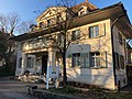
 Klösterlistutz 16 Bern 20230530 0048.jpg 8,256 × 5,504; 50.51 MB
-
 Klösterlistutz 16, 18, 18a, 20 Bern 20230530 0049.jpg 8,256 × 5,504; 56.79 MB


