Category:Grote kerk (Blokzijl)
Jump to navigation
Jump to search
| Object location | | View all coordinates using: OpenStreetMap |
|---|
church building in Steenwijkerland, Netherlands  | |||||
| Upload media | |||||
| Instance of | |||||
|---|---|---|---|---|---|
| Location | Blokzijl, Overijssel, Netherlands | ||||
| Street address |
| ||||
| Located on street |
| ||||
| Heritage designation |
| ||||
| Inception |
| ||||
| Significant event |
| ||||
 | |||||
Nederlands: Grote Kerk - Blokzijl
|
This is a category about rijksmonument number 10448
|
| Address |
|
Media in category "Grote kerk (Blokzijl)"
The following 69 files are in this category, out of 69 total.
-
 ? - Blokzijl - 20036438 - RCE.jpg 1,200 × 882; 209 KB
-

-
 Blokzijl - erfgoed - 2013 - Brouwerstraat -016.JPG 3,888 × 2,592; 6.03 MB
-
 Blokzijl - Grote kerk-004.JPG 2,592 × 3,888; 5.47 MB
-
 Blokzijl - Grote kerk-009.JPG 3,888 × 2,592; 2.52 MB
-
 Blokzijl - Grote kerk-1 - anno 1609.JPG 2,592 × 3,888; 2.14 MB
-
 Blokzijl 102.JPG 3,264 × 2,448; 2.06 MB
-
 Blokzijl 103.JPG 3,264 × 2,448; 1.88 MB
-
 Blokzijl 110.JPG 3,264 × 2,448; 2.02 MB
-
 Blokzijl 115.JPG 2,448 × 3,264; 2.11 MB
-
 Blokzijl 116.JPG 2,448 × 3,264; 1.99 MB
-
 Blokzijl 117.JPG 2,448 × 3,264; 1.88 MB
-
 Blokzijl 3450.JPG 300 × 400; 109 KB
-

-

-
 Brouwerstraat 11 Grote Kerk Blokzijl.jpg 2,647 × 3,529; 618 KB
-
 Brouwerstraat 11 Grote Kerk2 Blokzijl.jpg 2,592 × 3,456; 582 KB
-
 Brouwerstraat 11 Grote Kerk3 Blokzijl.jpg 2,736 × 3,648; 779 KB
-
 De grote kerk Blokzijl.jpg 1,733 × 2,308; 2.07 MB
-
 De Kolkklanken (9158360201).jpg 2,048 × 1,360; 2.8 MB
-
 Exterieur naar het zuid-oosten - Blokzijl - 20036385 - RCE.jpg 886 × 1,200; 209 KB
-
 Exterieur west gevel naar het noord-oosten - Blokzijl - 20036391 - RCE.jpg 958 × 1,200; 269 KB
-
 Gevel vanuit de Brouwerstr. gezien - Blokzijl - 20036386 - RCE.jpg 903 × 1,200; 245 KB
-
 Gevel Wijde Steeg - Blokzijl - 20036388 - RCE.jpg 905 × 1,200; 229 KB
-
 Glas in loodraam - Blokzijl - 20036401 - RCE.jpg 958 × 1,200; 164 KB
-
 Grote kerk Blokzijl.JPG 2,128 × 2,832; 2.24 MB
-
 Hervormde kerk Blokzijl vanaf Zuiderstraat.jpg 850 × 1,270; 169 KB
-
 Hervormde kerk met haven als voorgrond.jpg 850 × 569; 110 KB
-
 Ingang, Grote kerk (Blokzijl).JPG 3,024 × 4,032; 2.63 MB
-
 Interieur - Blokzijl - 20036398 - RCE.jpg 889 × 1,200; 196 KB
-
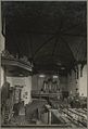
 Interieur gezien naar het westen - Blokzijl - 20325646 - RCE.jpg 840 × 1,200; 126 KB
-

-
 Interieur hervormde kerk gezien naar het oosten - Blokzijl - 20320027 - RCE.jpg 814 × 1,200; 148 KB
-

-

-
 Interieur naar het noorden - Blokzijl - 20036396 - RCE.jpg 961 × 1,200; 203 KB
-
 Interieur naar het oosten - Blokzijl - 20036397 - RCE.jpg 1,200 × 952; 222 KB
-
 Interieur naar het westen - Blokzijl - 20036395 - RCE.jpg 1,200 × 952; 189 KB
-
 Interieur naar het zuiden - Blokzijl - 20036394 - RCE.jpg 1,200 × 945; 196 KB
-
 Interieur preekstoel - Blokzijl - 20323385 - RCE.jpg 1,200 × 884; 162 KB
-
 Interieur, aanzicht orgel, orgelnummer 192 - Blokzijl - 20417548 - RCE.jpg 747 × 1,200; 160 KB
-
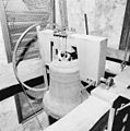 INTERIEUR, TOREN, KLOK (J.N. DERK) - Blokzijl - 20275557 - RCE.jpg 1,190 × 1,200; 325 KB
-
 INTERIEUR, TOREN, KLOK (J.N. DERK) - Blokzijl - 20275558 - RCE.jpg 1,188 × 1,200; 257 KB
-
 INTERIEUR, TOREN, KLOK (J.N. DERK) - Blokzijl - 20275559 - RCE.jpg 1,186 × 1,200; 257 KB
-
 INTERIEUR, TOREN, KLOK (J.N. DERK) - Blokzijl - 20275560 - RCE.jpg 1,195 × 1,200; 272 KB
-
 INTERIEUR, TOREN, KLOK (J.N. DERK) - Blokzijl - 20275561 - RCE.jpg 1,197 × 1,200; 271 KB
-
 Kerk, uitwendig - Blokzijl - 20036399 - RCE.jpg 804 × 1,200; 153 KB
-
 Kerk, uitwendig - Blokzijl - 20036400 - RCE.jpg 799 × 1,200; 130 KB
-
 Kerktoren, gezien naar het noordwesten - Blokzijl - 20404426 - RCE.jpg 956 × 1,200; 280 KB
-
 Offerblok - Blokzijl - 20036403 - RCE.jpg 961 × 1,200; 162 KB
-
 Offerblok - Blokzijl - 20036404 - RCE.jpg 975 × 1,200; 174 KB
-
 Offerblok - Blokzijl - 20036405 - RCE.jpg 956 × 1,200; 142 KB
-
 Offerblok - Blokzijl - 20036406 - RCE.jpg 966 × 1,200; 144 KB
-
 Oost gevel naar het noord-westen - Blokzijl - 20036390 - RCE.jpg 953 × 1,200; 246 KB
-
 Overzicht - Blokzijl - 20036371 - RCE.jpg 1,200 × 802; 158 KB
-
 Overzicht - Blokzijl - 20036372 - RCE.jpg 805 × 1,200; 169 KB
-
 Overzicht - Blokzijl - 20036375 - RCE.jpg 802 × 1,200; 146 KB
-
 Overzicht - Blokzijl - 20036376 - RCE.jpg 1,200 × 803; 166 KB
-
 Overzicht - Blokzijl - 20036458 - RCE.jpg 804 × 1,200; 171 KB
-
 Plattegrond der graven door H.Pauw 1808 - Blokzijl - 20036384 - RCE.jpg 1,200 × 889; 259 KB
-
 Toren in de Kerkstr. - Blokzijl - 20036387 - RCE.jpg 902 × 1,200; 191 KB
-
 Toren naar het oosten - Blokzijl - 20036393 - RCE.jpg 959 × 1,200; 205 KB
-
 Wijk III, verbrande huizen - Blokzijl - 20036452 - RCE.jpg 1,200 × 893; 186 KB
-
 Wijk III, verbrande huizen - Blokzijl - 20036453 - RCE.jpg 878 × 1,200; 229 KB
-

-
 Zicht op portaal zuidzijde hervormde kerk - Blokzijl - 20320778 - RCE.jpg 842 × 1,200; 186 KB
-

-

-
 Zuid-gevel met ingangspartij - Blokzijl - 20036389 - RCE.jpg 968 × 1,200; 275 KB


_en_de_Zeedijk_IMG_2834_2018-04-20_14.49.jpg)


.jpg)


.JPG)


_-_Blokzijl_-_20275557_-_RCE.jpg)
_-_Blokzijl_-_20275558_-_RCE.jpg)
_-_Blokzijl_-_20275559_-_RCE.jpg)
_-_Blokzijl_-_20275560_-_RCE.jpg)
_-_Blokzijl_-_20275561_-_RCE.jpg)


