Category:Grimburgwal 15, Amsterdam
Jump to navigation
Jump to search
| Object location | | View all coordinates using: OpenStreetMap |
|---|
 | |||||
| Upload media | |||||
| Instance of |
| ||||
|---|---|---|---|---|---|
| Location | Amsterdam, North Holland, Netherlands | ||||
| Street address |
| ||||
| Located on street | |||||
| Heritage designation |
| ||||
 | |||||
|
This is a category about rijksmonument number 1236
|
| Address |
|
Media in category "Grimburgwal 15, Amsterdam"
The following 7 files are in this category, out of 7 total.
-
 Amsterdam - Grimburgwal 15.jpg 1,936 × 2,592; 1.61 MB
-
 Amsterdam - hoek Grimburgwal - Oudezijds Voorburgwal.JPG 2,592 × 1,936; 2.13 MB
-
 Amsterdam - Oudezijds Voorburgwal 332-334.jpg 1,936 × 2,592; 1.25 MB
-
 M 15 - Amsterdam - 20016954 - RCE.jpg 1,198 × 1,200; 391 KB
-
 M 15 - Amsterdam - 20016955 - RCE.jpg 1,200 × 1,174; 356 KB
-
 M 15 - Amsterdam - 20378757 - RCE.jpg 1,200 × 1,197; 379 KB
-
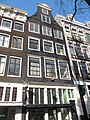 RM1236 Grimburgwal 15.jpg 2,448 × 3,264; 2.27 MB


