Category:Green River (Colorado River) in Wyoming
Jump to navigation
Jump to search
Subcategories
This category has the following 4 subcategories, out of 4 total.
E
- ETD Bridge over Green River (4 F)
- ETR Big Island Bridge (3 F)
S
Media in category "Green River (Colorado River) in Wyoming"
The following 58 files are in this category, out of 58 total.
-
 17233 Grand Canyon Nat Park Historic River Photo (7304987620).jpg 1,024 × 600; 201 KB
-
 17239 Grand Canyon Powell Expedition 1873 (4686937042).jpg 633 × 480; 89 KB
-
 17241 Grand Canyon Powell Expedition 1873 (4686937072).jpg 361 × 480; 60 KB
-
 17243 Grand Canyon Powell Expedition 1873 (4686303519).jpg 381 × 480; 67 KB
-
 17244 Grand Canyon Powell Expedition 1873 (4686303555).jpg 720 × 438; 123 KB
-

-
 Brush Creek. On Ashley Fork, Green River. Old nos. 348, 358 - NARA - 517835.jpg 3,000 × 2,307; 5.06 MB
-
 Brush Creek. On Ashley Fork, Green River. Old nos. 348, 358, 1871 - 1878 - NARA - 517835.jpg 3,000 × 2,307; 2.36 MB
-
 Buttes near Green River City (Wyo.) - T. H. O'Sullivan, phot. LCCN2006677736.jpg 8,848 × 6,842; 4.76 MB
-
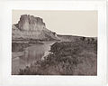 Castle Rock Green River by Andrew J Russell.jpg 1,536 × 1,212; 193 KB
-
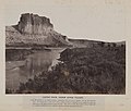 Castle Rock, Green River Valley. (8704886541).jpg 1,000 × 847; 716 KB
-
 CastleRock.jpg 600 × 509; 101 KB
-
 Citadel Rock, Green River Valley (36428529693).jpg 3,344 × 2,400; 793 KB
-
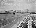
 ENP Bridge over Green River.jpg 4,736 × 3,709; 1.41 MB
-
 ETR Big Island Bridge.jpg 4,656 × 3,649; 2.18 MB
-
 Flaming Gorge. Green River, Wyoming - NARA - 519464.jpg 3,000 × 2,510; 1.6 MB
-
 Flaming Gorge. Green River, Wyoming - NARA - 519466.jpg 3,000 × 2,499; 1.68 MB
-
 Flaming Gorge. Green River, Wyoming - NARA - 519467.jpg 2,499 × 3,000; 1.7 MB
-

-

-

-
 Green River, Beehive Point. Old No. 414. (Beaman neg.) - NARA - 517808.jpg 3,000 × 1,887; 4.24 MB
-
 Green River, Beehive Point. Old No. 414. (Beaman neg.), 1871 - 1878 - NARA - 517808.jpg 3,000 × 1,887; 1.96 MB
-

-
 Green River. A tributary to Red Canyon. Old nos. 291, 408 - NARA - 517868.jpg 3,000 × 1,883; 4.1 MB
-
 Green River. A tributary to Red Canyon. Old nos. 291, 408, 1871 - 1878 - NARA - 517868.jpg 3,000 × 1,883; 1.91 MB
-

-

-

-

-
 Green River. Horseshoe Canyon, looking up stream. Old nos. 285, 418. - NARA - 517852.jpg 3,000 × 1,887; 4.07 MB
-

-

-

-

-

-

-

-

-

-

-

-
 Green River. Red Canyon. Old nos. 301, 407 - NARA - 517858.jpg 3,000 × 1,855; 3.51 MB
-
 Green River. Red Canyon. Old nos. 301, 407, 1871 - 1878 - NARA - 517858.jpg 3,000 × 1,855; 1.55 MB
-
 GreenRiverWY.jpg 887 × 600; 90 KB
-
 Horseshoe Canyon, Curve, Big Bend of Green River, Wyoming - NARA - 519564.jpg 3,000 × 1,931; 1.44 MB
-
 Horseshoe Canyon, Green River, Wyoming - NARA - 519565.jpg 3,000 × 1,912; 1.39 MB
-
 Horseshoe Canyon. Green River - NARA - 519468.jpg 3,000 × 2,492; 1.31 MB
-
 Moran river-wyoming.jpg 2,152 × 1,095; 649 KB
-
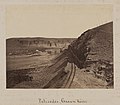 Palisades, Green River (8704887651).jpg 1,000 × 877; 813 KB
-
 Pbcomplexsb.jpg 3,296 × 2,472; 1.04 MB
-
 Red Canyon, Green River, Wyoming. Old nos. 402, 293 - NARA - 517820.jpg 1,853 × 3,000; 3.74 MB
-
 Red Canyon, Green River, Wyoming. Old nos. 402, 293, 1871 - 1878 - NARA - 517820.jpg 1,853 × 3,000; 1.67 MB
-

-
 Seedskadee nwr sunset.jpg 4,288 × 2,848; 6.53 MB
-
 Taken in western Wyoming along the Green River.jpg 2,592 × 1,936; 2.55 MB
-
 West bank of Green River. Sweetwater County, Wyoming - NARA - 516625.jpg 3,000 × 2,368; 1.52 MB
-
 Wyoming 1997 09.jpg 1,036 × 690; 816 KB
.jpg)
.jpg)
.jpg)
.jpg)
.jpg)
_on_the_California,_Mormon_Pioneer,_and_Oregon_National_Historic_Trails_(2003)_(2e585715-fe81-47cc-9ed5-4ee9b45708a6).JPG)


_-_T._H._O%27Sullivan,_phot._LCCN2006677736.jpg)

.jpg)

.jpg)


_-_NARA_-_517808.jpg)
,_1871_-_1878_-_NARA_-_517808.jpg)


._The_camp_tent_is_on_the_left_-_NARA_-_517869.jpg)
._The_camp_tent_is_on_the_left_and_5_men_are..._-_NARA_-_517869.jpg)


.jpg)


Categories:
- Rivers of Wyoming
- Green River (Colorado River) by state
- Tributaries of the Colorado River in Wyoming
- Bridger-Teton National Forest
- Geography of Sublette County, Wyoming
- Geography of Lincoln County, Wyoming
- Locations along Interstate 80 in Wyoming
- Locations along U.S. Route 30 in Wyoming
- Locations along U.S. Route 189 in Wyoming
- Locations along U.S. Route 191 in Wyoming
- Locations along Wyoming Highway 28
- Locations along Wyoming Highway 351
- Locations along Wyoming Highway 374
- Locations along Wyoming Highway 530