Category:Great Wilbraham
Jump to navigation
Jump to search

a village located in South Cambridgeshire, United Kingdom  | |||||
| Upload media | |||||
| Instance of | |||||
|---|---|---|---|---|---|
| Location | South Cambridgeshire, Cambridgeshire, East of England, England | ||||
| Said to be the same as | Great Wilbraham (Wikimedia duplicated page, civil parish) | ||||
 | |||||
English: Great Wilbraham is a small village situated in a rural area some seven miles (11 km) to the east of Cambridge, between the edge of an area of low-lying drained fens to the west and north, and higher ground beyond the A11 to the east.
Nederlands: Great Wilbraham is een dorp in het Engelse graafschap Cambridgeshire. Het dorp ligt in het district South Cambridgeshire en telt 639 inwoners.
Subcategories
This category has the following 2 subcategories, out of 2 total.
C
N
Media in category "Great Wilbraham"
The following 200 files are in this category, out of 376 total.
(previous page) (next page)-

-
 A changed view from Mill Road - geograph.org.uk - 3769760.jpg 1,200 × 925; 1.29 MB
-
 A December morning on Mill Road - geograph.org.uk - 3769793.jpg 1,024 × 1,024; 1.22 MB
-
 A dip in the Dyke - geograph.org.uk - 2240644.jpg 800 × 600; 237 KB
-
 A January morning in Great Wilbraham - geograph.org.uk - 4311518.jpg 1,024 × 731; 985 KB
-
 A long view from Mutlow Hill - geograph.org.uk - 3768866.jpg 1,024 × 768; 919 KB
-
 A view towards Cambridge - geograph.org.uk - 2698320.jpg 1,024 × 762; 1.34 MB
-
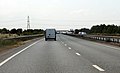
 A11 - geograph.org.uk - 3331136.jpg 640 × 430; 46 KB
-
 A11 heading north-east - geograph.org.uk - 5683699.jpg 640 × 428; 101 KB
-
 A11 heading north-east - geograph.org.uk - 5683715.jpg 640 × 428; 85 KB
-
 A11 heading south west - geograph.org.uk - 3564057.jpg 1,744 × 1,063; 1.08 MB
-
 A11 heading south west - geograph.org.uk - 3564063.jpg 1,777 × 1,078; 1.31 MB
-
 A11 junction - geograph.org.uk - 2588184.jpg 640 × 430; 56 KB
-
 A11 southbound - geograph.org.uk - 2718808.jpg 640 × 440; 53 KB
-
 A11 southbound - geograph.org.uk - 2718810.jpg 640 × 408; 37 KB
-
 A11 southbound - geograph.org.uk - 2718814.jpg 640 × 456; 70 KB
-
 A11 towards Newmarket - geograph.org.uk - 4873476.jpg 640 × 480; 67 KB
-
 A11 towards Newmarket - geograph.org.uk - 4873485.jpg 640 × 480; 55 KB
-
 A11 towards Newmarket - geograph.org.uk - 4873489.jpg 640 × 480; 48 KB
-
 A11, A1304 turning - geograph.org.uk - 3331138.jpg 640 × 438; 45 KB
-
 A11, Layby - geograph.org.uk - 3768273.jpg 640 × 430; 62 KB
-
 A11, Mill Road Bridge - geograph.org.uk - 3331133.jpg 640 × 430; 41 KB
-
 A11, Mill Road Bridge - geograph.org.uk - 3819311.jpg 640 × 430; 49 KB
-
 A11, The Wilbrahams turning - geograph.org.uk - 3372434.jpg 640 × 450; 63 KB
-
 A1304 turning, A11 - geograph.org.uk - 3768293.jpg 640 × 430; 46 KB
-
 Abandoned railway seen from Fleam Dyke - geograph.org.uk - 2240523.jpg 800 × 600; 211 KB
-
 Across the fields to Great Wilbraham church - geograph.org.uk - 2698907.jpg 1,024 × 716; 1.08 MB
-
 Across the fields to Little Wilbraham Windmill - geograph.org.uk - 2700343.jpg 1,024 × 768; 830 KB
-
 Across the years from Fleam Dyke - geograph.org.uk - 5234580.jpg 1,024 × 1,024; 1.59 MB
-
 Aglais urticae - geograph.org.uk - 970241.jpg 640 × 640; 183 KB
-
 Allotments on Toft Lane - geograph.org.uk - 1046882.jpg 640 × 480; 123 KB
-
 Angle End Cottage - detail - geograph.org.uk - 970183.jpg 640 × 480; 115 KB
-
 Angle End Cottage - geograph.org.uk - 970191.jpg 640 × 480; 58 KB
-
 Anthills on Great Wilbraham Common - geograph.org.uk - 2563272.jpg 1,600 × 1,200; 811 KB
-
 Autumn sowing - geograph.org.uk - 3178033.jpg 1,024 × 768; 1.08 MB
-
 Back the way you came - geograph.org.uk - 2698817.jpg 1,024 × 756; 1 MB
-
 Bales by the hedge - geograph.org.uk - 5254924.jpg 640 × 426; 86 KB
-
 Barley field and wind farm - geograph.org.uk - 3108176.jpg 1,600 × 1,200; 616 KB
-
 Barns, Home Farm - geograph.org.uk - 5760886.jpg 640 × 425; 31 KB
-
 Benchmark on St Nicholas - geograph.org.uk - 5419876.jpg 1,600 × 1,200; 1.29 MB
-
 Bend, A11 - geograph.org.uk - 3768286.jpg 640 × 430; 47 KB
-
 Between the Wilbrahams - geograph.org.uk - 2725921.jpg 640 × 486; 103 KB
-
 Beware of trains - geograph.org.uk - 2351769.jpg 800 × 600; 528 KB
-
 Blue sky and pylons - geograph.org.uk - 2698860.jpg 1,024 × 689; 820 KB
-
 Blue sky in November - geograph.org.uk - 2698405.jpg 1,024 × 768; 891 KB
-
 Break in Fleam Dyke - geograph.org.uk - 1017202.jpg 640 × 480; 94 KB
-
 Bridge over dry New Cut - geograph.org.uk - 2725905.jpg 1,024 × 768; 1.29 MB
-
 Bridge over New Cut - geograph.org.uk - 4110959.jpg 768 × 1,024; 1.31 MB
-
 Bridge over the A11 - geograph.org.uk - 3768276.jpg 640 × 430; 33 KB
-

-
 Bridleway from West Wratting Farm - geograph.org.uk - 1158631.jpg 640 × 480; 87 KB
-

-

-
 Butt Lane, Gt Wilbraham - geograph.org.uk - 1700512.jpg 4,272 × 2,848; 3.76 MB
-
 Byway and pylon - geograph.org.uk - 2249407.jpg 800 × 600; 442 KB
-
 Byway and stud farm - geograph.org.uk - 2249346.jpg 800 × 600; 498 KB
-
 Byway east of Great Wilbraham - geograph.org.uk - 4873631.jpg 640 × 480; 64 KB
-
 Byway from Great Wilbraham - geograph.org.uk - 1047123.jpg 640 × 480; 149 KB
-
 Byway from Great Wilbraham - geograph.org.uk - 3300037.jpg 1,200 × 857; 1.43 MB
-
 Byway sign - geograph.org.uk - 1047118.jpg 640 × 480; 179 KB
-
 Byway to - er - Six Mile Bottom^ - geograph.org.uk - 970286.jpg 640 × 480; 65 KB
-
 Byway with locked gate - geograph.org.uk - 1047120.jpg 640 × 480; 176 KB
-
 Cable-laying on Wilbraham Road - geograph.org.uk - 4311543.jpg 1,024 × 732; 937 KB
-
 Can You Guess The House Number - geograph.org.uk - 5631763.jpg 1,024 × 768; 242 KB
-
 Chalk Pit - geograph.org.uk - 2002315.jpg 1,600 × 1,200; 477 KB
-
 Chalk pit and turbines - geograph.org.uk - 3769289.jpg 1,200 × 905; 1.27 MB
-
 Changed view from Fleam Dyke - geograph.org.uk - 3178006.jpg 1,024 × 768; 1.03 MB
-
 Church of St. Nicholas - geograph.org.uk - 5261355.jpg 1,600 × 1,067; 699 KB
-
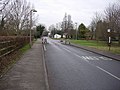 Church Road, Great Wilbraham - geograph.org.uk - 1156016.jpg 640 × 480; 111 KB
-
 Church Street, Great Wilbraham - geograph.org.uk - 4486269.jpg 1,280 × 851; 278 KB
-
 Church Street, Great Wilbraham - geograph.org.uk - 4853397.jpg 640 × 480; 77 KB
-

-
 Crops - geograph.org.uk - 5254921.jpg 640 × 426; 50 KB
-
 Crossing the A11 - geograph.org.uk - 3120536.jpg 1,024 × 731; 830 KB
-
 Cudworth Cottage - geograph.org.uk - 970071.jpg 640 × 480; 84 KB
-
 Cut Barley Field, Butt Lane, Gt Wilbraham - geograph.org.uk - 1700503.jpg 4,050 × 2,700; 2.97 MB
-
 Digger at Wilbraham Chalk Quarry - geograph.org.uk - 2251038.jpg 800 × 578; 513 KB
-
 Dovecotes for sale^ - geograph.org.uk - 969962.jpg 640 × 480; 62 KB
-
 Drove Way (track) - geograph.org.uk - 4853379.jpg 640 × 480; 83 KB
-
 Drove Way - geograph.org.uk - 2351797.jpg 800 × 566; 581 KB
-
 Drove Way - geograph.org.uk - 2563279.jpg 1,600 × 1,200; 837 KB
-
 Drove Way from the level crossing - geograph.org.uk - 2351712.jpg 800 × 600; 498 KB
-
 Drove Way, Great Wilbraham - geograph.org.uk - 2351662.jpg 800 × 608; 622 KB
-
 Drove Way, unmanned level crossing - geograph.org.uk - 2351718.jpg 800 × 600; 508 KB
-
 Elizabeth II postbox on Frog End, Great Wilbraham - geograph.org.uk - 4854705.jpg 2,592 × 1,944; 1.1 MB
-
 Energy infrastructure - geograph.org.uk - 1080396.jpg 480 × 640; 95 KB
-
 Entering Great Wilbraham from the south - geograph.org.uk - 2351523.jpg 800 × 600; 534 KB
-
 Entering Great Wilbraham in January - geograph.org.uk - 3300181.jpg 1,200 × 888; 1.43 MB
-
 Farm implement in a field - geograph.org.uk - 1016913.jpg 640 × 480; 103 KB
-
 Farm machinery by Drove Way - geograph.org.uk - 5760881.jpg 640 × 426; 42 KB
-
 Farm track - geograph.org.uk - 1156025.jpg 640 × 480; 128 KB
-
 Farm track - geograph.org.uk - 2249365.jpg 800 × 600; 615 KB
-
 Farm track in November - geograph.org.uk - 2698330.jpg 1,024 × 768; 1.08 MB
-
 Farm track linking footpaths - geograph.org.uk - 2351742.jpg 800 × 600; 633 KB
-
 Farm track near Great Wilbraham - geograph.org.uk - 4873622.jpg 640 × 480; 57 KB
-
 Farm track near Lower Heath Farm - geograph.org.uk - 4873628.jpg 640 × 480; 49 KB
-
 Farmland - geograph.org.uk - 5760888.jpg 640 × 426; 30 KB
-
 Farmland and pylon off Mill Road - geograph.org.uk - 4873493.jpg 640 × 480; 55 KB
-
 Farmland by the A11 - geograph.org.uk - 2718812.jpg 640 × 430; 45 KB
-
 Fenced off area - geograph.org.uk - 2563283.jpg 1,600 × 1,200; 965 KB
-
 Field and woodland - geograph.org.uk - 4853364.jpg 640 × 480; 73 KB
-

-
 Field beans and Little Wilbraham windmill - geograph.org.uk - 5499142.jpg 1,024 × 768; 1.01 MB
-
 Field boundary - geograph.org.uk - 5254903.jpg 640 × 426; 69 KB
-
 Field by the railway - geograph.org.uk - 2698547.jpg 1,024 × 768; 1.11 MB
-
 Field of barley - geograph.org.uk - 5064255.jpg 640 × 480; 93 KB
-
 Field of sugar beet - geograph.org.uk - 3596831.jpg 640 × 425; 130 KB
-
 Field towards Upper Heath Farm - geograph.org.uk - 4873481.jpg 640 × 480; 49 KB
-
 Field-edge path to Great Wilbraham - geograph.org.uk - 2351788.jpg 800 × 600; 635 KB
-
 Flat farmland - geograph.org.uk - 5760907.jpg 640 × 426; 25 KB
-
 Flat farmland - geograph.org.uk - 5761087.jpg 640 × 426; 28 KB
-
 Flat land - geograph.org.uk - 5760900.jpg 640 × 347; 20 KB
-
 Fleam Dyke approaching Mutlow Hill - geograph.org.uk - 182255.jpg 640 × 480; 101 KB
-
 Fleam Dyke in January - geograph.org.uk - 2240603.jpg 800 × 600; 211 KB
-
 Fleam Dyke in January - geograph.org.uk - 2240770.jpg 800 × 600; 223 KB
-
 Fleam Dyke on a windy August morning - geograph.org.uk - 6235223.jpg 1,024 × 768; 843 KB
-
 Fleam Dyke to Great Wilbraham - geograph.org.uk - 4236167.jpg 1,024 × 682; 903 KB
-

-
 Fleam Dyke to The Gogs - geograph.org.uk - 4235938.jpg 1,024 × 768; 903 KB
-
 Fleam Dyke to Wadlow Wind Farm - geograph.org.uk - 3177422.jpg 1,024 × 768; 965 KB
-
 Fleam Dyke, ditch and earthworks - geograph.org.uk - 2240630.jpg 800 × 600; 193 KB
-
 Fleam Dyke, where a railway once crossed - geograph.org.uk - 2240521.jpg 800 × 600; 196 KB
-
 Foot crossing - geograph.org.uk - 2351778.jpg 800 × 600; 596 KB
-
 Footbridge at Great Wilbraham Common - geograph.org.uk - 2700327.jpg 1,024 × 731; 1.12 MB
-
 Footpath junction - geograph.org.uk - 1016729.jpg 640 × 480; 99 KB
-
 Footpath to Great Wilbraham - geograph.org.uk - 3357136.jpg 1,600 × 1,220; 953 KB
-
 Former Baptist chapel, Great Wilbraham - geograph.org.uk - 5064348.jpg 640 × 480; 106 KB
-
 Frog End, Great Wilbraham - geograph.org.uk - 4854713.jpg 640 × 480; 93 KB
-
 Frog End, Great Wilbraham - geograph.org.uk - 4854715.jpg 640 × 440; 83 KB
-
 Frog End, Great Wilbraham - geograph.org.uk - 64570.jpg 640 × 386; 125 KB
-
 Frosty byway - geograph.org.uk - 1082682.jpg 640 × 480; 167 KB
-
 Gable Cottage - geograph.org.uk - 970247.jpg 640 × 480; 93 KB
-
 Gas plant - geograph.org.uk - 1047143.jpg 640 × 480; 113 KB
-
 Great Wilbraham - geograph.org.uk - 1046877.jpg 640 × 480; 113 KB
-
 Great Wilbraham Common - geograph.org.uk - 2700335.jpg 1,024 × 768; 974 KB
-
 Great Wilbraham Common - geograph.org.uk - 4549640.jpg 1,600 × 1,200; 720 KB
-
 Great Wilbraham Common - geograph.org.uk - 4549670.jpg 1,600 × 1,200; 679 KB
-
 Great Wilbraham entrance sign - geograph.org.uk - 2287858.jpg 640 × 480; 60 KB
-
 Great Wilbraham from Fleam Dyke - January - geograph.org.uk - 3176961.jpg 1,024 × 768; 1.04 MB
-
 Great Wilbraham High Street - geograph.org.uk - 2351518.jpg 1,024 × 748; 788 KB
-
 Great Wilbraham noticeboard - geograph.org.uk - 1046892.jpg 640 × 480; 108 KB
-
 Great Wilbraham Post Office - geograph.org.uk - 970198.jpg 640 × 480; 62 KB
-
 Great Wilbraham recreation ground - geograph.org.uk - 1046896.jpg 640 × 480; 112 KB
-
 Great Wilbraham, a barn conversion - geograph.org.uk - 5720544.jpg 1,024 × 683; 820 KB
-
 Great Wilbraham, a terrace on Angle End - geograph.org.uk - 5720523.jpg 1,024 × 732; 889 KB
-
 Great Wilbraham, a timber-framed cottage - geograph.org.uk - 2725925.jpg 1,024 × 768; 1.27 MB
-
 Great Wilbraham, across the cricket ground - geograph.org.uk - 5720527.jpg 1,024 × 768; 683 KB
-
 Great Wilbraham, Angle End - geograph.org.uk - 2236767.jpg 800 × 600; 111 KB
-
 Great Wilbraham, Angle End - geograph.org.uk - 2249289.jpg 800 × 600; 410 KB
-
 Great Wilbraham, Angle End and Temple End - geograph.org.uk - 5720535.jpg 1,024 × 819; 1.09 MB
-
 Great Wilbraham, Angle End Cottage - geograph.org.uk - 2249256.jpg 800 × 600; 520 KB
-
 Great Wilbraham, bare trees and St Nicholas - geograph.org.uk - 5610779.jpg 819 × 1,024; 1.3 MB
-
 Great Wilbraham, benches on the boundary - geograph.org.uk - 5610772.jpg 819 × 1,024; 1.06 MB
-

-
 Great Wilbraham, Chapel Dental - geograph.org.uk - 5991255.jpg 1,024 × 732; 888 KB
-
 Great Wilbraham, Chapel Meadows - geograph.org.uk - 5991257.jpg 1,024 × 683; 861 KB
-
 Great Wilbraham, church and cricket nets - geograph.org.uk - 5991193.jpg 1,024 × 1,024; 1.77 MB
-
 Great Wilbraham, Church Street - geograph.org.uk - 4311514.jpg 1,024 × 732; 978 KB
-
 Great Wilbraham, distant tower and rusty tank - geograph.org.uk - 3120351.jpg 1,024 × 754; 1.03 MB
-
 Great Wilbraham, January sunshine - geograph.org.uk - 2249219.jpg 800 × 600; 410 KB
-
 Great Wilbraham, snow in Frog End - geograph.org.uk - 2793200.jpg 1,024 × 768; 1.22 MB
-
 Great Wilbraham, Sunday morning in Temple End - geograph.org.uk - 4818081.jpg 1,024 × 1,024; 1.19 MB
-
 Great Wilbraham, sunny byway in January - geograph.org.uk - 2249306.jpg 800 × 600; 759 KB
-
 Great Wilbraham, Temple End - geograph.org.uk - 4818078.jpg 1,024 × 1,024; 1.65 MB
-
 Great Wilbraham, temporary traffic lights - geograph.org.uk - 5500551.jpg 1,024 × 1,024; 1.42 MB
-
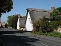
 Great Wilbraham, thatched houses in Temple End - geograph.org.uk - 4818079.jpg 1,024 × 731; 971 KB
-
 Great Wilbraham, The Carpenter's Arms - geograph.org.uk - 2249226.jpg 800 × 625; 514 KB
-
 Great Wilbraham, Tudor Cottage - geograph.org.uk - 5501141.jpg 1,024 × 683; 870 KB
-
 Great Wilbraham, Whitethorn - geograph.org.uk - 4311512.jpg 1,024 × 732; 1.06 MB
-
 Great Wilbraham, winter sunlight - geograph.org.uk - 5991187.jpg 1,024 × 819; 968 KB
-

-
 Great Wilbraham, working on the wicket - geograph.org.uk - 5312290.jpg 1,024 × 768; 1.1 MB
-
 Great Wilbraham.jpg 1,848 × 1,234; 592 KB
-
 Great Wilbrahams, road works in Angle End - geograph.org.uk - 5720534.jpg 1,024 × 819; 970 KB
-
 Guinea fowl and Great Wilbraham Church - geograph.org.uk - 4818031.jpg 1,024 × 682; 1.16 MB
-
 Gulls and the plough - geograph.org.uk - 3769212.jpg 1,200 × 895; 1.55 MB
-
 Harrowed field - geograph.org.uk - 989551.jpg 640 × 427; 63 KB
-
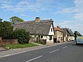 High Street, Great Wilbraham - geograph.org.uk - 969793.jpg 640 × 480; 73 KB
-
 Home Farm - geograph.org.uk - 1047349.jpg 640 × 480; 108 KB
-
 Home Farm - geograph.org.uk - 5760883.jpg 640 × 426; 32 KB
-
 Home Farm, Great Wilbraham - geograph.org.uk - 2351656.jpg 800 × 600; 537 KB
-
 House on Church Street, Great Wilbraham - geograph.org.uk - 4853395.jpg 640 × 480; 103 KB
-
 House on Mill Road - geograph.org.uk - 2698557.jpg 1,024 × 727; 1.07 MB
-
 Iceni Cottage - geograph.org.uk - 970117.jpg 640 × 480; 81 KB
-
 Ipswich to Cambridge train - geograph.org.uk - 2698426.jpg 1,024 × 768; 1.08 MB
-
 Ipswich-Cambridge train - geograph.org.uk - 2351679.jpg 800 × 591; 502 KB
-

-
 January sunlight on the power lines - geograph.org.uk - 2249443.jpg 640 × 469; 62 KB
-
 January walk on Fleam Dyke - geograph.org.uk - 2240773.jpg 800 × 600; 219 KB
-
 K6 in Great Wilbraham High Street - geograph.org.uk - 969972.jpg 640 × 480; 92 KB
-
 K6 phonebox - geograph.org.uk - 1403122.jpg 634 × 640; 126 KB
-
 Landfill at Wilbraham Chalk Quarry - geograph.org.uk - 2251054.jpg 800 × 600; 539 KB
-
 Lay-by on the A11 - geograph.org.uk - 4873474.jpg 640 × 480; 70 KB
-
 Layby, A11 - geograph.org.uk - 3329874.jpg 640 × 430; 60 KB
-
 Layby, A11 - geograph.org.uk - 3819308.jpg 640 × 430; 55 KB
-
 Level crossing near Great Wilbraham - geograph.org.uk - 182262.jpg 640 × 480; 74 KB
-

-
 Long-abandoned railway - geograph.org.uk - 2240616.jpg 800 × 600; 217 KB
-
 Man, dog and path - geograph.org.uk - 2351818.jpg 1,024 × 768; 889 KB
-
 Measuring the 2011 drought - geograph.org.uk - 2725914.jpg 1,024 × 768; 1.25 MB


_-_geograph.org.uk_-_4853379.jpg)


