Category:Great Ponton
Jump to navigation
Jump to search
village in Lincolnshire, UK  | |||||
| Upload media | |||||
| Instance of | |||||
|---|---|---|---|---|---|
| Location | Great Ponton, South Kesteven, Lincolnshire, East Midlands, England | ||||
 | |||||
Subcategories
This category has the following 3 subcategories, out of 3 total.
Media in category "Great Ponton"
The following 191 files are in this category, out of 191 total.
-

-

-
 A1 at Great Ponton - geograph.org.uk - 4223486.jpg 640 × 480; 275 KB
-
 A1 at Great Ponton - geograph.org.uk - 5132773.jpg 640 × 480; 49 KB
-
 A1 northbound at Great Ponton - geograph.org.uk - 5989945.jpg 1,024 × 576; 65 KB
-
 A1 northbound near The Willows - geograph.org.uk - 5132763.jpg 640 × 480; 46 KB
-
 A1 Southbound at Great Ponton - geograph.org.uk - 3456364.jpg 1,476 × 853; 882 KB
-
 A1 southbound parking area - geograph.org.uk - 3502028.jpg 2,253 × 1,419; 1.22 MB
-
 A1 speed camera - geograph.org.uk - 2644142.jpg 640 × 428; 82 KB
-
 A1, Great Ponton Services - geograph.org.uk - 3190223.jpg 640 × 430; 39 KB
-
 Access road to limestone quarry - geograph.org.uk - 3076810.jpg 640 × 480; 57 KB
-
 Ancient stone water trough - geograph.org.uk - 700799.jpg 640 × 480; 63 KB
-
 B6403 Ermine Street, near Great Ponton - geograph.org.uk - 2867275.jpg 1,280 × 853; 299 KB
-

-
 B6403, High Dike (Ermine Street) - geograph.org.uk - 4214545.jpg 640 × 427; 297 KB
-
 Barn at Church Farm, Great Ponton (geograph 6321934).jpg 1,024 × 768; 223 KB
-
 Bend on Heath Lane - geograph.org.uk - 5300092.jpg 3,648 × 2,736; 4.01 MB
-
 Blocked gateway - geograph.org.uk - 3349756.jpg 640 × 475; 46 KB
-
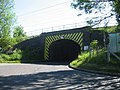
 Bridge 231 on High Dike road - geograph.org.uk - 4019747.jpg 3,088 × 2,056; 3.67 MB
-
 Bridge carrying the East Coast Main Line - geograph.org.uk - 5900675.jpg 6,032 × 4,014; 6.49 MB
-
 Bridge Ident - geograph.org.uk - 5900678.jpg 1,129 × 1,105; 390 KB
-

-
 Byway ending at the A1 - geograph.org.uk - 5300063.jpg 3,648 × 2,736; 3.3 MB
-
 Converted chapel on Dallygate - Great Ponton - geograph.org.uk - 1887437.jpg 1,500 × 996; 1.72 MB
-
 Corner on Stroxton Lane - geograph.org.uk - 5300047.jpg 3,648 × 2,736; 3.67 MB
-
 Crossroads on Heath Lane - geograph.org.uk - 4964075.jpg 1,024 × 683; 318 KB
-
 Dallygate - Great Ponton - geograph.org.uk - 1887365.jpg 1,500 × 996; 1.45 MB
-
 Dallygate - Great Ponton - geograph.org.uk - 1887419.jpg 1,500 × 996; 1.37 MB
-
 Dallygate - Great Ponton - geograph.org.uk - 1887428.jpg 1,500 × 996; 1.19 MB
-
 Dallygate Lane rail bridge - geograph.org.uk - 1028596.jpg 640 × 427; 101 KB
-
 Dallygate Lane Railway Bridge - geograph.org.uk - 2867268.jpg 1,280 × 853; 615 KB
-
 Dallygate Lane Railway Bridge - geograph.org.uk - 2979705.jpg 640 × 480; 200 KB
-
 Dallygate, Great Ponton - geograph.org.uk - 2726838.jpg 4,000 × 3,000; 4.32 MB
-
 Dallygate, Great Ponton - geograph.org.uk - 2979689.jpg 480 × 640; 71 KB
-
 Eastern edge, arable field, Ponton Heath - geograph.org.uk - 3796241.jpg 1,024 × 768; 126 KB
-
 Eastern side of pasture field, Ponton Heath - geograph.org.uk - 3796290.jpg 1,024 × 768; 131 KB
-

-
 Farm gateway tip, High Dike - geograph.org.uk - 5211191.jpg 640 × 427; 84 KB
-
 Farm track - geograph.org.uk - 5901335.jpg 6,032 × 4,014; 5.85 MB
-
 Farm track and power lines - Great Ponton - geograph.org.uk - 1887444.jpg 1,500 × 996; 1.31 MB
-
 Farm Track to Stonepit Plantation - geograph.org.uk - 3081031.jpg 2,256 × 1,504; 2.04 MB
-
 Farmland by the A1 - geograph.org.uk - 2622405.jpg 640 × 347; 27 KB
-
 Farmland near Great Ponton - geograph.org.uk - 2403936.jpg 536 × 640; 30 KB
-
 Farmland north-west of Farm Plantation - geograph.org.uk - 3796178.jpg 1,024 × 768; 108 KB
-
 Farmland off Ermine Street - geograph.org.uk - 3076806.jpg 640 × 480; 74 KB
-
 Farmland off Ermine Street - geograph.org.uk - 3076812.jpg 640 × 480; 72 KB
-
 Farmland off Hell Lane - geograph.org.uk - 3076804.jpg 640 × 480; 70 KB
-
 Farmland south of Little Ponton - geograph.org.uk - 2365015.jpg 640 × 430; 28 KB
-
 Farmland west of Stonepit Plantation - geograph.org.uk - 3796190.jpg 1,024 × 768; 152 KB
-
 Farmland, Pasture Farm - geograph.org.uk - 3076817.jpg 640 × 480; 59 KB
-
 Field boundary south of Heath Lane - geograph.org.uk - 3796261.jpg 1,024 × 768; 164 KB
-
 Field gate on the south side of Heath Lane - geograph.org.uk - 3796213.jpg 1,024 × 768; 148 KB
-
 Field with Pylons - geograph.org.uk - 5924100.jpg 6,032 × 4,014; 5.05 MB
-
 Fields north of the Church - geograph.org.uk - 5940148.jpg 12,677 × 3,988; 7.37 MB
-
 Fields off Heath Lane - geograph.org.uk - 1000022.jpg 640 × 480; 104 KB
-
 Fields south of Heath Lane - geograph.org.uk - 3349757.jpg 640 × 474; 49 KB
-

-
 Footbridge over the A1 at Great Ponton - geograph.org.uk - 4223491.jpg 640 × 480; 274 KB
-
 Footbridge over the A1, Great Ponton - geograph.org.uk - 2511243.jpg 640 × 298; 33 KB
-
 Footpath off Heath Lane - geograph.org.uk - 5300099.jpg 3,648 × 2,736; 3.82 MB
-
 Ford and Road Bridge on the River Witham - geograph.org.uk - 1839449.jpg 3,872 × 2,592; 2.32 MB
-
 Frosty morning at High Dike - geograph.org.uk - 5211197.jpg 640 × 427; 50 KB
-
-

-
 Gate by Heath Lane - geograph.org.uk - 2132071.jpg 640 × 480; 244 KB
-
 Great Ponton - geograph.org.uk - 4964058.jpg 1,024 × 683; 268 KB
-
 Great Ponton - geograph.org.uk - 5902463.jpg 6,032 × 4,014; 6.24 MB
-
 Green and brown - geograph.org.uk - 4326903.jpg 640 × 430; 50 KB
-
 Green Gate - geograph.org.uk - 2132076.jpg 640 × 480; 233 KB
-
 Greening field immediately east of Grantham Road - geograph.org.uk - 3796184.jpg 1,024 × 768; 119 KB
-
 Greening field, south of Heath Lane - geograph.org.uk - 3796217.jpg 1,024 × 768; 168 KB
-
 Group of trees by Heath Lane - geograph.org.uk - 1000028.jpg 640 × 480; 102 KB
-
 Heath Lane eastwards - geograph.org.uk - 1000025.jpg 640 × 525; 55 KB
-
 Heath Lane heading east to the A1 and Great Ponton - geograph.org.uk - 5300086.jpg 3,648 × 2,736; 3.83 MB
-
 Heath Lane passes The Pines - geograph.org.uk - 3349758.jpg 640 × 482; 40 KB
-
 Heath Lane towards Hungerton - geograph.org.uk - 1000024.jpg 640 × 448; 38 KB
-
 Heath Lane, Great Ponton - geograph.org.uk - 2131818.jpg 640 × 480; 247 KB
-
 Heath Lane, Great Ponton - geograph.org.uk - 4964073.jpg 1,024 × 683; 240 KB
-
 Heath Lane, Great Ponton - geograph.org.uk - 4964082.jpg 1,024 × 683; 165 KB
-
 Heath Lane, heading west, Ponton Heath - geograph.org.uk - 3796207.jpg 1,024 × 768; 123 KB
-
 Hedge by the ECML - geograph.org.uk - 4214977.jpg 640 × 430; 51 KB
-
 Hell Lane - geograph.org.uk - 3076800.jpg 640 × 480; 87 KB
-
 Hell Lane, off Ermine Street - geograph.org.uk - 2867285.jpg 682 × 1,024; 219 KB
-
 Hell Lane, off Ermine Street - geograph.org.uk - 2979717.jpg 640 × 480; 155 KB
-

-

-
 Lane near the High Dyke - geograph.org.uk - 5924078.jpg 6,032 × 4,014; 6.26 MB
-
 Lane to Dunkirk Farm, Great Ponton - geograph.org.uk - 3775373.jpg 3,776 × 2,520; 4.15 MB
-
 Lane towards Lower Bassingthorpe - geograph.org.uk - 3076819.jpg 640 × 480; 72 KB
-
 Lay by on a wet A1 South - geograph.org.uk - 819387.jpg 640 × 453; 47 KB
-
 Layby North of Great Ponton - geograph.org.uk - 4223495.jpg 640 × 480; 294 KB
-
 Limestone outcrop in railway cutting - geograph.org.uk - 4326910.jpg 640 × 289; 68 KB
-
 Lincolnshire Landscape - geograph.org.uk - 5933197.jpg 11,864 × 4,500; 7.9 MB
-
 Lincolnshire Panorama - geograph.org.uk - 5925428.jpg 14,414 × 3,000; 7.22 MB
-
 Minor road running north towards Heath Lane - geograph.org.uk - 3796167.jpg 1,024 × 768; 131 KB
-
 Northbound A1 - geograph.org.uk - 4223473.jpg 640 × 480; 310 KB
-
 Northbound A1, Great Ponton - geograph.org.uk - 4223481.jpg 640 × 480; 288 KB
-
 Northbound A1, Services at Great Ponton - geograph.org.uk - 4216949.jpg 640 × 480; 243 KB
-
 One block of ironstone is not enough - geograph.org.uk - 3796270.jpg 1,024 × 614; 113 KB
-
 One block or two^ - geograph.org.uk - 3796275.jpg 1,024 × 768; 178 KB
-
 Over the stile and into the next square - geograph.org.uk - 43065.jpg 480 × 640; 203 KB
-
 Pill box on Stroxton Lane - geograph.org.uk - 544303.jpg 640 × 480; 134 KB
-
 Pillbox and bridleway - geograph.org.uk - 2132095.jpg 640 × 480; 235 KB
-
 Pit Lane - geograph.org.uk - 4019731.jpg 3,088 × 2,056; 3.95 MB
-
 Pitt Lane - geograph.org.uk - 5901338.jpg 6,032 × 3,429; 5.08 MB
-
 Ploughed field, south-east of The Pines - geograph.org.uk - 3796264.jpg 1,024 × 768; 172 KB
-
 Ponton Heath - geograph.org.uk - 4964078.jpg 1,024 × 683; 250 KB
-
 Ponton Heath - geograph.org.uk - 5300105.jpg 3,648 × 2,736; 4.11 MB
-
 Ponton Heath Farm, Heath Lane - geograph.org.uk - 5300089.jpg 3,648 × 2,736; 3.85 MB
-
 Ponton Heath Farm, Ponton Heath - geograph.org.uk - 3796237.jpg 1,024 × 768; 173 KB
-
 Ponton Heath nature reserve - geograph.org.uk - 4964081.jpg 1,024 × 683; 399 KB
-
 Poplar plantation beside the Witham - Great Ponton - geograph.org.uk - 1887473.jpg 1,500 × 996; 2.07 MB
-
 Public footpath from Heath Lane to Great Ponton - geograph.org.uk - 3796327.jpg 1,024 × 768; 137 KB
-

-
 Public footpath to Green Lane - geograph.org.uk - 3796182.jpg 1,024 × 614; 109 KB
-
 Putting out the cones on the A1 - geograph.org.uk - 113596.jpg 640 × 427; 93 KB
-
 Pylon - geograph.org.uk - 5901341.jpg 4,014 × 6,032; 4.37 MB
-
 Pylon line - geograph.org.uk - 5924099.jpg 6,032 × 4,014; 4.83 MB
-
 Rabbit damage on plantation trees - geograph.org.uk - 700792.jpg 480 × 640; 52 KB
-
 Railway Bridge over Ermine Street - geograph.org.uk - 1321043.jpg 640 × 480; 95 KB
-
 Railway underpass - geograph.org.uk - 155381.jpg 640 × 480; 100 KB
-
 Reinforcement points on railway bridge - geograph.org.uk - 5900677.jpg 6,032 × 4,014; 4.98 MB
-
 Restricted Byway leading off Stroxton Lane - geograph.org.uk - 5300054.jpg 3,648 × 2,736; 3.3 MB
-
 Restricted Byway to Great Ponton House - geograph.org.uk - 5300058.jpg 3,648 × 2,736; 3.18 MB
-
 River Witham valley - geograph.org.uk - 694161.jpg 640 × 480; 130 KB
-
 River Witham, Great Ponton - geograph.org.uk - 2979698.jpg 480 × 640; 105 KB
-
 Road to High Dike Cottages - geograph.org.uk - 4019753.jpg 3,088 × 2,056; 3.8 MB
-
 Sheep grazing - geograph.org.uk - 4326902.jpg 640 × 430; 38 KB
-
 Signals and telegraph poles at High Dyke - geograph.org.uk - 3999722.jpg 1,070 × 1,171; 501 KB
-
 South side of arable field, Ponton Heath - geograph.org.uk - 3796279.jpg 1,024 × 768; 177 KB
-
 Southern edge, arable field, Ponton Heath - geograph.org.uk - 3796247.jpg 1,024 × 768; 120 KB
-
 Speed Camera on the A1 near Great Ponton - geograph.org.uk - 4223475.jpg 640 × 480; 286 KB
-
 Stopped at Great Ponton - geograph.org.uk - 6144091.jpg 1,024 × 769; 338 KB
-
 Stream in Bassingthorpe New Plantation - geograph.org.uk - 2867331.jpg 1,280 × 853; 630 KB
-
 Stroxton Lane - geograph.org.uk - 5237955.jpg 4,620 × 3,047; 4.99 MB
-
 Stroxton Lane 1 - geograph.org.uk - 2132098.jpg 640 × 480; 240 KB
-
 Telephone Exchange, Great Ponton - geograph.org.uk - 3031706.jpg 3,072 × 2,304; 1.8 MB
-
 The A1 at Great Ponton - geograph.org.uk - 4358397.jpg 6,000 × 4,000; 4.01 MB
-
 The northern corner of Farm Plantation - geograph.org.uk - 3796175.jpg 768 × 1,024; 118 KB
-
 The Old Rectory - geograph.org.uk - 5902461.jpg 6,032 × 4,014; 3.96 MB
-
 The Pines Farm, Great Ponton - geograph.org.uk - 2131813.jpg 640 × 481; 251 KB
-
 The poplar lined River Witham - Great Ponton - geograph.org.uk - 1887458.jpg 1,500 × 996; 1.8 MB
-
 The River Witham - Great Ponton - geograph.org.uk - 1887451.jpg 1,500 × 996; 1.73 MB
-
 The Terrace - geograph.org.uk - 5901624.jpg 6,032 × 4,014; 4.28 MB
-
 The Terrace, Great Ponton - geograph.org.uk - 2979683.jpg 640 × 480; 143 KB
-
 Toward the A1 - geograph.org.uk - 5902466.jpg 6,032 × 4,014; 6.05 MB
-
 Track to Dunkirk - Great Ponton - geograph.org.uk - 1887483.jpg 1,500 × 996; 1.52 MB
-
 Track to Pasture Farm - geograph.org.uk - 1294837.jpg 640 × 438; 60 KB
-

-
 Verge on the east side of Grantham Road - geograph.org.uk - 3796201.jpg 768 × 1,024; 556 KB
-

-
-

-
 Village Spring - geograph.org.uk - 694118.jpg 640 × 480; 60 KB
-

-
 Waste ground by the main line - geograph.org.uk - 4326907.jpg 640 × 430; 67 KB
-
 Western edge of arable field, Ponton Heath - geograph.org.uk - 3796284.jpg 1,024 × 768; 146 KB
-
 Western edge of ploughed field, north of Heath Lane (geograph 3796329).jpg 1,024 × 768; 128 KB
-
 Wide Ford at Mill Farm on the River Witham - geograph.org.uk - 1839460.jpg 3,872 × 2,592; 2.4 MB
-
 Winter morning at High Dike - geograph.org.uk - 5211202.jpg 640 × 427; 72 KB
-
 Woodland on Ponton Heath - geograph.org.uk - 5237943.jpg 4,669 × 2,707; 4.87 MB
-
 A1 looking northwards - geograph.org.uk - 393002.jpg 640 × 394; 56 KB
-
 A1 looking southwards - geograph.org.uk - 393009.jpg 640 × 480; 68 KB
-
 A1 looking towards Great Ponton - geograph.org.uk - 393011.jpg 640 × 459; 44 KB
-
 Beano's Wood - geograph.org.uk - 700787.jpg 640 × 480; 60 KB
-
 Dallygate Lane, Great Ponton - geograph.org.uk - 211646.jpg 640 × 427; 91 KB
-
 Driveway to Riverside Cottages - geograph.org.uk - 393005.jpg 640 × 480; 128 KB
-
 Ermine Street - geograph.org.uk - 155391.jpg 640 × 480; 54 KB
-
 Ermine Street towards the north. - geograph.org.uk - 155378.jpg 640 × 480; 56 KB
-
 Ermine Street towards the south - geograph.org.uk - 155379.jpg 640 × 512; 56 KB
-
 Farmland at Ponton Heath - geograph.org.uk - 211641.jpg 640 × 427; 99 KB
-
 Farmland at Stroxton - geograph.org.uk - 113600.jpg 640 × 427; 116 KB
-
 Farmland near Great Ponton - geograph.org.uk - 69364.jpg 640 × 480; 139 KB
-
 Farmland near Great Ponton - geograph.org.uk - 69365.jpg 640 × 480; 159 KB
-
 Great Ponton from the parish church - geograph.org.uk - 1416703.jpg 640 × 480; 76 KB
-
 Harvesting - geograph.org.uk - 38721.jpg 640 × 480; 72 KB
-
 High Power Electricity Pylons - geograph.org.uk - 694187.jpg 480 × 640; 118 KB
-
 Junction on the A1, south of Grantham - geograph.org.uk - 43017.jpg 640 × 480; 116 KB
-
 Landscape near Grange Farm - geograph.org.uk - 123428.jpg 640 × 427; 69 KB
-
 Network Rail access gate at Stoke Tunnel - geograph.org.uk - 367632.jpg 640 × 427; 117 KB
-
 Old barn, near Valley Farm - geograph.org.uk - 694201.jpg 640 × 480; 59 KB
-
 Parish Playing Fields, Great Ponton. - geograph.org.uk - 700795.jpg 640 × 480; 37 KB
-
 Parkland trees - geograph.org.uk - 700758.jpg 640 × 480; 149 KB
-

-
 Ponton road - geograph.org.uk - 155387.jpg 640 × 480; 65 KB
-
 Railway embankment - geograph.org.uk - 155386.jpg 640 × 480; 77 KB
-
 Rear entrance to Great Ponton Quarry - geograph.org.uk - 211647.jpg 640 × 427; 101 KB
-
 River Witham valley - geograph.org.uk - 694173.jpg 640 × 480; 138 KB
-
 Stroxton Lane near Ponton Heath - geograph.org.uk - 211640.jpg 640 × 427; 119 KB
-
 View towards Great Ponton - geograph.org.uk - 155388.jpg 640 × 480; 72 KB
-
 Washdyke Lane - geograph.org.uk - 392997.jpg 640 × 480; 67 KB
,_Layby_near_Great_Ponton_-_geograph.org.uk_-_4216756.jpg)


_-_geograph.org.uk_-_4214545.jpg)
.jpg)


_towards_Colsterworth_-_geograph.org.uk_-_3076805.jpg)


.jpg)


