Category:Greasbrough
Jump to navigation
Jump to search
village in the United Kingdom  | |||||
| Upload media | |||||
| Instance of | |||||
|---|---|---|---|---|---|
| Location | Rotherham, South Yorkshire, Yorkshire and the Humber, England | ||||
 | |||||
Media in category "Greasbrough"
The following 42 files are in this category, out of 42 total.
-
 1970's Apartments Greasborough - geograph.org.uk - 744577.jpg 640 × 408; 66 KB
-
 Barbot Hall - geograph.org.uk - 139064.jpg 640 × 480; 174 KB
-
 Barn conversion at Nether Haugh - geograph.org.uk - 799608.jpg 640 × 480; 142 KB
-
 Car Hill - geograph.org.uk - 799489.jpg 640 × 480; 117 KB
-
 Clay Hill, Nether Haugh - geograph.org.uk - 141015.jpg 640 × 480; 146 KB
-
-
 Glossop lodge on cinder bridge road restored middle to late 1970s.jpg 5,312 × 2,988; 5.93 MB
-
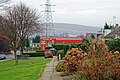
 Greasborough Dam In Autumn - geograph.org.uk - 1155689.jpg 640 × 425; 149 KB
-
 Greasbrough Church - geograph.org.uk - 2747374.jpg 640 × 480; 111 KB
-
 Greasbrough from The Tops - geograph.org.uk - 799587.jpg 640 × 480; 139 KB
-
 Handkerchief Piece, Greasborough - geograph.org.uk - 1724991.jpg 640 × 480; 77 KB
-
 St.Mary's church, Greasbrough - geograph.org.uk - 265565.jpg 640 × 427; 88 KB
-
 Milton Arms public house, Greasbrough - geograph.org.uk - 3738329.jpg 1,600 × 1,200; 454 KB
-
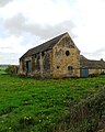 Old stone barn in Greasbrough - geograph.org.uk - 3948093.jpg 1,942 × 2,428; 1.58 MB
-
 Private Road to the Wentworth Estate - geograph.org.uk - 729164.jpg 640 × 332; 55 KB
-
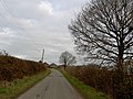
 Rig Lane - geograph.org.uk - 1436167.jpg 640 × 480; 97 KB
-
 Roman Ridge - geograph.org.uk - 799595.jpg 640 × 480; 146 KB
-
 Roman Ridge - geograph.org.uk - 799601.jpg 640 × 480; 169 KB
-
 St Mary's Church, Greasbrough - geograph.org.uk - 4127452.jpg 595 × 800; 140 KB
-
 Stile into Rockingham Wood - geograph.org.uk - 139080.jpg 640 × 480; 274 KB
-
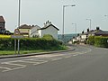 The entry to Greasbrough - geograph.org.uk - 799497.jpg 640 × 480; 97 KB
-
 The Tops - geograph.org.uk - 799583.jpg 640 × 473; 207 KB
-
 The Tops - geograph.org.uk - 799590.jpg 640 × 480; 158 KB
-
 Wentworth Mausoleum - geograph.org.uk - 141016.jpg 640 × 480; 147 KB
-
-

-
 Above Munsbrough Lane - geograph.org.uk - 487774.jpg 640 × 427; 316 KB
-
 Bassingthorpe Lane - geograph.org.uk - 729158.jpg 640 × 480; 94 KB
-

-

-
 Dog Kennel pond - geograph.org.uk - 772675.jpg 640 × 480; 65 KB
-
 Footpath at Clay Hill - geograph.org.uk - 568694.jpg 640 × 343; 53 KB
-
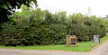
 Gate on Cortworth Lane - geograph.org.uk - 744555.jpg 640 × 480; 73 KB
-
 Greasbrough Public Hall - geograph.org.uk - 139076 (cropped).jpg 610 × 343; 98 KB
-
 Greasbrough Public Hall - geograph.org.uk - 139076.jpg 640 × 480; 151 KB
-
 Jack's juicy blackberries. - geograph.org.uk - 550523.jpg 640 × 327; 96 KB
-
 Lake in Wentworth Park. - geograph.org.uk - 391045.jpg 640 × 427; 125 KB
-

-
 Telecommunication mast - geograph.org.uk - 568689.jpg 640 × 419; 67 KB
-
 Telecoms mast from Bassingthorpe Lane - geograph.org.uk - 661512.jpg 640 × 480; 91 KB
-
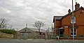
 The Yellow Lion Greasborough - geograph.org.uk - 568696.jpg 640 × 409; 91 KB
-
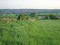
 View from Nether Haugh - geograph.org.uk - 141013.jpg 640 × 480; 137 KB


.jpg)


