Category:Grayrigg Forest
Jump to navigation
Jump to search
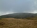
English: Grayrigg Forest is a hill in the civil parish of Grayrigg, in the Westmorland and Furness district, in the ceremonial county of Cumbria, England.
mountain in United Kingdom  | |||||
| Upload media | |||||
| Instance of | |||||
|---|---|---|---|---|---|
| Located in protected area | |||||
| Location | Lake District, North Yorkshire, Yorkshire and the Humber, England | ||||
| Topographic prominence |
| ||||
| Elevation above sea level |
| ||||
| Parent peak | |||||
 | |||||
Media in category "Grayrigg Forest"
The following 9 files are in this category, out of 9 total.
-
 Ascending Grayrigg Forest - geograph.org.uk - 3277338.jpg 800 × 457; 113 KB
-
 Grayrigg Forest - geograph.org.uk - 3370488.jpg 2,592 × 1,944; 1.77 MB
-
 Grayrigg Forest - geograph.org.uk - 694279.jpg 640 × 480; 66 KB
-
 Grayrigg Forest - geograph.org.uk - 694285.jpg 640 × 480; 70 KB
-
 Grayrigg Forest.jpg 1,024 × 768; 114 KB
-
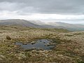 Pool, Grayrigg - geograph.org.uk - 989052.jpg 640 × 480; 83 KB
-
 Summit Grayrigg Forest - geograph.org.uk - 234266.jpg 480 × 640; 94 KB
-
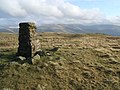 Trig Pillar ,Greyrigg Forest - geograph.org.uk - 1139191.jpg 640 × 480; 89 KB
-
 Trig Pillar, Grayrigg Forest - geograph.org.uk - 694277.jpg 480 × 640; 103 KB


