Category:Gravenhurst, Bedfordshire
Jump to navigation
Jump to search
civil parish in Central Bedfordshire, Bedfordshire, England, UK .jpg) | |||||
| Upload media | |||||
| Instance of | |||||
|---|---|---|---|---|---|
| Location | Central Bedfordshire, Bedfordshire, East of England, England | ||||
 | |||||
English: Gravenhurst is a civil parish in the Central Bedfordshire district of Bedfordshire, England
Subcategories
This category has the following 5 subcategories, out of 5 total.
Media in category "Gravenhurst, Bedfordshire"
The following 92 files are in this category, out of 92 total.
-
 A507-Clophill Road junction - geograph.org.uk - 2522832.jpg 640 × 480; 38 KB
-
 Benchmark on a bridge - geograph.org.uk - 3376886.jpg 3,648 × 2,736; 2.53 MB
-
 Blocked field entrance, south of Ion Lodge - geograph.org.uk - 4233362.jpg 1,024 × 768; 172 KB
-
 Bridleway approaching a copse, Higham Gobion - geograph.org.uk - 5993113.jpg 2,000 × 1,500; 1.07 MB
-
 Bridleway to Gravenhurst Lodge - geograph.org.uk - 1554577.jpg 640 × 480; 93 KB
-
 Bungalow, Ion Bridge - geograph.org.uk - 4880082.jpg 640 × 480; 103 KB
-
 Cainhoe Manor Farm, Gravenhurst, Beds - geograph.org.uk - 194242.jpg 640 × 480; 278 KB
-
 Campton Road, Upper Gravenhurst - geograph.org.uk - 4631923.jpg 640 × 480; 75 KB
-
 Cedar at Wrest Park - geograph.org.uk - 3021553.jpg 3,264 × 2,448; 3.47 MB
-
 Clophill Road - geograph.org.uk - 1554567.jpg 640 × 480; 94 KB
-
 Clophill Road, Upper Gravenhurst - geograph.org.uk - 4626663.jpg 640 × 480; 90 KB
-
 Clophill Road, Upper Gravenhurst - geograph.org.uk - 4626669.jpg 640 × 480; 73 KB
-
 Clophill Road, Upper Gravenhurst - geograph.org.uk - 4631935.jpg 640 × 480; 88 KB
-
 Coronation Bus Shelter - geograph.org.uk - 3064125.jpg 2,560 × 1,920; 1.01 MB
-
 Covered Trackway - geograph.org.uk - 2215781.jpg 768 × 1,024; 71 KB
-

-
 Drive up to farm - geograph.org.uk - 1554599.jpg 640 × 480; 84 KB
-
 Entering Upper Gravenhurst - geograph.org.uk - 4631916.jpg 640 × 480; 64 KB
-
 Farm track near Cainhoe Manor - geograph.org.uk - 4631951.jpg 640 × 480; 105 KB
-
 Farm track off Campton Road - geograph.org.uk - 4626522.jpg 640 × 480; 129 KB
-
 Farmland near College Farm - geograph.org.uk - 4880085.jpg 640 × 480; 73 KB
-
 Farmland near Upper Gravenhurst - geograph.org.uk - 4626526.jpg 640 × 480; 69 KB
-
 Farmland north-west of Little Ion - geograph.org.uk - 4233396.jpg 1,024 × 768; 158 KB
-
 Farmland south of Terrace Plantation - geograph.org.uk - 4233398.jpg 1,024 × 768; 178 KB
-

-
 Field entrance off Lower Gravenhurst - geograph.org.uk - 4880312.jpg 640 × 480; 100 KB
-
 Field margin near Little Ion - geograph.org.uk - 4880316.jpg 640 × 480; 72 KB
-
 Field near Little Ion - geograph.org.uk - 4880323.jpg 640 × 480; 75 KB
-
 Field with bales, Upper Gravenhurst - geograph.org.uk - 4626666.jpg 640 × 480; 82 KB
-
 Flat farmland bordered by a drain - geograph.org.uk - 4233384.jpg 1,024 × 768; 130 KB
-
 Footbridge - geograph.org.uk - 2216496.jpg 768 × 1,024; 321 KB
-
 Footpath over field - geograph.org.uk - 4627132.jpg 640 × 480; 90 KB
-
 Gated track off Campton Road - geograph.org.uk - 4862876.jpg 640 × 480; 167 KB
-
 Gateway to Cainhoe Manor - geograph.org.uk - 4631946.jpg 640 × 480; 79 KB
-
 GOC Wrest Park–Shillington 008 Whitehall, Gravenhurst (24880223761).jpg 3,067 × 2,301; 2 MB
-
 GOC Wrest Park–Shillington 011 Whitehall Plantation, Gravenhurst (24973557325).jpg 3,216 × 4,288; 4.47 MB
-
 GOC Wrest Park–Shillington 016 Little Ion Farmhouse, Gravenhurst (24605929139).jpg 3,627 × 2,724; 3.22 MB
-
 GOC Wrest Park–Shillington 018 Little Ion Farmhouse, Gravenhurst (24342959434).jpg 3,727 × 2,800; 2.92 MB
-
 GOC Wrest Park–Shillington 025 Higham Gobion Castle (24625937109).jpg 4,288 × 3,216; 3.9 MB
-
 GOC Wrest Park–Shillington 026 Higham Gobion Castle (24993562785).jpg 4,288 × 3,216; 3.7 MB
-
 GOC Wrest Park–Shillington 027 The Old Rectory, Higham Gobion (24698064220).jpg 4,288 × 3,216; 3.53 MB
-
 GOC Wrest Park–Shillington 028 Manor Farmhouse, Higham Gobion (25016987315).jpg 3,759 × 2,831; 2.49 MB
-
 GOC Wrest Park–Shillington 029 Manor Cottage, Higham Gobion (24386384344).jpg 3,948 × 2,969; 3.38 MB
-
 GOC Wrest Park–Shillington 041 Sheep (24990668416).jpg 3,797 × 2,857; 3.38 MB
-
 Grass triangle road junction in Gravehurst - geograph.org.uk - 3064092.jpg 2,560 × 1,920; 1.05 MB
-
 Gravenhurst Academy - geograph.org.uk - 4631933.jpg 640 × 480; 87 KB
-
 Gravenhurst Lodge - geograph.org.uk - 3064086.jpg 2,560 × 1,920; 935 KB
-
 Greening field south-east of College Farm - geograph.org.uk - 4233241.jpg 1,024 × 768; 165 KB
-
 Greening field, south of Ion Lodge - geograph.org.uk - 4233366.jpg 1,024 × 768; 144 KB
-
 Heading west near Little Ion - geograph.org.uk - 4880319.jpg 640 × 480; 69 KB
-
 High Street - geograph.org.uk - 1554591.jpg 640 × 480; 70 KB
-
 High Street, Upper Gravenhurst - geograph.org.uk - 4631930.jpg 640 × 480; 59 KB
-

-

-

-
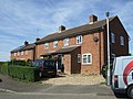
 Houses on Lower Gravenhurst - geograph.org.uk - 4880084.jpg 640 × 480; 67 KB
-
-
 Interesting mailbox... - geograph.org.uk - 190297.jpg 640 × 480; 109 KB
-
 Ion Bridge - geograph.org.uk - 3376891.jpg 640 × 480; 78 KB
-
 Ion Lodge - geograph.org.uk - 4862864.jpg 640 × 480; 164 KB
-
 Ion Lodge, south-west of Lower Gravenhurst - geograph.org.uk - 4233349.jpg 1,024 × 614; 123 KB
-
 Ivel Valley Walkers - geograph.org.uk - 2215765.jpg 1,024 × 768; 201 KB
-

-
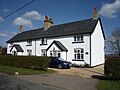
 Lower Gravenhurst - geograph.org.uk - 4880083.jpg 640 × 480; 97 KB
-
 Lower Gravenhurst - geograph.org.uk - 4880313.jpg 640 × 480; 69 KB
-
 Lower Gravenhurst church - geograph.org.uk - 4862870.jpg 640 × 480; 108 KB
-
 Minor road near Cainhoe Manor Farm - geograph.org.uk - 4631942.jpg 640 × 480; 107 KB
-
 Minor road towards Clophill - geograph.org.uk - 4631938.jpg 640 × 480; 89 KB
-
 Minor road towards Clophill - geograph.org.uk - 4631940.jpg 640 × 480; 72 KB
-
 Minor road towards the A6 - geograph.org.uk - 4880325.jpg 640 × 480; 69 KB
-
 Old quarries by the River Flit - geograph.org.uk - 4282247.jpg 3,264 × 2,448; 4.13 MB
-
 Open field - geograph.org.uk - 2209979.jpg 3,872 × 2,592; 4.77 MB
-
 Shrub covered road junction in Upper Gravenhurst - geograph.org.uk - 3064111.jpg 2,560 × 1,920; 1 MB
-

-
 Sloes, Higham Gobion - geograph.org.uk - 5993120.jpg 2,172 × 2,040; 1.46 MB
-
 Small wood standing tall in a flat landscape - geograph.org.uk - 4233388.jpg 1,024 × 768; 136 KB
-
 Stubble field and hedgerow - geograph.org.uk - 4627136.jpg 640 × 480; 80 KB
-
 Stubble field beside track - geograph.org.uk - 4626523.jpg 640 × 465; 90 KB
-
 Stubble field near Highlands - geograph.org.uk - 4631915.jpg 640 × 480; 85 KB
-
 The Green Dragon - geograph.org.uk - 3064140.jpg 2,560 × 1,920; 1.11 MB
-
 The Long Canal, Wrest Park - geograph.org.uk - 3153875.jpg 1,600 × 1,200; 542 KB
-
 The road from the A6 to Lower Gravenhurst - geograph.org.uk - 4233392.jpg 1,024 × 768; 131 KB
-
 The road to Hanscombe End - geograph.org.uk - 4233248.jpg 1,024 × 768; 182 KB
-
 The road to Lower and Upper Gravenhurst - geograph.org.uk - 4233352.jpg 1,024 × 768; 128 KB
-
 The road to Lower Gravenhurst - geograph.org.uk - 4233243.jpg 1,024 × 768; 160 KB
-
 Track to Cainhoe Park Farm - geograph.org.uk - 4631937.jpg 640 × 480; 95 KB
-
 View from Wrest Park pavilion - geograph.org.uk - 2812622.jpg 403 × 640; 43 KB
-
 Village Hall, Upper Gravenhurst - geograph.org.uk - 3064101.jpg 2,560 × 1,920; 1.01 MB
-

-
 Woodland path - geograph.org.uk - 2209990.jpg 3,872 × 2,592; 4.76 MB
-
 Wrest Park - geograph.org.uk - 3064070.jpg 2,560 × 1,920; 978 KB
-


.jpg)
.jpg)
.jpg)
.jpg)
.jpg)
.jpg)
.jpg)
.jpg)
.jpg)
.jpg)


