Category:Gravelly Hill Interchange
Jump to navigation
Jump to search
junction 6 of the M6 motorway   | |||||
| Upload media | |||||
| Instance of | |||||
|---|---|---|---|---|---|
| Location |
| ||||
| Inception |
| ||||
 | |||||
Gravelly Hill Interchange (popularly known as Spaghetti Junction), near Erdington, Birmingham, United Kingdon
| Counties (M6): | |
|---|---|
| (M6 Toll): | |
| Services (M6): |
|
| (M6 Toll): | |
| Connections: | |
| Places: | |
| Connections: | |
| Coordinates: | |
Media in category "Gravelly Hill Interchange"
The following 25 files are in this category, out of 25 total.
-

-
 Aerial view of M6A38 Spaghetti Junction.jpg 975 × 1,300; 1.22 MB
-

-
 Birmingham - Spaghetti Junction - Hockley Brook and Canal.jpg 1,866 × 1,320; 1.68 MB
-
 Birmingham - Three canals under Spaghetti Junction.jpg 3,457 × 2,187; 3.55 MB
-

-

-
 Bit of a junction ahead - geograph.org.uk - 1374708.jpg 640 × 425; 78 KB
-
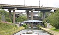
 Canal at Gravelly Hill Interchange - 2009-03-19.jpg 1,944 × 2,592; 1.83 MB
-
 Gravelly Hill Interchange - geograph.org.uk - 1223376.jpg 640 × 480; 60 KB
-
 Gravelly Hill Interchange OpenStreetMap.png 1,619 × 1,086; 986 KB
-
 Gravelly Hill Interchange.svg 842 × 498; 1.91 MB
-
 Helicopter - Night Time Photos (8740981128).jpg 2,573 × 1,709; 2.84 MB
-
 Hidden beneath Spaghetti Junction - geograph.org.uk - 1374720.jpg 640 × 425; 54 KB
-

-
 On to the M6 - geograph.org.uk - 986539.jpg 640 × 480; 67 KB
-
 OSM knooppunt Birmingham - spaghetti junction.png 300 × 300; 79 KB
-
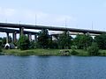 Salford Lake.jpg 1,280 × 960; 182 KB
-
 Spaghetti Junction - geograph.org.uk - 152123.jpg 640 × 480; 46 KB
-
 Spaghetti Junction from Tame Valley Canal.jpg 640 × 390; 64 KB
-
 Spaghetti-Junction-Crop.jpg 938 × 542; 597 KB
-
 The Gravelly Hill interchange - geograph.org.uk - 1887940.jpg 640 × 480; 47 KB
-
 Under The Junction (28190034158).jpg 4,002 × 5,374; 4.55 MB
-

-
 West Midlands Police Helicopter - Night Time Photos - Gravelly Hill Interchange.jpg 2,144 × 1,424; 2.16 MB
.jpg)


.jpg)


.jpg)
_-_geograph.org.uk_-_1291168.jpg)
