Category:Gravel driveways
Jump to navigation
Jump to search
A driveway (also called a 'drive' in British English) is a type of long or short private road for local access to one or a small group of structures, and is owned and maintained by an individual or group, and can often be of gravel surface.
Subcategories
This category has only the following subcategory.
C
- Gravel driveways in Canada (13 F)
Media in category "Gravel driveways"
The following 130 files are in this category, out of 130 total.
-

-
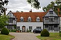
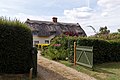
 'Springfield Cottage' in Farley, Wiltshire, England.jpg 3,749 × 2,812; 11.48 MB
-
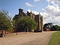
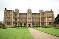
 Compton Castle, Marldon, Devon, late 19th century.jpg 4,812 × 3,251; 7.75 MB
-
 18th-century carriage arch in courtyard of Parham House, West Sussex, England.jpg 3,000 × 2,000; 4.45 MB
-
 20130505 Maastricht Itteren Hartelstein 35.JPG 3,968 × 2,976; 2.92 MB
-
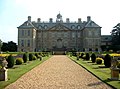
 Drive and garden terrace of Goodnestone Park Kent England.jpg 3,000 × 2,000; 6.19 MB
-
 House on the village green of Hatfield Heath, Essex, England 01.jpg 3,000 × 2,250; 5.3 MB
-
 House on the village green of Hatfield Heath, Essex, England 02.jpg 3,000 × 2,250; 4.17 MB
-
 Old Rectory on Church Road in Boreham, Essex, England 1.jpg 3,500 × 2,333; 6.01 MB
-
 Old Rectory on Church Road in Boreham, Essex, England 2.jpg 3,500 × 2,333; 7.3 MB
-
 Church of St Mary the Virgin, Eastry, Kent - churchyard listed north wall.jpg 2,000 × 3,000; 5.25 MB
-
 Greensted House in Greensted Green, Ongar, Essex, England.jpg 4,000 × 2,667; 8.8 MB
-

-
 Hatfield Broad Oak Taverners Green driveway Essex 1.jpg 5,925 × 4,160; 24.31 MB
-
 Entrance drive to Perses Taverners Green Great Canfield Essex 1.jpg 5,685 × 3,972; 21.49 MB
-
 Entrance drive to Perses Taverners Green Great Canfield Essex 2.jpg 6,136 × 4,160; 24.34 MB
-
 Entrance drive to Perses Taverners Green Great Canfield Essex 3.jpg 6,074 × 4,050; 22.77 MB
-
 Hatfield Heath CC v Potter Street & Church Langley CC, Essex, England 10.jpg 4,608 × 3,456; 15.13 MB
-
 Abbess Beauchamp and Berners Roding, Essex England - cottages.JPG 4,761 × 2,863; 9.85 MB
-
 At the end of the drive - geograph.org.uk - 1764554.jpg 2,848 × 2,136; 2.97 MB
-
 Barn entrance Goodnestone Park Dover Kent England.jpg 5,204 × 3,380; 16.35 MB
-
 Barningham Hall Norfolk 19 August 2014 (1).JPG 4,000 × 3,000; 4.72 MB
-
 Bayfield Hall 30 August 2014.JPG 4,000 × 3,000; 4.17 MB
-
 Belton House - geograph.org.uk - 1500445.jpg 640 × 480; 104 KB
-
 Belton House - geograph.org.uk - 37365.jpg 640 × 475; 97 KB
-
 Belton House 01.jpg 2,272 × 1,704; 2.43 MB
-
 Belton House, courtyard view - geograph.org.uk - 967025.jpg 480 × 640; 94 KB
-
 Belton North. Giano.png 1,599 × 1,143; 605 KB
-
 Belton Park - geograph.org.uk - 1500630.jpg 480 × 640; 173 KB
-
 Belton Park - geograph.org.uk - 268045.jpg 640 × 427; 74 KB
-
 Bend past the Manor - geograph.org.uk - 1168303.jpg 640 × 426; 70 KB
-
 Cannon and south front of Quex House Birchington Kent England.jpg 5,472 × 3,648; 15.95 MB
-
 Blanding's Turtle Laying Eggs Wideshot.jpg 2,576 × 1,932; 1.66 MB
-
 Border hedge and verge on path to house.jpg 3,648 × 5,472; 16.38 MB
-
 Bow Hill gateway to Upper Hardres Court at Upper Hardres Kent England - closer view.jpg 2,000 × 3,000; 6.69 MB
-
 Bow Hill gateway to Upper Hardres Court at Upper Hardres Kent England - lower view.jpg 2,000 × 3,000; 6.41 MB
-
 Bow Hill gateway to Upper Hardres Court at Upper Hardres Kent England.jpg 2,000 × 3,000; 6.65 MB
-
 Brent Pelham Hall gates Hertfordshire England.jpg 5,472 × 3,648; 22.16 MB
-
 Brick wall and gravel road at Goodnestone Park Kent England 1.jpg 3,000 × 2,000; 7.27 MB
-
 Brick wall and gravel road at Goodnestone Park Kent England 2.jpg 2,000 × 3,000; 7.03 MB
-
 Burlington estate entrance.jpg 6,016 × 4,000; 7.21 MB
-
 Bylaugh Hall Summer Evening.JPG 3,264 × 2,448; 2.64 MB
-
 Camp Mont Shenandoah entrance.jpg 6,016 × 4,000; 6.32 MB
-
 Cannon and south front of Quex House Birchington Kent England 2.jpg 5,472 × 3,648; 22.17 MB
-
 Car park, Hare Hill NT - geograph.org.uk - 1600656.jpg 640 × 426; 56 KB
-
 Carriage arch of Goodnestone Park Kent England.jpg 2,000 × 3,000; 4.69 MB
-
 Chericoke plantation entrance.jpg 6,016 × 4,000; 6.37 MB
-
 Church St house gate and drive Henham Essex England.jpg 5,472 × 3,648; 15.02 MB
-
 Closed Gate - geograph.org.uk - 692516.jpg 640 × 398; 116 KB
-
 Comptche Volunteer Fire Department - November 2022 - Sarah Stierch.jpg 3,773 × 2,373; 4.66 MB
-
 Courtyard - Belton House - geograph.org.uk - 1500396.jpg 640 × 480; 92 KB
-
 Danny House - geograph.org.uk - 1297871.jpg 451 × 640; 80 KB
-
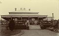
 Denton Manor (Denton Hall) c.1906.jpg 1,075 × 686; 905 KB
-
 Doddington Hall - geograph.org.uk - 45121.jpg 640 × 480; 113 KB
-
 Doddington Hall - geograph.org.uk - 820517.jpg 640 × 427; 75 KB
-
 Doddington Hall - geograph.org.uk - 820526.jpg 427 × 640; 83 KB
-
 Doddington Hall, front elevation - geograph.org.uk - 1317131.jpg 640 × 427; 334 KB
-
 Doddington Hall, rear elevation - geograph.org.uk - 1317143.jpg 640 × 427; 376 KB
-
 Douglas's Lodge, Parham Park - geograph.org.uk - 1239902.jpg 480 × 640; 115 KB
-
 Drive at Chavenage House-geograph-3507451.jpg 1,024 × 680; 255 KB
-
 Drive to Merry Hills Cottage - geograph.org.uk - 1613895.jpg 640 × 480; 127 KB
-
 Driveway leading to Gedgrave Hall - geograph.org.uk - 229302.jpg 640 × 480; 101 KB
-
 Driveway to Great Steeds Farm - geograph.org.uk - 479819.jpg 640 × 480; 143 KB
-
 Driveway to Poulton Priory - geograph.org.uk - 350340.jpg 640 × 480; 162 KB
-
 Driveway to Upper Hardres Court at Upper Hardres Kent England, in full sunshine.jpg 3,000 × 2,000; 6.82 MB
-
 Driveway to Upper Hardres Court at Upper Hardres Kent England, in partial sunshine.jpg 3,000 × 2,000; 5.57 MB
-
 Driveway to West Dean House, West Sussex - geograph.org.uk - 342097.jpg 640 × 533; 140 KB
-
 Entrance and driveway to Barningham Hall - geograph.org.uk - 782201.jpg 640 × 480; 182 KB
-
 Entrance to Wood Hall - geograph.org.uk - 584731.jpg 640 × 480; 173 KB
-
 Family home - geograph.org.uk - 405005.jpg 640 × 480; 123 KB
-
 Feeringbury Manor split double trunk tree, Feering Essex England 1.jpg 5,472 × 3,648; 25.3 MB
-
 Feeringbury Manor split double trunk tree, Feering Essex England 2.jpg 5,472 × 3,648; 28.66 MB
-
 Finchcocks 3.JPG 2,016 × 1,512; 779 KB
-
 Finchcocks 4.JPG 2,016 × 1,512; 761 KB
-
 Flintham House - geograph.org.uk - 336986.jpg 640 × 480; 118 KB
-
 Forbury Lane and Entrance to Forbury House - geograph.org.uk - 57666.jpg 640 × 480; 145 KB
-

-
 Gatehouse, Ingatestone Hall-geograph.org.uk-3085569.jpg 1,024 × 741; 193 KB
-
 Drive and entrance of Goodnestone Park Kent England.jpg 3,000 × 2,250; 4.87 MB
-
 Goodnestone House - the west front - geograph.org.uk - 877555.jpg 600 × 450; 157 KB
-
 Goodnestone Park. Dover 2.jpg 2,022 × 1,502; 642 KB
-
 Gravel driveway off the B4361 - geograph.org.uk - 219478.jpg 640 × 480; 132 KB
-
 Gravel Hill and gravel driveway.jpg 6,016 × 4,000; 6.41 MB
-
 Grimsthorpe Castle - North Facade.JPG 3,599 × 2,250; 1.47 MB
-
 GRIMSTHORPE CASTLE REAR VIEW.JPG 7,240 × 4,728; 12.83 MB
-

-
 Gunby Hall - geograph.org.uk - 919245.jpg 640 × 480; 77 KB
-
 Gunby Hall Front - geograph.org.uk - 919233.jpg 640 × 480; 88 KB
-
 Hampton Court Palace approach drive - geograph.org.uk - 1730631.jpg 640 × 414; 91 KB
-
 Approach to Lodge Farm - geograph.org.uk - 276552.jpg 640 × 480; 96 KB
-

-

-
 Hellmans Cross, Great Canfield, Essex, England - The Old Post House.JPG 5,387 × 3,528; 12.38 MB
-
-
 Heydon Hall Lodges (west entrance) - geograph.org.uk - 528359.jpg 640 × 480; 164 KB
-
 Houses off Lakes Lane, Beaconsfield - geograph.org.uk - 913564.jpg 640 × 480; 108 KB
-
 Ingatestone Hall 01.jpg 640 × 428; 78 KB
-
 Layer Marney Tower (geograph 1898094).jpg 4,000 × 3,000; 2.88 MB
-
 Layer marney1.jpg 1,200 × 1,600; 911 KB
-
 Leadenham House parkland - geograph.org.uk - 1260960.jpg 640 × 426; 97 KB
-

-
 Marwell Hall, Hampshire, England-22Jan2006.jpg 1,024 × 623; 312 KB
-
 Northbank drive.jpg 6,016 × 4,000; 5.78 MB
-
 Northington Grange - geograph.org.uk - 1101994.jpg 640 × 470; 76 KB
-
 Portington Hall.jpg 640 × 480; 105 KB
-

-
 RCAF Burtch Entrance.JPG 4,000 × 2,672; 972 KB
-
 Sandringham House - geograph.org.uk - 225730.jpg 640 × 427; 67 KB
-
 SandringhamHouseWestseite.jpg 640 × 480; 79 KB
-
 Sheringham Park 20 August 2014 (2).JPG 4,000 × 3,000; 4.28 MB
-
 Single track driveway, Hartpury - geograph.org.uk - 697193.jpg 480 × 640; 203 KB
-
 Stable Block Barningham Hall Norfolk 19 August 2014.JPG 4,000 × 3,000; 4.57 MB
-

-
 StateLibQld 1 181595 View of Ross Roy from the gravel driveway, 1922.jpg 1,000 × 713; 120 KB
-
 StateLibQld 1 232829 Carlton House in Mount Morgan.jpg 1,000 × 613; 74 KB
-

-

-
 The driveway to Longstowe Hall - geograph.org.uk - 459819.jpg 640 × 480; 108 KB
-
 The Gatehouse, Layer Marney Tower (geograph 3086012).jpg 1,024 × 759; 193 KB
-
 Thorpe Village Nottinghamshire.jpg 3,200 × 2,368; 2.85 MB
-
 Two-track gravel driveway.jpg 720 × 1,280; 393 KB
-
 View from the churchyard gate - geograph.org.uk - 846794.jpg 640 × 480; 196 KB
-

-

-

-
-
 Westview fences and gate.jpg 6,016 × 4,000; 6.37 MB
-

-
 Wretton Fen House - geograph.org.uk - 570059.jpg 480 × 640; 80 KB
-
 House garden - geograph.org.uk - 387565.jpg 640 × 480; 99 KB


.JPG)


_c.1906.jpg)


_-_geograph.org.uk_-_528359.jpg)

.jpg)


.JPG)


.jpg)


