Category:Grapengießerstraße (Lüneburg)
Jump to navigation
Jump to search

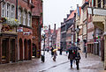
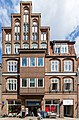
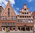
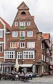
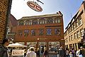
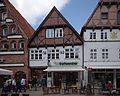
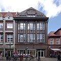
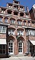
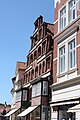
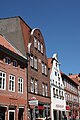
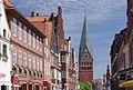
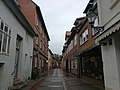
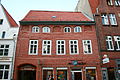
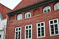
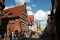
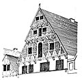
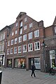
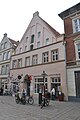
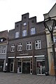
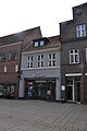
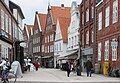
Grapengießerstraße is a street in Lüneburg, District Lüneburg, Lower Saxony, Germany.
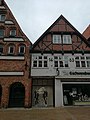
House numbers of the architectural monuments: 1, 3, 4, 5, 6, 7, 8, 9, 10, 11, 12, 13, 14, 15, 18, 19, 23, 24, 25, 26, 27/28, 29, 30, 31, 32, 33, 34, 38, 42/43, 45, 45a, 46, 47, 48, 49, 50, 51
- The Grapengießerstraße is one of the oldest streets in Lüneburg. The road is part of the connection between the castle on the limestone and the settlement Modestorpe. The Grapengießerstraße goes off on the northwest corner of the square Am Sande westwards. The name derives from the name Grapen, a medieval cooking pot. Lived here in the 15th century ore caster, these make these pots.
street in Lüneburg, Germany | |||||
| Upload media | |||||
| Instance of | |||||
|---|---|---|---|---|---|
| Location | Lüneburg, Lower Saxony, Germany | ||||
 | |||||
Subcategories
This category has only the following subcategory.
G
- Grapengießerstraße 15 (Lüneburg) (18 F)
Media in category "Grapengießerstraße (Lüneburg)"
The following 116 files are in this category, out of 116 total.
-
 016 2015 07 12 Grapengießerstraße.jpg 2,923 × 1,710; 4.37 MB
-
 020 2015 07 12 Kuhstraße.jpg 2,707 × 1,846; 3.88 MB
-
 022 2015 07 12 Grapengießerstraße 12, 13.jpg 1,960 × 2,550; 3.3 MB
-
 023 2015 07 12 Grapengießerstraße 11-15.jpg 2,732 × 1,829; 3.96 MB
-
 024 2015 07 12 Grapengießerstraße 11.jpg 1,772 × 2,821; 2.95 MB
-
 026 2015 07 15 Grapengießerstraße 11.jpg 1,937 × 2,582; 5.38 MB
-
 109 2015 07 15 Grapengießerstraße 13.jpg 1,678 × 2,979; 3.83 MB
-
 110 2015 07 15 Grapengießerstraße 10.jpg 2,167 × 2,307; 4.23 MB
-
 111 2015 07 15 Grapengießerstraße 9.jpg 1,686 × 2,965; 4.12 MB
-
 112 2015 07 15 Grapengießerstraße 8.jpg 1,820 × 2,746; 3.3 MB
-
 113 2015 07 15 Grapengießerstraße 7.jpg 2,675 × 1,869; 4.82 MB
-
 114 2015 07 15 Grapengießerstraße 6.jpg 1,513 × 3,302; 3.62 MB
-
 115 2015 07 15 Grapengießerstraße 5.jpg 1,601 × 3,122; 3.8 MB
-
 116 2015 07 15 Grapengießerstraße 4.jpg 1,815 × 2,755; 4.11 MB
-
 117 2015 07 15 Grapengießerstraße 3.jpg 2,325 × 2,150; 4.86 MB
-
 118 2015 07 15 Grapengießerstraße 1.jpg 1,782 × 2,804; 4.05 MB
-
 2010-06-04-lueneburg-by-RalfR-12.jpg 3,465 × 2,776; 3.19 MB
-
 2010-06-04-lueneburg-by-RalfR-13.jpg 2,000 × 3,008; 2.9 MB
-
 2010-06-06-lueneburg-by-RalfR-11.jpg 3,008 × 2,000; 3.32 MB
-
 2014 Lüneburg 24.jpg 5,184 × 3,456; 5 MB
-
 Dekorierter Stromkasten in Lüneburg IMG 4769.JPG 4,272 × 2,848; 5.46 MB
-
 GRAPEN LUE.jpg 4,288 × 2,848; 536 KB
-
 Grapengießerstraße - Lüneburg.jpg 2,677 × 1,575; 2.32 MB
-
 Grapengießerstraße 1 - 3 Lüneburg.jpg 6,016 × 4,000; 2.51 MB
-
 Grapengießerstraße 1 Lüneburg.jpg 6,016 × 4,000; 2.58 MB
-
 Grapengießerstraße 10 Lüneburg.jpg 6,016 × 4,000; 2.23 MB
-
 Grapengießerstraße 11 Lüneburg.jpg 6,016 × 4,000; 1.85 MB
-
 Grapengießerstraße 12 Lüneburg.jpg 4,224 × 3,976; 1.35 MB
-
 Grapengießerstraße 13 Lüneburg.jpg 6,016 × 4,000; 1.84 MB
-
 Grapengießerstraße 14 Lüneburg.jpg 4,960 × 3,952; 1.78 MB
-
 Grapengießerstraße 18 Lüneburg.jpg 6,016 × 4,000; 2 MB
-
 Grapengießerstraße 19 Lüneburg.jpg 3,940 × 3,928; 1.63 MB
-
 Grapengießerstraße 25 Lüneburg.jpg 4,508 × 3,924; 1.77 MB
-
 Grapengießerstraße 26 Lüneburg.jpg 3,416 × 3,964; 1.2 MB
-
 Grapengießerstraße 27 28 Lüneburg.jpg 3,828 × 3,896; 1.49 MB
-
 Grapengießerstraße 9 Lüneburg.jpg 6,016 × 4,000; 2.03 MB
-
 Grapengießerstraße Lüneburg.jpg 6,016 × 4,000; 2.22 MB
-
 Haus in Lüneburg 3 stitched.jpg 3,855 × 6,692; 4.39 MB
-
 Haus in Lüneburg skillshare 2010 Apostoloff 004.JPG 4,272 × 2,848; 4.23 MB
-
 Haus in Lüneburg skillshare 2010 Apostoloff 005.JPG 2,848 × 4,272; 4.32 MB
-
 Haus in Lüneburg skillshare 2010 Apostoloff 006.JPG 2,848 × 4,272; 4.44 MB
-
 Haus in Lüneburg skillshare 2010 Apostoloff 008.JPG 2,848 × 4,272; 3.52 MB
-
 Haus in Lüneburg skillshare 2010 Apostoloff 009.JPG 4,272 × 2,848; 5.62 MB
-
 Haus in Lüneburg skillshare 2010 Apostoloff 010.JPG 2,848 × 4,272; 4.05 MB
-
 Haus in Lüneburg skillshare 2010 Apostoloff 011.JPG 2,848 × 4,272; 4.8 MB
-
 Haus in Lüneburg skillshare 2010 Apostoloff 012.JPG 2,848 × 4,272; 4.73 MB
-
 Haus in Lüneburg skillshare 2010 Apostoloff 013.JPG 2,848 × 4,272; 4.22 MB
-
 Haus in Lüneburg skillshare 2010 Apostoloff 014.JPG 2,848 × 4,272; 1.32 MB
-
 Haus in Lüneburg skillshare 2010 Apostoloff 016.JPG 2,848 × 4,272; 3.31 MB
-
 Haus in Lüneburg skillshare 2010 Apostoloff 017.JPG 2,848 × 4,272; 3.98 MB
-
 Haus in Lüneburg skillshare 2010 Apostoloff 029.JPG 2,848 × 4,272; 5.86 MB
-
 Hausgiebel in Lüneburg skillshare 2010 001.JPG 4,272 × 2,848; 4.87 MB
-
 Hausgiebel in Lüneburg skillshare 2010 002.JPG 2,848 × 4,272; 4.58 MB
-
 Hausgiebel in Lüneburg skillshare 2010 006.JPG 4,272 × 2,848; 3.01 MB
-
 Hausgiebel Lüneburg stitched 1.jpg 3,984 × 4,089; 1.93 MB
-
 Häuser in der Grapengiesserstaße in Lüneburg.jpg 2,700 × 3,600; 8.22 MB
-
 Im Sande stitched 1 Skillshare Apostoloff.jpg 3,683 × 2,841; 1.64 MB
-
 Lueneburg IMGP9367 wp.jpg 1,944 × 3,000; 2.85 MB
-
 Lueneburg IMGP9369 wp.jpg 1,971 × 3,000; 2.84 MB
-
 Lueneburg IMGP9372 wp.jpg 3,000 × 2,016; 3.2 MB
-
 Lueneburg IMGP9772 wp.jpg 3,000 × 2,039; 3.83 MB
-
 Lueneburg IMGP9775 wp.jpg 3,000 × 1,990; 3.9 MB
-
 Lüneburg (38783876235).jpg 3,840 × 5,120; 6.14 MB
-
 Lüneburg (38783878085).jpg 5,120 × 3,840; 6.92 MB
-
 Lüneburg (38972748644).jpg 5,120 × 3,840; 6.18 MB
-
 Lüneburg (39681510151).jpg 5,120 × 3,840; 6.67 MB
-
 Lüneburg - Grapengießerstraße 01 ies.jpg 3,888 × 2,592; 1.73 MB
-
 Lüneburg - Grapengießerstraße 02 ies.jpg 3,888 × 2,592; 2.03 MB
-
 Lüneburg - Grapengießerstraße 03 ies.jpg 3,888 × 2,592; 2.48 MB
-
 Lüneburg - Grapengießerstraße 04 ies.jpg 3,888 × 2,592; 2.21 MB
-
 Lüneburg - Grapengießerstraße 05 ies.jpg 3,888 × 2,592; 2.06 MB
-
 Lüneburg - Grapengießerstraße 06 ies.jpg 3,888 × 2,592; 1.79 MB
-
 Lüneburg - Grapengießerstraße 07 ies.jpg 3,888 × 2,592; 1.74 MB
-
 Lüneburg - Grapengießerstraße 08 ies.jpg 3,888 × 2,592; 2.09 MB
-
 Lüneburg - Grapengießerstraße 09 ies.jpg 3,888 × 2,592; 2.15 MB
-
 Lüneburg - Grapengießerstraße 11 ies.jpg 3,888 × 2,592; 2.13 MB
-
 Lüneburg 123 Grapengießerstraße 45 Giebelprofil.jpg 1,312 × 642; 263 KB
-
 Lüneburg 124 Grapengießerstraße 45 Kamin.jpg 2,250 × 2,045; 1.1 MB
-
 Lüneburg 148 Grapengießerstraße 7 Hofarchitektur.jpg 1,145 × 1,058; 395 KB
-
 Lüneburg 170 Grapengießerstraße 13.jpg 1,245 × 1,216; 559 KB
-
 Lüneburg 171 Grapengießerstraße 45 Flügelbau im Hof.jpg 2,914 × 1,819; 1.67 MB
-
 Lüneburg 172 Grapengießerstraße 45 Fensterpfosten.jpg 778 × 1,360; 244 KB
-
 Lüneburg Am Sande 014 9332.jpg 2,671 × 3,126; 1.32 MB
-
 Lüneburg Am Sande 015 9337.jpg 2,300 × 2,945; 1.11 MB
-
 Lüneburg Am Sande 016 9340.jpg 2,717 × 3,031; 1.36 MB
-
 Lüneburg Am Sande 017 9347.jpg 2,127 × 2,767; 1.07 MB
-
 Lüneburg Am Sande 018 9352.jpg 2,442 × 4,056; 1.61 MB
-
 Lüneburg Fassade 09474.jpg 7,098 × 1,711; 2.62 MB
-
 Lüneburg Grapengießerstraße 09515.jpg 2,219 × 2,646; 1.08 MB
-
 Lüneburg Grapengießerstraße 23.jpg 2,848 × 4,288; 4.63 MB
-
 Lüneburg Grapengießerstraße 24.jpg 2,848 × 4,288; 4.54 MB
-
 Lüneburg Grapengießerstraße 28.jpg 2,848 × 4,288; 4.94 MB
-
 Lüneburg Grapengießerstraße 29.jpg 2,848 × 4,288; 4.66 MB
-
 Lüneburg Grapengießerstraße 30.jpg 2,848 × 4,288; 4.84 MB
-
 Lüneburg Grapengießerstraße 31.jpg 2,848 × 4,288; 5.86 MB
-
 Lüneburg Grapengießerstraße 32.jpg 2,848 × 4,288; 5.14 MB
-
 Lüneburg Grapengießerstraße 33.jpg 2,848 × 4,288; 4.59 MB
-
 Lüneburg Grapengießerstraße 34.jpg 2,848 × 4,288; 5.76 MB
-
 Lüneburg Grapengießerstraße 38.jpg 2,848 × 4,288; 4.29 MB
-
 Lüneburg Grapengießerstraße 42.jpg 2,848 × 4,288; 4.9 MB
-
 Lüneburg Grapengießerstraße 43.jpg 2,848 × 4,288; 5.13 MB
-
 Lüneburg Grapengießerstraße 45.jpg 2,848 × 4,288; 4.49 MB
-
 Lüneburg Grapengießerstraße 46.jpg 2,848 × 4,288; 5.23 MB
-
 Lüneburg Grapengießerstraße 47.jpg 2,848 × 4,288; 4.47 MB
-
 Lüneburg Grapengießerstraße 48.jpg 2,848 × 4,288; 4.45 MB
-
 Lüneburg Grapengießerstraße 49.jpg 2,848 × 4,288; 4.42 MB
-
 Lüneburg Grapengießerstraße 50.jpg 2,848 × 4,288; 4.51 MB
-
 Lüneburg Grapengießerstraße 51.jpg 2,848 × 4,288; 4.77 MB
-
 Lüneburg Hinterhof 09460.jpg 4,031 × 2,574; 1.46 MB
-
 Lüneburg, die Grapengießerstraße.jpg 2,443 × 1,697; 1.25 MB
-
 Lüneburg-Brick.house.01.jpg 2,136 × 2,848; 524 KB
-
 Lüneburg-grapengießerstr01.jpg 2,304 × 1,728; 3.01 MB
-
 Lüneburg-grapengießerstr02.jpg 2,238 × 1,671; 2.84 MB
-
 Lüneburg-grapengießerstr03.jpg 2,304 × 1,728; 2.79 MB
-
 Lüneburg-grapengießerstr04.jpg 2,304 × 1,728; 2.88 MB
-
 Stromkasten mit Hochhausmotiv in der Altstadt von Lüneburg.jpg 1,536 × 2,048; 1.34 MB


.jpg)
.jpg)
.jpg)
.jpg)


