Category:Gradient maps
Jump to navigation
Jump to search
Subcategories
This category has only the following subcategory.
- Maps generated with GunnMap (213 F)
Media in category "Gradient maps"
The following 14 files are in this category, out of 14 total.
-
 Age of oceanic lithosphere heb.jpg 2,001 × 1,277; 563 KB
-
 Age of oceanic lithosphere.jpg 2,000 × 1,432; 407 KB
-
 Earth Gravitational Model 1996.png 742 × 468; 34 KB
-
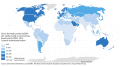 GDP per capita PPP 2014-en.svg 1,024 × 559; 486 KB
-
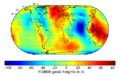
 Geoid height red blue.png 1,686 × 1,166; 940 KB
-
 Geoida.png 1,686 × 1,166; 1.43 MB
-
 Internet Access by Country (2017).svg 816 × 510; 3.32 MB
-
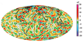 Magnetic Field Earth.png 568 × 291; 308 KB
-
 Meat consumption rate (kg) per capita by country gradient map (2002).svg 1,600 × 800; 3.32 MB
-
 Meat consumption rate (kg) per capita by country gradient map (2009).svg 1,600 × 800; 3.32 MB
-
 Percent population below poverty level by Puerto Rico census tract (2015).png 3,300 × 2,550; 222 KB
-

-

-
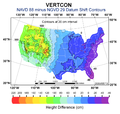 VERTCON.png 900 × 857; 441 KB


.svg)

_per_capita_by_country_gradient_map_(2002).svg)
_per_capita_by_country_gradient_map_(2009).svg)
.png)
.svg)
.svg)
