Category:Graaf Florisweg 26, Gouda
Jump to navigation
Jump to search
|
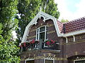
This is a category about a municipal monument in Gouda with number 795 |
| Object location | | View all coordinates using: OpenStreetMap |
|---|
Media in category "Graaf Florisweg 26, Gouda"
The following 3 files are in this category, out of 3 total.
-
 Bijgebouw. Detail. Graaf Florisweg 26.jpg 3,240 × 4,320; 8.17 MB
-
 Huis. Daklijst. Graaf Florisweg 26 detail.JPG 4,320 × 3,240; 6.02 MB
-
 Huis. Graaf Florisweg 26.jpg 4,320 × 3,240; 9.05 MB


