Category:Governors Island
Jump to navigation
Jump to search
|
This is a category about a place or building that is listed on the National Register of Historic Places in the United States of America. Its reference number is 85002435. |
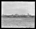
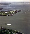
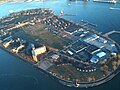
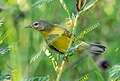
English: Governors Island is a 172-acre (70 ha) island in New York Harbor, within the borough of Manhattan in New York City, approximately 800 yards (732 m) south of Manhattan Island. Governors Island National Monument was designated in 2001 to preserve Castle Williams, Fort Jay, and four adjacent buildings on the island. The subcategory Nolan Park refers to a group of buildings, not a park in the usual sense.
island in the United States of America  .jpeg) | |||||
| Upload media | |||||
| Instance of | |||||
|---|---|---|---|---|---|
| Facet of |
| ||||
| Located in protected area | |||||
| Location | Manhattan, New York City, New York | ||||
| Located in or next to body of water |
| ||||
| Has part(s) |
| ||||
| Heritage designation |
| ||||
| Inception |
| ||||
| Area |
| ||||
 | |||||
Subcategories
This category has the following 16 subcategories, out of 16 total.
Pages in category "Governors Island"
This category contains only the following page.
Media in category "Governors Island"
The following 162 files are in this category, out of 162 total.
-
 12th Infantry, Signal Corps, Day Work, Governor's Island, N.Y. LCCN2014680520.jpg 5,822 × 4,335; 2.69 MB
-
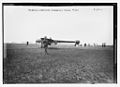
 -Group of 3 Sterograph Views of Aviation, including the Wright Brothers- MET DP72738.jpg 4,000 × 2,019; 2.07 MB
-
 1996.164.8-B38824 glass IMLS SL2.jpg 1,024 × 823; 305 KB
-
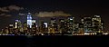
 2016 One World Observatory view southsoutheast towards Governors Island.jpg 2,304 × 1,585; 956 KB
-
 40 Wall Street, NYC.png 962 × 1,184; 1.91 MB
-
 7th Regiment garden party. Governor's Island. LCCN2014688176.jpg 5,860 × 4,272; 3.89 MB
-
 A view of New York, Governors Island, the river etc. from Long Island LCCN2004670009.tif 1,536 × 1,036; 1.52 MB
-
 Aerial Photograph of Lower Manhattan in New York City - NARA - 7455641.jpg 2,609 × 1,968; 1.28 MB
-
 Bain News Service,, publisher. (2163688606).jpg 1,024 × 743; 117 KB
-
 Battery Park & Governers (sic) Island, from Whitehall Bldg. LCCN2005691844.jpg 5,149 × 4,170; 2.91 MB
-
 BBT vent shaft jeh.JPG 2,288 × 1,196; 257 KB
-
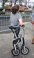
 Biking on the Island.JPG 800 × 600; 117 KB
-
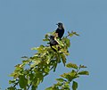
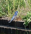 Blue grosbeak on Governors Island (45996).jpg 484 × 530; 397 KB
-
 Blue grosbeaks on Governors Island (46003).jpg 1,987 × 1,458; 3.19 MB
-
 Bobolinks on Governors Island (45776).jpg 1,551 × 1,300; 1.22 MB
-
 Brant on Governors Island - Lackluster Camouflage.jpg 4,000 × 3,000; 4.97 MB
-

-

-

-

-

-

-

-

-

-

-

-

-

-

-

-

-

-

-
-

-

-
-
 Circle Line Shark and Governors Island 02 (9440912877).jpg 4,288 × 2,848; 6.1 MB
-
 Cloud of bottles on Governors Island - panoramio (1).jpg 2,048 × 1,536; 1.36 MB
-
 Cloud of bottles on Governors Island - panoramio (2).jpg 2,048 × 1,536; 1.96 MB
-
 Cloud of bottles on Governors Island - panoramio.jpg 2,048 × 1,536; 1.13 MB
-

-
 Conical (2877927522).jpg 3,264 × 2,448; 3.56 MB
-
 Crow mobbing red-tailed hawk (45805).jpg 2,313 × 1,830; 2.8 MB
-
 Double-crested cormorant off Governors Island.jpg 4,000 × 3,000; 4.97 MB
-
 Dragon (3829249448).jpg 4,037 × 2,681; 5.85 MB
-
 Eastern black swallowtail (72098).jpg 2,026 × 1,405; 2.24 MB
-
 EB9 New York - City - lower part.jpg 2,713 × 3,914; 2.66 MB
-
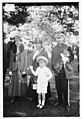
 Eleanor Griffith, Governor's Isl'd (i.e., Island) LCCN2014699132.jpg 5,766 × 4,216; 2.41 MB
-
 Field Telephone, U.S.A. LCCN2014696556.jpg 5,785 × 4,191; 3.62 MB
-
 FigmentNYC2014-16 (16176428566).jpg 4,368 × 2,912; 10.87 MB
-
 Fire Test (7555887340).jpg 1,160 × 1,420; 1.39 MB
-
 Garden party on Governor's Island, New York LCCN2014680504.tif 5,810 × 4,278; 23.71 MB
-
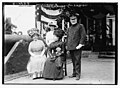
 Garden Party, Gov's Isl. (i.e., Island) LCCN2014701731.jpg 4,859 × 3,296; 2.31 MB
-
 Garden Party, Gov's Isl. LCCN2014701732.jpg 1,024 × 692; 220 KB
-
 Garden party, Governor's Island Miss Sue Spillar, Miss Kindfred, New York LCCN2014680509.tif 5,804 × 4,342; 24.03 MB
-

-
 Garden party, Governor's Island, N.Y. LCCN2014683973.jpg 5,747 × 4,222; 2.81 MB
-
 Garden party, Governor's Island, New York LCCN2014680505.jpg 5,804 × 4,316; 3.65 MB
-
 Garden party, Governor's Island, New York LCCN2014680508.jpg 5,804 × 4,310; 3.85 MB
-
 Garden party, Governor's Island, New York LCCN2014680510.jpg 5,847 × 4,341; 3.18 MB
-
 Gen. F.D. Grant; Sec'y Stimson LOC 2162710987.jpg 1,024 × 749; 90 KB
-

-
 Gov's Isl.- soldiers being shaved LCCN2014681441.jpg 7,026 × 5,416; 3.81 MB
-
 Gov's Isld., 5-29-14 LCCN2014696118.jpg 5,716 × 4,216; 3.22 MB
-
 Gov.'s Isl.- Reading Room for soldiers LCCN2014681435.jpg 6,982 × 5,378; 4.16 MB
-
 Gov.'s Isl.- soldier cleaning gun LCCN2014681436.jpg 7,041 × 5,423; 4.1 MB
-
 Gov.'s Isl.- soldier's bunks LCCN2014681438.jpg 6,937 × 5,401; 3.85 MB
-
 Gov.'s Isl.- soldier's kitchen LCCN2014681437.jpg 7,048 × 5,408; 4.1 MB
-
 Gov.'s Isl.- soldier's playing cards LCCN2014681439.jpg 6,988 × 5,482; 3.69 MB
-
 Governers (sic) Island & N.Y. Bay from Brooklyn LCCN98505921.tif 4,096 × 3,273; 12.79 MB
-
 Governers (sic) Island & The Narrows LCCN2005691845.jpg 5,184 × 4,161; 2.39 MB
-
 Governor's Island and Verrazano Narrows from WTC, 1990 (9533691).jpg 1,155 × 1,318; 2.79 MB
-
 Governor's Island at the end of day at the end of summer.JPG 1,936 × 2,592; 1.37 MB
-
 Governor's Island, New York Harbor, N.Y - NARA - 527660.jpg 3,000 × 1,474; 967 KB
-
 Governors Island - New York City (4889925256).jpg 2,048 × 1,536; 854 KB
-
 Governors Island - panoramio.jpg 1,600 × 1,200; 989 KB
-
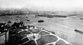
 Governors Island aerial.jpg 800 × 600; 151 KB
-
 Governors Island and Brooklyn from New York Harbor 01 (9443569894).jpg 4,288 × 2,848; 4.85 MB
-
 Governors Island from Brooklyn Heights 01 (9420543193).jpg 4,288 × 2,848; 4.96 MB
-
 Governors Island Marker.JPG 640 × 480; 98 KB
-
 Governors Island NY.JPG 800 × 600; 136 KB
-
 Governors Island, New York.jpg 5,184 × 3,456; 3.28 MB
-
 Heinrich's Aeroplane 5642875559 ced51e378b o.jpg 1,024 × 746; 110 KB
-
 High Rise Fire Study; Wind-Driven Fires (5888199090).jpg 1,800 × 1,197; 350 KB
-
 Islander at Governors Island, June 2009.JPG 1,600 × 1,200; 313 KB
-
 Looking South (29330189352).jpg 3,264 × 3,264; 649 KB
-
 Lot 12482-15 (25413156422).jpg 3,250 × 1,779; 1.5 MB
-
 Lower Manhattan Skylines Governors Island Views from Statue Cruises Upper New York Bay.jpg 4,000 × 3,000; 1.31 MB
-
 Manhattan and Brooklyn from Staten Island Ferry (7208224566).jpg 1,600 × 953; 262 KB
-
 Manhattan from the Staten Island Ferry (4672695907).jpg 4,752 × 2,316; 5.43 MB
-
 Manhattan from the Staten Island Ferry 2 (4672704901).jpg 4,680 × 2,958; 7.54 MB
-
 Manhattan from the Staten Island Ferry 3 (4673334998).jpg 4,569 × 2,935; 7.34 MB
-
 Manhattan from the Staten Island Ferry at Night (6222894666).jpg 5,184 × 2,144; 5.14 MB
-
 Manhattan from the Staten Island Ferry at Night 2a (6222377175).jpg 4,804 × 1,976; 4.32 MB
-
 Manhattan from the Staten Island Ferry at Night 2c (6876426445).jpg 4,223 × 1,815; 3.26 MB
-
 Manhattan from the Staten Island Ferry at Night 3a (6222898854).jpg 5,052 × 3,160; 7.42 MB
-
 Manhattan from the Staten Island Ferry at Night 3c (6876436051).jpg 4,212 × 3,160; 6.47 MB
-
 MANHATTAN SKYLINE SEEN FROM THE SOUTH - NARA - 548384.jpg 3,000 × 2,023; 670 KB
-
 Meuse-Argonne Point, Governor's Island.JPG 2,816 × 2,112; 2.63 MB
-
 Miss Kinball and Miss Little, Governor's Island. LCCN2014688172.jpg 5,847 × 4,291; 2.98 MB
-
 Mobiky Gov Island jeh.jpg 1,624 × 2,740; 949 KB
-
 Mrs. F. Shepard & son, & Col. W. E. Horton LCCN2014701726.jpg 3,334 × 4,847; 2.08 MB
-
-

-
 New Jersey from the Staten Island Ferry at Night (6222892718).jpg 5,184 × 2,300; 5.39 MB
-
 New York - New York City - NARA - 68145774.jpg 7,028 × 5,437; 17.6 MB
-
 New York - New York City - NARA - 68145776.jpg 7,028 × 5,403; 16.48 MB
-
-

-

-

-

-
 New York Base Slip Number 6 - DPLA - c072abc76b1c71ae676a03a30aababa7.tiff 7,508 × 4,896; 339 KB
-
 New York City by Augusto Janiscki Junior - Flickr - AUGUSTO JANISKI JUNIOR (12).jpg 1,536 × 2,048; 1.38 MB
-
 New York City View from Freedom Tower 2016-04-21 19.22.23 - Flickr id 26917244913.jpg 3,264 × 2,448; 3.3 MB
-
 New York skyscrapers from Governor's Island LCCN2002715655.jpg 1,536 × 841; 139 KB
-
 Liberty Over All, Governors Island, N. Y., World War I (NYPL b12647398-74401).tiff 2,432 × 1,652; 11.5 MB
-
 Paddy wagon lineup Gov Is jeh.jpg 4,333 × 2,438; 3.39 MB
-
-
 Phyllis Hartmann, Mrs. Carl Hartmann, Grace Allison LCCN2014701728.jpg 4,841 × 3,290; 2.26 MB
-
-
 Prairie warbler on Governors Island (70536).jpg 1,763 × 1,185; 1.73 MB
-
 Presenting colors, Gov. Island LOC 19151150856.jpg 1,024 × 701; 165 KB
-
 Presenting colors, Gov. Island LOC 19180864431.jpg 1,024 × 704; 200 KB
-

-

-
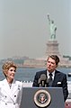
President Reagan's Remarks at the Statue of Liberty on Governors Island, New York, July 3, 1986.webm 14 min 6 s, 654 × 480; 53.46 MB
-
-
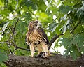 Red-tailed Hawk Eating Lunch.jpg 2,000 × 1,600; 3.03 MB
-

-
 Sec'y Stimson and Gen. Grant, Lawn Party, Gov's Island LOC 2162710703.jpg 1,024 × 742; 117 KB
-
 Sec'y Stimson, Gen. F.D. Grant LOC 2163471986.jpg 1,024 × 748; 122 KB
-
 Secy Stimson and Gen. Grant at lawn party, Gov's Island. LOC 2163471766.jpg 1,024 × 744; 164 KB
-
 Spectators - Drill, GovernorÆs Island LCCN2014696562.jpg 1,024 × 751; 157 KB
-
 Staten Island Ferry-Battery Park-2012.jpg 800 × 600; 65 KB
-
 Tea Garden, Governor's Isl. (i.e., Island) LCCN2014701729.jpg 4,865 × 3,283; 2.53 MB
-
 The problem of greater New York and its solution (1914) (14768522545).jpg 2,170 × 3,360; 1.2 MB
-

-
-

-
 Ward and Hudson Maxim LOC 2163688348.jpg 1,024 × 739; 120 KB
-
 Ward LCCN2014689549.tif 5,728 × 4,154; 22.69 MB
-
 Ward says good by (i.e., goodbye) to Gen. Grant LOC 2163688086.jpg 1,024 × 745; 112 KB
-
 Water Distribution, October 1991 - DPLA - 3288220a76b55845bc67d1fbf4981d0a.tiff 7,784 × 4,896; 531 KB
-
 Water Distribution, October 1991 - DPLA - 99a970236938ec11376e636d80514ca5.tiff 7,464 × 4,896; 554 KB
-

-
-

-
-

-

-

-

-

-
 Water-3.jpg 2,560 × 1,920; 2.8 MB
-

-
 Wiknic T-shirt winners2023 jeh.jpg 5,184 × 3,888; 2.07 MB
-
 World Trade Center (new) - panoramio.jpg 2,048 × 1,536; 1.33 MB
-
 Wright Model A - MET DP72740.jpg 4,000 × 2,019; 2.69 MB
-
 Yellow-crowned Night-Heron-Governors Island.jpg 2,048 × 2,048; 212 KB


.jpg)
_Island,_from_Whitehall_Bldg._LCCN2005691844.jpg)


.jpg)
.jpg)
.jpg)

.jpg)
.jpg)
.jpg)

_troops_that_make_up_labor_battalion,_Governor%27s_Island,_New_York._-_NARA_-_533589.jpg)
.jpg)
.jpg)

.jpg)
.jpg)

_LCCN2014699132.jpg)

.jpg)
.jpg)
_LCCN2014701731.jpg)


_Island_%26_The_Narrows_LCCN2005691845.jpg)
.jpg)


.jpg)


.jpg)
.jpg)


.jpg)

.jpg)
.jpg)

.jpg)
.jpg)
.jpg)
.jpg)
.jpg)
.jpg)
.jpg)
.jpg)


.jpg)


.jpg)


.jpg)


_LCCN2014701729.jpg)
_(14768522545).jpg)
_-_DPLA_-_0bc0136b758e8b1b1a10a95ca9803a68.jpg)
_-_DPLA_-_f3cd65b9be869ac2c3a4f5e9c8a46b27.jpg)

_to_Gen._Grant_LOC_2163688086.jpg)


_-_panoramio.jpg)


.jpg)
Categories:
- National Register of Historic Places in Manhattan
- National Historic Landmarks in New York City
- Prisoners of war in the American Civil War
- Former airfields in the United States
- Airports in the United States by name
- United States Coast Guard bases
- Airports in New York (state)
- Islands of Manhattan
- Airports by name
- Historic districts in New York City
- New York State Register of Historic Places in New York County