Category:Gorseinon
Jump to navigation
Jump to search
district town in Swansea, Wales  | |||||
| Upload media | |||||
| Instance of | |||||
|---|---|---|---|---|---|
| Location | Swansea, Wales | ||||
| official website | |||||
 | |||||
Català: Gorseinon és una ciutat i cymuned (municipi) en el sud-est de Gal·les, vora l'estuari del Loughor. Havia estat un poblet fins que, a les darreries del segle XIX cresqué amb força gràcies a la mineria del carbó i la indústria de la llauneria. Està situada en el comtat gal·lès d'Abertawe (Swansea en anglès), vora la frontera amb el comtat de Sir Gaerfyrddin, i a uns tretze quilòmetres al nord-oest de la ciutat d'Abertawe.
Cymraeg: Mae Gorseinon yn dref ger Abertawe yn sir Abertawe. Fe'i lleoli ger aber y Llwchwr, tua 6 milltir i'r gogledd-orllewin o ganol y ddinas. Mae Gorseinon hefyd yn gymuned llywodraeth leol gyda chyngor etholedig yn y dref. Pentref bychan ydoedd tan diwedd y 19eg ganrif pan dyfodd yn sgîl y diwydiannau glo a thunplat.
English: Gorseinon is a town in south west Wales, near the Loughor estuary. It was a small village until the late 19th century when it grew around the coal mining and tinplate industries. It is situated in the north west of Swansea, around 6 miles north west of the city centre. Gorseinon is also a local government community with its own elected town council.
Media in category "Gorseinon"
The following 198 files are in this category, out of 198 total.
-
 'Eadz Up, Gorseinon - geograph.org.uk - 3677172.jpg 800 × 569; 87 KB
-
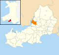 2010 Wales Swansea Community Gorseinon map.svg 512 × 472; 632 KB
-
 2024 Wales Swansea Community Gorseinon map.svg 512 × 472; 651 KB
-
 A4240 Alexandra Road, Gorseinon - geograph.org.uk - 1480632.jpg 640 × 320; 57 KB
-
 Abandoned sandstone quarry at Penyrheol - geograph.org.uk - 5770945.jpg 4,592 × 3,056; 4.99 MB
-
 Afon Lliw Bridge - geograph.org.uk - 4019457.jpg 640 × 480; 108 KB
-
 Alexandra Chambers Lawyers, Gorseinon - geograph.org.uk - 4879353.jpg 783 × 800; 154 KB
-

-

-
 Alexandra Road houses, Gorseinon - geograph.org.uk - 4879762.jpg 800 × 771; 195 KB
-
 Alexandra Road houses, Gorseinon - geograph.org.uk - 5000959.jpg 800 × 641; 136 KB
-
 Alexandra Road, Gorseinon - geograph.org.uk - 3264464.jpg 640 × 480; 62 KB
-
-
 Argyll Gardens name sign, Gorseinon - geograph.org.uk - 4878403.jpg 697 × 800; 191 KB
-
 Argyll Gardens, Gorseinon - geograph.org.uk - 4973406.jpg 6,000 × 4,000; 5.25 MB
-

-
 ATC hut, Park Road, Gorseinon - geograph.org.uk - 5001092.jpg 800 × 512; 124 KB
-
 AVA Dancewear, Gorseinon - geograph.org.uk - 3681153.jpg 800 × 544; 109 KB
-
 Barclays Bank and Wholly Well, Gorseinon - geograph.org.uk - 3681356.jpg 800 × 551; 127 KB
-
 Barclays Bank, Gorseinon - geograph.org.uk - 4879439.jpg 800 × 743; 174 KB
-

-
 Bethel Evangelical Church, Gorseinon - geograph.org.uk - 3677125.jpg 800 × 766; 159 KB
-
 Bethel Evangelical Church, Gorseinon - geograph.org.uk - 4973407.jpg 6,000 × 4,000; 3.99 MB
-
 Bethlehem Funeral Home, Gorseinon - geograph.org.uk - 3682603.jpg 800 × 564; 126 KB
-
 Bits ^ Pieces in Gorseinon High Street - geograph.org.uk - 3677107.jpg 800 × 710; 137 KB
-

-
 Boulder-lined Heol y Mynydd, Gorseinon - geograph.org.uk - 3683244.jpg 798 × 800; 200 KB
-
 Brynamlwg Road, Loughor - geograph.org.uk - 5001527.jpg 800 × 520; 94 KB
-
 Brynawel Road Gorseinon - geograph.org.uk - 3682566.jpg 800 × 516; 162 KB
-
 Brynteg Road Gorseinon - geograph.org.uk - 3682593.jpg 800 × 559; 124 KB
-
 Bungalows and church, Gorseinon - geograph.org.uk - 5001053.jpg 800 × 712; 150 KB
-
 Bust of W Rufus Lewis Esq.jpg 1,535 × 2,302; 570 KB
-

-
 Cameron Place, Loughor - geograph.org.uk - 5028849.jpg 785 × 800; 138 KB
-
 Capel Brynteg Chapel - geograph.org.uk - 3832604.jpg 640 × 480; 62 KB
-
 Carstore, Loughor - geograph.org.uk - 5029295.jpg 800 × 584; 119 KB
-
 Catholic Church - geograph.org.uk - 6159359.jpg 2,048 × 1,536; 838 KB
-
 Cattle grazing above the Loughour estuary - geograph.org.uk - 5770290.jpg 4,592 × 3,056; 3.15 MB
-

-

-
 Clos Vernon Watkins, Gorseinon - geograph.org.uk - 3682673.jpg 800 × 672; 139 KB
-

-
 Creeks and coastal grazing marsh, Loughour estuary - geograph.org.uk - 5770253.jpg 4,592 × 3,056; 3.57 MB
-
 Creeks and coastal grazing marsh, Loughour estuary - geograph.org.uk - 5770262.jpg 4,592 × 3,056; 3.24 MB
-
 Cwrt Hywel, Gorseinon - geograph.org.uk - 4879697.jpg 800 × 632; 130 KB
-
 Danybryn Road, Loughor - geograph.org.uk - 5028784.jpg 800 × 586; 127 KB
-
 Day Nursery - geograph.org.uk - 5591562.jpg 3,264 × 2,448; 2.57 MB
-
 Descending to the centre of Gorseinon - geograph.org.uk - 4973378.jpg 6,000 × 4,000; 7.2 MB
-
 Divine Beauty in Gorseinon - geograph.org.uk - 4878489.jpg 800 × 634; 121 KB
-
 DJ Motors Gorseinon - geograph.org.uk - 3681102.jpg 800 × 663; 135 KB
-
 Dyffryn Road, Gorseinon - geograph.org.uk - 3681111.jpg 640 × 464; 73 KB
-
 East along High Street, Gorseinon - geograph.org.uk - 4879339.jpg 800 × 495; 96 KB
-

-
 Einon House, Gorseinon - geograph.org.uk - 5001121.jpg 800 × 693; 159 KB
-

-

-

-
 Entrance to Gorseinon Hospital - geograph.org.uk - 3682550.jpg 800 × 656; 173 KB
-
 Entrance to the New Lodge, Gorseinon - geograph.org.uk - 5028810.jpg 800 × 679; 183 KB
-
 Exit road from the New Lodge, Gorseinon - geograph.org.uk - 5001518.jpg 800 × 600; 176 KB
-
 Ffarm y Gwynfaen Farm - geograph.org.uk - 3832820.jpg 640 × 431; 94 KB
-
 Ffordd Eira houses, Gorseinon - geograph.org.uk - 3683250.jpg 800 × 537; 107 KB
-
 Fit Kitchens showroom, Gorseinon - geograph.org.uk - 4878464.jpg 800 × 549; 106 KB
-
 Fitness Studio - geograph.org.uk - 5591511.jpg 3,264 × 2,448; 1.22 MB
-
 Footpath alongside Afon Lliw - geograph.org.uk - 976260.jpg 640 × 424; 60 KB
-

-
 Frampton Road houses, Gorseinon - geograph.org.uk - 3682742.jpg 800 × 524; 114 KB
-
 Gate and stile - geograph.org.uk - 6159016.jpg 2,048 × 1,536; 1.72 MB
-
 Glimpse of Loughor estuary - geograph.org.uk - 6159018.jpg 3,065 × 2,299; 1.83 MB
-

-

-
 Gorseinon Ambulance Station - geograph.org.uk - 3681117.jpg 800 × 541; 112 KB
-
 Gorseinon and District War Memorial - geograph.org.uk - 3682075.jpg 800 × 780; 152 KB
-
 Gorseinon Bus Station - geograph.org.uk - 4973402.jpg 6,000 × 4,000; 7.5 MB
-
 Gorseinon bus station public toilets - geograph.org.uk - 3677157.jpg 800 × 630; 160 KB
-
 Gorseinon Church - geograph.org.uk - 3754773.jpg 480 × 640; 59 KB
-
 Gorseinon Eisteddfod Stone Circle - geograph.org.uk - 4878411.jpg 800 × 428; 152 KB
-
 Gorseinon Hospital car park - geograph.org.uk - 3682556.jpg 800 × 600; 117 KB
-
 Gorseinon Library - geograph.org.uk - 3677132.jpg 800 × 522; 109 KB
-
 Gorseinon Market Shopping Centre - geograph.org.uk - 3676835.jpg 800 × 600; 137 KB
-
 Gorseinon Post Office - geograph.org.uk - 3681338.jpg 800 × 645; 140 KB
-
 Gorseinon Road looking west - geograph.org.uk - 3264463.jpg 640 × 480; 59 KB
-
 Gorseinon Station site geograph-3886017-by-Ben-Brooksbank.jpg 2,451 × 1,321; 2.22 MB
-
 Gorseinon Town Council offices - geograph.org.uk - 3677185.jpg 800 × 521; 107 KB
-

-

-
 Gorseinon, St Catherine's Church.jpg 640 × 443; 97 KB
-
 Half Cut in Loughor - geograph.org.uk - 5029800.jpg 800 × 680; 113 KB
-

-
 Haven Veterinary Group, Gorseinon - geograph.org.uk - 3682048.jpg 800 × 642; 151 KB
-
 Heol Eifion houses, Gorseinon - geograph.org.uk - 3683254.jpg 800 × 545; 93 KB
-

-
 HSBC and floral displays in Gorseinon - geograph.org.uk - 3677115.jpg 800 × 585; 143 KB
-
 ISmart, Gorseinon - geograph.org.uk - 4878488.jpg 800 × 665; 136 KB
-
 John's Fish Bar, Loughor - geograph.org.uk - 5028990.jpg 800 × 729; 126 KB
-
 Lane towards Llanant Farm - geograph.org.uk - 5771036.jpg 4,592 × 3,056; 3.88 MB
-
 Leisure Launderette, Gorseinon - geograph.org.uk - 5028794.jpg 800 × 583; 95 KB
-
 Lifelong Learning Centre, Gorseinon - geograph.org.uk - 3681390.jpg 800 × 534; 105 KB
-
 Lime Street Gorseinon - geograph.org.uk - 3681146.jpg 800 × 797; 161 KB
-
 Llanant Road, looking northwest towards Llanant Farm - geograph.org.uk - 5770278.jpg 4,465 × 2,977; 2.88 MB
-
 Llannant Road, Penyrheol, Gorseinon - geograph.org.uk - 3682645.jpg 800 × 525; 107 KB
-
 Lloyds Bank Gorseinon - geograph.org.uk - 3677041.jpg 800 × 795; 154 KB
-
 Llwchwr Community, Stafford Common - geograph.org.uk - 184965.jpg 640 × 427; 183 KB
-
 Llwybr Llandeilo Talybont Path - geograph.org.uk - 3832793.jpg 640 × 437; 130 KB
-

-
 Loughor-Casllwchwr boundary sign - geograph.org.uk - 5001521.jpg 800 × 756; 150 KB
-
 Mai Hong Chinese takeaway in Gorseinon - geograph.org.uk - 3677051.jpg 800 × 749; 141 KB
-
 Melin Mynach, Gorseinon - geograph.org.uk - 2779769.jpg 690 × 518; 252 KB
-
 Mill Street houses, Gorseinon - geograph.org.uk - 3676776.jpg 800 × 480; 95 KB
-
 Mini-roundabout near Gorseinon Hospital - geograph.org.uk - 3682559.jpg 800 × 503; 105 KB
-

-
 Mud flats and salt marshes on the Loughor estuary - geograph.org.uk - 5771057.jpg 4,592 × 3,056; 2.97 MB
-
 Noble Harbour Solicitors, Gorseinon - geograph.org.uk - 4878444.jpg 800 × 603; 127 KB
-

-
 O'Brien's Metals - geograph.org.uk - 5591619.jpg 3,264 × 2,448; 2.3 MB
-
 Ordnance Survey Cut Mark - geograph.org.uk - 4019432.jpg 640 × 480; 79 KB
-
 Ordnance Survey Cut Mark - geograph.org.uk - 4019437.jpg 480 × 640; 126 KB
-
 Ordnance Survey Cut Mark - geograph.org.uk - 4019442.jpg 480 × 640; 86 KB
-
 Ordnance Survey Cut Mark - geograph.org.uk - 4019451.jpg 480 × 640; 119 KB
-
 Panoramic view of the Loughor estuary - geograph.org.uk - 6159022.jpg 7,055 × 2,706; 4.23 MB
-
 Park Lane houses, Gorseinon - geograph.org.uk - 4878401.jpg 800 × 668; 155 KB
-
 Path through Argyll Gardens, Gorseinon - geograph.org.uk - 4878405.jpg 800 × 782; 215 KB
-
 Path through Parc Y Werin in Gorseinon - geograph.org.uk - 3682201.jpg 800 × 600; 216 KB
-

-
 Path to Rufus Lewis Avenue, Gorseinon - geograph.org.uk - 3682572.jpg 800 × 600; 198 KB
-
 Pencaecrwn Road Gorseinon - geograph.org.uk - 3682604.jpg 800 × 629; 145 KB
-
 Pencefnarda Farm, Penyrheol, Gorseinon - geograph.org.uk - 3682682.jpg 800 × 753; 192 KB
-

-

-
 Pencefnarda Road, Penyrheol, Gorseinon - geograph.org.uk - 3682655.jpg 800 × 539; 125 KB
-
 Penybryn Surgery Gorseinon - geograph.org.uk - 3682051.jpg 800 × 680; 136 KB
-
 Penyrheol boundary sign - geograph.org.uk - 3682624.jpg 640 × 639; 105 KB
-
 Penyrheol Community Church, Gorseinon - geograph.org.uk - 3682641.jpg 800 × 555; 100 KB
-

-

-
 Pink house in Loughor - geograph.org.uk - 5028856.jpg 800 × 731; 156 KB
-
 Princess Street, Gorseinon - geograph.org.uk - 5000803.jpg 800 × 690; 147 KB
-

-

-

-
 Raduni Bengal Kitchen, Gorseinon - geograph.org.uk - 3677087.jpg 800 × 632; 140 KB
-
 River Lougher - geograph.org.uk - 6159330.jpg 3,120 × 2,340; 1.13 MB
-
 River Loughor - geograph.org.uk - 6159021.jpg 2,046 × 1,536; 781 KB
-
 Rollaclad factory, Gorseinon - geograph.org.uk - 3682771.jpg 800 × 556; 101 KB
-

-
 Rushy pasture near Llanant Farm - geograph.org.uk - 5770967.jpg 4,052 × 2,702; 2.64 MB
-
 Sainsbury's Gorseinon - geograph.org.uk - 3681363.jpg 800 × 610; 110 KB
-
 Sainsbury's supermarket, Gorseinon - geograph.org.uk - 4879496.jpg 800 × 622; 146 KB
-
 SE corner of Gorseinon Primary School - geograph.org.uk - 3677077.jpg 800 × 562; 123 KB
-
 Seion Noddfa Baptist Chapel, Gorseinon - geograph.org.uk - 3676820.jpg 800 × 618; 136 KB
-
 Seion-Noddfa Baptist Chapel - geograph.org.uk - 4973392.jpg 6,000 × 4,000; 3.34 MB
-

-
 Shops on a Loughor corner - geograph.org.uk - 5029782.jpg 800 × 494; 92 KB
-
 Shrpherd’s greengrocer shop in Gorseinon, Wales.jpg 1,599 × 2,198; 1.14 MB
-

-
 Southern boundary of Grovesend - geograph.org.uk - 3682761.jpg 800 × 734; 182 KB
-
 Southern end of Penyrheol Road Gorseinon - geograph.org.uk - 3682630.jpg 640 × 640; 103 KB
-
 Spider Music shop in Gorseinon - geograph.org.uk - 4879404.jpg 800 × 730; 140 KB
-
 Squires burger bar, Gorseinon, Wales.jpg 1,202 × 1,637; 714 KB
-
 St Catherine's Church board, Gorseinon - geograph.org.uk - 5000814.jpg 800 × 627; 180 KB
-
 St Catherine's Church Gorseinon - geograph.org.uk - 3681992.jpg 800 × 532; 124 KB
-
 St Catherine's Church Gorseinon - geograph.org.uk - 5000783.jpg 800 × 518; 121 KB
-
 St Catherine's Church hall, Gorseinon - geograph.org.uk - 3682080.jpg 800 × 494; 120 KB
-
 St Catherine's church hall, Gorseinon - geograph.org.uk - 5000833.jpg 800 × 651; 106 KB
-
 St Catherine's Church tower Gorseinon - geograph.org.uk - 3682059.jpg 563 × 800; 136 KB
-
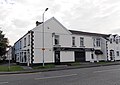
 Station Hotel - geograph.org.uk - 5591519.jpg 3,146 × 2,360; 1.15 MB
-
 Sunningdale Drive, Gorseinon - geograph.org.uk - 3682749.jpg 800 × 564; 113 KB
-

-

-
 Telephone Exchange - geograph.org.uk - 5591532.jpg 3,264 × 2,448; 2.71 MB
-
 The Gorseinon Centre - geograph.org.uk - 3768301.jpg 1,280 × 960; 220 KB
-
 The Mardy Inn, Gorseinon - geograph.org.uk - 3676710.jpg 800 × 539; 99 KB
-
 The Mardy Inn, Gorseinon - geograph.org.uk - 4973398.jpg 6,000 × 4,000; 6.17 MB
-
 Track detour - geograph.org.uk - 6159017.jpg 3,060 × 2,295; 3.15 MB
-

-
 Trimmed hedges near Llanant Farm - geograph.org.uk - 5771028.jpg 4,592 × 3,056; 3.75 MB
-
 Tua Gwynfaen. Towards Gwynfaen. - geograph.org.uk - 405056.jpg 640 × 480; 139 KB
-
 Tuag at Lannant - Towards Llannant - geograph.org.uk - 5671297.jpg 640 × 480; 100 KB
-

-
 Ty Einon Centre, Gorseinon - geograph.org.uk - 3682088.jpg 800 × 562; 131 KB
-
 Ty Einon Centre, Gorseinon - geograph.org.uk - 5000846.jpg 800 × 608; 107 KB
-

-
 Vans in Alexandra Road, Loughor - geograph.org.uk - 5028845.jpg 800 × 597; 146 KB
-
 War Memorial, Gorseinon (geograph 5000911).jpg 671 × 800; 139 KB
-

-
 Well Pharmacy, Alexandra Road, Gorseinon - geograph.org.uk - 4878492.jpg 785 × 800; 158 KB
-
 West along Park Road, Gorseinon - geograph.org.uk - 4878422.jpg 800 × 574; 121 KB
-
 West Street directions signs, Gorseinon - geograph.org.uk - 4878476.jpg 799 × 800; 131 KB
-

-
 West Street Gymnastics Centre, Gorseinon - geograph.org.uk - 3681092.jpg 800 × 546; 104 KB
-

-
 West Street War Memorial, Gorseinon - geograph.org.uk - 4878453.jpg 800 × 611; 126 KB
-
 Western boundary of Gorseinon - geograph.org.uk - 5001546.jpg 640 × 511; 92 KB
-

-
 Westgrove Court, Gorseinon - geograph.org.uk - 3682733.jpg 800 × 487; 88 KB
-
 Wheel display in Parc Melin Mynach - geograph.org.uk - 3706824.jpg 1,000 × 600; 184 KB
-
 Afon Lliw at Gorseinon - geograph.org.uk - 561546.jpg 640 × 480; 130 KB
-
 Gorseinon - geograph.org.uk - 405518.jpg 640 × 480; 88 KB


.jpg)


.jpg)


