Category:Goodmanham
Jump to navigation
Jump to search
English: Goodmanham is a small village and civil parish in the East Riding of Yorkshire, England. It is situated approximately 2 miles (3.2 km) to the north-east of Market Weighton. The village is situated on the Yorkshire Wolds Way National Trail, a long distance footpath.
village and civil parish in East Riding of Yorkshire, UK  L'église de Goodmanham | |||||
| Upload media | |||||
| Instance of | |||||
|---|---|---|---|---|---|
| Location | East Riding of Yorkshire, Yorkshire and the Humber, England | ||||
| Said to be the same as | Goodmanham (Wikimedia duplicated page, civil parish) | ||||
 | |||||
Subcategories
This category has the following 5 subcategories, out of 5 total.
A
- All Hallows Church, Goodmanham (12 F)
E
- Enthorpe Cutting (4 F)
G
- Goodmanham Arms (5 F)
K
- Kiplingcotes Chalk Pit (13 F)
R
- Rifle Butts Quarry (3 F)
Media in category "Goodmanham"
The following 200 files are in this category, out of 264 total.
(previous page) (next page)-
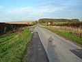
 A farm track off Cross Gate (road) - geograph.org.uk - 2389423.jpg 800 × 600; 279 KB
-
 A Flower beside the Hudson Way - geograph.org.uk - 544586.jpg 640 × 480; 44 KB
-
 A614 at Towthorpe - geograph.org.uk - 5996478.jpg 1,024 × 664; 97 KB
-
 Abundant Trackside Rose-bay Willow Herb - geograph.org.uk - 910214.jpg 640 × 480; 137 KB
-
 Aglais io - geograph.org.uk - 910247.jpg 640 × 483; 51 KB
-
 All Hallows' Church - geograph.org.uk - 6180761.jpg 1,024 × 768; 127 KB
-
 All Saints Church, Goodmanham - geograph.org.uk - 5717763.jpg 1,600 × 1,065; 399 KB
-
 An exciting place for a Jack Russell Terrier - geograph.org.uk - 4347292.jpg 1,024 × 768; 244 KB
-
 An Unnamed Wood - geograph.org.uk - 267844.jpg 640 × 480; 98 KB
-
 Aquatic Plants bedside Mill Beck - geograph.org.uk - 910230.jpg 640 × 480; 148 KB
-
 Barn in field at Goodmanham - geograph.org.uk - 4476813.jpg 4,596 × 3,440; 5.27 MB
-
 Bench on the Hudson Way - geograph.org.uk - 808518.jpg 640 × 478; 261 KB
-
 Bench on the Hudson Way near Googmanham - geograph.org.uk - 5104030.jpg 1,600 × 1,065; 733 KB
-
 Beverley to Market Weighton Railway - geograph.org.uk - 10578.jpg 640 × 480; 133 KB
-
 Blossom covered path in Goodmanham churchyard - geograph.org.uk - 4476825.jpg 4,608 × 3,456; 6 MB
-
 Bridge Number 05 - geograph.org.uk - 1562276.jpg 640 × 480; 99 KB
-
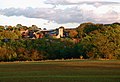
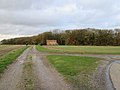
 Buildings at Goodmanham Wold - geograph.org.uk - 3938846.jpg 1,600 × 1,064; 752 KB
-
 Carpark at Goodmanham Dale - geograph.org.uk - 3938491.jpg 1,600 × 1,064; 453 KB
-

-
 Cross Gate - geograph.org.uk - 267846.jpg 640 × 480; 95 KB
-
 Cross Gate - geograph.org.uk - 5349537.jpg 1,024 × 768; 280 KB
-
 Cross Gate - geograph.org.uk - 5349540.jpg 1,024 × 768; 243 KB
-
 Cross Gate - panoramio.jpg 1,200 × 837; 359 KB
-
 Cross Gate bend, near Goodmanham - geograph.org.uk - 1390361.jpg 640 × 426; 180 KB
-
 Cross Gate over Goodmanham Wold - geograph.org.uk - 1563885.jpg 640 × 480; 66 KB
-
 Cross Gate over Goodmanham Wold - geograph.org.uk - 1563892.jpg 640 × 480; 64 KB
-
 Cross Gate over Goodmanham Wold - geograph.org.uk - 1563897.jpg 640 × 480; 73 KB
-
 Cross Gate, Goodmanham - geograph.org.uk - 1563871.jpg 640 × 480; 93 KB
-
 Cross Gate, near Goodmanham - geograph.org.uk - 1390358.jpg 640 × 426; 174 KB
-
 Cutting through the chalk - geograph.org.uk - 5729063.jpg 1,024 × 768; 287 KB
-
 Derelict former railway vans - geograph.org.uk - 5729096.jpg 1,024 × 768; 217 KB
-
 Developing scrub - geograph.org.uk - 4347294.jpg 1,024 × 768; 186 KB
-
 Disused Chalk Pit - geograph.org.uk - 5651914.jpg 640 × 480; 92 KB
-
 Dry valley off Goodmanham Dale - geograph.org.uk - 4347697.jpg 1,024 × 768; 287 KB
-
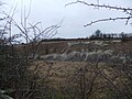
 Enthorpe Cutting ( Disused ) - geograph.org.uk - 2157163.jpg 4,000 × 3,000; 3.66 MB
-
 Enthorpe cutting - geograph.org.uk - 2305046.jpg 1,024 × 768; 179 KB
-
 Enthorpe railway bridge - geograph.org.uk - 2305060.jpg 1,024 × 768; 137 KB
-
 Enthorpe Station (Ex) - geograph.org.uk - 12022.jpg 640 × 483; 88 KB
-
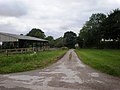
 Entrance to Brook Farm, Goodmanham - geograph.org.uk - 1432188.jpg 480 × 640; 63 KB
-
 Entrance to Kiplingcotes Nature Reserve - geograph.org.uk - 5104261.jpg 1,600 × 1,065; 787 KB
-
 Entrance to Manor Farm, Goodmanham - geograph.org.uk - 1432194.jpg 640 × 480; 84 KB
-
 Entrance to Mill House - geograph.org.uk - 1432077.jpg 640 × 480; 113 KB
-
-
 Entrance to Rectory Farm, Goodmanham - geograph.org.uk - 1432120.jpg 640 × 480; 76 KB
-
 Entrance to Rifle Butts Quarry - geograph.org.uk - 4476797.jpg 4,590 × 3,434; 6.72 MB
-
 Entrance to The Elms Farm - geograph.org.uk - 1432103.jpg 640 × 480; 92 KB
-
 Entrance track to Southwold Farm - geograph.org.uk - 1436462.jpg 640 × 480; 70 KB
-
 Farm access to Rectory Farm - geograph.org.uk - 4476819.jpg 4,594 × 3,438; 5.25 MB
-
 Farm Buildings, Goodmanham Wold - geograph.org.uk - 1563876.jpg 640 × 480; 48 KB
-
 Farm Track off Cross Gate - geograph.org.uk - 1563884.jpg 640 × 480; 71 KB
-

-
 Farm track towards Southwold Farm - geograph.org.uk - 3938872.jpg 1,600 × 1,064; 842 KB
-

-
 Farmland, Goodmanham Wold - geograph.org.uk - 1563900.jpg 640 × 480; 94 KB
-
 Field awaiting seeding - geograph.org.uk - 808520.jpg 640 × 478; 264 KB
-
 Field of Wheat^ - geograph.org.uk - 910178.jpg 640 × 480; 189 KB
-
 Fields near Goodmanham Lodge, E Yorks - geograph.org.uk - 2909044.jpg 640 × 572; 211 KB
-
 Fleetbeck Lane, Goodmanham - geograph.org.uk - 1563853.jpg 640 × 480; 92 KB
-
 Footpath from Goodmanham - geograph.org.uk - 1432143.jpg 480 × 640; 76 KB
-
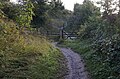
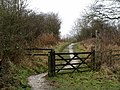
 Footpath to Goodmanham - geograph.org.uk - 5729093.jpg 1,024 × 768; 232 KB
-
 Footpath to the Hudson Way - geograph.org.uk - 1432062.jpg 640 × 480; 62 KB
-
 Former Wesleyan Chapel Goodmanham.jpg 640 × 480; 105 KB
-
 From the Hudson Way - geograph.org.uk - 808513.jpg 640 × 478; 226 KB
-
 Gateway on Springwell Fields - geograph.org.uk - 2333472.jpg 2,816 × 2,112; 2.96 MB
-
 Get orff my land ^ - geograph.org.uk - 1172376.jpg 360 × 480; 89 KB
-
 Goodmanham - geograph.org.uk - 138.jpg 640 × 480; 47 KB
-
 Goodmanham - geograph.org.uk - 590283.jpg 640 × 483; 68 KB
-
 Goodmanham - geograph.org.uk - 590289.jpg 640 × 437; 83 KB
-

-
 Goodmanham Dale - geograph.org.uk - 1003687.jpg 480 × 640; 171 KB
-
 Goodmanham Dale - geograph.org.uk - 1387504.jpg 640 × 426; 188 KB
-
 Goodmanham Dale - geograph.org.uk - 739714.jpg 640 × 460; 80 KB
-
 Goodmanham Dale - geograph.org.uk - 739715.jpg 640 × 469; 74 KB
-
 Goodmanham Dale - geograph.org.uk - 825653.jpg 640 × 432; 187 KB
-
 Goodmanham Dale, Kiplingcotes - geograph.org.uk - 2333477.jpg 640 × 480; 79 KB
-
 Goodmanham Grange - geograph.org.uk - 1563888.jpg 640 × 480; 88 KB
-
 Goodmanham Grange farm buildings - geograph.org.uk - 2389430.jpg 800 × 600; 286 KB
-
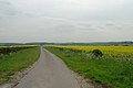
 Goodmanham Road - geograph.org.uk - 1003850.jpg 640 × 480; 183 KB
-
 Goodmanham Road, Goodmanham - geograph.org.uk - 5159359.jpg 1,600 × 1,065; 573 KB
-
 Goodmanham to Kiplingcotes road - geograph.org.uk - 370658.jpg 480 × 640; 151 KB
-
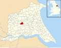 Goodmanham UK parish locator map.svg 1,425 × 1,107; 1.68 MB
-
 Goodmanham Wold - geograph.org.uk - 12281.jpg 640 × 483; 58 KB
-
 Goodmanham Wold - geograph.org.uk - 1388962.jpg 640 × 426; 207 KB
-
 Goodmanham Wold - geograph.org.uk - 1563872.jpg 640 × 480; 94 KB
-
 Goodmanham Wold - geograph.org.uk - 1563879.jpg 640 × 480; 50 KB
-
 Goodmanham Wold - geograph.org.uk - 267841.jpg 640 × 480; 98 KB
-
 Goodmanham Wold - geograph.org.uk - 5349545.jpg 1,024 × 768; 239 KB
-
 Goodmanham Wold Farm - geograph.org.uk - 11055.jpg 640 × 483; 104 KB
-
 Goodmanham Wold potatoes - geograph.org.uk - 1388971.jpg 426 × 640; 220 KB
-
 Goodmanham Wold Wheat - geograph.org.uk - 1390367.jpg 507 × 640; 192 KB
-
-
 Goodmanham.jpg 640 × 483; 120 KB
-
 Grove Farm, Goodmanham - geograph.org.uk - 1432112.jpg 640 × 480; 87 KB
-
 Houses on Goodmanham Road, Goodmanham - geograph.org.uk - 5159367.jpg 1,600 × 1,065; 744 KB
-
 Hudson Way - geograph.org.uk - 179493.jpg 640 × 480; 93 KB
-
 Hudson Way - geograph.org.uk - 179495.jpg 640 × 480; 89 KB
-
 Hudson Way - geograph.org.uk - 5651905.jpg 640 × 480; 102 KB
-
 Hudson Way - geograph.org.uk - 5996453.jpg 1,024 × 768; 251 KB
-
 Hudson Way at Goodmanham Dale - geograph.org.uk - 3938877.jpg 1,600 × 1,064; 764 KB
-
 Hudson Way crosses over the Yorkshire Wolds Way - geograph.org.uk - 5104034.jpg 1,600 × 1,065; 740 KB
-
 Hudson Way crosses over the Yorkshire Wolds Way - geograph.org.uk - 5104039.jpg 1,600 × 1,065; 758 KB
-
 Hudson way crosses the road from Goodmanham - geograph.org.uk - 3614136.jpg 1,024 × 768; 238 KB
-
 Hudson Way near Goodmanham - geograph.org.uk - 3937934.jpg 1,600 × 1,064; 802 KB
-
 Hudson way near Southwold Farm - geograph.org.uk - 3938864.jpg 1,600 × 1,064; 828 KB
-
 Hudson Way near Southwold Farm - geograph.org.uk - 5104279.jpg 1,600 × 1,047; 803 KB
-
 Hudson Way towards Kiplingcotes - geograph.org.uk - 3937943.jpg 1,600 × 1,064; 886 KB
-
 Hudson Way towards Kiplingcotes - geograph.org.uk - 3937947.jpg 1,600 × 1,064; 449 KB
-
 Hudson Way towards Kiplingcotes - geograph.org.uk - 3938488.jpg 1,600 × 1,064; 680 KB
-
 Hudson Way towards Kiplingcotes - geograph.org.uk - 3938495.jpg 1,600 × 1,064; 824 KB
-
 Hudson Way towards Kiplingcotes - geograph.org.uk - 3938852.jpg 1,600 × 1,064; 757 KB
-
 Hudson Way towards Kiplingcotes - geograph.org.uk - 3938891.jpg 1,600 × 1,064; 869 KB
-
 Hudson Way towards Kiplingcotes - geograph.org.uk - 5104041.jpg 1,600 × 1,065; 844 KB
-
 Hudson Way towards Kiplingcotes - geograph.org.uk - 5104232.jpg 1,600 × 1,065; 744 KB
-
 Hudson Way towards Kiplingcotes - geograph.org.uk - 5104235.jpg 1,600 × 1,065; 640 KB
-
 Hudson Way towards Kiplingcotes - geograph.org.uk - 5104242.jpg 1,600 × 1,065; 690 KB
-
 Hudson Way towards Kiplingcotes - geograph.org.uk - 5104249.jpg 1,600 × 1,065; 622 KB
-
 Hudson Way towards Kiplingcotes - geograph.org.uk - 5104253.jpg 1,600 × 1,065; 612 KB
-
 Hudson Way towards Kiplingcotes - geograph.org.uk - 5104265.jpg 1,600 × 1,065; 697 KB
-
 Hudson Way towards Kiplingcotes - geograph.org.uk - 5104273.jpg 1,600 × 1,065; 708 KB
-
 Jock's seat - geograph.org.uk - 4347295.jpg 1,024 × 768; 353 KB
-
 Junction for Goodmanham - geograph.org.uk - 4394364.jpg 640 × 480; 123 KB
-
 Kiplingcoates Chalk Pit - geograph.org.uk - 2157839.jpg 4,000 × 3,000; 2.91 MB
-
 Kiplingcotes Chalk Pit from Hudson Way - geograph.org.uk - 4923007.jpg 4,430 × 3,204; 6.49 MB
-
 Kiplingcotes Lane - geograph.org.uk - 2210047.jpg 800 × 600; 277 KB
-
 Kiplingcotes Lane - geograph.org.uk - 370441.jpg 640 × 480; 121 KB
-
 Kiplingcotes Lane - geograph.org.uk - 825665.jpg 640 × 494; 225 KB
-
 Kiplingcotes Race Course going left of Enthorpe Wood - geograph.org.uk - 4321001.jpg 4,608 × 3,456; 4.06 MB
-
 Lane to Enthorpe - geograph.org.uk - 4321027.jpg 4,608 × 3,456; 3.99 MB
-
 Lone Tree - geograph.org.uk - 563629.jpg 640 × 480; 72 KB
-
 Long Gone - geograph.org.uk - 2507736.jpg 3,648 × 2,736; 3.9 MB
-
 Looking along Kipling Cotes Race Course - geograph.org.uk - 2389464.jpg 800 × 600; 239 KB
-
 Looking up to Goodmanham Wold from Hudson Way - geograph.org.uk - 4926550.jpg 4,606 × 3,454; 6.39 MB
-
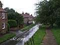
 Main Street, Goodmanham - geograph.org.uk - 1003807.jpg 640 × 403; 174 KB
-
 Main Street, Goodmanham - geograph.org.uk - 2325383.jpg 800 × 600; 275 KB
-
 Main Street, Goodmanham - geograph.org.uk - 3614251.jpg 1,024 × 768; 231 KB
-
 Main Street, Goodmanham - geograph.org.uk - 5717767.jpg 1,600 × 1,065; 804 KB
-
 Manor Farm - geograph.org.uk - 76933.jpg 640 × 480; 81 KB
-
 Mill Beck - geograph.org.uk - 655224.jpg 640 × 480; 133 KB
-
 Mill Beck - geograph.org.uk - 808133.jpg 640 × 478; 353 KB
-
 Mill Beck - geograph.org.uk - 910225.jpg 480 × 640; 145 KB
-
 Mill Beck and footpath, Goodmanham - geograph.org.uk - 1231341.jpg 640 × 426; 208 KB
-
 Mill Beck, Goodmanham - geograph.org.uk - 739701.jpg 454 × 640; 142 KB
-
 Minor road into Goodmanham - geograph.org.uk - 1432069.jpg 640 × 480; 82 KB
-
 Minor road junction near Goodmanham - geograph.org.uk - 1432330.jpg 640 × 480; 74 KB
-
 Minor road near Goodmanham - geograph.org.uk - 1432093.jpg 640 × 480; 112 KB
-
 Minor Road to Market Weighton - geograph.org.uk - 1432351.jpg 640 × 480; 53 KB
-
 Minor Road towards South Dalton - geograph.org.uk - 1563866.jpg 640 × 480; 70 KB
-
 Near Goodmanham - geograph.org.uk - 32311.jpg 640 × 480; 143 KB
-

-
 New plantation around Mastill Spring - geograph.org.uk - 5732969.jpg 1,024 × 768; 183 KB
-

-
 No hedge on the roadside large open fields - geograph.org.uk - 4321049.jpg 4,608 × 3,456; 3.23 MB
-
 Old milestone, Goodmanham - geograph.org.uk - 1567942.jpg 480 × 640; 113 KB
-
 Old rail bridge, Goodmanham - geograph.org.uk - 5996466.jpg 1,024 × 768; 312 KB
-
 Old Railway Bridge, Kiplingcotes - geograph.org.uk - 825674.jpg 640 × 425; 254 KB
-
 Old Railway Line - geograph.org.uk - 11208.jpg 640 × 483; 104 KB
-
 Over fields to Goodmanham Dale - geograph.org.uk - 4476766.jpg 4,594 × 3,436; 6.2 MB
-
 Over Rape field to The Dale - geograph.org.uk - 4476756.jpg 4,608 × 3,456; 6.28 MB
-
 Railway Bridge Goodmanham.jpg 640 × 480; 124 KB
-
 Railway Bridge near Goodmanham - geograph.org.uk - 632299.jpg 480 × 640; 118 KB
-
 Remains of a bridge parapet - geograph.org.uk - 5732961.jpg 1,024 × 768; 384 KB
-
 Returning from a trial ride - geograph.org.uk - 2305034.jpg 1,024 × 768; 176 KB
-
 Rifle Butts Quarry Nature Reserve - geograph.org.uk - 5996459.jpg 1,024 × 768; 227 KB
-
 Road into Goodmanham - geograph.org.uk - 5996461.jpg 1,024 × 768; 160 KB
-
 Road through Spring Dale - geograph.org.uk - 1567971.jpg 640 × 480; 104 KB
-
 Road through Springwell Field - geograph.org.uk - 2333462.jpg 640 × 480; 46 KB
-
 Road to Goodmanham from railway bridge - geograph.org.uk - 4923048.jpg 4,606 × 3,452; 5.53 MB
-
 Road to Kiplingcotes - geograph.org.uk - 183164.jpg 640 × 480; 95 KB
-
 Rolling Landscape - geograph.org.uk - 813769.jpg 640 × 478; 243 KB
-
 Round Hill - geograph.org.uk - 1436374.jpg 640 × 480; 106 KB
-
 Round Hill Car Park - geograph.org.uk - 825480.jpg 640 × 480; 250 KB
-
 Round Hill, Goodmanham Dale - geograph.org.uk - 739718.jpg 471 × 640; 62 KB
-
 Route into the former Kiplingcotes Chalk Pit - geograph.org.uk - 4347711.jpg 1,024 × 768; 159 KB
-
 Scarecrow amongst the Peas - geograph.org.uk - 910238.jpg 640 × 550; 102 KB
-
 Sharp bend in the lane from Goodmanham. - geograph.org.uk - 6180759.jpg 1,024 × 768; 123 KB
-
 Sheep near Goodmanham - geograph.org.uk - 1003763.jpg 640 × 413; 166 KB
-
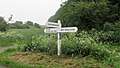 Signposted road junction. - geograph.org.uk - 6180756.jpg 1,024 × 584; 191 KB
-
 South Dalton Wold - geograph.org.uk - 12775.jpg 640 × 427; 61 KB
-
 Southwold Farm, Goodmanham Dale - geograph.org.uk - 739724.jpg 454 × 640; 100 KB
-
 Steps down, Kiplingcotes Chalk Pit - geograph.org.uk - 4347296.jpg 1,024 × 768; 212 KB
-
 Steps Goodmanham.jpg 640 × 480; 119 KB
-
 Steps up to the road - geograph.org.uk - 4347765.jpg 1,024 × 768; 307 KB
-
 Straw Bale - geograph.org.uk - 370671.jpg 640 × 480; 204 KB
-
 Straw bale - geograph.org.uk - 4394365.jpg 640 × 480; 211 KB
-
 Sunset over the fields - geograph.org.uk - 12743.jpg 640 × 483; 65 KB
-
 Sustrans route 66 - geograph.org.uk - 808507.jpg 640 × 478; 279 KB
-
 Sustrans route 66 - near Kiplingcotes - geograph.org.uk - 370652.jpg 640 × 480; 153 KB
-
 Taxus Cottage on Goodmanham Road - geograph.org.uk - 5159363.jpg 1,600 × 1,062; 687 KB
-

-

-
 The End Of The Wolds - geograph.org.uk - 267838.jpg 480 × 360; 93 KB
-

-

-

-
 The former York to Hull Railway - geograph.org.uk - 1327777.jpg 640 × 480; 150 KB
-
 The Hudson Way - geograph.org.uk - 2172586.jpg 2,736 × 3,648; 4.02 MB
-
 The Hudson Way - geograph.org.uk - 3614115.jpg 1,024 × 768; 307 KB
-
 The Hudson Way - geograph.org.uk - 655229.jpg 640 × 480; 120 KB
-
 The Hudson Way - geograph.org.uk - 825438.jpg 480 × 640; 260 KB
-
 The Hudson Way - geograph.org.uk - 825456.jpg 480 × 640; 232 KB
_-_geograph.org.uk_-_2389423.jpg)


_-_geograph.org.uk_-_2157163.jpg)


_-_geograph.org.uk_-_12022.jpg)


