Category:Golf courses in Fife
Jump to navigation
Jump to search
Subcategories
This category has the following 20 subcategories, out of 20 total.
A
- Aberdour Golf Course (2 F)
B
- Balcomie links (19 F)
- Burntisland Links (5 F)
C
- Canmore Golf Course (2 F)
- Castle Course, St Andrews (6 F)
- Charleton golf course (5 F)
- Cluny Clays golf course (2 F)
D
- Dora golf course (3 F)
E
K
L
P
- Pitreavie golf course (3 F)
S
- Scotscraig golf course (23 F)
- St Michaels golf course (4 F)
T
- Torrance Course (2 F)
- Tulliallan Golf Club (2 F)
Media in category "Golf courses in Fife"
The following 33 files are in this category, out of 33 total.
-
 18th - geograph.org.uk - 518808.jpg 640 × 417; 65 KB
-
 A St Andrews Bay golf course. - geograph.org.uk - 15012.jpg 640 × 351; 41 KB
-
 Beyond the green - geograph.org.uk - 1277844.jpg 640 × 480; 68 KB
-
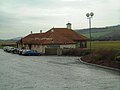
 Club House, Leven - geograph.org.uk - 1199646.jpg 640 × 480; 58 KB
-
 Craighead Golf Club - geograph.org.uk - 3991034.jpg 3,024 × 2,205; 1.62 MB
-
 Craigie Hill - geograph.org.uk - 57832.jpg 640 × 443; 49 KB
-
 Craigtoun golf course - geograph.org.uk - 488409.jpg 640 × 406; 56 KB
-
 Doocot on golf course - geograph.org.uk - 807492.jpg 640 × 426; 45 KB
-
 Driving range, St Andrews - geograph.org.uk - 1441882.jpg 640 × 359; 57 KB
-
 Elmwood Golf Club - geograph.org.uk - 121823.jpg 640 × 480; 60 KB
-
 Entrance to St Andrews Bay - geograph.org.uk - 1231815.jpg 640 × 483; 39 KB
-
 Fairmont course bunkers - geograph.org.uk - 1222747.jpg 640 × 480; 57 KB
-
 Fairway of the 2nd - geograph.org.uk - 707334.jpg 640 × 480; 53 KB
-
 Fairway on Strathtyrum golf course - geograph.org.uk - 111895.jpg 640 × 480; 89 KB
-
 Forrester park - geograph.org.uk - 75988.jpg 638 × 434; 62 KB
-
 Golf Club and starter's box - geograph.org.uk - 130622.jpg 640 × 480; 68 KB
-
 Golf Course - geograph.org.uk - 374208.jpg 640 × 424; 61 KB
-
 Golf course pond - geograph.org.uk - 1277851.jpg 640 × 480; 76 KB
-
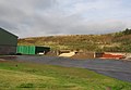
 Golf course under construction. - geograph.org.uk - 15008.jpg 640 × 413; 66 KB
-
 Golf, Leven - geograph.org.uk - 788904.jpg 640 × 407; 71 KB
-
 Hill of Doos - geograph.org.uk - 524942.jpg 640 × 412; 61 KB
-
 Hill of Tarvit golf course - geograph.org.uk - 524941.jpg 640 × 362; 69 KB
-
 Kingask - geograph.org.uk - 744735.jpg 640 × 419; 83 KB
-
 Kirkcaldy golf course.JPG 2,048 × 1,536; 584 KB
-
 Kittock's Den - geograph.org.uk - 1142995.jpg 640 × 480; 63 KB
-
 Ladies golf course at Lundin Links - geograph.org.uk - 1366915.jpg 640 × 480; 73 KB
-
 Lundin Links - geograph.org.uk - 15038.jpg 640 × 459; 39 KB
-
 Part of the Torrance Course - geograph.org.uk - 1142960.jpg 640 × 480; 79 KB
-
 Saline Golf Course - geograph.org.uk - 124241.jpg 640 × 480; 157 KB
-
 Strathtyrum Course, St Andrews - geograph.org.uk - 1441898.jpg 640 × 396; 60 KB
-
 The wall, Fairmont GC - geograph.org.uk - 323522.jpg 640 × 375; 61 KB
-
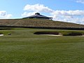
 UFO landing place - geograph.org.uk - 1222501.jpg 640 × 480; 58 KB
-
 War memorial on the golf course - geograph.org.uk - 950758.jpg 640 × 480; 46 KB


