Category:Goldthorpe
Jump to navigation
Jump to search
English: Goldthorpe is a village within the Metropolitan Borough of Barnsley, in South Yorkshire, England. Anciently a small medieval farming village, Goldthorpe is recorded in the Domesday Book and was under the Manor of Bolton upon Dearne which was once owned by Roger de Busli.
village within the Metropolitan Borough of Barnsley in South Yorkshire, England  | |||||
| Upload media | |||||
| Instance of | |||||
|---|---|---|---|---|---|
| Location | Barnsley, South Yorkshire, Yorkshire and the Humber, England | ||||
 | |||||
Subcategories
This category has the following 5 subcategories, out of 5 total.
Media in category "Goldthorpe"
The following 29 files are in this category, out of 29 total.
-

-
 Albert Road, Goldthorpe (geograph 4588589).jpg 4,958 × 3,608; 4.51 MB
-
 Awaiting redevelopment (geograph 2397862).jpg 800 × 566; 98 KB
-
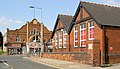
 Dearne Advanced Learning Centre (Geograph 2699621).jpg 1,024 × 768; 245 KB
-
 Dumpit muncher - geograph.org.uk - 1103936.jpg 640 × 414; 53 KB
-
 Early morning Goldthorpe high street. - geograph.org.uk - 511651.jpg 640 × 356; 75 KB
-
 Engine Lane Goldthorpe - geograph.org.uk - 573977.jpg 640 × 480; 111 KB
-
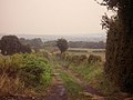
 Footpath to Bolton - geograph.org.uk - 197490.jpg 640 × 480; 111 KB
-
 Former co-operative store, Goldthorpe (geograph 5753084).jpg 1,024 × 662; 123 KB
-
 Former Empire Cinema, Goldthorpe (geograph 5753540).jpg 1,024 × 768; 175 KB
-

-
 Goldthorpe centre. - geograph.org.uk - 534196.jpg 640 × 368; 106 KB
-
 Goldthorpe Pentecostal Community Church (geograph 5753071).jpg 1,024 × 768; 158 KB
-
 Goldthorpe Presbytery (geograph 5755503).jpg 1,024 × 768; 135 KB
-
 Graffiti Bridge - geograph.org.uk - 197485.jpg 640 × 480; 97 KB
-
 Harry Ottley Plantation - geograph.org.uk - 343701.jpg 640 × 480; 79 KB
-
 High Street in Goldthorpe (geograph 4741731).jpg 4,504 × 3,283; 2.93 MB
-
 If it wasnt for the ouses in between (geograph 5754278).jpg 1,024 × 768; 267 KB
-
 Lockwood Road (geograph 5753089).jpg 1,024 × 768; 259 KB
-
 Poplar Avenue - geograph.org.uk - 197493.jpg 640 × 480; 78 KB
-
 Portwest, Goldthorpe (geograph 5755496).jpg 1,024 × 768; 244 KB
-
 Regeneration east of Goldthorpe - geograph.org.uk - 501650.jpg 640 × 479; 76 KB
-
 Sculpture near the entrance to Phoenix Park (geograph 5755498).jpg 1,024 × 768; 182 KB
-
 Shops on Doncaster Road, Goldthorpe (geograph 5753548).jpg 1,024 × 768; 182 KB
-
 Steps to Railway View (geograph 5753043).jpg 1,024 × 768; 196 KB
-
 The church of the Sacred Heart, Goldthorpe (geograph 5753058).jpg 1,024 × 768; 170 KB
-
 The Rusty Dudley public house, Goldthorpe (geograph 4010469).jpg 1,327 × 1,600; 600 KB
-
 The Salvation Army (geograph 5754267).jpg 1,024 × 768; 154 KB
-
 West Street, Goldthorpe (geograph 5753052).jpg 1,024 × 768; 190 KB

.jpg)
.jpg)
.jpg)


.jpg)
.jpg)

.jpg)
.jpg)


.jpg)
.jpg)
.jpg)

.jpg)

.jpg)
.jpg)
.jpg)
.jpg)
.jpg)
.jpg)
.jpg)