Category:Goirkestraat
Jump to navigation
Jump to search
| Object location | | View all coordinates using: OpenStreetMap |
|---|
street in Tilburg, the Netherlands  | |||||
| Upload media | |||||
| Instance of | |||||
|---|---|---|---|---|---|
| Named after | |||||
| Location | Tilburg, North Brabant, Netherlands | ||||
| Street address |
| ||||
 | |||||
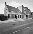
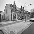
Nederlands: De Goirkestraat is een weg in Tilburg, die het noorden van de stad met het centrum verbindt. Het noordelijkste deel, dat naar Ringbaan Noord loopt, heet officieel Julianapark. In het zuiden eindigt de straat op Wilheminapark en Hasseltstraat.
Met uitzondering van het deel dat Julianapark heet, behoort de straat tot het Rijksbeschermd gezicht Wilhelminapark/Goirkestraat, aangewezen op 7 maart 2014 met gebiedsnummer 1686. Zie: Tilburgse herdgang beschermd stadsgezicht
Subcategories
This category has the following 8 subcategories, out of 8 total.
D
- Dionysiuskerkhof (Tilburg) (9 F)
G
- Galerie Pjotr (1 F)
- Goirkese kerk (37 F)
- Goirkestraat 84, Tilburg (3 F)
- Goirkestraat 88, Tilburg (6 F)
N
- Norbertijnerpoort (3 F)
S
- Sint Ignatiusgesticht (Tilburg) (23 F)
T
Media in category "Goirkestraat"
The following 22 files are in this category, out of 22 total.
-
 Goirkestraat 109.jpg 4,000 × 2,667; 6.5 MB
-
 Goirkestraat 13.jpg 4,608 × 3,456; 10.56 MB
-
 Goirkestraat 183-185.jpg 4,000 × 2,666; 7.19 MB
-
 Goirkestraat 87.jpg 4,000 × 2,932; 7.54 MB
-
 Map - NL - Tilburg - Wijk 02 Oud-Noord - Buurt 03 Het Goirke.svg 375 × 375; 46 KB
-
 Overzicht - Tilburg - 20344056 - RCE.jpg 1,188 × 1,200; 340 KB
-
 Overzicht hoekpand, café - Tilburg - 20344054 - RCE.jpg 1,185 × 1,200; 309 KB
-
 Overzicht voorgevel - Tilburg - 20342675 - RCE.jpg 1,185 × 1,200; 452 KB
-
 Overzicht voorgevel - Tilburg - 20344057 - RCE.jpg 1,200 × 1,200; 325 KB
-
 Overzicht voorgevel en linker zijgevel - Tilburg - 20344055 - RCE.jpg 1,200 × 1,183; 390 KB
-
 Overzicht voorgevel en rechter zijgevel, fabrikantenvilla - Tilburg - 20344059 - RCE.jpg 1,200 × 1,197; 425 KB
-
 Overzicht voorgevel en rechter zijgevel, herenhuis - Tilburg - 20344061 - RCE.jpg 1,200 × 1,195; 305 KB
-
 Overzicht voorgevel herenhuis - Tilburg - 20344060 - RCE.jpg 1,192 × 1,200; 292 KB
-
 Overzicht voorgevels en linker zijgevel - Tilburg - 20344062 - RCE.jpg 1,183 × 1,200; 275 KB
-
 Overzicht voorgevels en linker zijgevel, winkels - Tilburg - 20344052 - RCE.jpg 1,181 × 1,200; 313 KB
-
 Overzicht voorgevels en linker zijgevel, winkels - Tilburg - 20344053 - RCE.jpg 1,200 × 1,192; 314 KB
-
 Rijksbeschermd stads- of dorpsgezicht - Wilhelminapark-Goirkestraat.png 2,016 × 2,267; 148 KB
-
 Tilburg - Goirkestraat 7.jpg 3,000 × 1,999; 4.72 MB
-
 Tilburg - Goirkestraat 82.jpg 2,668 × 3,000; 6.86 MB
-
 Tilburg - Goirkestraat 84.jpg 2,815 × 3,000; 7.47 MB
-
 Tilburg - Goirkestraat 9-9a.jpg 3,000 × 2,250; 6.48 MB
-
 Tilburg - Goirkestraat 98.jpg 2,694 × 3,000; 8.2 MB


