Category:Glasfryn
Jump to navigation
Jump to search
village in Wales, United Kingdom  | |||||
| Upload media | |||||
| Instance of | |||||
|---|---|---|---|---|---|
| Location | Conwy County Borough, Wales | ||||
| Elevation above sea level |
| ||||
 | |||||
Media in category "Glasfryn"
The following 23 files are in this category, out of 23 total.
-
 A Derelict Farm - geograph.org.uk - 948444.jpg 640 × 480; 84 KB
-
 Below Trum Nant Fach - geograph.org.uk - 439458.jpg 640 × 480; 120 KB
-
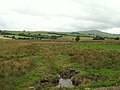 Bogland, near Glasfryn - geograph.org.uk - 35949.jpg 640 × 480; 126 KB
-
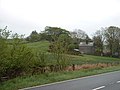 Bron-y-graig house - geograph.org.uk - 173001.jpg 640 × 480; 91 KB
-
 Farmland alongside A5, near Glasfryn - geograph.org.uk - 35947.jpg 640 × 480; 114 KB
-
 Farmland near Glasfryn - geograph.org.uk - 173043.jpg 640 × 480; 104 KB
-

-
 Glasfryn Village - geograph.org.uk - 118360.jpg 640 × 480; 102 KB
-

-
 Pant y Griafolen - geograph.org.uk - 768166.jpg 640 × 480; 139 KB
-
 Pant y Moeliaid, Glasfryn - geograph.org.uk - 1802794.jpg 1,024 × 716; 358 KB
-
 Stream bed - geograph.org.uk - 439400.jpg 640 × 480; 142 KB
-
 The Pot Menagerie at Llwyn-onn - geograph.org.uk - 173047.jpg 640 × 480; 114 KB
-
 Unclassified road near Glasfryn - geograph.org.uk - 118364.jpg 640 × 480; 76 KB
-
 A Fertile Valley - geograph.org.uk - 600730.jpg 640 × 480; 67 KB
-
 An Isolated Dwelling - geograph.org.uk - 598354.jpg 640 × 480; 57 KB
-
 Blaen y Cwm - geograph.org.uk - 439383.jpg 640 × 480; 137 KB
-
 Bwlch y Pentre - geograph.org.uk - 439428.jpg 640 × 480; 93 KB
-
 Bwlch y Pentre - geograph.org.uk - 600714.jpg 640 × 480; 104 KB
-
 Carreg-y-Ddafad - geograph.org.uk - 413499.jpg 640 × 480; 122 KB
-
 Dwr codi - geograph.org.uk - 413505.jpg 640 × 480; 159 KB
-
 Fence on Bwlch y Pentre - geograph.org.uk - 439409.jpg 640 × 480; 108 KB
-
 Two Boundaries - geograph.org.uk - 600721.jpg 640 × 480; 77 KB


