Category:Gilmerton, Edinburgh
Jump to navigation
Jump to search
suburb of Edinburgh, Scotland, UK  | |||||
| Upload media | |||||
| Instance of | |||||
|---|---|---|---|---|---|
| Location |
| ||||
 | |||||
A suburb of Edinburgh close to the Midlothian border.
Subcategories
This category has the following 2 subcategories, out of 2 total.
G
- Gilmerton Cove (5 F)
T
Media in category "Gilmerton, Edinburgh"
The following 52 files are in this category, out of 52 total.
-
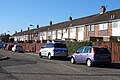
 12 to 18 Ravenscroft Street - geograph.org.uk - 5298048.jpg 640 × 427; 313 KB
-
 ALDI on Gilmerton Road - geograph.org.uk - 4387093.jpg 3,264 × 2,448; 3.88 MB
-
 Bain Rigg (geograph 7397278).jpg 1,024 × 768; 307 KB
-
 Bridge at Gilmerton Dykes, Edinburgh - geograph.org.uk - 5674509.jpg 1,600 × 1,066; 482 KB
-
 Burdiehouse Burn - geograph.org.uk - 5298189.jpg 480 × 640; 475 KB
-
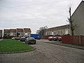
 Bus terminus at Hyvots Bank - geograph.org.uk - 1768746.jpg 1,024 × 768; 119 KB
-
 Continuing redevelopment at Hyvots Bank - geograph.org.uk - 1768763.jpg 1,024 × 768; 160 KB
-
 Dr Guthrie's Girls' School - geograph.org.uk - 5297974.jpg 640 × 444; 286 KB
-
 Dr Guthrie's Girls' School - geograph.org.uk - 5297975.jpg 640 × 437; 294 KB
-
 Drum Place - geograph.org.uk - 5958312.jpg 640 × 427; 304 KB
-
 Ferniehill - geograph.org.uk - 344996.jpg 640 × 480; 56 KB
-
 Ferniehill green space (geograph 7551610).jpg 1,024 × 768; 314 KB
-
 Ferniehill Place (geograph 7551608).jpg 1,024 × 768; 213 KB
-
 Fernieside Grove (geograph 7444147).jpg 1,024 × 768; 160 KB
-
 Fernieside Place (geograph 7551139).jpg 1,024 × 768; 362 KB
-
 Fordell Way (geograph 7397288).jpg 1,024 × 768; 291 KB
-
 Gilmerton - geograph.org.uk - 15294.jpg 640 × 480; 55 KB
-
 Gilmerton Community Centre - geograph.org.uk - 5298017.jpg 640 × 427; 300 KB
-
 Gilmerton Cove3a (5719925456).jpg 4,380 × 2,911; 1.2 MB
-
 Gilmerton Dykes Road (geograph 7397268).jpg 1,024 × 768; 256 KB
-
 Gilmerton Parish Kirk - geograph.org.uk - 5298030.jpg 640 × 480; 360 KB
-
 Gilmerton Post Office, Edinburgh.jpg 2,560 × 1,920; 2.06 MB
-
 House building, Gilmerton (geograph 7396861).jpg 1,024 × 768; 264 KB
-
 Housebuilding, Gilmerton (geograph 7396912).jpg 1,024 × 768; 375 KB
-
 Housebuilding, Gilmerton (geograph 7396915).jpg 1,024 × 768; 355 KB
-

-
 Hyvot Park - 18 months on - geograph.org.uk - 2589765.jpg 2,592 × 1,944; 2.24 MB
-

-
 Limefield, Gilmerton (geograph 7396109).jpg 1,024 × 768; 213 KB
-
 Mast at Drum, Edinburgh - geograph.org.uk - 345734.jpg 640 × 480; 87 KB
-
 Moredun housing regeneration - geograph.org.uk - 1539371.jpg 640 × 397; 64 KB
-
 Moredun Park Road (geograph 7551011).jpg 1,024 × 768; 307 KB
-
 New housing at Edmonstone (geograph 7201130).jpg 5,184 × 3,888; 2.53 MB
-
 New shops and housing, Gilmerton (geograph 6290920).jpg 3,264 × 2,448; 3.65 MB
-
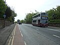 Old Dalkeith Road (A7) - geograph.org.uk - 4483717.jpg 640 × 480; 76 KB
-
 Old Dalkeith Road passing Edmonstone (geograph 6800816).jpg 1,024 × 768; 304 KB
-
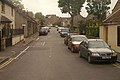
 Ravenscroft Street, Gilmerton (geograph 7396112).jpg 1,024 × 768; 183 KB
-
-
 Redevelopment at Gilmerton Dykes - geograph.org.uk - 903052.jpg 640 × 480; 75 KB
-
 Regeneration at Hyvots Bank - geograph.org.uk - 1768773.jpg 1,024 × 768; 143 KB
-
 Regeneration at Hyvots Bank - geograph.org.uk - 903041.jpg 640 × 480; 85 KB
-
 Ruined lodge, Edmonstone (geograph 7444137).jpg 1,024 × 768; 431 KB
-
 Scotia Depicta - Gilmerton Quarry -Plate-.jpg 2,500 × 1,738; 3.88 MB
-
 Shops at Moredun - geograph.org.uk - 5298143.jpg 640 × 427; 304 KB
-
 Stennis Gardens, by Ellen's Glen - geograph.org.uk - 4926450.jpg 3,264 × 2,448; 2.32 MB
-
 Storm damage - Ferniehill Drive - geograph.org.uk - 2760645.jpg 3,264 × 2,448; 3.99 MB
-
 Tanz, Drum Street (geograph 7396111).jpg 1,024 × 768; 215 KB
-
 Terraced housing- Moredunvale Loan (geograph 7597350).jpg 3,193 × 2,014; 2.68 MB
-
 Traffic Jam - geograph.org.uk - 5298187.jpg 640 × 381; 271 KB
-
 Tweedsmuir Drive, Edmonstone (geograph 7201183).jpg 5,184 × 3,888; 2.61 MB
-
 West Edge Meadows, Edinburgh (geograph 6926927).jpg 1,024 × 665; 144 KB
-
 Westland Cottages - geograph.org.uk - 5298073.jpg 640 × 427; 236 KB


.jpg)


.jpg)
.jpg)
.jpg)
.jpg)
.jpg)


.jpg)
.jpg)

.jpg)
.jpg)
.jpg)


.jpg)


.jpg)
.jpg)
.jpg)
_-_geograph.org.uk_-_4483717.jpg)
.jpg)
.jpg)


.jpg)


.jpg)
.jpg)

.jpg)
.jpg)
