Category:Germany photographs taken on 2010-06-25
Jump to navigation
Jump to search
Countries of Europe: Albania · Austria · Belarus · Belgium · Bulgaria · Croatia · Czech Republic · Denmark · Estonia · Finland · France‡ · Georgia‡ · Germany · Greece · Italy · Latvia · Malta · Monaco · Netherlands‡ · Norway · Poland · Portugal‡ · Romania · Russia‡ · Slovenia · Spain‡ · Sweden · Switzerland · Turkey‡ · Ukraine · United Kingdom
‡: partly located in Europe
‡: partly located in Europe
| ← | 25 June 2010 | → | ||
| ← | June 2010 | → | ||

Germany photographs taken on 25 June 2010.
Image files should be categorized here automatically using {{taken on}} template. Direct categorisation is also possible, if automatic is impossible.
Subcategories
This category has the following 4 subcategories, out of 4 total.
Media in category "Germany photographs taken on 2010-06-25"
The following 92 files are in this category, out of 92 total.
-
 2010 - panoramio (58).jpg 1,728 × 2,592; 4.27 MB
-
 55494 Rheinböllen, Germany - panoramio.jpg 800 × 450; 39 KB
-
 66822 Lebach, Germany - panoramio.jpg 800 × 450; 42 KB
-
 Aitern, Rathaus.jpg 5,694 × 3,950; 5.12 MB
-
 Aitern.jpg 5,694 × 3,822; 4.3 MB
-
 Algäuer Brauhaus AG - panoramio.jpg 2,816 × 2,120; 722 KB
-
 Allgäuer Brauhaus - panoramio.jpg 2,816 × 2,120; 715 KB
-
 Allgäuer Brauhaus Leuterschach - panoramio.jpg 2,816 × 2,120; 716 KB
-

-
 ANS (Active Network Systems) - panoramio.jpg 2,848 × 2,134; 1.17 MB
-
 Bad Homburg vor der Höhe, Germany - panoramio.jpg 3,648 × 2,736; 3.52 MB
-
 Böllen, Rathaus.jpg 3,858 × 3,381; 1.49 MB
-
 Böllen.jpg 4,782 × 3,404; 4.72 MB
-
 Ehrsberg, Kapelle St. Wendelin.jpg 3,898 × 3,160; 1.91 MB
-
 Ehrsberg-Wühre.jpg 4,650 × 2,733; 1.74 MB
-
 F18 at ILA 2010 04.jpg 4,272 × 2,848; 1.72 MB
-
 Felder bei Neckarwestheim - geo.hlipp.de - 11314.jpg 640 × 425; 48 KB
-
 Feldweg - geo.hlipp.de - 11315.jpg 640 × 425; 55 KB
-
 Fröhnd, Rathaus.jpg 3,264 × 2,448; 1.98 MB
-
 Koschendorf - Friedhof.jpg 1,200 × 789; 384 KB
-
 Grasbrunn- Maibaum - geo.hlipp.de - 11377.jpg 426 × 640; 271 KB
-
 Hahn, Germany - panoramio.jpg 800 × 450; 40 KB
-
 Harthausen- Maibaum - geo.hlipp.de - 11376.jpg 426 × 640; 115 KB
-
 Hasel, evangelische Kirche.jpg 2,324 × 3,264; 2 MB
-
 Hasel, Rathaus.jpg 3,055 × 2,408; 2.42 MB
-
 Hausen im Wiesental, evangelische Kirche.jpg 2,051 × 3,065; 2.23 MB
-
 Hausen im Wiesental, katholische St. Josephs-Kirche.jpg 2,428 × 2,932; 1.9 MB
-
 Hausen im Wiesental, Rathaus.jpg 3,019 × 2,339; 2.3 MB
-
 Herrenschwand, Kapelle.jpg 2,448 × 3,264; 1.08 MB
-
 Herzogenriedpark - panoramio (1).jpg 1,899 × 1,886; 672 KB
-
 Herzogenriedpark - panoramio (2).jpg 1,972 × 1,896; 883 KB
-
 Herzogenriedpark - panoramio.jpg 1,551 × 1,535; 475 KB
-
 Hofladen und Besenwirtschaft - geo.hlipp.de - 11311.jpg 640 × 425; 67 KB
-
 Hohenbrunn- Maibaum im Abendlicht - geo.hlipp.de - 11378.jpg 426 × 640; 175 KB
-
 Häg, Kirche.jpg 3,339 × 2,448; 2.04 MB
-
 Kapelle in Hintsberg - geo.hlipp.de - 11374.jpg 640 × 426; 310 KB
-
 Katholische Herz-Jesu-Kirche - panoramio.jpg 1,368 × 1,313; 352 KB
-
 Kirchhaldenweg - panoramio.jpg 2,816 × 2,120; 1.01 MB
-
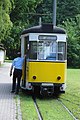
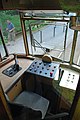
 Kirnitschtalbahn 01.jpg 3,872 × 2,592; 6.32 MB
-
 Kirnitschtalbahn 02.jpg 3,872 × 2,592; 6.66 MB
-
 Kirnitschtalbahn 03.jpg 2,592 × 3,872; 7.66 MB
-
 Kirnitschtalbahn 04.jpg 3,872 × 2,592; 7.12 MB
-
 Kirnitschtalbahn 05.jpg 2,592 × 3,872; 6.58 MB
-
 Kirnitschtalbahn 06.jpg 2,592 × 3,872; 4.55 MB
-
 Kirnitschtalbahn 07.jpg 2,592 × 3,872; 7.82 MB
-
 Kirnitschtalbahn 08.jpg 3,872 × 2,592; 7.77 MB
-
 Kirnitschtalbahn 09.jpg 3,872 × 2,592; 8.93 MB
-
 Kirnitschtalbahn 10.jpg 2,592 × 3,872; 7.31 MB
-
 Kirnitschtalbahn 11.jpg 3,872 × 2,592; 6.09 MB
-
 Kirnitschtalbahn 13.jpg 2,592 × 3,872; 7.57 MB
-
 Kirnitschtalbahn 14.jpg 3,722 × 2,378; 5.49 MB
-
 Kirnitschtalbahn 15.jpg 3,872 × 2,592; 6.12 MB
-
 Kirnitschtalbahn 16.jpg 2,592 × 3,872; 7.02 MB
-
 Kirnitschtalbahn 17.jpg 3,872 × 2,592; 7.79 MB
-
 Kirnitzschtalbahn 12.jpg 3,872 × 2,592; 7.03 MB
-
 Kirnitzschtalbahn 18.jpg 2,592 × 3,872; 7.4 MB
-
 Lautzenhausen, Germany - panoramio - mroszewski.jpg 800 × 450; 40 KB
-
 Lautzenhausen, Germany - panoramio.jpg 800 × 450; 52 KB
-
 Leuterschach - panoramio (1).jpg 2,816 × 2,120; 988 KB
-
 Leuterschach - panoramio (2).jpg 1,440 × 2,106; 438 KB
-
 Leuterschach - panoramio (3).jpg 2,816 × 2,120; 992 KB
-
 Leuterschach - panoramio (4).jpg 2,816 × 2,120; 1,016 KB
-
 Leuterschach - panoramio (5).jpg 2,120 × 2,816; 730 KB
-
 Leuterschach - panoramio.jpg 2,816 × 2,120; 790 KB
-
 MWS-Halle am Herzogenriedpark - panoramio.jpg 2,060 × 1,893; 975 KB
-
 Ortsansicht Schonstett - geo.hlipp.de - 11363.jpg 640 × 426; 173 KB
-
 P&C Logistikzentrum - panoramio.jpg 2,848 × 2,134; 2.25 MB
-
 Präger Gletscherkessel.jpg 3,264 × 2,448; 1.52 MB
-
 Rinsee bei Lampersberg - geo.hlipp.de - 11352.jpg 640 × 426; 387 KB
-
 Ronried - panoramio (1).jpg 2,120 × 2,816; 798 KB
-
 Ronried - panoramio.jpg 2,120 × 2,816; 721 KB
-
 Schafweide im Staatsgut Grub - geo.hlipp.de - 11408.jpg 640 × 480; 109 KB
-
 Schönau, evangelische Bergkirche.jpg 2,037 × 3,086; 2.56 MB
-
 Schönau, Kirche Mariä Himmelfahrt 1.jpg 2,499 × 3,155; 4.93 MB
-
 Schönau, Kirche Mariä Himmelfahrt 2.jpg 2,226 × 2,933; 1.84 MB
-

-
 Tunau, Herz-Jesu-Kirche.jpg 1,790 × 2,054; 2.69 MB
-
 Tunau, Rathaus.jpg 2,815 × 2,398; 3.44 MB
-
 Weg, Herz-Jesu-Kapelle.jpg 2,982 × 2,331; 1.82 MB
-
 Wehr, Hauptstraße.jpg 2,996 × 2,258; 2.16 MB
-
 Wehr, Kirche St. Martin 1.jpg 2,933 × 2,190; 2.03 MB
-
 Wehr, Kirche St. Martin 2.jpg 2,160 × 3,264; 2 MB
-
 Wehr, Rathaus 1.jpg 2,664 × 2,376; 2.25 MB
-
 Wehr, Rathaus 2.jpg 2,089 × 2,253; 1.11 MB
-
 Weiler Wolfersberg - geo.hlipp.de - 11375.jpg 640 × 426; 121 KB
-
 Weinbergweg - geo.hlipp.de - 11312.jpg 640 × 425; 80 KB
-
 Wembach, Rathaus.jpg 3,034 × 2,110; 2.91 MB
-
 Zell im Wiesental, altkatholische Kirche.jpg 2,056 × 3,266; 2.12 MB
-
 Zell im Wiesental, ehemaliger Textilbetrieb F&H.jpg 2,852 × 1,842; 2.44 MB
-
 Zell im Wiesental, evangelische Kirche St. Peter.jpg 1,900 × 3,283; 2.21 MB
-
 Zell im Wiesental, Kalvarienbergkapelle.jpg 1,790 × 2,298; 2.95 MB
-
 Zell im Wiesental, katholische Kirche St. Fridolin.jpg 1,976 × 2,873; 1.33 MB
.jpg)


_-_panoramio.jpg)


.jpg)
.jpg)


.jpg)
.jpg)
.jpg)
.jpg)
.jpg)


.jpg)


