Category:Geology of Western Australia
Jump to navigation
Jump to search
States of Australia: New South Wales · Queensland · South Australia · Tasmania · Victoria · Western Australia
Internal territories of Australia: Australian Capital Territory · Jervis Bay · Northern Territory
External territories of Australia:
Internal territories of Australia: Australian Capital Territory · Jervis Bay · Northern Territory
External territories of Australia:
Wikimedia category | |||||
| Upload media | |||||
| Instance of | |||||
|---|---|---|---|---|---|
| Category combines topics | |||||
| Western Australia | |||||
state of Australia  someja da satełite in novenbre     | |||||
| Instance of |
| ||||
| Named after | |||||
| Location | AUS | ||||
| Located in or next to body of water |
| ||||
| Capital | |||||
| Legislative body | |||||
| Highest judicial authority | |||||
| Head of state |
| ||||
| Head of government |
| ||||
| Inception |
| ||||
| Highest point |
| ||||
| Population |
| ||||
| Area |
| ||||
| Elevation above sea level |
| ||||
| Replaces |
| ||||
| official website | |||||
 | |||||
Subcategories
This category has the following 29 subcategories, out of 29 total.
*
B
C
D
E
- Ellendale Diamond Field (4 F)
I
K
L
M
N
O
P
R
T
V
W
- Wyalup-Rocky Point (36 F)
- Wydalup Bay, Western Australia (10 F)
Y
Media in category "Geology of Western Australia"
The following 87 files are in this category, out of 87 total.
-
 Agatified bark in limestone wanneroo beach.jpg 2,560 × 1,920; 897 KB
-
 Ausgeolbasic.jpg 918 × 845; 129 KB
-
 Australia exmouth yardie creek gorge.jpg 2,592 × 1,944; 1.99 MB
-
 Banded Chert near Marble Bar in Western Australia.jpg 4,288 × 2,848; 5.18 MB
-
 Banded iron formation Dales Gorge.jpg 4,288 × 2,848; 2.51 MB
-
 Black swans Kalbarri.jpg 2,048 × 1,536; 1,001 KB
-
 Broome Sandstone.png 1,549 × 1,549; 4.34 MB
-
 Cliff face on the Irwin River at Coalseam Conservation Park, September 2021 01.jpg 3,264 × 2,448; 3.18 MB
-
 Cliff face on the Irwin River at Coalseam Conservation Park, September 2021 02.jpg 3,264 × 2,448; 3.25 MB
-
 Cliff face on the Irwin River at Coalseam Conservation Park, September 2021 03.jpg 3,264 × 2,448; 4.22 MB
-
 Cliff face on the Irwin River at Coalseam Conservation Park, September 2021 04.jpg 2,448 × 3,264; 2.95 MB
-
 Cliff face on the Irwin River at Coalseam Conservation Park, September 2021 05.jpg 2,448 × 3,264; 3.37 MB
-
 Cliff face on the Irwin River at Coalseam Conservation Park, September 2021 06.jpg 3,264 × 2,448; 2.99 MB
-
 Cliff face on the Irwin River at Coalseam Conservation Park, September 2021 07.jpg 3,264 × 2,448; 4.68 MB
-
 Cliff face on the Irwin River at Coalseam Conservation Park, September 2021 08.jpg 3,264 × 2,448; 4.12 MB
-
 Compelling Coastline along Roebuck Bay, OZ.jpg 720 × 480; 161 KB
-
 Connolly Basin Western Australia oblique.jpg 928 × 580; 121 KB
-
 Connolly Basin Western Australia.jpg 985 × 728; 162 KB
-
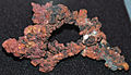 Copper (Boddington Gold Mine, Western Australia) (17120069007).jpg 1,997 × 1,140; 1.85 MB
-
 CSIRO ScienceImage 11239 Rottnest Island Western Australia.jpg 2,657 × 1,993; 4.91 MB
-
 CSIRO ScienceImage 1483 Olivine Adcumulate.jpg 2,657 × 1,759; 1.92 MB
-
 CSIRO ScienceImage 1664 Nickelsulphide Ore.jpg 2,657 × 1,754; 5.53 MB
-
 Dales Gorge, WA.jpg 4,288 × 2,848; 7.79 MB
-
 Detrital zircons BSE micrographs NAI 2014 Annual Science Report.jpg 801 × 517; 220 KB
-
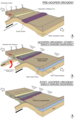
 Dome and Keel Cross Section.pdf 1,133 × 752; 916 KB
-
 Dunite Greenstone From Pilbara.JPG 2,448 × 3,264; 2.18 MB
-
 E4 Abandoned.jpg 960 × 720; 305 KB
-
 Earthquake locations Western Australia dot map - Perth.png 395 × 599; 43 KB
-
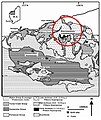
 Ellendale Diamond Field Location.png 2,759 × 2,475; 10.09 MB
-
 Endless Stations 56 - Lake Argyle and the Ord River Dam.jpg 5,120 × 3,738; 16.95 MB
-
 Endless Stations 77 - Clouds of Jupiter.jpg 1,156 × 3,000; 4.28 MB
-
 Endless Stations 78 - Awesome Rocks 2.jpg 1,959 × 3,000; 5.83 MB
-
 Endless Stations 79 - Grilled Cheese.jpg 2,306 × 3,000; 9.04 MB
-
 Fitzroy River proposed national park.jpg 5,152 × 3,864; 4.81 MB
-
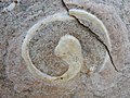 Fossil at windjana gorge.jpg 4,608 × 3,456; 6.36 MB
-
 Fringed Rock Shelter.jpg 2,848 × 1,896; 1.11 MB
-
 Geology of Kimberley (Western Australia) Alternative Models (a).png 1,866 × 2,997; 1.06 MB
-
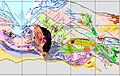
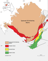 Geology of Kimberley (Western Australia) Geological Map.png 1,515 × 1,939; 1.05 MB
-
 Geology of Kimberley (Western Australia) Tectonic Evolution (a).png 1,866 × 999; 336 KB
-
 Geology of Kimberley (Western Australia) Tectonic Evolution (b).png 1,866 × 999; 451 KB
-
 Geology of Kimberley (Western Australia) Tectonic Evolution (c).png 1,866 × 1,001; 386 KB
-
 Geology of Kimberley (Western Australia) Tectonic Evolution (d).png 1,866 × 1,001; 441 KB
-
 Glikson Western Australia.jpg 826 × 728; 158 KB
-
 Gogo fish fossil preserved in the Windjana Gorge limestone reef.jpg 4,000 × 3,000; 4.7 MB
-
 Granite From Pilbara.JPG 2,448 × 3,264; 1.93 MB
-
 Hancock Gorge.jpg 2,000 × 1,500; 786 KB
-
 Heron in tree.jpg 2,304 × 1,536; 1.61 MB
-
 In Honeycomb Gorge, WA.jpg 4,288 × 2,848; 4.37 MB
-
 ISS-65 Roebuck Bay, Western Australia.jpg 5,568 × 3,712; 3.26 MB
-
 Jack Hills detrital zircons BSE micrographs.jpg 886 × 1,129; 373 KB
-
 Jack Hills, Western Australia (Landsat 5 TM, 2009-07-14, detail).jpg 1,772 × 1,253; 2.82 MB
-
 Jasperoid.jpg 800 × 600; 143 KB
-
 Jimbacrinus bostocki MHNT Gascoyne Junction, Western Australia.jpg 5,710 × 4,912; 11.86 MB
-
 Kalbarri NP Coastal.jpg 3,456 × 2,592; 2.19 MB
-
 Kimberley EMBM1.png 1,866 × 999; 305 KB
-
 Kimberley EMBM2.png 1,866 × 999; 440 KB
-
 Knox Gorge, WA.jpg 5,472 × 3,648; 7.39 MB
-
 KomatiiteA2.jpg 1,024 × 768; 165 KB
-
 Mount Augustus WA (cropped).jpg 4,288 × 613; 3.41 MB
-
 Mount Augustus WA.jpg 4,288 × 2,848; 12.78 MB
-
 Mount magnet orbicular granite.jpg 1,600 × 1,200; 2.18 MB
-
 Napier Range Windjana Gorge NP.jpg 3,039 × 2,014; 9.29 MB
-
 NAT F2foldsF1.jpg 400 × 300; 62 KB
-
 Orbicular granite sample Mount Magnet Australia polished.jpg 768 × 1,024; 299 KB
-

-

-
 Precambrian rock Greenough River in Western Australia.jpg 4,288 × 2,848; 5.49 MB
-
 Pressure relief fracturing, Dales Gorge.jpg 4,288 × 2,848; 5.24 MB
-
 Prohibition Banded Iron Formation Western Australia.jpg 960 × 477; 94 KB
-

-
 Ranges in Purnululu National Park.jpg 3,371 × 2,752; 2.49 MB
-
 Rock arch and cliffs at Fish Hook Bay (26159097600).jpg 2,968 × 1,976; 5.37 MB
-
 Rock fault on west side of great northern highway.jpg 1,600 × 1,200; 529 KB
-
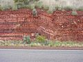
 Rock strata along munjina wittenoom road.jpg 1,600 × 1,200; 441 KB
-
 Rock strata forestcue falls.jpg 1,200 × 1,600; 460 KB
-
 Rock strata.jpg 1,600 × 1,200; 437 KB
-

-

-

-

-
 Stromatolithe Paléoarchéen - MNHT.PAL.2009.10.1.jpg 5,185 × 3,655; 9.94 MB
-

-
 The Bungle Bungle Ranges.jpg 3,264 × 2,448; 4.99 MB
-
 Warrawoona geology 2.JPG 560 × 666; 299 KB
-
 Westmusgrave.jpg 1,228 × 776; 267 KB
-
 Winjana gorge fossils.jpg 4,608 × 3,456; 6.43 MB
-
 Yardie Creek (6159218995).jpg 15,000 × 4,107; 18.95 MB


_(17120069007).jpg)


_Alternative_Models_(a).png)
_Geological_Map.png)
_Tectonic_Evolution_(a).png)
_Tectonic_Evolution_(b).png)
_Tectonic_Evolution_(c).png)
_Tectonic_Evolution_(d).png)


.jpg)


_5_(48751302333).jpg)
_1_(15034287211).jpg)


_2.jpg)

.jpg)


_(15177778617).jpg)
_1_(17346619166).jpg)
_4_(17370602842).jpg)


_(32535818074).jpg)


.jpg)
.jpg)