Category:Geological maps of Ethiopia
Jump to navigation
Jump to search
Countries of Africa: Algeria · Botswana · Cameroon · Cape Verde · Chad · Democratic Republic of the Congo · Egypt‡ · Eritrea · Ethiopia · Guinea · Madagascar · Mali · Mauritania · Morocco · Namibia · Niger · Nigeria · Rwanda · Senegal · South Africa · South Sudan · Sudan · Tanzania · Tunisia
Other areas: Canary Islands · Mayotte · Réunion
‡: partly located in Africa
Other areas: Canary Islands · Mayotte · Réunion
‡: partly located in Africa
Media in category "Geological maps of Ethiopia"
The following 10 files are in this category, out of 10 total.
-
 2010 etiopia earthquake.jpg 402 × 457; 61 KB
-
 Afar Geologic Map.jpg 1,182 × 1,685; 599 KB
-
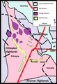
 Afar rock types.png 403 × 590; 80 KB
-
 AfarGEOLOGY He.jpg 2,559 × 1,905; 627 KB
-
 AfarGEOLOGY.jpg 2,559 × 1,905; 859 KB
-
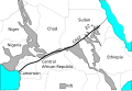
 Central African Rifts.svg 730 × 923; 57 KB
-
 Central African Shear Zone-fr.svg 576 × 395; 47 KB
-
 Central African Shear Zone.svg 576 × 395; 46 KB
-
 Ethiopia Hydrogeology3.png 744 × 988; 50 KB
-
 Geologic with plates.png 402 × 590; 73 KB


