Category:Geological cross sections of the United States
Jump to navigation
Jump to search
Subcategories
This category has the following 8 subcategories, out of 8 total.
Media in category "Geological cross sections of the United States"
The following 48 files are in this category, out of 48 total.
-

-

-
 Allegany County (1900) (14590814889).jpg 3,582 × 1,746; 583 KB
-
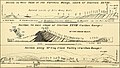
 Appalachian orogeny.jpg 432 × 583; 107 KB
-
 Bulletin (1910) (14759940441).jpg 3,056 × 1,776; 1.06 MB
-
 Bulletin (1971-) (20429742211).jpg 1,484 × 402; 148 KB
-
 Bulletin of the Geological Society of America (1911) (20261879218).jpg 3,344 × 1,240; 795 KB
-
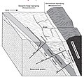
 Cascadia Subduction Cross Section.jpg 1,025 × 586; 224 KB
-
 Condon 1992 USGS Professional Paper 1505-A plate-1.jpg 19,400 × 13,400; 19.12 MB
-
 Cross section Mansfield.png 988 × 578; 95 KB
-
 Denver Basin Cross Section.png 1,444 × 657; 179 KB
-

-

-

-
-

-

-
 Evolution of the Chiricahua Landscape.jpg 1,473 × 1,563; 449 KB
-
 Geologic cross section of Devonian strata from New York to Alabama.svg 1,000 × 500; 221 KB
-
 Gogebic Range.jpg 608 × 561; 185 KB
-
 Grand Canyon Stratigraphic Units.tif 3,454 × 2,860; 28.31 MB
-
 Grand Staircase Diagram.jpg 6,503 × 1,985; 3.48 MB
-
 Grand Staircase Stratigraphic Units.tif 3,193 × 1,869; 17.1 MB
-
 Grand Staircase-big.jpg 1,700 × 483; 204 KB
-
 Grand Staircase.jpg 484 × 113; 26 KB
-
 Illinois Basin Pennsylvanian strata cross section.jpg 1,243 × 673; 95 KB
-
 Kame internal structure.jpg 5,312 × 2,988; 3.59 MB
-
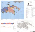
 NPS ozark-geologic-map-west.jpg 3,280 × 1,940; 2.03 MB
-
 Paradox-basin-cross-section.png 874 × 431; 210 KB
-
 PSM V53 D026 Cross section of a complex valley in the appalachians.png 1,709 × 442; 79 KB
-
 San Andreas Fault Sequential Diagrams.jpg 800 × 1,130; 138 KB
-
 Section of the North Wall of the Grand Canyon Wellcome M0006039.jpg 4,535 × 2,326; 2.51 MB
-

-
 SJB XSection3-2.pdf 1,531 × 837; 101 KB
-
 St. John, USVI, geologic map.pdf 6,564 × 5,991; 2.53 MB
-
 Taconic orogeny.gif 868 × 1,452; 158 KB
-
 Taconic orogeny.png 434 × 726; 19 KB
-
 Teton region in the Early Ordovician.jpg 507 × 385; 33 KB
-
 Teton region in the Late Cambrian.jpg 492 × 356; 25 KB
-
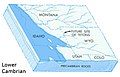 Teton region in the Lower Cambrian.jpg 481 × 309; 27 KB
-
 Texas Passive Continental Margin.JPG 767 × 297; 65 KB
-
 The Quarterly journal of the Geological Society of London (12684185185).jpg 3,200 × 1,773; 838 KB
-
 Uinta Basin geologic cross section.png 1,054 × 564; 96 KB
-
 USGS 2006 1237 Fig7b.png 1,713 × 709; 138 KB
-
 USGS McDermitt caldera geologic cross-section.png 807 × 272; 49 KB
-
 Vertical distribution of ore in Bisbee-Warren district, Arizona.jpg 1,874 × 824; 344 KB
-
 Waterpocket Fold cross section.JPG 412 × 140; 19 KB
-
 Yellowstone magma chamber.jpg 471 × 269; 16 KB
.jpg)
_(14590814889).jpg)

_(14759940441).jpg)


_(14594594959).jpg)
_(14594645750).jpg)
_(14758312116).jpg)
_(14781276695).jpg)


.jpg)


%27_(11156562793).jpg)
_(20429742211).jpg)
_(20261879218).jpg)
.jpg)