Category:Geography of San Diego, California
Jump to navigation
Jump to search
Wikimedia category | |||||
| Upload media | |||||
| Instance of | |||||
|---|---|---|---|---|---|
| |||||
- 100 most populous cities of the United States
- 1–25
- Austin
- Boston
- Charlotte
- Chicago
- Columbus
- Dallas
- Denver
- El Paso
- Houston
- Indianapolis
- Jacksonville
- Los Angeles
- Nashville
- New York City
- Oklahoma City
- Philadelphia
- Portland
- San Diego
- San Francisco
- San Jose
- Seattle
- Washington, D.C.
- 26–50
- Atlanta
- Baltimore
- Colorado Springs
- Detroit
- Kansas City
- Las Vegas
- Louisville
- Memphis
- Miami
- Minneapolis
- Oakland
- Omaha
- Raleigh
- Sacramento
- 51–75
- Cincinnati
- Cleveland
- Corpus Christi
- Durham
- Greensboro
- Lexington
- Lincoln
- Newark
- New Orleans
- Orlando
- Pittsburgh
- Plano
- Saint Paul
- St. Louis
- Tampa
- 76–100
- Baton Rouge
- Buffalo
- Fort Wayne
- Madison
- Norfolk
- Reno
- Richmond
- Santa Clarita
- Spokane
- Toledo
- Winston-Salem
Subcategories
This category has the following 10 subcategories, out of 10 total.
Media in category "Geography of San Diego, California"
The following 39 files are in this category, out of 39 total.
-
 San Diego Neighborhoods.png 1,323 × 2,107; 753 KB
-
 San Diego-Tijuana JPLLandsat.jpg 1,150 × 724; 174 KB
-
 San Diego-Tijuana Metro 3D Map.jpg 1,150 × 724; 1.27 MB
-
 Adobe Falls rocks (5323237746).jpg 1,667 × 1,032; 817 KB
-
 AdobeFallsByPhilKonstantin.JPG 2,448 × 3,264; 1.56 MB
-
 Battle Mountain.jpg 4,032 × 3,024; 5.1 MB
-
 Border USA Mexico.jpg 3,600 × 2,475; 6.69 MB
-
 Ceder Ridge Canyon.jpg 4,032 × 3,024; 5.34 MB
-
 Civita Park.jpg 4,032 × 3,024; 8.88 MB
-
 Clay Park - Ping Pong Table foreground, Playground and Cricket Players in Background 2.jpg 3,456 × 4,608; 4.78 MB
-
 Crestmont Canyon - 2.jpg 4,032 × 3,024; 5.83 MB
-
 East of Vancouver.jpg 3,024 × 4,032; 6.48 MB
-
 ISS-40 Los Angeles Basin and San Diego area.jpg 4,256 × 2,832; 2.14 MB
-
 ISS022-E-35525 - View of Earth.jpg 4,256 × 2,832; 1.43 MB
-
 ISS022-E-35526 - View of Earth.jpg 4,256 × 2,832; 1.49 MB
-
 ISS022-E-35527 - View of Earth.jpg 4,256 × 2,832; 1.4 MB
-
 ISS022-E-35528 - View of Earth.jpg 4,256 × 2,832; 1.33 MB
-
 ISS022-E-35529 - View of Earth.jpg 4,256 × 2,832; 1.29 MB
-
 Kosa'aay Map 1769.jpg 2,000 × 1,656; 2.69 MB
-
 Looking out over dry Lake Hodges.jpg 4,000 × 3,000; 3.02 MB
-
 Los Penasquitos Canyon night.jpg 5,312 × 2,988; 1.94 MB
-
 110703 TPSR LPL Pump Station 65 downward vertical 025.jpg 1,536 × 2,048; 1.95 MB
-
 MargaritaPeak.jpg 1,024 × 683; 141 KB
-
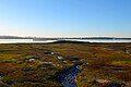 Mission Bay Wetlands in San Diego, California.jpg 400 × 267; 41 KB
-
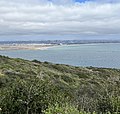
 Pacific view from the -Coaster (8319723252).jpg 1,936 × 2,592; 2 MB
-
 Pepper Canyon.jpg 4,032 × 2,268; 4.26 MB
-
 Potato Chip Rock panorama.jpg 9,888 × 3,024; 5.86 MB
-
 Potato Chip Rock.jpg 2,988 × 5,312; 6.06 MB
-
 Rose canyon.jpg 3,008 × 2,000; 3.19 MB
-
 San Diego Community Map.gif 500 × 950; 70 KB
-
 San Diego I-8 Exit2.JPG 820 × 615; 122 KB
-
 San Diego scenics fields and hills.jpg 3,673 × 2,400; 620 KB
-
 San Pasqual Valley.jpg 4,493 × 2,996; 1.74 MB
-
 Smuggler's Gulch Fence.jpg 3,000 × 2,000; 6.98 MB
-
 Smuggler's Gulch.jpg 5,312 × 2,988; 6.19 MB
-
 Sorento Valley (San Diego) 1 2016-05-16.jpg 4,032 × 3,024; 3.76 MB
-
 U.S - Mexico Border Walls.jpg 828 × 500; 173 KB
-
 View of San Diego from the Bayside Trail in Cabrillo National Monument.jpg 2,268 × 2,152; 1.93 MB
-
 Metateforwikibyreviewer.jpg 3,872 × 2,592; 7.91 MB


.jpg)


.jpg)


_1_2016-05-16.jpg)


