Category:Geography of Nakano, Nagano
Jump to navigation
Jump to search
日本語: 長野県中野市の地理。
Subcategories
This category has the following 5 subcategories, out of 5 total.
Media in category "Geography of Nakano, Nagano"
The following 16 files are in this category, out of 16 total.
-
 Iiyama 20200320153836 (50270781343).jpg 3,264 × 2,448; 3.38 MB
-
 Iiyama 20200320153907 (50271622952).jpg 3,264 × 2,448; 3.15 MB
-
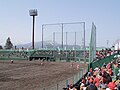 Nakano Baseball Stadium 1.jpg 800 × 600; 139 KB
-
 Nakano Baseball Stadium 2.jpg 800 × 600; 111 KB
-
 Nakano city center area Aerial photograph.1976.jpg 4,407 × 3,374; 12.4 MB
-
 Nakano in Nagano Prefecture Ja.svg 393 × 608; 16 KB
-
 Nakano in Nagano Prefecture.png 653 × 600; 104 KB
-
 Population distribution of Nakano, Nagano, Japan.svg 512 × 256; 22 KB
-
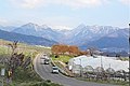 たかやしろ・見晴らし街道.jpg 4,133 × 2,759; 1.41 MB
-
 信州中野市一栗竹どんど焼き.jpg 3,456 × 5,184; 5.12 MB
-
 地図-長野県中野市-2006.png 256 × 329; 7 KB
-
 壁田 - panoramio.jpg 1,600 × 900; 290 KB
-
 柳沢遺跡と千曲川への夜間瀬川交流会地点(2020-2-18).jpg 3,264 × 2,448; 1.58 MB
-
 浜津ケ池公園.jpg 3,264 × 2,448; 2.87 MB
-
 高梨館跡公園.jpg 3,329 × 4,995; 4.22 MB
-
 高梨館跡公園1.jpg 5,184 × 3,455; 5.19 MB
.jpg)
.jpg)


