Category:Geography of Hadsel
Jump to navigation
Jump to search
English: Geography of Hadsel.
Suomi: Hadselin maantiede.
Wikimedia category | |||||
| Upload media | |||||
| Instance of | |||||
|---|---|---|---|---|---|
| |||||
Subcategories
This category has the following 31 subcategories, out of 31 total.
- Maps of Hadsel (5 F)
B
- Børøya (8 F)
F
- Fiskebøl (8 F)
- Fiskebøldalen (3 F)
H
I
- Ingelsfjorden (13 F)
L
- Langdalsskardet (3 F)
M
- Morfjordskaret (1 F)
R
S
- Sløverfjorden (8 F)
- Sommarhus (1 F)
- Stordalen (Hadsel) (2 F)
- Svartsundet (12 F)
T
- Tennfjorden (13 F)
- Tjønna (3 F)
U
- Ulvøya (Hadsel) (16 F)
V
- Vassdalen (Hadsel) (1 F)
Ø
- Øyra (5 F)
Media in category "Geography of Hadsel"
The following 15 files are in this category, out of 15 total.
-
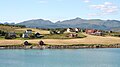
 Eidsfjord.jpg 3,456 × 2,304; 4.03 MB
-
 Fiskebøl 2013.jpg 3,648 × 2,502; 405 KB
-
 Frosty Raftsundet landscape with Trolltindan in morning, 2012 October.JPG 3,246 × 2,151; 5.01 MB
-
 Fylkesvei 885 Nordland.jpg 2,304 × 3,456; 4.25 MB
-
 Hanøy 01.jpg 4,000 × 2,672; 3.7 MB
-
 Holdøya 02.JPG 3,456 × 1,926; 3.27 MB
-
 Holdøya 03.JPG 3,456 × 1,978; 3.8 MB
-
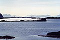 Lofoten Seascape (921817760).jpg 600 × 400; 36 KB
-
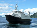 Lofotferje1-02.jpg 4,000 × 3,000; 3.82 MB
-
 Lofotferje1-Lonkan.jpg 4,000 × 1,367; 1.96 MB
-
 Moysalen 2.jpg 1,287 × 929; 146 KB
-
 Raftsundet 200708-2.jpg 3,456 × 2,304; 2.36 MB
-
 Tennstrandnes by Tennfjorden, Raftsundet, Hinnøya, Norway, 2015 September.jpg 3,600 × 2,400; 10.16 MB
-
 The red sunbath of Stormolla, 2009 09.JPG 5,160 × 3,418; 10.77 MB
-
 Towards Raftsund Bridge.jpg 3,456 × 2,304; 2.65 MB


.jpg)


