Category:Geodesic maps
Jump to navigation
Jump to search
Media in category "Geodesic maps"
The following 64 files are in this category, out of 64 total.
-
 1922 Index of Great Trigonometrical Survey of India.jpg 5,560 × 4,448; 16.54 MB
-
 29 of 'Schlesien. Eine Landeskunde für das deutsche Volk, etc' (11299506306).jpg 1,554 × 1,111; 375 KB
-
 BC-4 World Primary Network.jpg 1,780 × 1,176; 1.28 MB
-
 Clarke figure of the Earth 1860.jpg 4,500 × 5,900; 5.5 MB
-

-
 DOPPLER SATELLITE GROUND STATIONS PROVIDING DATA FOR WGS 72 DEVELOPMENT.GIF 1,355 × 980; 160 KB
-
 Dreiecksnetz sachsen.jpg 3,259 × 2,052; 1.22 MB
-
 Earth Gravitational Model 1996-ru.png 742 × 468; 79 KB
-
 Earth Gravitational Model 1996.png 742 × 468; 34 KB
-
 Europa Bezugspegel.svg 1,200 × 1,000; 677 KB
-
 GRACE Amazon hydrology.jpg 800 × 1,155; 142 KB
-
 Horizontal Control Network of the United States June 1931.jpg 1,365 × 844; 438 KB
-
 Italy interferogram ESA341143.jpg 2,479 × 4,788; 3.69 MB
-
 Izmit interferogram.jpg 569 × 585; 83 KB
-
 Kaart Leopoldsburg-Lommel 1867.jpg 1,556 × 2,344; 997 KB
-
 Karte Sachsen Dreiecksnetz Triangulation ca. 1880.JPG 3,264 × 2,448; 1.85 MB
-
 L-Triangulierung.png 1,256 × 1,123; 84 KB
-
 Lageskizze Helmertturm und Fernmiren.jpg 1,181 × 1,181; 289 KB
-
 Laquila differential interferogram by TerraSAR-X.jpg 1,154 × 1,202; 2.18 MB
-
 Lost Hills Subsidence interferogram.jpg 504 × 662; 88 KB
-
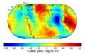
 Lowresgeoidheight.jpg 580 × 284; 103 KB
-
 Map of tectonics in Asia.jpg 2,671 × 3,372; 1.54 MB
-
 MapTektonikaSibiriaFragment.jpg 591 × 773; 370 KB
-
 Meades Ranch.svg 820 × 520; 658 KB
-
 Märket Island Growth 1810-1980.svg 590 × 430; 30 KB
-
 Méridienne Picard.jpg 1,532 × 2,990; 652 KB
-
 Méridienne Snellius1.jpg 2,196 × 3,396; 1.59 MB
-
 NASA Hectormine Earthquake Interferogram.jpg 288 × 222; 25 KB
-
 OSU MSS95.tif 912 × 756; 1.97 MB
-
 P6101260 adj.jpg 4,032 × 2,272; 1.23 MB
-
 PGR Paulson07 big.jpg 810 × 985; 111 KB
-
 PSM V30 D267 Geodetic map of new jersey.png 1,767 × 2,581; 193 KB
-
 RDbounds.png 492 × 488; 9 KB
-
 RDcorrectiegrid.svg 443 × 496; 809 KB
-
 Red geodésica de 1.er orden y nivelaciones de precisión de España (1883).jpg 10,653 × 7,971; 20.45 MB
-
 SAR Kilauea topo interferogram.jpg 577 × 577; 152 KB
-
 Soldner-Koordinatensysteme um 1900.jpg 995 × 812; 305 KB
-
 Struve Arc in Finland Map.jpg 1,244 × 4,000; 374 KB
-
 Struve Geodetic Arc-fr.svg 975 × 1,076; 657 KB
-
 Struve Geodetic Arc-he.svg 975 × 1,076; 357 KB
-
 Struve Geodetic Arc-zoom-af.svg 775 × 1,558; 325 KB
-
 Struve Geodetic Arc-zoom-cs.svg 775 × 1,558; 253 KB
-
 Struve Geodetic Arc-zoom-en.svg 775 × 1,558; 408 KB
-
 Struve Geodetic Arc-zoom-fr.svg 775 × 1,558; 440 KB
-
 Struve Geodetic Arc-zoom-hu.svg 775 × 1,558; 179 KB
-
 Struve Geodetic Arc-zoom-ka.svg 775 × 1,558; 263 KB
-
 Struve Geodetic Arc-zoom-lt.svg 775 × 1,558; 244 KB
-
 Struve Geodetic Arc-zoom-lv.svg 775 × 1,558; 244 KB
-
 Struve Geodetic Arc-zoom-ru.svg 775 × 1,558; 174 KB
-
 Struve Geodetic Arc-zoom-sv.svg 775 × 1,558; 246 KB
-
 Struve Geodetic Arc-zoom-vi.svg 775 × 1,558; 406 KB
-
 Struve Geodetic Arc-zoom-de.svg 775 × 1,558; 244 KB
-
 TCT and Doppler stations October 1 1977.gif 1,200 × 898; 575 KB
-
 TCT surveys January 1 1967.jpg 650 × 409; 243 KB
-
 Transcontinental Traverse map from Geodesy for the Layman.png 933 × 615; 206 KB
-
 Triangulation map of Colorado - DPLA - 351482ca82b46093240789e8c9c7a17a.jpg 8,999 × 5,869; 4.74 MB
-
 Triangulation station.JPG 448 × 383; 23 KB
-
 Ur-Nivellement (1894).jpg 2,984 × 2,342; 2.61 MB
-
 Ur-Nivellement-1894-Band-8-Tafel-5.png 2,048 × 1,623; 7.37 MB
-
 Ur-Nivellement-1896-1900-Gebietsabgrenzung-Hefte.png 4,453 × 3,542; 2.03 MB
-
 Vertical references in Europe.svg 575 × 444; 525 KB
-
 WORLDWIDE GEOMETRIC SATELLITE TRIANGULATION NETWORK, BC-4 CAMERAS.GIF 1,322 × 875; 121 KB
-

-
 Übersicht der Stationen.PNG 550 × 311; 174 KB

.jpg)


.jpg)


.jpg)


