Category:Gawthorpe, Wakefield
Jump to navigation
Jump to search
village in Wakefield, West Riding of Yorkshire, England, United Kingdom  | |||||
| Upload media | |||||
| Instance of | |||||
|---|---|---|---|---|---|
| Location | Ossett, Wakefield, West Yorkshire, Yorkshire and the Humber, England | ||||
 | |||||
Subcategories
This category has the following 10 subcategories, out of 10 total.
B
- Bridle Place, Gawthorpe (3 F)
C
- Chidswell Lane (15 F)
G
- Gawthorpe water tower (9 F)
H
O
- Owl Lane, Ossett (4 F)
S
- Swithenbank Avenue (6 F)
Media in category "Gawthorpe, Wakefield"
The following 125 files are in this category, out of 125 total.
-

-
 A638 at Swithenbank Street overbridge - geograph.org.uk - 6126931.jpg 1,024 × 769; 152 KB
-
 A638 near Gawthorpe - geograph.org.uk - 6126930.jpg 1,024 × 770; 128 KB
-

-
 A638 passing under the B6128 - geograph.org.uk - 3424910.jpg 640 × 453; 53 KB
-
 Approaching Lower Park Farm - geograph.org.uk - 5816372.jpg 3,888 × 5,184; 6.36 MB
-

-
 Ashbrook Close - Church Lane - geograph.org.uk - 1890918.jpg 640 × 480; 55 KB
-
 Ashbrook Close - Church Street - geograph.org.uk - 3587364.jpg 640 × 480; 63 KB
-
 Ashleigh Gardens - Dewsbury Road - geograph.org.uk - 3586967.jpg 640 × 480; 71 KB
-
 Ashmore Drive - off Brookdale Avenue - geograph.org.uk - 3586819.jpg 640 × 480; 68 KB
-
 At the foot of Lodge Hill - geograph.org.uk - 2148812.jpg 1,024 × 768; 128 KB
-
 Berryfield Garth - Holly Approach - geograph.org.uk - 3587420.jpg 640 × 480; 56 KB
-
 Blocked footpath - geograph.org.uk - 2148770.jpg 1,024 × 768; 123 KB
-
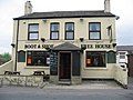 Boot and Shoe pub, Gawthorpe - geograph.org.uk - 409916.jpg 640 × 480; 78 KB
-

-

-
 Bridle Avenue - Hillcrest Avenue - geograph.org.uk - 3586947.jpg 640 × 480; 84 KB
-
 Bridle Lane - Dewsbury Road - geograph.org.uk - 3587008.jpg 640 × 480; 71 KB
-

-
 Brookdale Avenue - Branstone Grove - geograph.org.uk - 3586829.jpg 640 × 480; 58 KB
-
 Brookdale Avenue - High Street - geograph.org.uk - 3586739.jpg 640 × 480; 86 KB
-
 Cattle pasture, south of New Park Grange Farm - geograph.org.uk - 4194975.jpg 1,024 × 768; 147 KB
-
 Chidwell Lane, Gawthorpe - geograph.org.uk - 5745604.jpg 1,600 × 1,065; 435 KB
-
 Deneside - Kingsway - geograph.org.uk - 3746434.jpg 640 × 480; 69 KB
-
 Deneside - looking towards Kingsway - geograph.org.uk - 3746438.jpg 640 × 480; 52 KB
-

-
 Dewsbury Road - viewed from Kingsway - geograph.org.uk - 3586953.jpg 640 × 480; 79 KB
-
 Dewsbury Road - viewed from Kingsway - geograph.org.uk - 3586964.jpg 640 × 480; 58 KB
-

-

-
 Elderberry blossom near Lower Park Farm - geograph.org.uk - 5816392.jpg 4,781 × 3,758; 3.97 MB
-

-

-

-

-
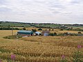
 Farmland between Tufty Farm and New Park Grange - geograph.org.uk - 4194480.jpg 1,024 × 768; 152 KB
-
 Farmland south of Tufty Farm - geograph.org.uk - 4194491.jpg 1,024 × 768; 145 KB
-

-
 Footbridge on the Leeds Country Way - geograph.org.uk - 4194972.jpg 1,024 × 768; 209 KB
-
 Footbridge over the A638 - geograph.org.uk - 3424899.jpg 640 × 409; 55 KB
-
 Footpath - Dewsbury Road - geograph.org.uk - 1902368.jpg 480 × 640; 74 KB
-
 Footpath - Greenacres - geograph.org.uk - 3586843.jpg 481 × 640; 72 KB
-
 Footpath - Greenacres - geograph.org.uk - 3586849.jpg 480 × 640; 85 KB
-
 Footpath - High Street - geograph.org.uk - 3586832.jpg 480 × 640; 107 KB
-
 Footpath - High Street - geograph.org.uk - 3586836.jpg 480 × 640; 63 KB
-
 Footpath - Owl Lane - geograph.org.uk - 3586708.jpg 480 × 640; 102 KB
-
 Footpath - Swithenbank Street - geograph.org.uk - 3586856.jpg 480 × 640; 99 KB
-
 Footpath - Swithenbank Street - geograph.org.uk - 3586917.jpg 480 × 640; 147 KB
-
 Footpath leading to Flushdyke - geograph.org.uk - 5746022.jpg 1,600 × 1,065; 585 KB
-
 Footpath off Gawthorpe Lane, Gawthorpe - geograph.org.uk - 1243763.jpg 480 × 640; 175 KB
-
 Footpath to Lodge Hill - geograph.org.uk - 3133912.jpg 640 × 427; 88 KB
-
 Gawthorpe Conservative Club - geograph.org.uk - 409889.jpg 640 × 480; 98 KB
-

-
 Gawthorpe Lane, Gawthorpe - geograph.org.uk - 1555259.jpg 640 × 480; 84 KB
-

-
 God has moved out - geograph.org.uk - 1554556.jpg 640 × 480; 56 KB
-
 Greenacres - High Street - geograph.org.uk - 3586838.jpg 640 × 480; 60 KB
-

-
 Greenacres Close - Greenacres - geograph.org.uk - 3586846.jpg 640 × 480; 63 KB
-
 Greening field, north of Lower Park Farm - geograph.org.uk - 4194982.jpg 1,024 × 614; 127 KB
-
 Harrowed field, south-east of Dogloitch Wood - geograph.org.uk - 4194993.jpg 1,024 × 768; 154 KB
-
 High Close - Brookdale Avenue - geograph.org.uk - 3586814.jpg 640 × 446; 54 KB
-
 Hillcrest Avenue - Bridle Lane - geograph.org.uk - 3586940.jpg 640 × 480; 71 KB
-
 Hirstlands Avenue - Dewsbury Road - geograph.org.uk - 3587006.jpg 640 × 480; 101 KB
-

-
 Holly Approach - Wood Street - geograph.org.uk - 3587402.jpg 640 × 480; 57 KB
-
 Holly Dene - Holly Approach - geograph.org.uk - 3587417.jpg 640 × 480; 79 KB
-
 Holly Mede - Holly Approach - geograph.org.uk - 3587424.jpg 640 × 480; 61 KB
-
 Holme Way - Holme Leas Drive - geograph.org.uk - 3746427.jpg 640 × 480; 48 KB
-

-
 Horses in a snow-covered paddock - geograph.org.uk - 3306330.jpg 1,024 × 768; 117 KB
-
 Kings Croft - Kingsmead - geograph.org.uk - 3746458.jpg 640 × 480; 59 KB
-
 Kings Lea - Kingsmead - geograph.org.uk - 3746454.jpg 640 × 480; 58 KB
-
 Kings Paddock - Kingsway Close - geograph.org.uk - 3746371.jpg 640 × 480; 61 KB
-
 Kingsmead - off Kingsway - geograph.org.uk - 3746441.jpg 640 × 480; 57 KB
-

-
 Kingsway Court - Kingsway Close - geograph.org.uk - 3746364.jpg 640 × 480; 83 KB
-
 Kingsway Gardens - Kingsway - geograph.org.uk - 3746352.jpg 640 × 480; 57 KB
-
 Lady Close - Dewsbury Road - geograph.org.uk - 3587005.jpg 640 × 480; 67 KB
-
 Lane to Lower Park Farm - geograph.org.uk - 6254747.jpg 1,600 × 1,200; 608 KB
-

-
 Lodge Hill Farmhouse - geograph.org.uk - 3133921.jpg 640 × 427; 92 KB
-
 Lodge Hill Road - Holly Approach - geograph.org.uk - 3587427.jpg 640 × 480; 57 KB
-
 Lodge Hill Road - Swithenbank Avenue - geograph.org.uk - 3587433.jpg 640 × 480; 65 KB
-
 Mayfield Gardens - Bridle Lane - geograph.org.uk - 3586920.jpg 640 × 480; 60 KB
-

-
 Moorlands Avenue - Hillcrest Avenue - geograph.org.uk - 3586950.jpg 640 × 480; 82 KB
-
 Mugged for my mints again - geograph.org.uk - 2120669.jpg 800 × 600; 218 KB
-
 Nettleton Chase - High Street - geograph.org.uk - 3586738.jpg 640 × 480; 69 KB
-
 Old Milestone by Dewsbury Road, Gawthorpe (geograph 6102119).jpg 480 × 640; 338 KB
-
 Oldfield Close - Holly Approach - geograph.org.uk - 3587405.jpg 640 × 480; 61 KB
-

-
 Path leading to Chidwell Lane, Gawthorpe - geograph.org.uk - 5745601.jpg 1,600 × 1,065; 847 KB
-
 Path leading to Owl Lane, Gawthorpe - geograph.org.uk - 5745147.jpg 1,600 × 1,065; 756 KB
-
 Path leading to Owl Lane, Gawthorpe - geograph.org.uk - 5745150.jpg 1,600 × 1,065; 708 KB
-
 Path leading to Owl Lane, Gawthorpe - geograph.org.uk - 5745154.jpg 1,600 × 1,065; 747 KB
-
 Path leading to Owl Lane, Gawthorpe - geograph.org.uk - 5745156.jpg 1,600 × 1,065; 399 KB
-
 Pickering Lane - Leeds Road - geograph.org.uk - 3586710.jpg 640 × 480; 63 KB
-
 Pickersgill Street - Wakefield Road - geograph.org.uk - 3586962.jpg 640 × 480; 68 KB
-
 Public footpath across a harrowed field - geograph.org.uk - 4195002.jpg 1,024 × 768; 155 KB
-

-
 Public footpath to Hey Beck and West Ardsley - geograph.org.uk - 3306347.jpg 1,024 × 768; 131 KB
-
 Public footpath to Tufty Farm - geograph.org.uk - 4194475.jpg 1,024 × 768; 151 KB
-
 Pylon in a greening field - geograph.org.uk - 2148766.jpg 1,024 × 768; 108 KB
-
 Roadworks on the M1 near to Kirkhamgate - geograph.org.uk - 4867991.jpg 640 × 427; 364 KB
-
 Roundabout on the A638. - geograph.org.uk - 5960711.jpg 1,024 × 683; 236 KB
-
 School Lane, Gawthorpe - geograph.org.uk - 2120681.jpg 800 × 600; 208 KB
-
 School Street - Cross Street - geograph.org.uk - 3586735.jpg 480 × 640; 69 KB
-
 Shearburn Close - Oldfield Close - geograph.org.uk - 3587414.jpg 640 × 480; 60 KB
-
 Stithy Street - Bridle Lane - geograph.org.uk - 3746308.jpg 640 × 480; 53 KB
-

-
 The Mad Mile - geograph.org.uk - 409966.jpg 480 × 640; 68 KB
-
 The Mill is closed - geograph.org.uk - 1026927.jpg 480 × 640; 54 KB
-
 The Royal Oak - Owl Lane - geograph.org.uk - 3586702.jpg 640 × 480; 61 KB
-

-
 Thorpe View - Wood Street - geograph.org.uk - 3587401.jpg 640 × 480; 71 KB
-
 Traffic at the roundabout - geograph.org.uk - 1554593.jpg 640 × 480; 58 KB
-
 Tufty Farm Gawthorpe - geograph.org.uk - 31066.jpg 640 × 480; 91 KB
-
 View of Red Lodge Farm from the west - geograph.org.uk - 5816396.jpg 5,067 × 3,801; 4.18 MB
-
 Warneford Avenue - Dewsbury Road - geograph.org.uk - 3746285.jpg 640 × 480; 99 KB
-
 Wood Grove - Wood Street - geograph.org.uk - 3587431.jpg 640 × 480; 69 KB
-
 Wood Street - Dewsbury Road - geograph.org.uk - 3587379.jpg 640 × 480; 55 KB
-
 Wood Street - Lodge Hill Road - geograph.org.uk - 3587428.jpg 640 × 480; 52 KB
-
 Zion Street - High Street - geograph.org.uk - 3586719.jpg 640 × 480; 64 KB


.jpg)


