Category:Gates in York
Jump to navigation
Jump to search
For the Bars (or gates) in the city walls, see Category:City gates of York
Subcategories
This category has the following 17 subcategories, out of 17 total.
G
R
- Rowntree Park Memorial Gates (11 F)
Media in category "Gates in York"
The following 40 files are in this category, out of 40 total.
-
 Clifton Croft York 01.jpg 4,608 × 3,456; 6.31 MB
-
 Derelict buildings, Lawrence Street - geograph.org.uk - 1164747.jpg 640 × 339; 43 KB
-
 Farm track leading from Willow Grove, Earswick - geograph.org.uk - 5656030.jpg 1,600 × 1,064; 885 KB
-
 Farm track near Copmanthorpe - geograph.org.uk - 4799955.jpg 800 × 600; 177 KB
-
 Farm track near Low Well Farm - geograph.org.uk - 4098286.jpg 1,600 × 1,064; 792 KB
-
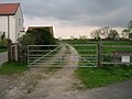
 Gate at Fir Croft Farm, Moor Lane, Haxby - geograph.org.uk - 324747.jpg 640 × 480; 144 KB
-
 Gate in Aldwark York.jpg 4,608 × 3,456; 5.31 MB
-
 Gate near Cowslip Farm - geograph.org.uk - 3484586.jpg 427 × 640; 151 KB
-
 Gate off Elvington Lane - geograph.org.uk - 2202060.jpg 640 × 480; 217 KB
-
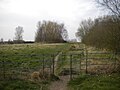
 Gate off Hob Moor - geograph.org.uk - 5492559.jpg 1,000 × 662; 1.04 MB
-
 Gate Treasurer's House York.jpg 2,048 × 1,536; 2.77 MB
-
 Gated farm track - geograph.org.uk - 2383887.jpg 640 × 480; 93 KB
-
 Gated farm track off Elvington Lane - geograph.org.uk - 2384112.jpg 1,600 × 1,200; 375 KB
-
 Gated farm track, Elvington - geograph.org.uk - 2359366.jpg 1,600 × 1,200; 422 KB
-
 Gates walls railings former churchyard St Mary Bishophill 04.jpg 4,608 × 3,456; 8.82 MB
-
 Gateway on Fulford Ings, York.jpg 2,560 × 1,920; 1.64 MB
-

-
 Gateway, Aldwark, York.jpg 1,175 × 1,848; 951 KB
-
 Keep out - geograph.org.uk - 1706263.jpg 640 × 480; 308 KB
-
 Kissing gate, Strensall - geograph.org.uk - 4560899.jpg 1,024 × 768; 177 KB
-

-

-
 Millfield Lane over 7 decades - No 2 - geograph.org.uk - 97532.jpg 500 × 365; 46 KB
-
 Minster Way towards Rabbit Warren (wood) - geograph.org.uk - 4076473.jpg 1,600 × 1,064; 790 KB
-
 Path leading to Askham Richard - geograph.org.uk - 4834784.jpg 1,200 × 835; 337 KB
-
 Side gate to former churchyard of St Mary Bishophill York.jpg 2,431 × 3,242; 4.7 MB
-
 Swinegate gate (2114889209).jpg 1,920 × 2,560; 1.48 MB
-
 Swinson House Piccadilly York 02.jpg 3,949 × 2,962; 3.96 MB
-
 The King's Manor - geograph.org.uk - 408048.jpg 640 × 480; 122 KB
-
 Track leading towards the Former Acaster Malbis Airfield - geograph.org.uk - 6225410.jpg 5,184 × 3,456; 5.13 MB
-
 Track to Plantation Farm - geograph.org.uk - 2384744.jpg 1,600 × 1,200; 635 KB
-
 Wall and gates Holy Trinity Micklegate York 03.jpg 2,244 × 2,992; 3.3 MB
-
 Wall and gates Holy Trinity Micklegate York 04.jpg 2,889 × 3,852; 4.75 MB
-
 Warning sign at Cowslip Farm - geograph.org.uk - 5531065.jpg 800 × 600; 133 KB
-
 Water Gate (geograph 7415374).jpg 1,024 × 751; 833 KB
-
 What else could you be? (1428266677).jpg 2,560 × 1,712; 2.03 MB
-
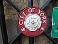 White rose emblem of the City of York - geograph.org.uk - 407806.jpg 640 × 480; 92 KB
-
 York - geograph.org.uk - 1726969.jpg 1,744 × 1,289; 1.84 MB
-
 An ornate garden gate - geograph.org.uk - 1512299.jpg 640 × 640; 182 KB
-
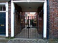
 New gates - geograph.org.uk - 413042.jpg 640 × 480; 225 KB


_-_geograph.org.uk_-_4076473.jpg)


.jpg)


.jpg)
.jpg)


