Category:Gates in County Durham
Jump to navigation
Jump to search
Ceremonial counties of England: Bedfordshire · Berkshire · Buckinghamshire · Cambridgeshire · Cheshire · Cornwall · Cumbria · Derbyshire · Devon · Dorset · Durham · East Riding of Yorkshire · East Sussex · Essex · Gloucestershire · Greater London · Greater Manchester · Hampshire · Herefordshire · Hertfordshire · Kent · Lancashire · Leicestershire · Lincolnshire · Merseyside · Norfolk · North Yorkshire · Northamptonshire · Northumberland · Nottinghamshire · Oxfordshire · Rutland · Shropshire · Somerset · South Yorkshire · Staffordshire · Suffolk · Surrey · Tyne and Wear · Warwickshire · West Midlands · West Sussex · West Yorkshire · Wiltshire · Worcestershire
City-counties: Bristol · City of London
Former historic counties:
Other former counties:
City-counties: Bristol · City of London
Former historic counties:
Other former counties:
Subcategories
This category has the following 4 subcategories, out of 4 total.
Media in category "Gates in County Durham"
The following 113 files are in this category, out of 113 total.
-
 Entrance Gates to Croxdale Estate - geograph.org.uk - 1389720.jpg 640 × 480; 101 KB
-
 A better class of rubbish - geograph.org.uk - 485197.jpg 480 × 640; 86 KB
-
 A View to Hamsterley forest - geograph.org.uk - 246977.jpg 640 × 480; 95 KB
-

-

-
 St Helen’s Church, Beamish Museum, 28 August 2013.jpg 2,000 × 1,407; 998 KB
-
 Bishop Auckland Cricket club - geograph.org.uk - 256015.jpg 640 × 480; 79 KB
-
 Side view of St. Peters Church, Bishopton.jpg 1,477 × 1,108; 317 KB
-
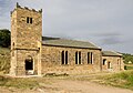
 St Peter's Church and gate - geograph.org.uk - 419319.jpg 640 × 480; 185 KB
-
 Black Hill Gate , Hope Plantation. - geograph.org.uk - 145569.jpg 640 × 479; 116 KB
-
 Black Hill Gate - geograph.org.uk - 1716558.jpg 640 × 510; 120 KB
-
 Bridleway crossing moorland south of Holwick Scars - geograph.org.uk - 3164037.jpg 1,500 × 1,125; 1.13 MB
-
 Bridleway in upper Teesdale - geograph.org.uk - 1506642.jpg 640 × 480; 84 KB
-
 Bridleway to Holwick - geograph.org.uk - 518426.jpg 640 × 480; 88 KB
-
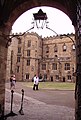 Castle of Durham 03.JPG 1,542 × 2,275; 676 KB
-
 Cemetery entrance Greatham Village - geograph.org.uk - 1578384.jpg 640 × 480; 132 KB
-
 City of Durham Dec 2012 Kingsgate (10895568895).jpg 1,150 × 2,048; 704 KB
-
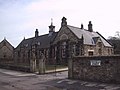 Colliery Village school at Beamish - geograph.org.uk - 975568.jpg 640 × 480; 59 KB
-
 Crag House. - geograph.org.uk - 512912.jpg 640 × 480; 145 KB
-
 Croxdale Hall entrance gates - geograph.org.uk - 1395469.jpg 640 × 480; 86 KB
-
 Disused Boat - geograph.org.uk - 91322.jpg 640 × 480; 64 KB
-
 Doctor's Gate - geograph.org.uk - 269506.jpg 640 × 480; 59 KB
-
 Cathedral of Durham 04.JPG 1,920 × 2,560; 1.18 MB
-
 Durham Cathedral - Doorway - geograph.org.uk - 977800.jpg 413 × 640; 97 KB
-
 Eldon Moor House - geograph.org.uk - 404798.jpg 640 × 480; 93 KB
-

-
 End of lane on moor above Ireshope - geograph.org.uk - 2147867.jpg 2,000 × 1,500; 2.6 MB
-
 Entrance to Auckland Park - geograph.org.uk - 138926.jpg 640 × 422; 53 KB
-

-
 Entrance to Gainford Cemetery - geograph.org.uk - 458627.jpg 480 × 640; 81 KB
-
 Entrance to Newsham Hall - geograph.org.uk - 459254.jpg 640 × 480; 125 KB
-
 Entrance to North Cemetery Darlington - geograph.org.uk - 1725572.jpg 2,048 × 1,536; 1.1 MB
-

-

-
 St Michael's Church, Esh - geograph.org.uk - 146615.jpg 640 × 480; 189 KB
-
 Fawnlees Hall, Wolsingham - geograph.org.uk - 348946.jpg 640 × 480; 96 KB
-
 Field gates in Brignall, County Durham, England..jpg 640 × 480; 179 KB
-
 Garden Cottage, Selaby Hall - geograph.org.uk - 459011.jpg 640 × 480; 105 KB
-
 Gate , Northumbrian Water - geograph.org.uk - 227641.jpg 640 × 479; 100 KB
-

-
 Gate Posts , Salter Carr Farm - geograph.org.uk - 192518.jpg 640 × 479; 139 KB
-
 Gate, Riverside Footpath - geograph.org.uk - 339542.jpg 640 × 426; 122 KB
-
 Gateway to Middle Swainston - geograph.org.uk - 344580.jpg 640 × 480; 67 KB
-
 Gateway to South Park - geograph.org.uk - 1746133.jpg 640 × 480; 88 KB
-
 Gilded gates, South Park Darlington - geograph.org.uk - 1746064.jpg 480 × 640; 90 KB
-
 Golden Gates to Wynyard Park . - geograph.org.uk - 400498.jpg 640 × 480; 124 KB
-
 Hamsterley Forest - geograph.org.uk - 589956.jpg 427 × 640; 122 KB
-
 Headlam Hall gates - geograph.org.uk - 256053.jpg 640 × 480; 136 KB
-
 Headlam Hall Hotel. - geograph.org.uk - 148084.jpg 640 × 479; 135 KB
-
 Iron Gate - geograph.org.uk - 684461.jpg 640 × 480; 134 KB
-
 Ketton Packhorse Bridge. - geograph.org.uk - 161090.jpg 640 × 428; 104 KB
-
 Level Crossing south of Stanhope Ford - geograph.org.uk - 4579144.jpg 1,024 × 767; 231 KB
-
 Lodge , Wycliffe Hall. - geograph.org.uk - 147247.jpg 640 × 479; 100 KB
-
 Lodge and Gate , Eggleston Hall - geograph.org.uk - 227584.jpg 640 × 391; 99 KB
-
 Lodge and Gate , Raby Castle - geograph.org.uk - 224462.jpg 640 × 406; 101 KB
-
 Lodge gates, Westholme Hall - geograph.org.uk - 459037.jpg 640 × 433; 96 KB
-
 North Lodge, Windlestone Hall - geograph.org.uk - 404405.jpg 640 × 480; 99 KB
-
 Rear entrance to Selaby Hall - geograph.org.uk - 459007.jpg 640 × 401; 47 KB
-
 Ropner Park gates - geograph.org.uk - 407767.jpg 640 × 480; 140 KB
-
 Saltersgate Ammunition Depot - geograph.org.uk - 550143.jpg 640 × 480; 147 KB
-
 Signs of the times - geograph.org.uk - 499068.jpg 640 × 422; 296 KB
-
 Small gate - geograph.org.uk - 683865.jpg 640 × 449; 342 KB
-
 South Park gates - geograph.org.uk - 252742.jpg 520 × 412; 105 KB
-

-
 Stanhope Ford - geograph.org.uk - 1340774.jpg 640 × 480; 97 KB
-
 The tower of St Margaret's, Tanfield - geograph.org.uk - 76491.jpg 640 × 465; 109 KB
-
 The entrance and road to Nova Scotia - geograph.org.uk - 268541.jpg 640 × 480; 226 KB
-
 The gates to Yarm School - geograph.org.uk - 489803.jpg 640 × 480; 133 KB
-
 Track - geograph.org.uk - 501246.jpg 640 × 480; 127 KB
-
 University College, Durham Crypt.jpg 1,536 × 1,142; 279 KB
-
 Unused gates rear of Redworth Hall - geograph.org.uk - 1327646.jpg 640 × 480; 108 KB
-
 Walworth 074.jpg 3,648 × 2,736; 2.37 MB
-
 Walworth Castle 029.jpg 3,648 × 1,824; 1.58 MB
-
 Wiserly Barn - geograph.org.uk - 535557.jpg 640 × 480; 95 KB
-
 Access to High Close House - geograph.org.uk - 459514.jpg 640 × 480; 114 KB
-
 Access to Winston Church - geograph.org.uk - 1513929.jpg 640 × 480; 134 KB
-
 Candlesieve Sike - geograph.org.uk - 590128.jpg 640 × 427; 95 KB
-
 Coldberry End - geograph.org.uk - 699110.jpg 640 × 480; 82 KB
-
 Deerness Valley Path, above Crook - geograph.org.uk - 338045.jpg 640 × 480; 67 KB
-
 Disused Gate - geograph.org.uk - 630572.jpg 640 × 427; 87 KB
-

-
 Entrance to quarry Plawsworth Near Durham - geograph.org.uk - 246638.jpg 640 × 480; 137 KB
-

-
 Footpath Gate and Sign, Hudes Hope - geograph.org.uk - 22912.jpg 360 × 480; 45 KB
-

-
 Gate and wood - geograph.org.uk - 358658.jpg 640 × 480; 89 KB
-
 Gate at Leamside - geograph.org.uk - 351810.jpg 640 × 480; 72 KB
-
 Gate Entrance , Langton Grange - geograph.org.uk - 224432.jpg 640 × 479; 145 KB
-
 Gate near Haverley House - geograph.org.uk - 314298.jpg 640 × 480; 102 KB
-
 Gate next to cattle grid - geograph.org.uk - 695231.jpg 640 × 427; 148 KB
-
 Gate on Busk Lane. - geograph.org.uk - 295362.jpg 640 × 465; 85 KB
-
 Gate on the track to Heatheryburn - geograph.org.uk - 706014.jpg 640 × 480; 75 KB
-

-
 Gate Posts , High Moor. - geograph.org.uk - 145545.jpg 640 × 479; 154 KB
-
 Gate, Ladyfold Rigg - geograph.org.uk - 385150.jpg 640 × 384; 59 KB
-
 Gate, Musgrove or Cleaburn Pasture - geograph.org.uk - 677213.jpg 640 × 425; 215 KB
-
 Gate. - geograph.org.uk - 512615.jpg 640 × 480; 152 KB
-

-

-
 Gateway on the track to Heatheryburn - geograph.org.uk - 706106.jpg 640 × 480; 72 KB
-
 Gateway to churchyard Stanhope - geograph.org.uk - 398823.jpg 426 × 640; 80 KB
-

-
 Guard Duty - geograph.org.uk - 590196.jpg 518 × 640; 136 KB
-
 Iron and wood gates Stanhope - geograph.org.uk - 398872.jpg 640 × 426; 138 KB
-
-
 Low Thornberry gate - geograph.org.uk - 401498.jpg 640 × 480; 110 KB
-
 Moorland Gate and Path at Black Hill - geograph.org.uk - 458998.jpg 640 × 480; 64 KB
-
 Muddy gateway - geograph.org.uk - 358646.jpg 640 × 480; 75 KB
-
 Old Iron Gate on Cragdale Moor. - geograph.org.uk - 294896.jpg 640 × 480; 270 KB
-
 The old drive to Woodlands Park. - geograph.org.uk - 344007.jpg 640 × 480; 124 KB
-
 Thorny Close, leading to Morton Farm. - geograph.org.uk - 140701.jpg 640 × 479; 159 KB
-
 Thrundle Farm gates - geograph.org.uk - 413944.jpg 640 × 480; 76 KB
-
 Victorian Cast Iron Gate Posts - geograph.org.uk - 76165.jpg 640 × 480; 60 KB


.jpg)


