Category:Garretson Forge and Farm
Jump to navigation
Jump to search
| Object location | | View all coordinates using: OpenStreetMap |
|---|
building in New Jersey, United States  | |||||
| Upload media | |||||
| Instance of | |||||
|---|---|---|---|---|---|
| Location | New Jersey | ||||
| Heritage designation |
| ||||
 | |||||
|
This is a category about a place or building that is listed on the National Register of Historic Places in the United States of America. Its reference number is 74001153. |
Media in category "Garretson Forge and Farm"
The following 4 files are in this category, out of 4 total.
-
 Garretson Picnic Area.GIF 2,816 × 2,112; 1.37 MB
-
 Garretson Pump.GIF 2,112 × 2,816; 1.49 MB
-
 Garretson Sign.GIF 2,816 × 2,112; 1.03 MB
-
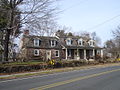 PeterGarretsonFarmhouse.jpg 1,280 × 960; 587 KB


