Category:Gare du Mont-Dore
Jump to navigation
Jump to search
| Object location | | View all coordinates using: OpenStreetMap |
|---|
railway station in Mont-Dore, France  | |||||
| Upload media | |||||
| Instance of | |||||
|---|---|---|---|---|---|
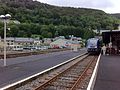
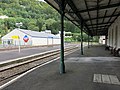
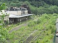
| Location | Mont-Dore, Puy-de-Dôme, Auvergne-Rhône-Alpes, Metropolitan France, France | ||||
| Transport network | |||||
| Owned by | |||||
| Operator | |||||
| Heritage designation | |||||
| Date of official closure |
| ||||
| Elevation above sea level |
| ||||
| Connecting line | |||||
 | |||||
Media in category "Gare du Mont-Dore"
The following 18 files are in this category, out of 18 total.
-
 06.04.87 Le Mont-Dore X 2905 & X 2882.jpg 1,550 × 961; 1.41 MB
-
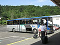 Bus TER montdore.JPG 4,320 × 3,240; 3.53 MB
-
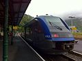
 Gare du Mont Dore 10.JPG 2,592 × 1,936; 1.73 MB
-
 Gare du Mont Dore 2.JPG 2,592 × 1,936; 1.79 MB
-
 Gare du Mont Dore 3.JPG 2,592 × 1,936; 1.31 MB
-
 Gare du Mont Dore 4.JPG 2,592 × 1,936; 2.02 MB
-
 Gare du Mont Dore 5.JPG 2,592 × 1,936; 2.01 MB
-
 Gare du Mont Dore 6.JPG 2,592 × 1,936; 2.09 MB
-
 Gare du Mont Dore 7.JPG 2,592 × 1,936; 2.2 MB
-
 Gare du Mont Dore 8.JPG 2,592 × 1,936; 2.44 MB
-
 Gare du Mont Dore 9.JPG 2,592 × 1,936; 2.1 MB
-
 Gare du mont dore fin 2018.jpg 3,840 × 2,160; 1.53 MB
-
 Gare du Mont Dore.JPG 1,936 × 2,592; 2.46 MB
-
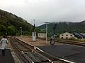
 Gare du Mont-Dore (dead-end).jpg 2,816 × 2,112; 2.63 MB
-
 Gare du Mont-Dore.jpg 2,816 × 2,112; 1.36 MB
-
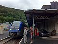
 Gare Mont Dore 2022.jpg 2,160 × 1,620; 1.71 MB
-
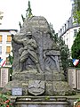 Le Mont-Dore - War memorial.jpg 2,112 × 2,816; 1.88 MB
-
 Pont tournant de la gare du Mont Dore.JPG 2,592 × 1,936; 2.5 MB


.jpg)


