Category:Gare de Crécy-la-Chapelle
Jump to navigation
Jump to search
| Object location | | View all coordinates using: OpenStreetMap |
|---|
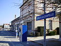
railway station in Crécy-la-Chapelle, France   | |||||
| Upload media | |||||
| Instance of | |||||
|---|---|---|---|---|---|
| Location | Crécy-la-Chapelle, Seine-et-Marne, Île-de-France, Metropolitan France, France | ||||
| Transport network | |||||
| Architect |
| ||||
| Owned by | |||||
| Operator | |||||
| Date of official opening |
| ||||
| Elevation above sea level |
| ||||
| Connecting line | |||||
| Adjacent station | |||||
 | |||||
Media in category "Gare de Crécy-la-Chapelle"
The following 33 files are in this category, out of 33 total.
-
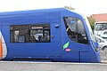
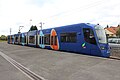
 Citadis Dualis Crecy-la-Chapelle.jpg 5,472 × 3,648; 5.72 MB
-
 Crécy-en-Brie - La gare 01.jpg 755 × 481; 149 KB
-
 Crécy-en-Brie - La gare 02.jpg 800 × 491; 154 KB
-
 Crécy-la-Chapelle gebouw.jpg 4,000 × 2,248; 1.78 MB
-
 Gare Crécy Chapelle 1.jpg 5,184 × 3,456; 6.38 MB
-
 Gare Crécy Chapelle 10.jpg 3,456 × 5,184; 4.75 MB
-
 Gare Crécy Chapelle 11.jpg 5,184 × 3,456; 6.95 MB
-
 Gare Crécy Chapelle 12.jpg 5,184 × 3,456; 6.33 MB
-
 Gare Crécy Chapelle 13.jpg 5,184 × 3,456; 6.51 MB
-
 Gare Crécy Chapelle 14.jpg 5,184 × 3,456; 6.62 MB
-
 Gare Crécy Chapelle 2.jpg 5,184 × 3,456; 6.19 MB
-
 Gare Crécy Chapelle 3.jpg 5,184 × 3,456; 4.21 MB
-
 Gare Crécy Chapelle 4.jpg 5,184 × 3,456; 5.21 MB
-
 Gare Crécy Chapelle 5.jpg 4,694 × 1,202; 1.6 MB
-
 Gare Crécy Chapelle 6.jpg 5,184 × 3,456; 7.38 MB
-
 Gare Crécy Chapelle 7.jpg 5,184 × 3,456; 5.89 MB
-
 Gare Crécy Chapelle 8.jpg 5,184 × 3,456; 6.09 MB
-
 Gare Crécy Chapelle 9.jpg 5,184 × 3,456; 6.23 MB
-
 Gare de Crécy-la-Chapelle - côté est avec ancien nom.jpg 2,048 × 1,536; 771 KB
-
 Gare de Crécy-la-Chapelle - côté ouest.jpg 2,048 × 1,536; 775 KB
-
 Gare de Crécy-la-Chapelle - panneau avec ancien nom.jpg 2,048 × 1,536; 775 KB
-
 Gare de Crécy-la-Chapelle - quai.jpg 2,048 × 1,536; 788 KB
-
 Repère nivellement Gare Crécy Chapelle 1.jpg 5,184 × 3,456; 8.09 MB
-
 Repère nivellement Gare Crécy Chapelle 2.jpg 5,184 × 3,456; 10.79 MB
-
 Repère nivellement Gare Crécy Chapelle 3.jpg 5,184 × 3,456; 6.06 MB
-
 SNCF U 25521 22, Crécy-la-Chapelle Le TiTi de Crécy (13254664553).jpg 4,608 × 3,072; 1.24 MB
-
 Tram-train Crécy-la-Chapelle 1.jpg 4,000 × 2,248; 1.64 MB
-
 Tram-train Crécy-la-Chapelle overstap.jpg 4,000 × 2,248; 2.35 MB
-
 Transilien P Gare Crécy Chapelle 1.jpg 5,184 × 3,456; 6.92 MB
-
 Transilien P Gare Crécy Chapelle 2.jpg 5,184 × 3,456; 4.71 MB
-
 Transilien P Gare Crécy Chapelle 3.jpg 7,498 × 2,664; 15.63 MB
-
 Transilien P Gare Crécy Chapelle 4.jpg 5,184 × 3,456; 5.14 MB
-
 Transilien P Gare Crécy Chapelle 5.jpg 5,184 × 3,456; 6.04 MB


.jpg)

