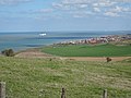
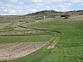
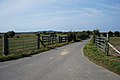
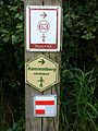
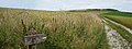
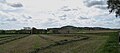
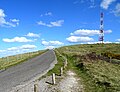
Category:GR 128
Jump to navigation
Jump to search


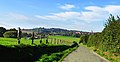
Français : Le sentier de grande randonnée 128 (GR 128) relie Wissant en France à Aix-la-Chapelle en Allemagne.
Il traverse les pays suivants:
- France
- Département du Pas-de-Calais : Clairmarais, Wissant, Peuplingues, Bouquehault, Quercamps,
- Département du Nord: Boeschepe, Bailleul, Berthen, Cassel, Eecke, Godewaersvelde, le Mont-des-Cats, et Kemmel, Saint-Sylvestre-Cappel, Steenvoorde, Watten, .
- Belgique: Kemmel, Ypres, Zonnebeke, Roulers, Tielt, Deinze, Gand, Laarne, Termonde, Mazenzele (Opwijk), Weerde, Wespelaar, Louvain, Tirlemont, Drieslinter, Kortenbos, Looz, Tongres, Hoeselt, Fourons
- Pays-Bas: Maastricht
- Allemagne: Aix-la-Chapelle
English: The GR 128 footpath goes through France (Nord and Pas-de-Calais departements), Belgium, the Netherlands and Germany.
 | |||||
| Upload media | |||||
| Instance of | |||||
|---|---|---|---|---|---|
| Location |
| ||||
| Length |
| ||||
| Terminus | |||||
| |||||
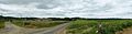
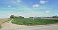
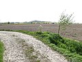
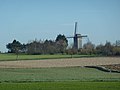
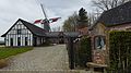
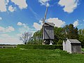
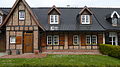
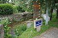
Media in category "GR 128"
The following 114 files are in this category, out of 114 total.
-
 20090201 GR Destelbergen - Laarne (0008).jpg 1,600 × 1,200; 1.21 MB
-
 20090201 GR Destelbergen - Laarne (0016).jpg 1,600 × 1,200; 1.1 MB
-
 20090201 GR Destelbergen - Laarne (0033).jpg 1,600 × 1,200; 829 KB
-
 20090201 GR Destelbergen - Laarne (0052).jpg 1,600 × 1,200; 995 KB
-
 20090201 GR Destelbergen - Laarne (0055).jpg 1,200 × 1,600; 1,017 KB
-
 Bailleul sur le circuit du Ravensberg (4).jpg 3,209 × 4,277; 2.69 MB
-
 Bailleul sur le circuit du Ravensberg (8).jpg 3,264 × 2,786; 2.82 MB
-
 Berthen 06102018.jpg 3,292 × 1,693; 3.95 MB
-
 Berthen sur le GR128 (2).jpg 4,308 × 2,862; 6.29 MB
-
 Berthen sur le GR128 (9).jpg 4,262 × 2,790; 5.3 MB
-
 Berthen sur le GR128.jpg 4,262 × 2,790; 6.72 MB
-
 Berthen.- sur le GR 128 (1).jpg 4,912 × 3,264; 11.37 MB
-
 Berthen.- sur le GR 128 (2).jpg 3,376 × 2,484; 2.92 MB
-
 Berthen.- sur le GR 128 (3).jpg 3,452 × 2,586; 4 MB
-
 Berthen.- sur le GR 128 (4).jpg 4,912 × 3,264; 8.63 MB
-
 Berthen.- sur le GR 128 (5).jpg 4,912 × 3,264; 11.3 MB
-
 Berthen.- sur le GR 128 (6).jpg 4,912 × 3,264; 10.41 MB
-
 Berthen.- sur le GR 128 (7).jpg 4,912 × 3,264; 8.56 MB
-
 Berthen.- sur le GR 128 (8).jpg 4,912 × 3,264; 8.82 MB
-
 Boeschepe, chapelle du Mont Kokereel N.D du Sacré Cœur (1).jpg 3,540 × 2,635; 6.17 MB
-
 Boeschepe, chapelle du Mont Kokereel N.D du Sacré Cœur (2).jpg 2,262 × 2,259; 1.71 MB
-
 Boeschepe, chapelle du Mont Kokereel N.D du Sacré Cœur (3).jpg 4,912 × 3,264; 7.25 MB
-
 Cap Blanc-Nez.- Escalles.jpg 4,896 × 3,672; 8.59 MB
-
 Cap Blanc-Nez.- Le mont d'hubert (1).jpg 4,896 × 3,672; 8.39 MB
-
 Cap Blanc-Nez.- Le mont d'hubert (10).jpg 4,723 × 3,541; 4.53 MB
-
 Cap Blanc-Nez.- Le mont d'hubert (11).jpg 4,896 × 3,672; 8 MB
-
 Cap Blanc-Nez.- Le mont d'hubert (13).jpg 4,517 × 3,387; 3.64 MB
-
 Cap Blanc-Nez.- Le mont d'hubert (14).jpg 4,896 × 3,672; 7.6 MB
-
 Cap Blanc-Nez.- Le mont d'hubert (3).jpg 4,420 × 3,316; 2.66 MB
-
 Cap Blanc-Nez.- Le mont d'hubert (4).jpg 4,896 × 3,672; 8.09 MB
-
 Cap Blanc-Nez.- Le mont d'hubert (9).jpg 4,797 × 3,597; 3.99 MB
-
 Cassel.- GR128 Autour du Castellum.JPG 2,701 × 2,666; 5.15 MB
-
 Eecke Eté2016 le circuit du Klockhuis (11).jpg 4,912 × 3,264; 5.91 MB
-
 Eecke Eté2016 le circuit du Klockhuis (12).jpg 4,912 × 3,264; 7.59 MB
-
 Eecke Eté2016 le circuit du Klockhuis (13).jpg 4,912 × 3,264; 7.53 MB
-
 Eecke Eté2016 le circuit du Klockhuis (15).jpg 4,912 × 3,264; 10.3 MB
-
 Eecke Eté2016 le circuit du Klockhuis (16).jpg 2,848 × 1,929; 2.21 MB
-
 Eecke Eté2016 le circuit du Klockhuis (17).jpg 4,912 × 3,264; 9.74 MB
-
 Eecke Eté2016 le circuit du Klockhuis (18).jpg 4,912 × 3,264; 9.99 MB
-
 Eecke Eté2016 le circuit du Klockhuis (2).jpg 4,912 × 3,264; 5 MB
-
 Eecke Eté2016 le circuit du Klockhuis (20).jpg 3,703 × 2,113; 3.68 MB
-
 Eecke Eté2016 le circuit du Klockhuis (3).jpg 4,912 × 3,264; 6.47 MB
-
 Eecke Eté2016 le circuit du Klockhuis (4).jpg 4,168 × 3,264; 3.09 MB
-
 Eecke Eté2016 le circuit du Klockhuis (5).jpg 4,823 × 3,205; 3.36 MB
-
 Eecke Eté2016 le circuit du Klockhuis (6).jpg 4,912 × 3,264; 7.84 MB
-
 Eecke Eté2016 le circuit du Klockhuis (7).jpg 4,912 × 3,264; 6.63 MB
-
 Eecke Eté2016 le circuit du Klockhuis (9).jpg 4,912 × 3,264; 6.34 MB
-
 Eecke Eté2016 le Oratoire Ste Rita.jpg 2,894 × 3,264; 2.04 MB
-
 Eecke rue des 3 moulins (15330617426).jpg 4,000 × 3,000; 4.84 MB
-
 Eecke, vue sur le Mont des Cats. (15353643255).jpg 4,000 × 3,000; 4.81 MB
-
 Frontière franco-belge à Dehill (vakantiewoning).jpg 4,681 × 3,511; 3.18 MB
-
 Godewaersvelde route de la chapelle Fouquenprez.jpg 4,896 × 3,672; 12.74 MB
-
 Godewaersvelde sentier de Berthen.jpg 1,899 × 1,807; 2.62 MB
-
 Godewaersvelde sur le GR128 (1).jpg 3,308 × 2,184; 2.95 MB
-
 Godewaersvelde sur le GR128 (2).jpg 1,022 × 766; 499 KB
-
 Godewaersvelde sur le GR128 (3).jpg 1,024 × 683; 510 KB
-
 Godewaersvelde sur le GR128 (8).jpg 2,874 × 2,520; 5.08 MB
-
 GR 128 en GR 129 in Deinze.jpg 1,161 × 2,801; 979 KB
-
 GR128 Wissant-Aken.jpg 1,536 × 2,048; 775 KB
-
 Groot Begijnhof Sint-Elisabeth (DSCF0314).jpg 4,640 × 3,046; 9.07 MB
-
 Groot Begijnhof Sint-Elisabeth (DSCF0317).jpg 3,741 × 3,161; 6.47 MB
-
 Holle weg Velm - panoramio (1).jpg 3,000 × 4,000; 1.69 MB
-
 Le Mont des Cassel vu de Ste-Marie-Cappel.JPG 4,896 × 2,752; 5.49 MB
-
 Le Mont des Recollets sur le GR 128.jpg 3,918 × 2,888; 6.1 MB
-
 Le Mont des Récollets vu de Ste-Marie-Cappel.JPG 4,896 × 2,752; 5.53 MB
-
 Le mont Kemmel (Kemmelberg) Borne du GR128.JPG 3,019 × 4,027; 1.69 MB
-
 Le sentier du Blanc Nez .- Eté2016 (1).jpg 4,912 × 3,264; 6.09 MB
-
 Le sentier du Blanc Nez .- Eté2016 (2).jpg 4,885 × 1,827; 2.31 MB
-
 Le sentier du Blanc Nez .- Eté2016 (3).jpg 4,912 × 3,264; 6.59 MB
-
 Licques GR128 Grand Wissant.JPG 4,896 × 3,672; 7.01 MB
-
 Loker Rodeberg (1).JPG 4,896 × 3,672; 6.46 MB
-
 Loker Rodeberg (2).JPG 4,896 × 3,672; 6.68 MB
-
 Loker Scherpenberg.JPG 4,896 × 3,672; 6.86 MB
-
 Loker Schomminkestraat.JPG 4,896 × 3,672; 7.24 MB
-
 Mont Cassel et mont des Récollets.jpg 4,896 × 2,161; 2.02 MB
-
 Mont d'Hubert à Escalles (Pas-de-Calais).jpg 3,361 × 2,570; 6.5 MB
-
 Mont des Cats vus à la frontière franco-belge (1).jpg 4,896 × 2,752; 5.48 MB
-
 Monts des flandres vus à la frontière franco-belge (2).jpg 4,896 × 2,752; 5.46 MB
-
 Monts des flandres vus à la frontière franco-belge (3).jpg 4,896 × 2,752; 5.41 MB
-
 Ryveld - Moulin De La Roome Terdeghem. (2).jpg 4,896 × 1,964; 2.55 MB
-
 Réserve naturelle régionale du mont de Couple (3).jpg 4,912 × 3,264; 5.47 MB
-
 Réserve naturelle régionale du mont de Couple (5).jpg 4,912 × 2,379; 3.1 MB
-
 Réserve naturelle régionale du mont de Couple bis en 2019 (3).jpg 2,447 × 2,621; 1.4 MB
-
 Réserve naturelle régionale du mont de Couple en2019 (2).jpg 4,912 × 3,264; 7.5 MB
-
 Saint-Jans-Cappel Eté2016 sur le GR128.jpg 4,912 × 3,264; 7.03 MB
-
 Saint-Jans-Cappel sur le sentier des jacinthes (1).jpg 3,247 × 2,790; 2.51 MB
-
 Saint-Jans-Cappel sur le sentier des jacinthes (2).jpg 4,246 × 3,140; 2.92 MB
-
 Saint-Jans-Cappel sur le sentier des jacinthes (3).jpg 3,297 × 2,198; 1.58 MB
-
 Saint-Jans-Cappel.- Eté2016 Vue sur le Mont-Rouge et le Mont Kemmel (1).jpg 3,305 × 864; 1.78 MB
-
 Saint-Jans-Cappel.- Eté2016 Vue sur le Mont-Rouge et le Mont Kemmel (3).jpg 4,896 × 3,672; 6.55 MB
-
 Steenvoorde les chemins de randonnée (1).jpg 4,000 × 3,000; 3.18 MB
-
 Steenvoorde les chemins de randonnée (3).jpg 4,000 × 3,000; 2.3 MB
-
 Steenvoorde sur le GR128 (1).jpg 4,701 × 2,404; 2.34 MB
-
 Steenvoorde sur le GR128 (4).JPG 4,896 × 3,672; 6.82 MB
-
 Steenvoorde sur le GR128 (5).JPG 4,896 × 2,501; 1.76 MB
-
 Terdeghem (GR 128) (5).JPG 4,896 × 3,672; 7.29 MB
-
 Terdeghem (GR 128) (6).JPG 4,896 × 3,672; 6.92 MB
-
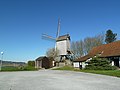 Terdeghem le moulin de la Roome (2).jpg 4,000 × 3,000; 4.49 MB
-
 Terdeghem le moulin de la Roome.jpg 4,000 × 3,000; 4.59 MB
-
 Terdeghem maisons basses du « Village patrimoine ».jpg 4,691 × 3,519; 4.14 MB
-
 Terdeghem moulin de la Roome (1).JPG 4,896 × 2,752; 3.89 MB
-
 Terdeghem moulin de la Roome (2).JPG 4,896 × 2,752; 5.4 MB
-
 Terdeghem moulin de la Roome (3).JPG 2,752 × 4,896; 5.41 MB
-
 Terdeghem moulin de la Roome (4).JPG 4,896 × 2,752; 5.61 MB
-
Terdeghem vidéo du Moulin de la Roome.ogv 13 s, 1,920 × 1,080; 8.84 MB
-
 Terdeghem. Moulin de la Roome.jpg 4,896 × 3,672; 3.92 MB
-
 Terdeghem.- L'église Saint-Martin (1).JPG 4,896 × 2,752; 5.65 MB
-
 Terdeghem.- L'église Saint-Martin (2).JPG 4,896 × 2,752; 5.23 MB
-
 Terdeghem.- les maison du village (1).JPG 4,896 × 2,752; 4.97 MB
-
 Terdeghem.- les maison du village (2).JPG 4,896 × 2,752; 5.21 MB
-
 Terdeghem.- les maison du village (3).JPG 4,896 × 2,752; 5.74 MB
-
 Terdeghem.- les maison du village (4).JPG 4,896 × 2,752; 5.95 MB
-
 Terdeghem.- les maison du village (5).JPG 4,896 × 2,752; 5.75 MB
-
 Wissant Eté2016 Le Herlen rue F. Dubuisson.jpg 4,912 × 3,264; 7.09 MB
.jpg)
.jpg)
.jpg)
.jpg)
.jpg)
.jpg)
.jpg)

.jpg)
.jpg)

.jpg)
.jpg)
.jpg)
.jpg)
.jpg)
.jpg)
.jpg)
.jpg)
.jpg)
.jpg)
.jpg)

.jpg)
.jpg)
.jpg)
.jpg)
.jpg)
.jpg)
.jpg)
.jpg)

.jpg)
.jpg)
.jpg)
.jpg)
.jpg)
.jpg)
.jpg)
.jpg)
.jpg)
.jpg)
.jpg)
.jpg)
.jpg)
.jpg)
.jpg)

.jpg)
.jpg)
.jpg)


.jpg)
.jpg)
.jpg)
.jpg)

.jpg)
.jpg)
.jpg)


_Borne_du_GR128.JPG)
.jpg)
.jpg)

.JPG)
.JPG)


.jpg)
.jpg)
.jpg)
.jpg)
.jpg)
.jpg)
.jpg)
.jpg)

.jpg)
.jpg)
.jpg)
.jpg)
.jpg)
.jpg)
.jpg)
.JPG)
.JPG)
_(5).JPG)
_(6).JPG)
.jpg)


.JPG)
.JPG)
.JPG)
.JPG)

.JPG)
.JPG)
.JPG)
.JPG)
.JPG)
.JPG)
.JPG)

.jpg)
.jpg)
.jpg)