Category:Friederike von Papenburg (ship, 1989)
Jump to navigation
Jump to search
| Object location | | View all coordinates using: OpenStreetMap |
|---|
 | |||||
| Upload media | |||||
| Instance of | |||||
|---|---|---|---|---|---|
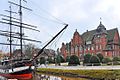
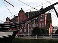
| Location | Papenburg, Emsland, Lower Saxony, Germany | ||||
| Has use | |||||
| Manufacturer | |||||
| Country of registry | |||||
| Service entry |
| ||||
| Length |
| ||||
 | |||||
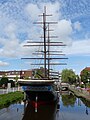
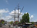
- The ship has two names painted on the hull: Friederike at the bow and Friederike von Papenburg at the stern.
Media in category "Friederike von Papenburg (ship, 1989)"
The following 28 files are in this category, out of 28 total.
-
 Arkadenhaus mit Brigg Friederike.jpg 1,280 × 720; 343 KB
-
 Brigg Friederike und Rathaus Papenburg.jpg 5,892 × 3,928; 1.49 MB
-
 DE-Papenbg-rathaus-friederike.jpg 4,928 × 3,264; 5.15 MB
-
 Friderike von Papenburg, Hauptkanal 01.jpg 4,000 × 3,000; 6 MB
-
 Friderike von Papenburg, Hauptkanal 02.jpg 3,000 × 4,000; 6.23 MB
-
 Friderike von Papenburg, Hauptkanal 03.jpg 3,000 × 4,000; 5.05 MB
-
 Friderike von Papenburg, Hauptkanal 04.jpg 4,000 × 3,000; 5.98 MB
-
 Friderike von Papenburg, Hauptkanal 05.jpg 3,000 × 4,000; 5.56 MB
-
 Friderike von Papenburg, Hauptkanal 06.jpg 4,000 × 3,000; 5.9 MB
-
 Friderike von Papenburg, Hauptkanal 07.jpg 4,000 × 3,000; 6.09 MB
-
 Friderike von Papenburg, Hauptkanal 08.jpg 3,000 × 4,000; 5.78 MB
-
 Friderike von Papenburg, Hauptkanal 09.jpg 3,000 × 4,000; 5.46 MB
-
 Friderike von Papenburg, Hauptkanal 10.jpg 4,000 × 3,000; 5.91 MB
-
 Friderike von Papenburg, Hauptkanal 11.jpg 4,000 × 3,000; 6.05 MB
-
 Friderike von Papenburg, Hauptkanal 12.jpg 3,000 × 4,000; 6.2 MB
-
 Friderike von Papenburg, Hauptkanal 13.jpg 4,000 × 3,000; 5.97 MB
-
 Friderike von Papenburg, Hauptkanal 14.jpg 3,000 × 4,000; 5.53 MB
-
 Friederike S Papenburg 07-05-2015.jpg 1,920 × 2,560; 1.19 MB
-
 Papenburg 2013 by-RaBoe 01.jpg 1,111 × 738; 769 KB
-
 Papenburg 2013 by-RaBoe 03.jpg 1,111 × 738; 772 KB
-
 Papenburg 2013 by-RaBoe 04.jpg 1,111 × 738; 760 KB
-
 Papenburg 2013 by-RaBoe 05.jpg 1,111 × 738; 738 KB
-
 Papenburg 2013 by-RaBoe 07.jpg 1,111 × 738; 679 KB
-
 Papenburg 2013 by-RaBoe 08.jpg 1,111 × 738; 713 KB
-
 Papenburg Friederike Rathaus.JPG 2,048 × 1,536; 609 KB
-
 Papenburg Lenzpumpe.jpg 1,985 × 2,838; 1.04 MB
-
 Papenburg Touristen Information.jpg 2,448 × 3,264; 1.38 MB
-
 Papenburg, de Frederick von Papenburg foto4 2010-05-17 11.39.JPG 3,456 × 2,592; 4.5 MB


