Category:France photographs taken on 2015-08-04
Jump to navigation
Jump to search
Countries of Europe: Austria · Azerbaijan‡ · Belarus · Belgium · Bulgaria · Croatia · Czech Republic · Estonia · Finland · France‡ · Georgia‡ · Germany · Greece · Hungary · Italy · Latvia · Lithuania · Luxembourg · Netherlands‡ · North Macedonia · Norway · Poland · Portugal‡ · Romania · Russia‡ · Slovakia · Spain‡ · Sweden · Switzerland · Turkey‡ · Ukraine · United Kingdom
Specific status: Isle of Man
‡: partly located in Europe
Specific status: Isle of Man
‡: partly located in Europe
| ← | 4 August 2015 | → | ||
| ← | August 2015 | → | ||

France photographs taken on 4 August 2015.
Image files should be categorized here automatically using {{taken on}} template. Direct categorisation is also possible, if automatic is impossible.
Media in category "France photographs taken on 2015-08-04"
The following 200 files are in this category, out of 241 total.
(previous page) (next page)-
 Baslieux (Meurthe-et-M.) chapelle N.D. de Bonté, stuatue de la façade.JPG 2,736 × 3,648; 3.44 MB
-
 Baslieux (Meurthe-et-M.) chapelle N.D. de Bonté.JPG 3,648 × 2,736; 4.31 MB
-
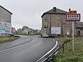
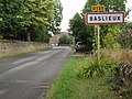 Baslieux (Meurthe-et-M.) city limit sign.JPG 3,648 × 2,736; 4.21 MB
-
 Baslieux (Meurthe-et-M.) croix de chemin 1561.JPG 2,736 × 3,648; 3.53 MB
-
 Baslieux (Meurthe-et-M.) croix de chemin au bourg.JPG 2,736 × 3,648; 3.48 MB
-
 Baslieux (Meurthe-et-M.) croix de chemin Calvaire du Grand Champ.JPG 2,736 × 3,648; 3.24 MB
-
 Baslieux (Meurthe-et-M.) croix de chemin nord.JPG 2,736 × 3,648; 3.45 MB
-
 Baslieux (Meurthe-et-M.) croix de cimetière.JPG 2,736 × 3,648; 3.47 MB
-
 Baslieux (Meurthe-et-M.) dessus de porte d'une grange.JPG 3,648 × 2,736; 4.2 MB
-
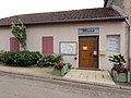 Baslieux (Meurthe-et-M.) mairie.JPG 3,648 × 2,736; 4.23 MB
-
 Baslieux (Meurthe-et-M.) maison d'école.JPG 3,648 × 2,736; 4 MB
-
 Baslieux (Meurthe-et-M.) monument aux morts.JPG 3,648 × 2,736; 4.27 MB
-
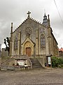 Baslieux (Meurthe-et-M.) église (01).JPG 2,736 × 3,648; 3.56 MB
-
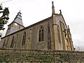 Baslieux (Meurthe-et-M.) église (02).JPG 3,648 × 2,736; 4.01 MB
-
 Bazailles (Meurthe-et-M.) calvaire sur façade maison.JPG 3,648 × 2,736; 4.15 MB
-
 Bazailles (Meurthe-et-M.) château-d'eau.JPG 2,736 × 3,648; 3.37 MB
-
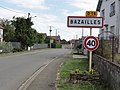 Bazailles (Meurthe-et-M.) city limit sign.JPG 3,648 × 2,736; 4 MB
-
 Bazailles (Meurthe-et-M.) croix de chemin.JPG 2,736 × 3,648; 2.86 MB
-
 Bazailles (Meurthe-et-M.) croix sur façade maison.JPG 2,736 × 3,648; 3.65 MB
-
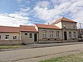
 Bazailles (Meurthe-et-M.) mairie.JPG 3,648 × 2,736; 3.63 MB
-
 Bazailles (Meurthe-et-M.) monument aux morts.JPG 2,736 × 3,648; 2.63 MB
-
 Bazailles (Meurthe-et-M.) statue Madonna et Enfant.JPG 2,736 × 3,648; 3.59 MB
-
 Bazailles (Meurthe-et-M.) école.JPG 3,648 × 2,736; 4.18 MB
-
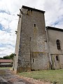
 Bazailles (Meurthe-et-M.) église (01).JPG 3,648 × 2,736; 4.02 MB
-
 Bazailles (Meurthe-et-M.) église (02).JPG 2,736 × 3,648; 3.4 MB
-
 Bazailles (Meurthe-et-M.) église (03).JPG 3,648 × 2,736; 3.95 MB
-
 Bazailles (Meurthe-et-M.) église (04).JPG 3,648 × 2,736; 4.2 MB
-
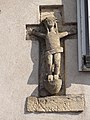
 Bazailles (Meurthe-et-M.) église, statue Christ au liens.JPG 2,736 × 3,648; 3.61 MB
-
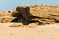 Beach and erosion, Les-Portes-en-Ré, Ré island, Charente-Maritime.jpg 4,319 × 2,865; 10.43 MB
-
 Beach in les Portes-en-Ré august 2015.jpg 4,159 × 2,506; 7.26 MB
-
 Beach in Les-Portes-en-Ré august 2015.jpg 4,539 × 3,021; 10.79 MB
-
 Beach Sainte-Marie-de-Ré 2 Charente Maritime.jpg 4,547 × 3,026; 11.43 MB
-
 Beach Sainte-Marie-de-Ré Charente Maritime.jpg 4,496 × 2,992; 8.58 MB
-
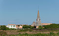 Bell tower Sainte-Marie de Ré, août 2015, Charente Maritime, France.jpg 4,367 × 2,646; 7.05 MB
-
 Blue flowers 3.jpg 1,512 × 1,760; 705 KB
-
 Boismont (Meurthe-et-M.) château-d'eau.JPG 2,736 × 3,648; 3.32 MB
-
 Boismont (Meurthe-et-M.) city limit sign.JPG 3,648 × 2,736; 4.05 MB
-
 Boismont (Meurthe-et-M.) mairie.JPG 3,648 × 2,736; 4.11 MB
-
 Boismont (Meurthe-et-M.) monument aux morts.JPG 3,648 × 2,736; 3.97 MB
-
 Boismont (Meurthe-et-M.) paysage.JPG 3,648 × 2,736; 4.31 MB
-
 Boismont (Meurthe-et-M.) silo avec pont à bascule.JPG 2,736 × 3,648; 3.19 MB
-
 Boismont (Meurthe-et-M.) écoles et mairie.JPG 3,648 × 2,736; 4.1 MB
-
 Boismont (Meurthe-et-M.) église (01).JPG 3,648 × 2,736; 4.01 MB
-
 Boismont (Meurthe-et-M.) église (02).JPG 3,648 × 2,736; 3.89 MB
-
 Bussy-Saint-Georges - Église Saint-Georges - Pierre tombale.jpg 3,000 × 4,000; 2.51 MB
-
 Bussy-Saint-Martin - Église Saint-Martin 1.jpg 4,000 × 3,000; 2.42 MB
-
 Bussy-Saint-Martin - Église Saint-Martin 2.jpg 3,000 × 4,000; 3.35 MB
-
 Cabine telephonique - panoramio.jpg 1,944 × 2,592; 1.26 MB
-
 Cathédrale de la Major de Marseille et tour CMA CGM.jpg 3,264 × 2,448; 1.72 MB
-
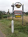 Chenières (Meurthe-et-M.) city limit sign.JPG 2,736 × 3,648; 3.64 MB
-
 Chenières (Meurthe-et-M.) croix de chemin nord.JPG 2,736 × 3,648; 3.37 MB
-
 Chenières (Meurthe-et-M.) croix de chemin sud (01).JPG 3,648 × 2,736; 4.16 MB
-
 Chenières (Meurthe-et-M.) croix de chemin sud (02).JPG 2,736 × 3,648; 3.51 MB
-
 Chenières (Meurthe-et-M.) lavoir (01).JPG 3,648 × 2,736; 4.04 MB
-
 Chenières (Meurthe-et-M.) lavoir (02).JPG 3,648 × 2,736; 4.25 MB
-
 Chenières (Meurthe-et-M.) mairie-école.JPG 3,648 × 2,736; 4.16 MB
-
 Chenières (Meurthe-et-M.) pompe.JPG 2,736 × 3,648; 3.49 MB
-
 Chenières (Meurthe-et-M.) salle des Mille clubs.JPG 3,648 × 2,736; 3.59 MB
-
 Chenières (Meurthe-et-M.) église (01).JPG 2,736 × 3,648; 3.28 MB
-
 Chenières (Meurthe-et-M.) église (02).JPG 3,648 × 2,736; 4.03 MB
-
 Cloud over mountain.jpg 4,408 × 2,216; 1.49 MB
-
 Conches-sur-Gondoires - Église Notre-Dame-de-l'Assomption 1.jpg 4,000 × 3,000; 2 MB
-
 Conches-sur-Gondoires - Église Notre-Dame-de-l'Assomption 2.jpg 4,000 × 3,000; 2.1 MB
-
 Conches-sur-Gondoires - Église Notre-Dame-de-l'Assomption 3.jpg 4,000 × 3,000; 2.04 MB
-
 Conches-sur-Gondoires - Église Notre-Dame-de-l'Assomption 4.jpg 3,000 × 4,000; 2.52 MB
-
 Croix Sacré de Pommerol - panoramio.jpg 1,944 × 2,592; 1.33 MB
-
 Cutry (Meurthe-et-M.) city limit sign.JPG 3,648 × 2,736; 4.24 MB
-
 Cutry (Meurthe-et-M.) croix de chemin 1839, détail.JPG 2,736 × 3,648; 3.09 MB
-
 Cutry (Meurthe-et-M.) croix de chemin 1839.JPG 2,736 × 3,648; 3.63 MB
-
 Cutry (Meurthe-et-M.) croix de chemin avec piédestal sculpté.JPG 2,736 × 3,648; 3.45 MB
-
 Cutry (Meurthe-et-M.) mairie.JPG 3,648 × 2,736; 3.66 MB
-
 Cutry (Meurthe-et-M.) monument aux morts (01).JPG 3,648 × 2,736; 4.1 MB
-
 Cutry (Meurthe-et-M.) monument aux morts (02).JPG 3,648 × 2,736; 4.31 MB
-
 Cutry (Meurthe-et-M.) monument aux morts (03).JPG 2,736 × 3,648; 3.44 MB
-
 Cutry (Meurthe-et-M.) musée.JPG 3,648 × 2,736; 3.96 MB
-
 Cutry (Meurthe-et-M.) école.JPG 3,648 × 2,736; 4.08 MB
-
 Cutry (Meurthe-et-M.) église (01).JPG 2,736 × 3,648; 2.98 MB
-
 Cutry (Meurthe-et-M.) église (02).JPG 3,648 × 2,736; 3.84 MB
-
 Cutry (Meurthe-et-M.) église (03).JPG 2,736 × 3,648; 3.2 MB
-
 Cutry (Meurthe-et-M.) église et croix de mission.JPG 2,736 × 3,648; 3.49 MB
-
 Erosion sand Les Portes-en-Ré Charente Maritime.jpg 4,592 × 3,056; 12.68 MB
-
 Flower in france.jpg 1,552 × 1,336; 611 KB
-
 Flowers near L'Aguille Percee 2.jpg 1,035 × 1,307; 301 KB
-
 Flowers near L'Aguille Percee.jpg 1,212 × 1,141; 504 KB
-
 France mountain panorama.jpg 25,066 × 2,948; 10.46 MB
-
 Gouvernes - Église Saint-Germain-de-Paris.jpg 3,000 × 4,000; 2.31 MB
-

-

-
 Holey stone.jpg 2,639 × 2,832; 2.2 MB
-
 House Nicolas Baudin, windows, Saint-Martin-de-Ré, Ré island, Charente-Maritime.jpg 4,408 × 3,056; 11.17 MB
-
 L'Aguille Percee 2.jpg 7,854 × 2,610; 3.41 MB
-
 L'Aguille Percee 3.jpg 5,456 × 2,768; 3.76 MB
-
 L'Aguille Percee 4.jpg 5,456 × 3,632; 5.61 MB
-
 L'Aguille Percee 5.jpg 3,632 × 5,456; 3.14 MB
-
 L'Aguille Percee.jpg 4,688 × 3,064; 3.15 MB
-
 L'Aiguille Percee - Dôme de la Sache.jpg 9,328 × 3,137; 5.55 MB
-
 L'Aiguille Percee 6.jpg 5,456 × 3,632; 4.66 MB
-
 L'Aiguille Percee hillside.jpg 5,024 × 3,632; 5.47 MB
-
 L'Aiguille Percee massif 2.jpg 5,456 × 3,632; 5.32 MB
-
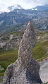
 L'Aiguille Percee rock formation.jpg 2,148 × 2,893; 2.1 MB
-
 L'Aiguille Percee trail 2.jpg 5,717 × 3,278; 4.83 MB
-
 L'Aiguille Percee trail 3.jpg 5,456 × 3,632; 5.43 MB
-
 L'Aiguille Percee trail 4.jpg 10,203 × 3,125; 6.61 MB
-
 L'Aiguille Percee trail 5.jpg 5,456 × 3,632; 5.82 MB
-
 L'Aiguille Percee trail 7.jpg 5,456 × 3,632; 5.42 MB
-
 L'Aiguille Percee trail 8.jpg 5,456 × 3,632; 5.57 MB
-
 L'Aiguille Percee trail 9.jpg 3,632 × 5,456; 6.95 MB
-
 L'Aiguille Percee trail.jpg 5,456 × 3,632; 5.41 MB
-
 L'Aiguille Percée massif 6.jpg 5,456 × 3,632; 5.73 MB
-
 L'Aiguille Percée trail.jpg 3,632 × 5,456; 5.53 MB
-
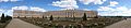
 L'Orangerie de Versailles.jpg 3,840 × 2,160; 4.05 MB
-
 Lac de Tignes.jpg 5,724 × 2,954; 3.43 MB
-
 Laix (Meurthe-et-M.) chapelle du cimetière.JPG 3,648 × 2,736; 4.24 MB
-
 Laix (Meurthe-et-M.) city limit sign.JPG 3,648 × 2,736; 4.21 MB
-
 Laix (Meurthe-et-M.) croix de chemin.JPG 2,736 × 3,648; 3.59 MB
-
 Laix (Meurthe-et-M.) croix de l'ancien cimetière, détail.JPG 2,736 × 3,648; 3.58 MB
-
 Laix (Meurthe-et-M.) croix de l'ancien cimetière.JPG 2,736 × 3,648; 3.36 MB
-
 Laix (Meurthe-et-M.) croix funéraire à l'ancien cimetière.JPG 2,736 × 3,648; 3.54 MB
-
 Laix (Meurthe-et-M.) lavoir (01).JPG 3,648 × 2,736; 4.16 MB
-
 Laix (Meurthe-et-M.) lavoir (02).JPG 3,648 × 2,736; 4.28 MB
-
 Laix (Meurthe-et-M.) linteau porte de maison 1827.JPG 3,648 × 2,736; 4.25 MB
-
 Laix (Meurthe-et-M.) mairie et tracteur.JPG 3,648 × 2,736; 4.06 MB
-
 Laix (Meurthe-et-M.) mairie.JPG 3,648 × 2,736; 3.85 MB
-
 Laix (Meurthe-et-M.) monument aux morts (01).JPG 2,736 × 3,648; 3.49 MB
-
 Laix (Meurthe-et-M.) monument aux morts (02).JPG 2,736 × 3,648; 2.79 MB
-
 Laix (Meurthe-et-M.) monument aux morts (03).JPG 2,736 × 3,648; 2.92 MB
-
 Laix (Meurthe-et-M.) église (01).JPG 3,648 × 2,736; 3.76 MB
-
 Laix (Meurthe-et-M.) église (02).JPG 2,736 × 3,648; 3.21 MB
-
 Longwy (Meurthe-et-M.) city limit sign.JPG 3,648 × 2,736; 4.16 MB
-
 Longwy (Meurthe-et-M.) Hôtel de Ville.JPG 3,648 × 2,736; 4.27 MB
-
 Longwy (Meurthe-et-M.) kiosque à musique.JPG 3,648 × 2,736; 4.14 MB
-
 Longwy (Meurthe-et-M.) monument aux morts (01).JPG 2,736 × 3,648; 3.46 MB
-
 Longwy (Meurthe-et-M.) monument aux morts (02).JPG 2,736 × 3,648; 3.19 MB
-
 Longwy (Meurthe-et-M.) monument aux morts (03).JPG 3,648 × 2,736; 4.25 MB
-
 Longwy (Meurthe-et-M.) monument aux morts (04).JPG 3,648 × 2,736; 4.16 MB
-
 Longwy (Meurthe-et-M.) monument aux morts (05).JPG 3,648 × 2,736; 4.28 MB
-
 Longwy (Meurthe-et-M.) monument aux morts (06).JPG 3,648 × 2,736; 4.2 MB
-
 Longwy (Meurthe-et-M.) monument aux morts (07).JPG 3,648 × 2,736; 4.37 MB
-
 Low tide Les Portes-en-Ré Charente Maritime.jpg 2,819 × 4,592; 8.31 MB
-
 Maison de Tignes.jpg 5,057 × 3,002; 2.79 MB
-
 Mercy-le-Bas (Meurthe-et-M.) château-d'eau.JPG 3,648 × 2,736; 3.83 MB
-
 Mercy-le-Bas (Meurthe-et-M.) city limit sign.JPG 3,648 × 2,736; 3.95 MB
-
 Mercy-le-Bas (Meurthe-et-M.) mairie - la Poste.JPG 3,648 × 2,736; 4.1 MB
-
 Mercy-le-Bas (Meurthe-et-M.) église (01).JPG 2,736 × 3,648; 3.45 MB
-
 Mercy-le-Bas (Meurthe-et-M.) église (02).JPG 3,648 × 2,736; 3.96 MB
-
 Monéteau-FR-89-bar tabac de la Place.jpg 4,032 × 3,024; 2.61 MB
-
 Mountain panorama 2.jpg 14,808 × 2,955; 9.88 MB
-
 Nature reserve sign.jpg 5,456 × 3,632; 5.38 MB
-
 Orange flower 2.jpg 1,360 × 1,280; 394 KB
-
 Oxygene bottles.jpg 4,985 × 3,417; 3.93 MB
-
 Parc Nationel de la Vanoise.jpg 3,632 × 4,665; 5.32 MB
-
 Parterre du Midi de Versailles.jpg 4,912 × 1,080; 512 KB
-
 Photographe - 20150804 15h51 (10906).jpg 2,194 × 3,291; 4.15 MB
-
 Pointe de Fresse trail.jpg 5,456 × 3,632; 4.5 MB
-
 Pommerol - panoramio.jpg 1,944 × 2,592; 1.25 MB
-
 Pond and mountain.jpg 4,632 × 3,104; 3.82 MB
-
 Reserve Naturelle sign.jpg 2,913 × 5,286; 4.59 MB
-
 Rock formation in Tignes.jpg 3,632 × 5,456; 5.49 MB
-
 Rock peak 2.jpg 4,144 × 3,632; 4.01 MB
-
 Rock peak 4.jpg 3,632 × 5,456; 5.64 MB
-
 Rock peak 5.jpg 3,632 × 4,629; 4.8 MB
-
 Rock peak 6.jpg 2,949 × 5,181; 4.63 MB
-
 Rock peak.jpg 3,632 × 5,456; 3.58 MB
-
 Round straw bales - panoramio (1).jpg 2,048 × 1,262; 1.87 MB
-
 Round straw bales - panoramio.jpg 2,048 × 1,152; 1.76 MB
-
 Round straw bales at Morsan - panoramio.jpg 2,048 × 1,152; 1.58 MB
-
 Réhon (Meurthe-et-M.) calvary.JPG 3,648 × 2,736; 3.74 MB
-
 Réhon (Meurthe-et-M.) cimetière et son grand croix.JPG 3,648 × 2,736; 4.31 MB
-
 Réhon (Meurthe-et-M.) city limit sign and calvary.JPG 3,648 × 2,736; 3.95 MB
-
 Réhon (Meurthe-et-M.) city limit sign Heumont.JPG 3,648 × 2,736; 3.99 MB
-
 Réserve naturelle nationale de Tignes-Champagny 2.jpg 5,192 × 3,136; 5.31 MB
-
 Réserve naturelle nationale de Tignes-Champagny.jpg 1,800 × 1,034; 656 KB
-
 Saint genis portal.jpg 2,701 × 3,076; 6.05 MB
-
 Saint-Martin-de-Ré, port, close-up, Ré island, Charente-Maritime.jpg 4,474 × 3,056; 7.84 MB
-
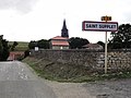 Saint-Supplet (Meurthe-et-M.) city limit sign et église.JPG 3,648 × 2,736; 2.82 MB
-
 Saint-Supplet (Meurthe-et-M.) mairie.JPG 3,648 × 2,736; 3.95 MB
-
 Saint-Supplet (Meurthe-et-M.) monument aux morts (01).JPG 2,736 × 3,648; 3.5 MB
-
 Saint-Supplet (Meurthe-et-M.) monument aux morts (02).JPG 2,736 × 3,648; 3.58 MB
-
 Saint-Supplet (Meurthe-et-M.) monument aux morts (03).JPG 2,736 × 3,648; 3.65 MB
-
 Saint-Supplet (Meurthe-et-M.) rivière Sainte-Anne.JPG 2,736 × 3,648; 3.62 MB
-
 Saint-Supplet (Meurthe-et-M.) église (01).JPG 3,648 × 2,736; 4.14 MB
-
 Saint-Supplet (Meurthe-et-M.) église (02).JPG 2,736 × 3,648; 3.63 MB
-
 Sand concretions Les Portes-en-Ré Charente Maritime.jpg 4,440 × 3,006; 9.98 MB
-
 Sand Les Portes-en-Ré Charente Maritime.jpg 4,592 × 3,056; 13.6 MB
-

-
 Sea at Sainte-Marie de Ré, août 2015, Charente Maritime, France.jpg 4,592 × 3,056; 9.63 MB
-
 Seaboard, Les-Portes-en-Ré, Ré island, Charente-Maritime.jpg 4,592 × 3,056; 10.34 MB
-
 Sentier au cascades - panoramio.jpg 2,592 × 1,944; 1.3 MB
-
 Sign VTT.jpg 3,568 × 3,632; 4.04 MB
-
 Stone texture.jpg 4,824 × 1,984; 2.76 MB
-
 Stratocumulus cumulogenitus - 20150804 16h39 (10909).jpg 5,217 × 3,478; 5.89 MB
-
 Table d' orientation de L'Aiguille Percee.jpg 5,456 × 3,632; 3.77 MB
-
 TGV Valenciennes (32955376483).jpg 6,000 × 3,376; 15.75 MB
-
 Tignes - Aiguille Percee massif.jpg 4,816 × 2,584; 2.58 MB
-
 Tignes - panorama.jpg 11,492 × 2,813; 5.77 MB
-
 Tignes - rock formation.jpg 3,456 × 2,896; 3.57 MB
-
 Tignes - trail 2.jpg 5,456 × 3,632; 4.98 MB
-
 Tignes - trail 3.jpg 5,456 × 3,632; 5.67 MB
-
 Tignes - trail 4.jpg 5,456 × 3,632; 4.56 MB
-
 Tignes - trail.jpg 5,456 × 3,632; 5.23 MB
_chapelle_N.D._de_Bont%C3%A9,_stuatue_de_la_fa%C3%A7ade.JPG)
_chapelle_N.D._de_Bont%C3%A9.JPG)
_city_limit_sign.JPG)
_croix_de_chemin_1561.JPG)
_croix_de_chemin_au_bourg.JPG)
_croix_de_chemin_Calvaire_du_Grand_Champ.JPG)
_croix_de_chemin_nord.JPG)
_croix_de_cimeti%C3%A8re.JPG)
_dessus_de_porte_d%27une_grange.JPG)
_mairie.JPG)
_maison_d%27%C3%A9cole.JPG)
_monument_aux_morts.JPG)
_%C3%A9glise_(01).JPG)
_%C3%A9glise_(02).JPG)
_calvaire_sur_fa%C3%A7ade_maison.JPG)
_ch%C3%A2teau-d%27eau.JPG)
_city_limit_sign.JPG)
_croix_de_chemin.JPG)
_croix_sur_fa%C3%A7ade_maison.JPG)
_mairie.JPG)
_monument_aux_morts.JPG)
_statue_Madonna_et_Enfant.JPG)
_%C3%A9cole.JPG)
_%C3%A9glise_(01).JPG)
_%C3%A9glise_(02).JPG)
_%C3%A9glise_(03).JPG)
_%C3%A9glise_(04).JPG)
_%C3%A9glise,_statue_Christ_au_liens.JPG)


_ch%C3%A2teau-d%27eau.JPG)
_city_limit_sign.JPG)
_mairie.JPG)
_monument_aux_morts.JPG)
_paysage.JPG)
_silo_avec_pont_%C3%A0_bascule.JPG)
_%C3%A9coles_et_mairie.JPG)
_%C3%A9glise_(01).JPG)
_%C3%A9glise_(02).JPG)


_city_limit_sign.JPG)
_croix_de_chemin_nord.JPG)
_croix_de_chemin_sud_(01).JPG)
_croix_de_chemin_sud_(02).JPG)
_lavoir_(01).JPG)
_lavoir_(02).JPG)
_mairie-%C3%A9cole.JPG)
_pompe.JPG)
_salle_des_Mille_clubs.JPG)
_%C3%A9glise_(01).JPG)
_%C3%A9glise_(02).JPG)


_city_limit_sign.JPG)
_croix_de_chemin_1839,_d%C3%A9tail.JPG)
_croix_de_chemin_1839.JPG)
_croix_de_chemin_avec_pi%C3%A9destal_sculpt%C3%A9.JPG)
_mairie.JPG)
_monument_aux_morts_(01).JPG)
_monument_aux_morts_(02).JPG)
_monument_aux_morts_(03).JPG)
_mus%C3%A9e.JPG)
_%C3%A9cole.JPG)
_%C3%A9glise_(01).JPG)
_%C3%A9glise_(02).JPG)
_%C3%A9glise_(03).JPG)
_%C3%A9glise_et_croix_de_mission.JPG)


_over_the_Sa%C3%B4ne._In_the_background_the_tower_of_the_Notre-Dame_Basilica._-_panoramio.jpg)


_chapelle_du_cimeti%C3%A8re.JPG)
_city_limit_sign.JPG)
_croix_de_chemin.JPG)
_croix_de_l%27ancien_cimeti%C3%A8re,_d%C3%A9tail.JPG)
_croix_de_l%27ancien_cimeti%C3%A8re.JPG)
_croix_fun%C3%A9raire_%C3%A0_l%27ancien_cimeti%C3%A8re.JPG)
_lavoir_(01).JPG)
_lavoir_(02).JPG)
_linteau_porte_de_maison_1827.JPG)
_mairie_et_tracteur.JPG)
_mairie.JPG)
_monument_aux_morts_(01).JPG)
_monument_aux_morts_(02).JPG)
_monument_aux_morts_(03).JPG)
_%C3%A9glise_(01).JPG)
_%C3%A9glise_(02).JPG)
_city_limit_sign.JPG)
_H%C3%B4tel_de_Ville.JPG)
_kiosque_%C3%A0_musique.JPG)
_monument_aux_morts_(01).JPG)
_monument_aux_morts_(02).JPG)
_monument_aux_morts_(03).JPG)
_monument_aux_morts_(04).JPG)
_monument_aux_morts_(05).JPG)
_monument_aux_morts_(06).JPG)
_monument_aux_morts_(07).JPG)


_ch%C3%A2teau-d%27eau.JPG)
_city_limit_sign.JPG)
_mairie_-_la_Poste.JPG)
_%C3%A9glise_(01).JPG)
_%C3%A9glise_(02).JPG)


.jpg)


.jpg)


_calvary.JPG)
_cimeti%C3%A8re_et_son_grand_croix.JPG)
_city_limit_sign_and_calvary.JPG)
_city_limit_sign_Heumont.JPG)


_city_limit_sign_et_%C3%A9glise.JPG)
_mairie.JPG)
_monument_aux_morts_(01).JPG)
_monument_aux_morts_(02).JPG)
_monument_aux_morts_(03).JPG)
_rivi%C3%A8re_Sainte-Anne.JPG)
_%C3%A9glise_(01).JPG)
_%C3%A9glise_(02).JPG)


_from_1647._Gray,_d%C3%A9partement_de_la_Haute-Sa%C3%B4ne,_France._On_the_right_the_tower_of_the_Notre-Dame_Basilica._-_panoramio.jpg)


.jpg)

.jpg)


