Category:Frampton, Lincolnshire
Jump to navigation
Jump to search
English: Frampton is a village in Lincolnshire, England. The village is situated just to the south of the now spreading town of Boston and to the east, the seaward side of the A16 road. Which runs along the townlands (See The Fens, Formation.) The village lies on the edge of one of the great marine creek levees formed during the Bronze Age but three of four kilometres from the modern saltmarsh.
village and civil parish in Borough of Boston, Lincolnshire, England  | |||||
| Upload media | |||||
| Instance of | |||||
|---|---|---|---|---|---|
| Location | Boston, Lincolnshire, East Midlands, England | ||||
 | |||||
Subcategories
This category has the following 8 subcategories, out of 8 total.
Media in category "Frampton, Lincolnshire"
The following 200 files are in this category, out of 249 total.
(previous page) (next page)-

-
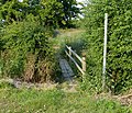
 Access road - geograph.org.uk - 5661418.jpg 640 × 480; 77 KB
-
 Access track - geograph.org.uk - 5661420.jpg 640 × 480; 61 KB
-
 Barn at Manor Farm - geograph.org.uk - 3695012.jpg 1,600 × 1,117; 449 KB
-
 Bench overlooking RSPB Frampton Marsh reserve - geograph.org.uk - 3664147.jpg 3,394 × 2,547; 2.46 MB
-
 Beyond the sea wall - geograph.org.uk - 1206545.jpg 640 × 480; 58 KB
-
 Black barn along Sandholme Lane - geograph.org.uk - 3695122.jpg 1,600 × 1,091; 395 KB
-
 Boardsides (A1121) towards Boston - geograph.org.uk - 3238217.jpg 3,088 × 2,056; 1.66 MB
-
 Bridge over Old Hammond Beck - geograph.org.uk - 3238255.jpg 3,088 × 2,056; 2.21 MB
-
 Bull Lane - geograph.org.uk - 5568631.jpg 640 × 480; 53 KB
-
 Bull Lane looking east from Coupledyke Lane - geograph.org.uk - 4393427.jpg 4,320 × 3,240; 5.65 MB
-
 Cabbage field along Sandholme Lane - geograph.org.uk - 3694960.jpg 1,600 × 1,369; 602 KB
-
 Cattle bridge across a tidal creek - geograph.org.uk - 3664172.jpg 4,000 × 3,000; 3.59 MB
-
 Cattle grazing Frampton saltmarsh - geograph.org.uk - 3664130.jpg 2,835 × 2,245; 1.8 MB
-
 Cattle grazing on saltmarsh in The Wash near Frampton Marsh - geograph.org.uk - 4232789.jpg 4,320 × 3,240; 5.44 MB
-
 Cattle grazing the edge of the salt marsh - geograph.org.uk - 3664144.jpg 4,000 × 3,000; 3.54 MB
-
 Cattle grazing the salt marsh at Frampton Marsh - geograph.org.uk - 3664170.jpg 3,154 × 2,698; 2.43 MB
-
 Cattle Handling Pen - geograph.org.uk - 1206459.jpg 640 × 480; 65 KB
-
 Cattle heading for a drink - geograph.org.uk - 3664765.jpg 2,930 × 2,234; 1.88 MB
-
 Cattle near the sea bank - geograph.org.uk - 3664164.jpg 3,041 × 2,382; 2 MB
-
 Church End - geograph.org.uk - 3285443.jpg 640 × 427; 122 KB
-
 Clear to Boston - geograph.org.uk - 4253900.jpg 1,280 × 960; 320 KB
-
 Corner Cottage, Hubbert's Bridge - geograph.org.uk - 4253915.jpg 1,280 × 874; 466 KB
-
 Coupledyke Lane - geograph.org.uk - 5568619.jpg 640 × 480; 65 KB
-
 Coupledyke Lane - geograph.org.uk - 5568628.jpg 640 × 480; 46 KB
-
 Coupledyke Lane - geograph.org.uk - 5568632.jpg 640 × 480; 47 KB
-
 Cow on the Macmillan Way footpath - geograph.org.uk - 3664470.jpg 3,527 × 2,445; 2.37 MB
-
 Cow on the sea bank - geograph.org.uk - 3664469.jpg 3,663 × 2,667; 2.68 MB
-
 Crop field north of Spotfield Lane - geograph.org.uk - 3621573.jpg 640 × 480; 59 KB
-
 Crop field off, Kirton End - geograph.org.uk - 3621557.jpg 640 × 480; 86 KB
-
 Cross Bank on Frampton Marsh - geograph.org.uk - 3662306.jpg 4,000 × 3,000; 4.89 MB
-
 Daffodil Field off Sandholme Lane - geograph.org.uk - 4415852.jpg 4,156 × 2,771; 7.5 MB
-
 Daffodils next to Sandholme Lane - geograph.org.uk - 4419732.jpg 3,776 × 2,520; 4.02 MB
-
 Drain across Frampton Marsh - geograph.org.uk - 3662270.jpg 3,543 × 2,654; 2.81 MB
-
 Drain behind the sea bank at Frampton Marsh - geograph.org.uk - 3663021.jpg 3,996 × 2,913; 3.38 MB
-
 Drain-side footpath at Hubbert's Bridge - geograph.org.uk - 4253865.jpg 1,280 × 960; 409 KB
-
 Dyke from Bull Lane - geograph.org.uk - 5568635.jpg 640 × 480; 64 KB
-
 Electricity pylons crossing Kirton Marsh - geograph.org.uk - 3694967.jpg 1,600 × 1,216; 474 KB
-
 Entering Hubbert's Bridge on Frampton Lane - geograph.org.uk - 3649499.jpg 2,256 × 1,504; 2.23 MB
-
 Entering Hubberts Bridge - geograph.org.uk - 2575691.jpg 800 × 600; 229 KB
-
 Entrance gateway near Frampton Hall, Lincolnshire - geograph.org.uk - 4227484.jpg 4,320 × 3,240; 5.74 MB
-
 Factory and houses along Ralphs Lane - geograph.org.uk - 3670141.jpg 2,521 × 1,850; 1.88 MB
-
 Farm along Sandholme Lane - geograph.org.uk - 3695396.jpg 1,600 × 1,157; 408 KB
-
 Farm buildings on Frampton Marsh - geograph.org.uk - 3661965.jpg 2,269 × 1,538; 1.02 MB
-
 Farm track - geograph.org.uk - 6132131.jpg 640 × 575; 76 KB
-
 Farm track across Frampton Marsh - geograph.org.uk - 3661982.jpg 3,406 × 2,507; 2.46 MB
-
 Farmland near Roads Farm, Frampton - geograph.org.uk - 4232053.jpg 4,320 × 3,240; 5.92 MB
-
 Farmland near the village of Frampton - geograph.org.uk - 3688770.jpg 1,600 × 1,173; 325 KB
-
 Farmland south of Wyberton - geograph.org.uk - 3688681.jpg 1,600 × 1,239; 689 KB
-
 Farmland towards London Road - geograph.org.uk - 3621575.jpg 640 × 480; 61 KB
-
 Farmland, Frampton - geograph.org.uk - 3621567.jpg 640 × 480; 68 KB
-
 Farmland, Great Fen - geograph.org.uk - 4361278.jpg 640 × 480; 64 KB
-
 Field of cauliflowers east of Frampton - geograph.org.uk - 4231803.jpg 4,320 × 3,240; 5.96 MB
-
 Field on the southern edge of Wyberton - geograph.org.uk - 3670140.jpg 1,600 × 1,444; 812 KB
-
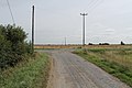
 Fields north of Frampton Roads - geograph.org.uk - 5661405.jpg 640 × 480; 55 KB
-
 Five house Lane - geograph.org.uk - 2768409.jpg 1,280 × 853; 335 KB
-
 Flat farmland along Sandholme Lane - geograph.org.uk - 3695137.jpg 1,600 × 1,163; 548 KB
-
 Flooded grassland at Frampton Marsh - geograph.org.uk - 4232656.jpg 4,320 × 3,240; 5.33 MB
-
 Flooded grassland inside the sea bank - Frampton Marsh - geograph.org.uk - 4232679.jpg 4,320 × 3,240; 5.55 MB
-
 Footbridge along Sandholme Lane - geograph.org.uk - 3690273.jpg 1,600 × 1,369; 1.12 MB
-
 Footpath on the old sea bank near Sandholme - geograph.org.uk - 4393846.jpg 4,320 × 3,240; 5.77 MB
-

-
 Footpath to The Wash at Frampton Marsh - geograph.org.uk - 4232698.jpg 4,320 × 3,240; 5.48 MB
-
 Frampton Hall Gatepiers - geograph.org.uk - 3284998.jpg 640 × 427; 146 KB
-
 Frampton House near Kirton - geograph.org.uk - 5593692.jpg 640 × 477; 237 KB
-
 Frampton Lane ^ Old Hammond Beck - geograph.org.uk - 2768396.jpg 1,280 × 853; 352 KB
-
 Frampton Marsh - geograph.org.uk - 1206537.jpg 640 × 480; 47 KB
-
 Frampton Marsh - geograph.org.uk - 431800.jpg 640 × 477; 76 KB
-
 Frampton Marsh - geograph.org.uk - 5661417.jpg 640 × 480; 42 KB
-
 Frampton Marsh - geograph.org.uk - 5661469.jpg 640 × 480; 56 KB
-
 Frampton Marsh - geograph.org.uk - 5661472.jpg 640 × 480; 49 KB
-
 Frampton Marsh farmland - geograph.org.uk - 3661975.jpg 2,969 × 3,471; 3.16 MB
-

-
 Frampton Marsh Visitor Centre - geograph.org.uk - 2578230.jpg 640 × 480; 118 KB
-
 Frampton Marsh, July 2009 - geograph.org.uk - 4732486.jpg 1,024 × 785; 118 KB
-

-
 Frampton Roads - geograph.org.uk - 5661400.jpg 640 × 480; 89 KB
-
 Frampton Roads - geograph.org.uk - 5661402.jpg 640 × 480; 73 KB
-
 Frampton Roads - geograph.org.uk - 5661403.jpg 640 × 480; 59 KB
-
 Frampton Roads heading to The Wash - geograph.org.uk - 4231797.jpg 4,320 × 3,240; 5.47 MB
-
 Frampton, aerial 2016 - geograph.org.uk - 5012831.jpg 1,600 × 1,067; 367 KB
-
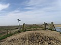
 Gate across path - geograph.org.uk - 5661423.jpg 640 × 480; 81 KB
-
 Gate on top of the sea bank - geograph.org.uk - 3662262.jpg 3,863 × 2,455; 2.94 MB
-
-
 Gate onto the saltmarsh of The Wash near Frampton Marsh - geograph.org.uk - 4232771.jpg 4,320 × 3,240; 5.77 MB
-
 Gates on the sea bank - geograph.org.uk - 4232716.jpg 4,320 × 3,240; 5.87 MB
-
 Geese on Frampton Marsh RSPB site - geograph.org.uk - 4232624.jpg 4,320 × 3,240; 5.41 MB
-
 Getting ready for a train to pass - geograph.org.uk - 4253895.jpg 1,280 × 949; 309 KB
-
 Giving nature a helping hand - geograph.org.uk - 4397624.jpg 4,320 × 3,240; 5.19 MB
-
 Grassland at Frampton Marsh - geograph.org.uk - 4232609.jpg 4,320 × 3,240; 5.06 MB
-
 Grazing near Boardsides - geograph.org.uk - 3598436.jpg 640 × 412; 39 KB
-
 Great Crested Grebe - Frampton Marsh Nature Reserve - geograph.org.uk - 2329906.jpg 2,880 × 1,913; 2.78 MB
-
 Greenwich Meridian marker near Frampton, Lincolnshire - geograph.org.uk - 4231898.jpg 4,320 × 3,240; 5.7 MB
-
 Hall Lane - geograph.org.uk - 5661399.jpg 640 × 480; 86 KB
-
 Hall Lane looking south - geograph.org.uk - 4415588.jpg 4,204 × 2,803; 6.74 MB
-
 Hall Lane, Frampton (1) - geograph.org.uk - 5633077.jpg 640 × 480; 134 KB
-
 Hall Lane, Frampton (2) - geograph.org.uk - 5633078.jpg 640 × 480; 223 KB
-
 Heading north along the sea bank at Frampton Marsh - geograph.org.uk - 3664142.jpg 4,000 × 3,000; 3.47 MB
-
 Hedge and tree along Millfield Lane East - geograph.org.uk - 3688787.jpg 1,600 × 1,259; 428 KB
-
 Holiday cottages at The Elms - geograph.org.uk - 4253903.jpg 1,280 × 880; 276 KB
-
 Holiday homes - geograph.org.uk - 1895224.jpg 1,600 × 1,200; 278 KB
-
 House along Millfield Lane West - geograph.org.uk - 3688646.jpg 1,600 × 1,024; 450 KB
-
 House for sale in Frampton, Lincolnshire - geograph.org.uk - 4227468.jpg 4,320 × 3,240; 5.47 MB
-
 Houses in the village of Frampton - geograph.org.uk - 3688883.jpg 1,600 × 1,305; 667 KB
-
 Hubbert's Bridge - geograph.org.uk - 4138869.jpg 640 × 480; 57 KB
-
 Hubbert's Bridge - geograph.org.uk - 4138871.jpg 640 × 480; 49 KB
-
 Hubbert's Bridge Railway Station - geograph.org.uk - 1883503.jpg 3,296 × 2,472; 1.99 MB
-

-
 Hunters of the sky - geograph.org.uk - 3664120.jpg 3,314 × 2,864; 2.99 MB
-
 Irrigating a potato field near Frampton - geograph.org.uk - 3688901.jpg 1,600 × 1,241; 511 KB
-
 Irrigating the crops near Frampton - geograph.org.uk - 3688757.jpg 1,600 × 1,200; 470 KB
-
 It's a topsy turvy world - geograph.org.uk - 1434982.jpg 640 × 480; 136 KB
-
 Junction of Bannister's Lane and West End Road - geograph.org.uk - 4415555.jpg 4,272 × 2,848; 7.66 MB
-
 Junction of Kell's Drove and holmes Lane - geograph.org.uk - 3644988.jpg 2,256 × 1,504; 1.85 MB
-
 Junction of paths - geograph.org.uk - 5661466.jpg 640 × 480; 64 KB
-
 Junction of paths - geograph.org.uk - 5661477.jpg 640 × 480; 44 KB
-

-
 Lagoon on Frampton Marsh RSPB site - geograph.org.uk - 4232636.jpg 4,320 × 3,240; 5.64 MB
-
 Lane passing through Sandholme - geograph.org.uk - 3695385.jpg 1,600 × 1,272; 654 KB
-
 Lilley's Bridge - geograph.org.uk - 2768138.jpg 1,280 × 853; 448 KB
-
 Line of trees near College Farm - geograph.org.uk - 3661923.jpg 3,814 × 2,828; 3.47 MB
-
 London Road towards Wyberton - geograph.org.uk - 3670146.jpg 3,010 × 2,303; 1.97 MB
-
 Longitude Zero marker - geograph.org.uk - 5661407.jpg 640 × 480; 108 KB
-
 Longitude Zero meridian monument near Frampton, Lincolnshire - geograph.org.uk - 4231917.jpg 4,320 × 3,240; 5.43 MB
-

-
 Looking northwest along Millfield Lane West - geograph.org.uk - 3688714.jpg 1,600 × 1,228; 407 KB
-
 Looking towards Frampton Church - geograph.org.uk - 5568624.jpg 640 × 480; 72 KB
-
 Macmillan Way - geograph.org.uk - 5661474.jpg 640 × 480; 47 KB
-
 Macmillan Way - geograph.org.uk - 5661476.jpg 640 × 480; 47 KB
-
 Manor Farm along Sandholme Lane - geograph.org.uk - 3695037.jpg 1,024 × 861; 143 KB
-
 Marsh Harrier at Frampton Marsh - geograph.org.uk - 1432409.jpg 640 × 480; 144 KB
-
 Marvellous marsh - geograph.org.uk - 3664673.jpg 3,379 × 2,850; 3.12 MB
-
 Memorial Cottage on Thornimans Lane - geograph.org.uk - 3688905.jpg 1,600 × 1,163; 763 KB
-
 Middlegate Road (West), Kirton - geograph.org.uk - 2769689.jpg 1,280 × 853; 413 KB
-
 Middlegate Road - geograph.org.uk - 3285020.jpg 640 × 427; 143 KB
-
 Middlegate Road East in Frampton - geograph.org.uk - 3690251.jpg 1,600 × 1,200; 714 KB
-
 Millennium beacon on Frampton Roads east of Frampton - geograph.org.uk - 4231947.jpg 4,320 × 3,240; 5.46 MB
-
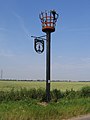 Millennium Beacon, Frampton, Lincs - geograph.org.uk - 227640.jpg 480 × 640; 253 KB
-

-
 Millfield Lane West junction with the A16 - geograph.org.uk - 3688724.jpg 1,600 × 1,200; 534 KB
-
 Millfield Lane West near Wyberton - geograph.org.uk - 3688605.jpg 1,600 × 1,193; 539 KB
-
 Moore's Arms - geograph.org.uk - 3285053.jpg 640 × 427; 112 KB
-
 Moore's Arms - geograph.org.uk - 3285058.jpg 427 × 640; 103 KB
-
 Mounting block - geograph.org.uk - 3285072.jpg 640 × 427; 138 KB
-
 Muddy track off Frampton Roads - geograph.org.uk - 3228997.jpg 3,088 × 2,056; 1.82 MB
-
 Multon Ings Lane, near Kirton End - geograph.org.uk - 4414823.jpg 4,272 × 2,848; 7.55 MB
-
 National Grid Gasworks, Spotfield Lane - geograph.org.uk - 4414837.jpg 3,873 × 2,528; 5.49 MB
-
 New Hammond Beck - geograph.org.uk - 948825.jpg 640 × 427; 108 KB
-
 New Sea Bank - geograph.org.uk - 5661473.jpg 640 × 480; 52 KB
-
 New steps and path - geograph.org.uk - 3664472.jpg 4,000 × 3,000; 3.6 MB
-
 North Forty Foot Drain - geograph.org.uk - 4361285.jpg 640 × 480; 57 KB
-
 Obstacle course - geograph.org.uk - 1434961.jpg 480 × 640; 144 KB
-

-
 Old Hammond Beck, Towards Boston - geograph.org.uk - 2768404.jpg 1,280 × 853; 288 KB
-
 Old Milestone - geograph.org.uk - 1186353.jpg 480 × 640; 130 KB
-
 Old Milestone - geograph.org.uk - 2781957.jpg 1,024 × 768; 298 KB
-
 Old shed near Baker's Bridge - geograph.org.uk - 4444655.jpg 1,024 × 768; 251 KB
-
 On the old Sea Bank, near Wyberton Marsh - geograph.org.uk - 4419826.jpg 3,776 × 2,520; 4 MB
-
 Parallel lines - geograph.org.uk - 1432689.jpg 640 × 480; 127 KB
-
 Park Cottage - geograph.org.uk - 3285087.jpg 640 × 427; 117 KB
-
 Park Cottage - geograph.org.uk - 3285092.jpg 640 × 427; 92 KB
-
 Passing Hubberts Bridge Down Home signal - geograph.org.uk - 4253896.jpg 1,280 × 1,004; 326 KB
-
 Passing place on Millfield Lane West - geograph.org.uk - 3688697.jpg 1,600 × 1,135; 648 KB
-
 Perfectly ploughed - geograph.org.uk - 4225698.jpg 4,320 × 3,240; 5.78 MB
-
 Power harrowing - geograph.org.uk - 1206909.jpg 640 × 480; 78 KB
-
 Public footpath along Cross Bank - geograph.org.uk - 3662287.jpg 3,424 × 2,723; 2.64 MB
-
 Ralphs Lane (B1391) - geograph.org.uk - 3621560.jpg 640 × 480; 67 KB
-
 Ralphs Lane (B1391) - geograph.org.uk - 3621569.jpg 640 × 480; 64 KB
-
 Ralphs Lane (B1391) - geograph.org.uk - 3621577.jpg 640 × 480; 61 KB
-
 Road junction and finger post - geograph.org.uk - 5568617.jpg 640 × 480; 86 KB
-
 Roads Farm - geograph.org.uk - 5661408.jpg 640 × 480; 56 KB
-
 RSPB Frampton Marsh - geograph.org.uk - 5472298.jpg 1,600 × 1,067; 494 KB
-
 RSPB Frampton Marsh Visitor Centre - geograph.org.uk - 5661412.jpg 640 × 480; 95 KB
-
 RSPB Frampton Marsh Visitor Centre - geograph.org.uk - 5661499.jpg 640 × 480; 77 KB
-
 RSPB Frampton Marsh.jpg 3,264 × 1,952; 1.4 MB
-
 Salt marsh along The Wash coast - geograph.org.uk - 3664753.jpg 3,159 × 2,655; 2.37 MB
-
 Sandholme House towards Sandholme Lane - geograph.org.uk - 4415855.jpg 4,272 × 2,848; 5.45 MB
-
 Sandholme Lane - geograph.org.uk - 1421424.jpg 640 × 426; 72 KB
-
 Sandholme Lane - geograph.org.uk - 1421430.jpg 640 × 426; 88 KB
-
 Sandholme Lane - geograph.org.uk - 5568639.jpg 640 × 480; 49 KB
-
 Sandholme Lane in Sandholme - geograph.org.uk - 3695373.jpg 1,600 × 1,179; 500 KB
-
 Sandholme Lane near Manor Farm - geograph.org.uk - 3695360.jpg 1,600 × 1,200; 401 KB
-
 Sandholme Lane south of Frampton - geograph.org.uk - 3694947.jpg 1,600 × 1,156; 553 KB
-
 Sea bank at Frampton Marsh - geograph.org.uk - 3662266.jpg 3,988 × 2,795; 3.48 MB
-
 Seat on the sea bank - geograph.org.uk - 3664827.jpg 3,583 × 2,780; 2.82 MB
-
 Sharp bend in the sea bank - geograph.org.uk - 3661938.jpg 4,000 × 3,000; 4.58 MB
-
 Sleaford 15 - geograph.org.uk - 2781958.jpg 768 × 1,024; 409 KB
-
 Sluice, Frampton marsh - geograph.org.uk - 1206483.jpg 640 × 480; 100 KB
-
 Small sluice on Frampton Marsh - geograph.org.uk - 4232691.jpg 4,320 × 3,240; 6.05 MB
-
 Small tree and daffodils on Sandholme Lane - geograph.org.uk - 4393782.jpg 4,320 × 3,240; 5.62 MB
-
 Small woodland in Sandholme, Lincolnshire - geograph.org.uk - 4393768.jpg 4,320 × 3,240; 5.42 MB
-
 South Forty Foot Drain - geograph.org.uk - 3598431.jpg 640 × 480; 48 KB
-
 South Forty Foot Drain - geograph.org.uk - 3598438.jpg 640 × 480; 45 KB
-
 South Forty Foot Drain - geograph.org.uk - 4138874.jpg 640 × 480; 57 KB
-
 South Forty Foot Drain - geograph.org.uk - 4138875.jpg 640 × 480; 58 KB
-
 South Forty Foot Drain - Hubbert's Bridge - geograph.org.uk - 1883487.jpg 3,296 × 2,472; 1.92 MB
-

-
 Station Road towards Hubberts Bridge - geograph.org.uk - 2575678.jpg 800 × 600; 205 KB
-
 Steps down the sea bank - geograph.org.uk - 3662280.jpg 3,487 × 2,546; 2.68 MB
-
 Swallows on the telephone wires - geograph.org.uk - 4138882.jpg 640 × 480; 41 KB


_towards_Boston_-_geograph.org.uk_-_3238217.jpg)


_-_geograph.org.uk_-_5633077.jpg)
_-_geograph.org.uk_-_5633078.jpg)


,_Kirton_-_geograph.org.uk_-_2769689.jpg)


_-_geograph.org.uk_-_2769692.jpg)


_-_geograph.org.uk_-_3621560.jpg)
_-_geograph.org.uk_-_3621569.jpg)
_-_geograph.org.uk_-_3621577.jpg)


