Category:Foveran (civil parish)
Jump to navigation
Jump to search
Scottish parish in Aberdeenshire, Scotland, UK | |||||
| Upload media | |||||
| Instance of | |||||
|---|---|---|---|---|---|
| Named after | |||||
| Location |
| ||||
| Population |
| ||||
| Area |
| ||||
 | |||||
Subcategories
This category has the following 3 subcategories, out of 3 total.
Media in category "Foveran (civil parish)"
The following 200 files are in this category, out of 335 total.
(previous page) (next page)-
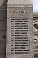
 "We shall remember them" I - geograph.org.uk - 2895178.jpg 865 × 1,600; 481 KB
-
 "We shall remember them" II - geograph.org.uk - 2895184.jpg 868 × 1,600; 469 KB
-
 "We shall remember them" III - geograph.org.uk - 2895206.jpg 1,064 × 1,600; 706 KB
-
 A new woodland, Wateridgemuir - geograph.org.uk - 5641664.jpg 1,024 × 683; 462 KB
-
 A90 bypassing Foveran - geograph.org.uk - 6413870.jpg 3,515 × 2,730; 2.31 MB
-
 A90 heading north - geograph.org.uk - 3993161.jpg 640 × 469; 54 KB
-
 A90 roadworks - geograph.org.uk - 5641690.jpg 1,024 × 683; 340 KB
-
 A90 under construction, Fountainbleu - geograph.org.uk - 5641697.jpg 1,024 × 683; 291 KB
-
 A90 under construction, Fountainbleu - geograph.org.uk - 5641711.jpg 1,024 × 683; 322 KB
-
 A90, Fountainbleu - geograph.org.uk - 5641695.jpg 1,024 × 683; 294 KB
-
 A975 heading south - geograph.org.uk - 3993154.jpg 640 × 480; 70 KB
-
 Aberdeen Western Peripheral Route north end - geograph.org.uk - 5641710.jpg 1,024 × 683; 308 KB
-
 Aberdeenshire autumn field scene... - geograph.org.uk - 6324684.jpg 6,000 × 4,000; 7.06 MB
-
 Aberdeenshire landscape... - geograph.org.uk - 6324673.jpg 6,000 × 4,000; 6.01 MB
-
 Across the Line - geograph.org.uk - 5536839.jpg 4,272 × 2,848; 2.64 MB
-
 Anti tank blocks, Foveran Links - geograph.org.uk - 5642662.jpg 1,024 × 683; 215 KB
-
 Anti tank blocks, Foveran Links - geograph.org.uk - 5642664.jpg 1,024 × 683; 217 KB
-
 Approaching the T-junction at Fiddesbeg - geograph.org.uk - 6213195.jpg 2,592 × 1,944; 1.76 MB
-
 Auchnacant - geograph.org.uk - 5641667.jpg 1,024 × 703; 302 KB
-
 B9000 - A90 junction under construction - geograph.org.uk - 5641709.jpg 1,024 × 683; 303 KB
-
 B9000 - geograph.org.uk - 5641672.jpg 1,024 × 683; 319 KB
-
 B9000 at South Farden - geograph.org.uk - 3989521.jpg 640 × 480; 47 KB
-
 B9000 towards Newburgh - geograph.org.uk - 3989518.jpg 640 × 480; 82 KB
-
 B9000 towards Newburgh - geograph.org.uk - 3989526.jpg 640 × 480; 57 KB
-
 B9000 towards Newburgh - geograph.org.uk - 3989530.jpg 640 × 480; 51 KB
-
 B9000, Loanhead - geograph.org.uk - 5641720.jpg 1,024 × 683; 247 KB
-
 B999 heading north - geograph.org.uk - 3978674.jpg 640 × 413; 58 KB
-
 B999 heading north - geograph.org.uk - 3978682.jpg 640 × 480; 58 KB
-
 B999 heading north west - geograph.org.uk - 3978687.jpg 640 × 457; 56 KB
-
 Beach, Drums Links - geograph.org.uk - 5642673.jpg 1,024 × 683; 209 KB
-
 Beach, Drums Links - geograph.org.uk - 5642687.jpg 1,024 × 683; 213 KB
-
 Beach, Drums Links - geograph.org.uk - 5642697.jpg 1,024 × 683; 205 KB
-
 Beach, Foveran Links - geograph.org.uk - 5642637.jpg 1,024 × 683; 202 KB
-
 Bend in the A975, Foveran - geograph.org.uk - 3993152.jpg 640 × 480; 87 KB
-
 Blackhillie - geograph.org.uk - 5641338.jpg 1,024 × 576; 328 KB
-
 Blackhillie Farm - geograph.org.uk - 5235926.jpg 4,272 × 2,848; 2.21 MB
-
 Blackhillie Turbine - geograph.org.uk - 5235911.jpg 2,848 × 4,272; 1.08 MB
-
 Boats on the Ythan Estuary - geograph.org.uk - 3079125.jpg 1,024 × 680; 77 KB
-
 Bothy and steading, Hill of Fiddes - geograph.org.uk - 5641328.jpg 1,024 × 683; 378 KB
-
 Bridge and Bushes - geograph.org.uk - 5536903.jpg 4,272 × 2,848; 2.61 MB
-
 Burn, Drums Links - geograph.org.uk - 5642689.jpg 1,024 × 683; 258 KB
-
 Burnmouth Scalp - geograph.org.uk - 6019772.jpg 640 × 427; 416 KB
-
 Cattle by West Cannahars - geograph.org.uk - 2576087.jpg 3,456 × 2,304; 1.1 MB
-
 Children's playground, Newburgh - geograph.org.uk - 3989544.jpg 640 × 480; 68 KB
-
 Club house, Newburgh Golf Course - geograph.org.uk - 3993146.jpg 640 × 462; 39 KB
-
 Community Noticeboard, Newburgh - geograph.org.uk - 2895215.jpg 1,600 × 1,062; 376 KB
-
 Copse by Udny Station - geograph.org.uk - 2576259.jpg 3,456 × 2,304; 1 MB
-
 Cottages Near Little Haddo - geograph.org.uk - 1174097.jpg 640 × 480; 262 KB
-
 Country road heading east - geograph.org.uk - 3978671.jpg 640 × 480; 77 KB
-
 Country road heading east - geograph.org.uk - 3978680.jpg 640 × 480; 66 KB
-

-
 Country road heading west - geograph.org.uk - 3993157.jpg 640 × 480; 97 KB
-
 Country road heading west - geograph.org.uk - 3993160.jpg 640 × 480; 90 KB
-
 Country road heading west - geograph.org.uk - 3993162.jpg 640 × 480; 53 KB
-
 Country road heading west - geograph.org.uk - 3993166.jpg 640 × 480; 89 KB
-
 Country road, Fiddesbeg - geograph.org.uk - 3993175.jpg 640 × 480; 57 KB
-
 Country Scene - geograph.org.uk - 2920459.jpg 1,600 × 1,064; 449 KB
-
 Countryside Cycling near Udny Station, Aberdeenshire - geograph.org.uk - 6241892.jpg 2,400 × 1,590; 1.3 MB
-
 Craibadona Moss - geograph.org.uk - 2576176.jpg 3,456 × 2,304; 938 KB
-
 Crop field off the A975 - geograph.org.uk - 3993153.jpg 640 × 480; 110 KB
-
 Crop field, Latch - geograph.org.uk - 3993163.jpg 640 × 480; 80 KB
-
 Cultercullen - geograph.org.uk - 5641312.jpg 1,024 × 683; 306 KB
-
 Cultercullen Community Park - geograph.org.uk - 5641305.jpg 1,024 × 683; 308 KB
-
 Cultercullen Community Park - geograph.org.uk - 5641314.jpg 1,024 × 683; 377 KB
-
 Culterty (1978) - geograph.org.uk - 854338.jpg 640 × 415; 114 KB
-
 Culterty House, Newburgh (1978) - geograph.org.uk - 2120446.jpg 1,024 × 667; 268 KB
-
 Cutting, Formartine and Buchan Railway - geograph.org.uk - 2733479.jpg 640 × 480; 101 KB
-
 Davishill Farm - geograph.org.uk - 1006352.jpg 640 × 426; 39 KB
-
 Derelict Chicken Shed - geograph.org.uk - 2106376.jpg 3,488 × 2,616; 4.49 MB
-
 Deserted Cottage - geograph.org.uk - 5235893.jpg 4,272 × 2,848; 1.72 MB
-
 DIY dogmuck bag dispenser - geograph.org.uk - 5642302.jpg 683 × 1,024; 331 KB
-
 Doon Hill - geograph.org.uk - 2583544.jpg 2,304 × 3,456; 1.15 MB
-
 Drive to Foveran House - geograph.org.uk - 2895153.jpg 1,064 × 1,600; 611 KB
-
 Drums - geograph.org.uk - 5642741.jpg 1,024 × 683; 313 KB
-
 Drums Links - geograph.org.uk - 5642703.jpg 1,024 × 683; 112 KB
-
 Drums Links - geograph.org.uk - 5642709.jpg 1,024 × 683; 349 KB
-
 Drums Links - geograph.org.uk - 5642712.jpg 1,024 × 683; 443 KB
-
 Drums Links, nearer the edge - geograph.org.uk - 1539689.jpg 640 × 480; 383 KB
-

-

-

-
 Drums Links, WW2 beach defences - geograph.org.uk - 1716640.jpg 640 × 380; 201 KB
-
 Dubbystyle - geograph.org.uk - 1017587.jpg 640 × 435; 64 KB
-
 Dubbystyle Farm - geograph.org.uk - 1017593.jpg 640 × 427; 58 KB
-
 Dubbystyle Farmhouse - geograph.org.uk - 2585973.jpg 3,456 × 2,304; 1.43 MB
-
 Dune front, Drums Links - geograph.org.uk - 5642676.jpg 1,024 × 683; 199 KB
-
 Dunes and pillbox, Foveran Links - geograph.org.uk - 5642641.jpg 1,024 × 683; 227 KB
-
 Dunes, Drums and Menie - geograph.org.uk - 5642740.jpg 1,024 × 683; 360 KB
-
 Dunes, Drums Links - geograph.org.uk - 5642693.jpg 1,024 × 683; 92 KB
-
 Dyke by Dubbystyle - geograph.org.uk - 2586028.jpg 3,456 × 2,304; 1.34 MB
-
 Ellon Plant Hire, Fountainbleu - geograph.org.uk - 5641706.jpg 1,024 × 683; 309 KB
-
 Entering Newburgh - geograph.org.uk - 3989533.jpg 640 × 480; 69 KB
-
 Eroded dunes, Drums Links - geograph.org.uk - 5642701.jpg 1,024 × 683; 275 KB
-
 Estuaries, Newburgh - geograph.org.uk - 5642314.jpg 1,024 × 683; 300 KB
-
 Exploring the dunes, Foveran Links - geograph.org.uk - 6412269.jpg 6,000 × 4,000; 5.53 MB
-
 Family Butchers, Newburgh - geograph.org.uk - 2895235.jpg 1,600 × 1,064; 252 KB
-
 Farmland and wind turbines - geograph.org.uk - 3993171.jpg 640 × 480; 94 KB
-
 Farmland and woodland, Foveran - geograph.org.uk - 3993151.jpg 640 × 480; 80 KB
-
 Farmland at Dubbystyle - geograph.org.uk - 6213189.jpg 2,592 × 1,944; 1.7 MB
-
 Farmland near Davishill - geograph.org.uk - 6213196.jpg 2,592 × 1,944; 1.68 MB
-
 Farmland near Udny Station - geograph.org.uk - 6213199.jpg 2,592 × 1,944; 1.31 MB
-
 Farmland off the B9000 - geograph.org.uk - 3989528.jpg 640 × 480; 53 KB
-
 Farmland towards the River Foveran - geograph.org.uk - 3993159.jpg 640 × 480; 79 KB
-
 Farmland, Mains of Tillery - geograph.org.uk - 3978685.jpg 640 × 480; 66 KB
-
 Farmland, Mill of Foveran - geograph.org.uk - 3993156.jpg 640 × 480; 86 KB
-
 Farmland, Mill of Minnes - geograph.org.uk - 3993179.jpg 640 × 480; 87 KB
-
 Farmland, West Cannahars - geograph.org.uk - 3978668.jpg 640 × 480; 97 KB
-
 Fiddesbeg Cottages - geograph.org.uk - 3993173.jpg 640 × 433; 71 KB
-
 Field by Hillhead - geograph.org.uk - 2586017.jpg 3,456 × 2,304; 1.49 MB
-
 Field by Tillery - geograph.org.uk - 2583481.jpg 3,456 × 2,304; 793 KB
-
 Field South Farden - geograph.org.uk - 5641685.jpg 1,024 × 683; 245 KB
-
 Fieldscape - geograph.org.uk - 2930181.jpg 1,600 × 1,064; 439 KB
-
 Fisherman's huts, Udny Links, Newburgh - geograph.org.uk - 3079094.jpg 1,024 × 682; 173 KB
-
 Flooded field outside Newburgh - geograph.org.uk - 5641714.jpg 1,024 × 683; 270 KB
-

-
 Footpath, Newburgh - geograph.org.uk - 3989546.jpg 640 × 480; 60 KB
-
 Formartine and Buchan Way - geograph.org.uk - 2733471.jpg 640 × 480; 103 KB
-
 Formartine and Buchan Way - geograph.org.uk - 6324679.jpg 6,000 × 4,000; 7.4 MB
-
 Formartine and Buchan Way... - geograph.org.uk - 6324671.jpg 6,000 × 4,000; 7.2 MB
-
 Fornety - geograph.org.uk - 5641700.jpg 1,024 × 683; 387 KB
-
 Forvie Dunes - geograph.org.uk - 5132356.jpg 4,272 × 2,848; 2.67 MB
-
 Fountainbleau, Christmas must be coming^ - geograph.org.uk - 1491770.jpg 640 × 383; 437 KB
-
 Fountainbleu - geograph.org.uk - 3989522.jpg 640 × 480; 63 KB
-
 Foveran Burn - geograph.org.uk - 2895499.jpg 1,600 × 1,064; 407 KB
-
 Foveran Burn - geograph.org.uk - 5581904.jpg 3,008 × 2,000; 2.55 MB
-
 Foveran Burn Mill of Minnes - geograph.org.uk - 3993178.jpg 480 × 640; 86 KB
-
 Foveran Burn, Newburgh - geograph.org.uk - 3078294.jpg 1,024 × 682; 65 KB
-
 Foveran Burn, Newburgh - geograph.org.uk - 3078295.jpg 1,024 × 681; 119 KB
-
 Foveran Burn, Newburgh - geograph.org.uk - 3989542.jpg 640 × 480; 42 KB
-
 Foveran Burn, Newburgh - geograph.org.uk - 5642317.jpg 1,024 × 683; 303 KB
-
 Foveran Buttress - geograph.org.uk - 1350286.jpg 640 × 427; 104 KB
-
 Foveran bypass construction - geograph.org.uk - 5641676.jpg 1,024 × 683; 338 KB
-
 Foveran bypass construction - geograph.org.uk - 5641708.jpg 1,024 × 683; 263 KB
-
 Foveran Cemetery - geograph.org.uk - 1350317.jpg 427 × 640; 58 KB
-
 Foveran links, beauty and horror - geograph.org.uk - 1348521.jpg 640 × 480; 693 KB
-
 Foveran Links, heavy gun emplacement - geograph.org.uk - 1348541.jpg 640 × 480; 444 KB
-

-

-
 Foveran Links, the view towards Aberdeen - geograph.org.uk - 1348569.jpg 640 × 480; 368 KB
-
 Foveran links, wartime defences - geograph.org.uk - 1348271.jpg 640 × 480; 444 KB
-
 Foveran Parish Church Hall, Newburgh - geograph.org.uk - 5642308.jpg 683 × 1,024; 317 KB
-
 Foveran Parish Kirk - geograph.org.uk - 3993155.jpg 640 × 480; 111 KB
-
 Foveran parish kirk - geograph.org.uk - 5581842.jpg 3,008 × 2,000; 2.79 MB
-
 Foveran Primary School - geograph.org.uk - 6413867.jpg 4,614 × 3,451; 4.34 MB
-
 Foveran sheep - geograph.org.uk - 6413878.jpg 5,158 × 3,608; 4.87 MB
-
 Giant sand dune, Foveran Links - geograph.org.uk - 6411664.jpg 3,958 × 3,065; 3.03 MB
-
 Gowf Coorse - geograph.org.uk - 2895517.jpg 1,600 × 1,064; 372 KB
-
 Grain by Auchloon - geograph.org.uk - 2576108.jpg 3,456 × 2,304; 1,016 KB
-
 Grass fields south of Davishill. - geograph.org.uk - 936817.jpg 640 × 427; 115 KB
-
 Grazing near Fountainbleu - geograph.org.uk - 3989524.jpg 640 × 480; 42 KB
-
 Grazing near Newburgh - geograph.org.uk - 3989532.jpg 640 × 480; 81 KB
-
 Grazing towards Bridgend - geograph.org.uk - 3989517.jpg 640 × 480; 82 KB
-
 Grazing, Kincraig - geograph.org.uk - 3993165.jpg 640 × 480; 78 KB
-
 Grazing, Milltown of Minnes - geograph.org.uk - 3993188.jpg 640 × 480; 87 KB
-
 Grazing, South Farden - geograph.org.uk - 3989519.jpg 640 × 480; 52 KB
-
 Grazing, Wateridgemuir - geograph.org.uk - 3989514.jpg 640 × 480; 69 KB
-
 Harvested field... - geograph.org.uk - 6324676.jpg 6,000 × 4,000; 6.5 MB
-
 Hill of Fiddes - geograph.org.uk - 5641325.jpg 1,024 × 683; 295 KB
-
 Hill of Fiddes Farm - geograph.org.uk - 5014035.jpg 640 × 427; 328 KB
-
 Hill of Fiddes Farm - geograph.org.uk - 5235875.jpg 4,272 × 2,848; 1.82 MB
-

-

-

-

-
 Hill of Fiddes sign - geograph.org.uk - 5641327.jpg 1,024 × 683; 317 KB
-
 Hill of Minnes Road - geograph.org.uk - 1010212.jpg 640 × 427; 51 KB
-
 Hillhead Farm - geograph.org.uk - 1017582.jpg 640 × 366; 40 KB
-
 Hillside grazing near Newburgh - geograph.org.uk - 3993148.jpg 640 × 480; 52 KB
-
 Holyrood Chapel, Newburgh - geograph.org.uk - 5581917.jpg 2,366 × 1,882; 1.77 MB
-
 House at Waterside, Newburgh - geograph.org.uk - 3078329.jpg 1,024 × 682; 154 KB
-
 Improvised gates by Monkshill - geograph.org.uk - 2583453.jpg 3,341 × 2,201; 922 KB
-
 In Holyrood Graveyard, Newburgh - geograph.org.uk - 6250012.jpg 640 × 465; 113 KB
-
 Industrial site, Foveran - geograph.org.uk - 3993150.jpg 640 × 480; 54 KB
-
 Kirkhill Farm Road - geograph.org.uk - 1015786.jpg 640 × 427; 58 KB
-
 Kirkyard by the water - geograph.org.uk - 6413854.jpg 5,335 × 3,418; 3.85 MB
-
 Ladeside Foveran - geograph.org.uk - 1350265.jpg 640 × 427; 71 KB
-
 Lapwings at Inches, River Ythan - geograph.org.uk - 5489438.jpg 1,024 × 682; 193 KB
-

-
 Latch - geograph.org.uk - 3993164.jpg 640 × 480; 75 KB
-

-
 Level Crossing Site - geograph.org.uk - 5536868.jpg 4,272 × 2,848; 3.13 MB
-
 Lifeboat station - geograph.org.uk - 5131409.jpg 640 × 427; 56 KB
-
 Little Haddo - geograph.org.uk - 1174089.jpg 640 × 480; 289 KB
-
 Looking Towards Little Haddo - geograph.org.uk - 1174104.jpg 640 × 480; 294 KB
-
 Looking Towards Mains of Tarty - geograph.org.uk - 1173934.jpg 640 × 365; 206 KB
-
 Main Street, Newburgh (A975) - geograph.org.uk - 3993144.jpg 640 × 480; 69 KB
-
 Main Street, Newburgh - geograph.org.uk - 2894085.jpg 1,600 × 1,064; 328 KB
-
 Main Street, Newburgh - geograph.org.uk - 3078311.jpg 1,024 × 681; 133 KB
-
 Main Street, Newburgh - geograph.org.uk - 5642311.jpg 1,024 × 683; 289 KB
-
 Mains of Knockhall - geograph.org.uk - 1173946.jpg 640 × 480; 280 KB
-
 Mains of Knockhall - geograph.org.uk - 1173959.jpg 640 × 480; 269 KB
-
 Mains of Newtyle - geograph.org.uk - 2088785.jpg 3,488 × 2,616; 4.59 MB
-
 Marshall Road, Newburgh - geograph.org.uk - 5641719.jpg 1,024 × 683; 282 KB
-
 Mill of Fiddes - geograph.org.uk - 1006331.jpg 640 × 427; 69 KB
-
 Mill of Foveran - geograph.org.uk - 1350273.jpg 640 × 427; 68 KB
-
 Mill of Foveran - geograph.org.uk - 3993158.jpg 640 × 480; 96 KB
-
 Milltown of Minnes - geograph.org.uk - 1017608.jpg 640 × 433; 71 KB
-
 Mobile sands, Drums Links - geograph.org.uk - 5642706.jpg 1,024 × 683; 213 KB
-
 Monkshill Cottages - geograph.org.uk - 5536906.jpg 4,272 × 2,848; 2.91 MB
-
 Monkshill Farm - geograph.org.uk - 1006359.jpg 640 × 458; 72 KB


_-_geograph.org.uk_-_854338.jpg)
_-_geograph.org.uk_-_2120446.jpg)


_-_geograph.org.uk_-_5014007.jpg)
_-_geograph.org.uk_-_5014011.jpg)
_-_geograph.org.uk_-_5014020.jpg)
_-_geograph.org.uk_-_5014027.jpg)


_-_geograph.org.uk_-_3993144.jpg)


&filefrom=Monkshill+Track+-+geograph.org.uk+-+5536834.jpg#mw-category-media)