Category:Fort bij Nigtevecht
Jump to navigation
Jump to search
| Object location | | View all coordinates using: OpenStreetMap |
|---|
 | |||||
| Upload media | |||||
| Instance of | |||||
|---|---|---|---|---|---|
| Part of | |||||
| Location |
| ||||
| Has part(s) | |||||
| Heritage designation |
| ||||
 | |||||
|
This is a category about rijksmonumentcomplex number 514605
|
| Address |
|
Subcategories
This category has only the following subcategory.
Media in category "Fort bij Nigtevecht"
The following 51 files are in this category, out of 51 total.
-
 10cmbrons opstelplaatsinfort.JPG 1,360 × 2,048; 564 KB
-
 Betonnen duiker - Nigtevecht - 20533058 - RCE.jpg 1,200 × 800; 260 KB
-
 Betonnen duiker - Nigtevecht - 20533059 - RCE.jpg 1,200 × 800; 222 KB
-
 Betonnen duiker - Nigtevecht - 20533061 - RCE.jpg 1,200 × 800; 184 KB
-
 Bovenaanzicht hoofdgebouw, keelzijde - Nigtevecht - 20339330 - RCE.jpg 1,187 × 1,200; 327 KB
-
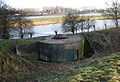
 Bovenop de bunker - Nigtevecht - 20340666 - RCE.jpg 1,190 × 1,200; 309 KB
-
 FbN 06.JPG 1,754 × 1,163; 413 KB
-
 FbN binnendeur.JPG 1,360 × 2,048; 693 KB
-
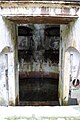
 FbN Druipkoker.JPG 1,360 × 2,048; 566 KB
-
 FbN interieurkeelkazemat.JPG 2,048 × 1,360; 630 KB
-
 FbN Manschappenruimte.JPG 2,048 × 1,360; 494 KB
-
 FbN privaat1.JPG 1,360 × 2,048; 695 KB
-
 FbN privaat2.JPG 1,360 × 2,048; 657 KB
-
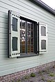
 FbN raam.JPG 1,360 × 2,048; 635 KB
-
 FbN Uitkijkpost.JPG 1,360 × 2,048; 702 KB
-
 FbN Wachtlokaal.JPG 2,048 × 1,360; 594 KB
-
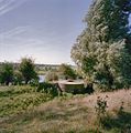
 Fort bij Nigtevecht 1.JPG 3,264 × 2,448; 1.56 MB
-
 Fort bij Nigtevecht 2.JPG 2,984 × 1,980; 939 KB
-
 Fort bij Nigtevecht 3.JPG 3,180 × 2,332; 1.47 MB
-
 Fort bij Nigtevecht 4.JPG 3,208 × 2,196; 1.59 MB
-
 Fort bij Nigtevecht 5.JPG 3,184 × 2,376; 1.33 MB
-
 Fort bij Nigtevecht 6.JPG 3,264 × 2,448; 1.53 MB
-
 Fort bij Nigtevecht 7.JPG 3,264 × 2,448; 1.41 MB
-
 Fort bij Nigtevecht 8.JPG 2,792 × 1,900; 889 KB
-
 Fort nigtevecht guardhouse.JPG 3,888 × 2,592; 4.96 MB
-
 Fort Nigtevecht Hefkoepel.JPG 2,048 × 1,360; 648 KB
-
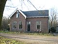
 FortbijNigevecht Fotwachterwoning.JPG 2,048 × 1,360; 564 KB
-
 FortbijNigtevecht Genieloods.JPG 2,048 × 1,360; 681 KB
-
 FortbNigtevecht hefkoepelgebouw 01.JPG 1,360 × 2,048; 692 KB
-
 FortbNigtevecht hefkoepelgebouw 02.JPG 1,360 × 2,048; 703 KB
-
 FortbNigtevecht hefkoepelgebouw 03.JPG 2,048 × 1,360; 604 KB
-
 Fortwachterswoning en loods - Nigtevecht - 20340679 - RCE.jpg 1,191 × 1,200; 425 KB
-
 Genieloods interieur.jpg 1,360 × 2,048; 663 KB
-
 Genieloods raam 01.jpg 1,360 × 2,048; 736 KB
-
 Genieloods raam 02.jpg 1,360 × 2,048; 764 KB
-
 Genieloods zolder.jpg 1,360 × 2,048; 701 KB
-
 Hefkoepel - Nigtevecht - 20339329 - RCE.jpg 1,188 × 1,200; 391 KB
-
 Interieur, gang - Nigtevecht - 20341752 - RCE.jpg 1,192 × 1,200; 185 KB
-
 Interieur, toiletten - Nigtevecht - 20341750 - RCE.jpg 1,192 × 1,200; 166 KB
-
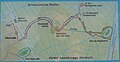 Kaart Abcoude Nigtevecht.JPG 1,791 × 925; 428 KB
-
 Liniewal Geindijk-Nigtevecht vanafGein.JPG 2,048 × 1,360; 737 KB
-
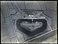 NIMH - 2011 - 3716 - Aerial photograph of Fort bij Nigtevecht, The Netherlands.jpg 3,500 × 2,684; 1.97 MB
-
 NIMH - 2155 005320 - Aerial photograph of Fort Nigtevecht, The Netherlands.jpg 3,520 × 2,393; 2.4 MB
-
 NIMH - 2155 005335 - Aerial photograph of Fort Nigtevecht, The Netherlands.jpg 3,520 × 2,374; 2.06 MB
-
 Observatiekoepel - Nigtevecht - 20339328 - RCE.jpg 1,182 × 1,200; 375 KB
-
 Overzicht keelzijde - Nigtevecht - 20341753 - RCE.jpg 1,192 × 1,200; 329 KB
-
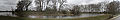 Pano 02.jpg 20,774 × 3,392; 14.61 MB
-
 Plan zandophoging Fort Nigtevecht.jpg 2,592 × 1,936; 1.43 MB
-
 Verboden kringen Fort Nigtevecht.jpg 2,592 × 1,837; 1.66 MB
-
 Zicht op het complex - Nigtevecht - 20339326 - RCE.jpg 1,182 × 1,200; 415 KB
-
 Zicht op het complex, over het Amsterdam-Rijnkanaal - Nigtevecht - 20339327 - RCE.jpg 1,185 × 1,200; 209 KB


