Category:Forest roads in England
Jump to navigation
Jump to search
Subcategories
This category has the following 4 subcategories, out of 4 total.
K
- Forest roads in Kent (5 F)
L
N
- Forest roads in Northumberland (19 F)
S
- Springs Road, Esholt (1 F)
Media in category "Forest roads in England"
The following 14 files are in this category, out of 14 total.
-
 Bole Edge Plantation - geograph.org.uk - 171070.jpg 640 × 480; 199 KB
-
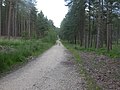 Boveridge Heath, road - geograph.org.uk - 1354364.jpg 640 × 480; 98 KB
-
 Forest road climbing in Chopwell Wood - geograph.org.uk - 3893601.jpg 1,500 × 1,125; 2.09 MB
-
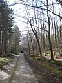 Forest road in Chopwell Wood - geograph.org.uk - 761056.jpg 480 × 640; 127 KB
-
 Forest road, Highmeadow Wood - geograph.org.uk - 737167.jpg 640 × 426; 132 KB
-
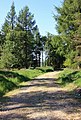 Forestry access road, Newgate Bank - geograph.org.uk - 1331698.jpg 433 × 640; 449 KB
-
 Looking down Whitegate Top - geograph.org.uk - 3343410.jpg 640 × 480; 172 KB
-
 Peaslake Ewhurst Road pre-Worboys sign.JPG 3,712 × 2,088; 3.4 MB
-
 Replanting at Nutwith Common - geograph.org.uk - 1222091.jpg 640 × 480; 107 KB
-

-

-
 Track to Nether Hey - geograph.org.uk - 385181.jpg 427 × 640; 171 KB
-
 West Moors, forestry road - geograph.org.uk - 1640550.jpg 640 × 480; 103 KB
-
 West Moors, forestry road - geograph.org.uk - 1656799.jpg 640 × 480; 97 KB


